Welcome to Nature’s Masterpieces: National Park Edition. Explore nature’s art through our lenses. Experience the textures and imagine the scents of the earth. Those who take the time to seek the art of nature will find treasures that are usually overlooked by most people. Enjoy a leisurely stroll through our gallery as we visit nature’s artwork in some of our country’s most beautiful settings.
Abstract Expressionism in the style of Jackson Pollock. Wind paints gold and silver threads chaotically across a patch of earth – Fort Bowie National Historic Site.
To the artist there is never anything ugly in nature ~ Auguste Rodin
Post Impressionism reminiscent of Vincent van Gogh. Here we find desert grasses swirling their way onto a slowly eroding mesa – Petrified Forest National Park.
Art is a harmony parallel with nature ~ Paul Cezanne
Credit Mother Nature herself for this modern sculpture. Her mediums: wind and water on rock. This natural masterpiece can be found at Chaco Culture National Historical Park.
I think having land and not ruining it is the most beautiful art that anybody could ever want to own ~ Andy Warhol
Impressionism a la Claude Monet. A colorful, blurred reflection of autumn leaves in Bear Lake at Rocky Mountain National Park.
Abstract art is not the creation of another reality but the true vision of reality ~ Piet Mondrian
Dale Chihuly’s glass artworks are what came to mind when we ran across these delicate Apache Plumes – Guadalupe Mountains National Park.
All art is but imitation of nature ∼ Lucius Annaeus Seneca
Paul Cezanne perhaps. A post-impressionism type scene that truly left an impression on us – Badlands National Park
An artist must possess Nature. He must identify himself with her rhythm, by efforts that will prepare the mastery which will later enable him to express himself in his own language ~ Henri Matisse
This serene scene prompts reminders of Georgia O’Keeffe’s fabulous landscapes – Yellowstone National Park.
My painting is what I have to give back to the world for what the world gives to me ~ Georgia O’Keeffe
Those who do not want to imitate anything, produce nothing ~ Salvador Dali
Pop Art. Due to the colors, this one reminds us of a deteriorated version Andy Warhol’s iconic Marilyn Diptych – Death Valley National Park.
Although we could go on and on, we’re going to wrap up the post with one final abstract masterpiece. The photo below was taken in California on our most recent road trip. The image seems to drip, splash, and flow, but interestingly it is not water. Stay tuned for a post about the park coming soon.
California abstract
Man is simply playing by nature’s rules, and art is man’s attempt to imitate the beauty of the Creator’s hand ~ Dan Brown
Bandelier National Monument has been on our to-do list for years, so we were thrilled to finally make the trip. We enjoyed everything about Bandelier, from the scenic drive through the scenic Jemez Mountains, to the history, and the ancient dwellings in Frijoles Canyon. The tour starts here, and we hope you enjoy it too!
Where is it?
Bandelier National Monument is about 12 miles south of Los Alamos, New Mexico, a 17-minute drive via State Road 501 and State Road 4. There are a couple of scenic overlooks along the roads, so allow time to stop – the views are worth it. The park’s physical address is 15 Entrance RD, Los Alamos, however we do not recommend using GPS for directions to the park as we found the internet service to be very sporadic.
On the road to Bandelier.
Features of the park include:
Frijoles Canyon visitor center/park film/museum
Bookstore/gift shop
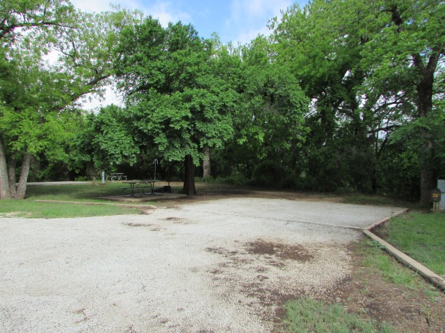
Picnic tables
Bandelier CCC Historic District featuring historic park buildings.
Periodic ranger talks
Periodic ranger guided tours, walks, and hikes.
Stargazing and periodic night sky programs
70 miles of hiking trails
One family campground, one group campground, backcountry camping with permit
Winter cross country skiing trails
Note: The only access to Bandelier during the summer months is via White Rock Visitor Center, 115 State Road 4, White Rock, New Mexico, where visitors can leave their vehicles and take a 20-minute shuttle ride to the park. Shuttles run every 20-30 minutes. Click here for the park’s website.
Frijoles Canyon overlook with the cloud shrouded Jemez Mountains in the background.
Bandelier CCC Historic District
President Woodrow Wilson declared Bandelier a national monument in 1916. Then, as with many other national park units, the Civilian Conservation Corps (CCC) developed the park’s infrastructure during the 1930s. Today thirty-one of the park’s pueblo revival style buildings are collectively a designated national historic landmark and compose the historic district.
Visitor center
The main buildings, which included the administrative building, Frijoles Canyon Lodge, restaurant, and cabins, and staff residences, were designed to look like a southwestern village bordering a main plaza. All of Bandelier’s buildings are built of a stone called Bandelier rhyolite tuff, and the outsides of most of them remain as they were when they were built.
One of the former lodge’s beautifully landscaped patios.
Another historical side note is that Bandelier’s lodge was used to house some of the Project Y scientists in 1943 and then construction crews in 1944 while the secret Los Alamos Laboratory was being built during the Manhattan Project.
Frijoles Canyon
Upon entering the canyon, one can’t help but notice the pink and honey colored Swiss cheese look of the canyon walls. At first, we thought it was sandstone, but we quickly learned that it is volcanic ash that compacted over time called tuff, specifically Bandelier tuff.
Holey tuff
Bandelier National Monument is located in an area where volcanic eruptions shaped the landscape. About a million years ago two huge eruptions in the Jemez Volcanic Field created Valles Caldera, a super volcano that is 14 miles northwest of Bandelier. The eruptions created enough power to cover a 400 square mile area with volcanic ash and other materials up to 1,000 feet thick. Additionally, the same violent eruptions formed the Pajarito Plateau, the geologic area upon which the city of Los Alamos and Bandelier are located. As we ventured farther into the canyon, we soon realized that the builders of the park’s historic buildings weren’t the first people to use Bandelier tuff as a construction material.
Tyuonyi
Several large ancient pueblos are located within the monument, but Tyuonyi (pronounced QU-whe-nee) is one of the few that has been excavated. Most of Bandelier’s other pueblos remain unexcavated at the request of current pueblo people who live in the area and can trace their ancestors to these sacred sites.
Occupied 500-700 years ago, Tyuonyi was one to two stories high, had 400 rooms, and housed about 100 people.Historical photo of Tyuonyi.
Cliff Dwellings
We took Pueblo Loop Trail which led us toward the spectacular cliff dwellings. Our first stop was Talus House.
Talus House
Talus House is a 1920 reconstruction, built to show how the ancient dwellings may have looked. However, scientists today are of the opinion that the reconstruction is slightly inaccurate. After further studies, they now believe that the dwellings had no windows, and entry doors were located on the roofs. Nevertheless, we appreciated having some idea of how the Ancestral Pueblo people lived in the canyon. Next, we were off to see our first caveate.
Caveate and ladder
Caveates (pronounced cave-eights) are small caves that were dug out of the cliff and used as living or storage spaces. Stone dwellings were built in front of many of the caveates and attached to the cliff face. According to park information, there are over 1,000 caveates in Frijoles Canyon, some of which have multiple interconnected rooms.
Visitors can climb ladders to some of the caveates, so of course we took advantage of the opportunity!
As we continued on the trail towards Long House, the largest pueblo complex at Bandelier, we saw many petroglyphs and a couple of decorated walls.
Little bird petroglyph. Interestingly Pajarito, as in Pajarito Plateau, means little bird.Petroglyph of a dancing man perhaps.
Caveate walls and ceilings were usually covered with clay and then blackened with soot to help keep the soft rock from crumbling. Some of Bandelier’s caveates preserve painted images of animals and geometric designs.
Preserved caveate wall art, now protected by glass.
Long House
Bandelier’s Long House is a large pueblo complex that was built along the base of the canyon wall. With the support of the canyon wall, the buildings could reach four stories tall.
Long House
Rows of small holes in the wall are where wooden ceiling beams called vigas were attached to the cliff face. Remains of some of the stone walls abut the cliff at ground level.
Detail of Long House. Note the caveates which would have been on the back wall of the dwellings.More detail showing the small ground level rooms.
The Ancestral Pueblo people who lived in Frijoles Canyon were small in stature. Women were an average height of 5′ tall, while men were an average of 5’3″, and the average life span was 35 years. They occupied the canyon from 1150 CE to 1550 CE. The people of nearby Cochiti Pueblo are their most direct descendants.
Nature in the Park
Bandelier features additional sites to see, one being the popular Alcove House. We chose not to visit Alcove House because it sits 140 feet above the canyon floor, and getting to it involves climbing several ladders and stairways. Instead, we decided to take the nature trail back to the museum.
Lots of green on the trail near Frijoles Creek.As we walked, we could hear the water flowing in Frijoles Creek, but we only caught a few glimpses of its sparkling water.We made a couple of friends along the way too.We think these cute little guys are fence lizards.
The Museum
Bandelier’s museum is an important part of the park that visitors won’t want to miss. Museum exhibits include life-size dioramas depicting how the Ancestral Pueblo people lived, as well as some beautiful pottery pieces, obsidian arrowheads, and ancient tools. We have featured a few of them below.
One of the museum’s well-done dioramas.Bandelier black-on-gray bowl. According to the museum, bowls with designs on the inside were used as serving bowls.More pottery and obsidian arrowheads.
Obsidian is formed when lava cools rapidly making a very hard, glass-like rock. However, it chips easily and sharply, therefore the Ancestral Pueblo peoples used it to make arrowheads, spear points, and implements.
Espinosa Polychrome Pot. Per museum information: Glazed decorated pottery was commonly used in Frijoles Canyon and south along the Rio Grande.
Thank you for visiting Bandelier National Monument with us! We’re going to close with a shot of a really cool rotting tree stump that we saw on the nature trail.
Need more road trip inspiration? Here are some other great destinations:
Los Alamos, New Mexico has had several nicknames over the years: Secret City, The Hill, Atomic City, and Site Y. The city exists because it grew up around the Los Alamos Laboratory where the world’s first atomic weapons were secretly developed. Current national security projects continue at the laboratory today. Los Alamos is also the home of one-third of the Manhattan Project National Historical Park. The other park units are in Oak Ridge, Tennessee and Hanford, Washington. We will explain why the park spans three sites later in the post. In the meantime, enjoy your tour of the Los Alamos unit.
Where is It?
The city of Los Alamos sits in the foothills of the Jemez Mountains about 33 miles northwest of New Mexico’s capitol city of Santa Fe. The visitor center is located at 475 20th Street and is a good place to begin the self-guided walking tour of the historic sites and museums. The park is free to visit, although the Los Alamos History Museum requires an admission fee. Click here to access the park’s website.
Statues of Dr. J. Robert Oppenheimer, scientific director, and General Leslie Groves, military director, both of whom oversaw Project Y which was the code name for the secret Los Alamos Laboratory.
The History Begins With the Los Alamos Ranch School
Ashley Pond, Jr., a Detroit, Michigan native and one of Teddy Roosevelt’s Rough Riders during the Spanish American War, founded the Los Alamos Ranch School in 1917. Pond’s love of the outdoors, ranching, and New Mexico’s fresh air are what drove him to establish the prep school that catered mainly to the sons of wealthy east coast families.
The Ranch School’s Big House. The building which no longer exists served as the boy’s sleeping quarters where they slept on screened porches year-round. It also housed a library, study rooms, and classrooms. During the Manhattan Project, the Big House was home to several scientists who all shared one bathroom.
The government paid almost a half million dollars for the school and 50,000 acres of surrounding land. In December 1942, the school’s director received notice that the school was to be surrendered to the government as a matter of utmost importance in the prosecution of the war.
The Alamos Ranch School closed after its last graduation in January 1943, and the military moved in. Nine months later, a secret laboratory had been built and work was underway for the development of atomic weapons. Along with it a secret city was quickly springing up for the project’s workers and their families. Meanwhile, Hanford, Washington and Oak Ridge, Tennessee were also becoming top secret worksites for other phases of the Manhattan Project.
Fuller Lodge was originally the headquarters, staff quarters and mess hall for the Ranch School. It then served as a dining hall, community center, and guest quarters for visiting scientists during the Manhattan Project. The lodge is still a community center today.
Historic Sites
Our walking tour began at the park’s visitor center. The delightful lady working in the office gave us information about the historical sites and also told us about the filming sites of the (then) upcoming movie Oppenheimer. Click here to view a YouTube movie trailer.
We then walked down the street called Bathtub Row. The homes on Bathtub Row were originally built to house the Ranch School’s faculty. With Project Y’s new homes and dormitories – hastily built for the purpose of merely lasting until the end of the war – only having showers, the community began referring to the street where some of the top officials and scientists lived as Bathtub Row. You guessed it, they had the only bathtubs in town, and the name stuck.
Dr. J. Robert Oppenheimer and his family lived in this home.This cottage, also built for the Ranch School, was home to Nobel Prize-winning chemist, Edwin McMillan during the Manhattan Project. Hans Bethe (pronounced Beta), a Nobel Prize-winning physicist who specialized in nuclear reactions, lived there in 1945-1946. The house is now home to the Los Alamos History Museum’s Harold Agnew Cold War Gallery. By the way, Harold Agnew was also a Manhattan Project physicist, Nobel Prize winner, and director of the Los Alamos National Laboratory from 1970-1979.
Trivia: Eighteen of the scientists who worked on the Manhattan Project in Los Alamos under the direction of Dr. J. Robert Oppenheimer were Nobel Prize winners. Oppenheimer was a Nobel nominee on three different occasions, however, he never won.
The guest cottage, built 1918, once served as the Ranch School’s infirmary and guest quarters for visiting parents of the students. Today it is the main building of the Los Alamos History Museum, a can’t-miss stop when visiting the park.
Massive Efforts
As part of our walking tour, we visited the Los Alamos History Museum and the Bradbury Science Museumwhere we learned a lot about the history of Los Alamos and the incredible efforts that went into the Manhattan Project. Below are some historic photos that are relevant to the testing of the first atomic weapon.
The Trinity device, codenamed TheGadget, was detonated at the Trinity Site near the White Sands Proving Grounds in New Mexico on July 16, 1945. The blast resulted in the world’s first nuclear explosion.Manhattan Project chemist and explosives expert Donald Hornig sits atop the 100-foot Trinity test tower with the Gadget.Dr. J. Robert Oppenheimer and General Leslie Groves with a few scraps of metal – all that was left of the tower after the Trinity test.The photo above is the only color image captured at the Trinity site. Department of Energy photo via Wikipedia.
It’s hard to believe that less than a month after the Trinity test, a uranium bomb called Little Boy exploded over Hiroshima, Japan. Fat Man, a bomb fueled by plutonium exploded over the Japanese city of Nagasaki three days later. The bombings, while unimaginably devastating, effectively brought an end to World War II.
Post-war model of Little Boy.
Trivia: The fireball created by the Trinity test carried up sand that melted in the mushroom cloud. The melted sand then dropped back to earth where it solidified into a new manmade mineral. Scientists dubbed the new mineral trinitite.
Three Sites, One Goal
Oak Ridge, Tennessee was home to another secret city that was built for the purpose of enriching uranium to fuel nuclear weapons and also to produce small amounts of plutonium. Interestingly, most of its 50,000 workers did not know they were working on components of the first atomic weapons. Today Oak Ridge is still home to the Oak Ridge National Laboratory, the largest laboratory in the US.
Oak Ridge site. National Park Service/Department of Energy Photo.
Another large industrial complex was built in Hanford, Washington for the purpose of producing plutonium. According to the National Park Service, the complex had huge production-scale reactors, chemical separations plants, and fuel fabrication facilities. The Hanford site employed approximately 51,000 workers.
Hanford, Washington site. Department of Energy Photo.
Air transportation was too risky for the transport of plutonium and uranium. Therefore, the elements produced by the Oak Ridge and Hanford laboratories were delivered to Los Alamos by inconspicuous, unguarded “traveling salesmen” who hand carried special luggage via the railroad.
The wartime Project Y – Los Alamos Laboratory. Originally designed for about 150 scientists, engineers and others, the laboratory employed more than 2,500 people by the end of the war. At the time, it was the largest laboratory in the world. A new campus was built across town in the 1950s and is home to the national laboratory’s current location.
Trivia: At its height of employment in 1944, approximately 129,000 people worked on the secretive Manhattan Project, and of those 84,500 were construction workers.
More History Around Town
The laboratory was built around the existing Ashley Pond, named after the founder of the Los Alamos Ranch School.Today Ashley Pond is the centerpiece of a beautiful city park.The east gate was the only way in or out of Los Alamos during the Manhattan Project and for some years after. National Park Service photo.Today this replica of the Main Gate is a feature of Main Gate Park at the top of the hill on the east side of the city.Built in 1948 at the site of a checkpoint, the guard tower stands across the street from Main Gate Park as a chilling reminder of the secrecy of Los Alamos. Today there are still checkpoints where visitors must show an ID and state their business on the main road through the national laboratory’s campus.Performing Arts Center/Los Alamos Little Theater. During the Manhattan Project, this building was the laboratory’s east cafeteria which reportedly had the best food in town.The “new” Los Alamos National Laboratory campus in 1995. Wikimedia Commons Photo.
The Manhattan Project was successful due to a massive effort that spanned just 27 months from start to finish and included thousands of military and civilian laborers who worked toward a common goal although they were located in three separate sites across the country.
Thank you so much for joining us on our historical tour of Los Alamos! For more national park inspiration, check out these great sites:
As always, we strive to be as accurate with our information as possible. If we made a mistake, it was unintentional. (Hey, we’re only human!) Our suggestions are for places that we’ve heard good things about but haven’t visited personally, and our opinions are our own.
Chaco Canyon was a busy place 1,000 years ago. Early great houses (large public buildings) began being built around 800 AD, and construction continued for about 300 years. Today the ruins of the Chacoan great houses stand as a testament to their builders’ culture, brilliant architectural and astrological knowledge, and remarkable ability to thrive in the harsh conditions of the desert southwest. Enjoy your visit.
Where is it?
Chaco Canyon lies in the Four Corners region of the US in northwestern New Mexico. (Four Corners is where the corners of the states of New Mexico, Arizona, Utah, and Colorado meet.) A town called Nageezi is the closest map dot to the park, but it doesn’t offer much more than a turn off for the road to the canyon, which involves another 24-mile trek, and part of the road is very bumpy gravel. But getting there is half the fun, right?
On the (smooth) road to Chaco Canyon.
Besides being a national park unit, Chaco Culture National Historical Park is also a UNESCO World Heritage Site and a designated International Dark Sky Park. Features of the park include:
Visitor center, museum, park film
Bookstore/gift shop
Nine-mile-long Canyon Loop Drive – open to motor vehicles and bicycles.
Three additional bike trails.
Four backcountry trails – permit required.
Gallo Campground, featuring 32 individual and two group sites which can be reserved through www.recreation.gov. RV, tent, and car camping is available with some restrictions and no hook ups.
Periodic night sky events, and the park also features an observatory.
Chaco Canyon was a regional center for trade, and an elaborate road system covering hundreds of miles connected the area’s great houses. The map below shows the great houses and the roads. Chaco Culture National Historical Park, formerly Chaco Canyon National Monument, protects the 16 great houses in and around the canyon. The park’s great houses are the best preserved prehistoric architectural structures in North America. Additionally, archaeological and anthropological studies of the site have resulted in the discovery of over 1.5 million artifacts, most of which are in the care of the University of New Mexico in Albuquerque.
A glimpse inside the park’s museum.
The new Chaco Canyon Visitor Center and museum opened in 2017 after years of planning and construction. Artifacts from the park’s collection as well as some borrowed from other museums were to be displayed in the park’s museum. Unfortunately, the heating and air conditioning system does not provide the proper climate controls needed to preserve the artifacts. Now, several years later with no resolution to the climate control issues in sight, empty display cases line the walls of the museum.
Some of the display cases feature reproduction pottery such as the jar shown above.
Despite the fact that the museum didn’t have original artifacts, it did provide us with a lot of interesting information about the canyon, its inhabitants, and the great houses.
The Great Houses
Builders of the great houses quarried stone and carried timber from many miles away. They also constructed dams, waterways, and stairways. Chaco Canyon’s great houses are sacred to many Native American tribes.
Hungo Pavi was occupied from AD 1000 – 1250s and remains unexcavated.
Hungo Pavi
Chetro Ketl is the second largest great house in Chaco Canyon and was occupied from AD 950 – 1250s. With 400 rooms, it covers 5.5 acres (2.3 hectares) which actually makes it the largest in terms of surface area.
Chetro Ketl practically blends into its surroundings.Chetro Ketl’s back wall.Petroglyphs on the mesa wall between Chetro Ketl and its closest neighbor Pueblo Bonito.
Pueblo Del Arroyo was occupied from AD 1075 – 1250s. Unlike other Chacoan great houses, Pueblo Del Arroyo does not have a great kiva (communal meeting place or possible ritual site). Perhaps its people shared Pueblo Bonito’s great kivas, as the two great houses sit just a few hundred yards apart.
Pueblo Del ArroyoArchaeologists who excavated Pueblo Del Arroyo in the mid 1920s uncovered only about half of the great house.
Pueblo Bonito
The largest of all great houses, was occupied from AD 850 – 1250s and was the first Chacoan great house to be excavated.
Pueblo Bonito as seen from the trail.
Archaeologists believe that Pueblo Bonito was the convergence point of the roads leading to Chaco Canyon. The four story, D-shaped structure featured about 800 rooms, 32 kivas, and four great kivas. Its number of occupants remains debatable due to the lack of trash piles and burial sites. Some theorize that the huge great house was used primarily as a ritual site, thus the four great kivas.
In 1941, 30,000 tons of rock slid off of the mesa’s face and destroyed about 30 of the pueblo’s rooms. The Chacoan builders of the great house knew a rockslide was possible and had built supporting masonry walls just in case. Remarkably, Threatening Rock as it was called, held stable for centuries before it finally gave way.
View of the pueblo and the rockslide.It is hard to tell how big the pueblo is from ground level.
For size and scale purposes, the aerial photo below shows the great house and the rockslide debris. Credit for the photo goes to Bob Adams of Albuquerque, New Mexico via Wikipedia.
Aerial view of Pueblo Bonito.
More Canyon Highlights
Casa Rinconada Community was occupied from AD 1075 – 1250s and is considered a village rather than a great house. The village features the largest great kiva in the canyon.
Casa Rinconada Community’s great kiva.
From wayside information: Unlike the monumental Chacoan great houses, the villages along this trail are more modest. Yet both the great houses and the villages were built and occupied during the same period. Hundreds of these small villages and communities have been discovered clustered around Chacoan great houses. The role of the great houses isn’t clear. Perhaps they served a central purpose: ceremonial, economic, and administrative, and the small village communities supported those efforts.
Ruins of the Casa Rinconada Community.
Una Vida is another of Chaco Canyon’s great houses and was occupied from AD 850 – 1250s. Basically untouched, Una Vida has had little excavation.
Ruins at Una Vida
According to archaeologists, Una Vida was two to three stories tall and had 100 ground floor rooms and kivas. Additional rooms surrounded the plaza. Interestingly, a jewelry workshop was found at Una Vida along with pottery from Mesa Verde which is now Mesa Verde National Park.
Petroglyph panel at Una Vida.
Desert sand and vegetation preserve most of Una Vida and its great kiva, so it looks much like it did when it was discovered in 1849. Una Vida is reached via a 1-mile out and back trail that starts at the visitor center.
Wetherill Cemetery
A lonely patch of sandy scrubland is the final resting place of Richard Wetherill, his wife, Marietta, and several others.
Wetherill Cemetery
Richard Wetherill was a Colorado rancher, but he had a passion for ancient puebloan culture and was an amateur archaeologist. He is credited with coining the word Anasazi to describe the ancient ones who occupied the ancestral pueblo dwellings of the southwestern US and is also credited with rediscovering and excavating some of the dwellings at what is now Mesa Verde National Park.
Richard Wetherill
Wetherill established a homestead in Chaco Canyon where he assisted in excavating Pueblo Bonito under the auspices of the American Museum of Natural History. He ran a trading post in the canyon until his death. Click here to learn more about Mr. Wetherill and his mysterious murder.
Fajada Butte
Rising approximately 440 feet (135 meters) from the canyon floor, Fajada Butte is the predominant natural landmark in Chaco Canyon. It is also sacred to the Navajo, Hopi, and Pueblo peoples, and it is home to the most significant petroglyph in the canyon: the Sun Dagger.
According to the park: Atop Fajada Butte Chacoan skywatchers commemorated the movement of the sun and the seasons. Sunlight passed between three boulder slabs onto a spiral petroglyph to mark the sun’s position on summer solstice, winter solstice, and the equinoxes.
In recent years, scientists have noticed a change in the light pattern on the spiral due to slipping of the boulder slabs. They suspect that the slipping could be from human-caused erosion to the base of the rocks, and as a result access to Fajada Butte is prohibited.
We were fortunate to visit Chaco Canyon when many wildflowers were blooming. We hope that we have identified them correctly. Click on any image in the gallery below to view as a slideshow.
Wild Rubharb
Narrowleaf Beardtongue
Desert Plume
Scarlet Globemallow
King Cup Cactus
Evening Primrose
Wild Rubharb
Easter Daisy
Fleabane
Fleabane
Notch-leaved Phacelia
Mormon Tea
Thank you so much for joining us on our Chaco Canyon road trip! We appreciate you more than we can express. We’re closing the post with one of the friends we made on our visit to the park.
Common blotch-sided lizard
Want to see more in New Mexico? Check out these great destinations:
As always, we strive to be as accurate with our information as possible. If we made a mistake, it was unintentional. (Hey, we’re only human!) Our opinions are our own.
This is the story of a national park that was, then wasn’t. We visited Chickasaw National Recreation Area because we wanted to see what remained of a national park that once was one of the most visited in the United States. In fact, the park attracted visitors to southern Oklahoma before Oklahoma was even an official state!
Family at the park – probably early 1900s.
Our guess is that most people who visit the park today don’t pay much attention to the park that was. Most of today’s visitors are likely there to enjoy the camping and water sport opportunities that the new park offers. Interestingly, the park has always been about water, but not in the ways most people would think. Enjoy the journey as we explore the historic place that was once Platt National Park.
Today the Civilian Conservation Corps (CCC) built sidewalks and rock entrance monuments remain but without the wooden signs. National Park Service photo.
Birth of a Park
According to the National Park Service: Between the 1830 Indian Removal Act and 1850, the U.S. government used forced treaties and/or U.S. Army action to move about 100,000 American Indians living east of the Mississippi River, westward to Indian Territory in what is now Oklahoma. Among the relocated tribes were the Cherokee, Choctaw, Chickasaw, Creek, and Seminole.
Trail of Tears map. (Wikipedia)
The trails the tribes followed are collectively called the Trail of Tears. Chickasaw and Choctaw settled on the same land grant in the southern third of Indian Territory but later agreed with the government to split the land between the two nations. Lands acquired by the Chickasaw Nation included the area that would later become Platt National Park.
1924 postcard
Fearing uncontrolled use of their lands’ mineral and freshwater springs, both the Choctaw and Chickasaw Nations sold 32 springs along with 640 acres of land to the Department of the Interior for protection in 1902. The site was initially named Sulphur Springs Reservation, however, four years later the name was changed to Platt National Park.
1939 Guidebook
Platt Historic District
Platt National Park was the seventh U.S. national park and was named after the late Connecticut Senator Orville Platt who had supported legislation to protect the springs located on the land. In 1914, the park, which was then the smallest of all national parks, attracted more visitors than Yellowstone and Yosemite National Parks.
Fountain at the original entrance to the park built by the Civilian Conservation Corps (CCC) in the 1930s.Bromide Pavilion, also built by the CCC in the mid-1930s, was a place for visitors to collect water piped in from Bromide Spring until it quit flowing in the 1970s. Today it is still a beautiful building.1930s comfort station. Now modernized, the structure has withstood the test of time.
Pavilion Springs
Sulphur Springs Pavilion, circa 1902.
Much to the Chickasaw and Choctaw people’s dissatisfaction, visitors flocked to the springs because they believed the mineral waters held healing powers. Resorts such as the one above and others that popped up around the springs brought about the sale of the springs and surrounding lands to the government.
Renamed Pavilion Springs because of several different pavilions built over them through the years, this photo shows a newer, smaller pavilion. Circa 1904.This pavilion was built by the CCC in the 1930s and still covers Pavilion Springs today.Pavilion Springs continue to flow. The sign in the background shows the concentrations of minerals in the water.
Travertine Nature Center
Built in 1969, the Travertine Nature Center was the last major improvement project of Platt National Park. The building was designed to reflect the architectural style of renowned American architect Frank Lloyd Wright while keeping the National Park Service Rustic look of the park’s other structures.
The Travertine Nature Center serves as a visitor center in the park, and while it is a newer building it is considered part of the Platt Historic District. Its features include dioramas depicting the park’s wildlife as well as live exhibits of fish and amphibians. Visitors to the center can pick up park brochures, buy a souvenir in the bookstore, and talk with rangers about the park.
Diorama in the nature center. Foxes, deer, and many other animals can be found in the park.We think this guy may be a bluegill which is found in the lakes at the park. Whatever he is, he looks kind of grumpy.Travertine Creek flows beneath the nature center – very Frank Lloyd Wright-ish!
And speaking of history, how long has it been since you’ve seen one of these?
It’s in a little alcove on the outside of the Travertine Nature Center. It doesn’t work anymore, but it was a step back in time to see a pay phone.
Little Niagara
A longtime favorite swimming area for visitors, Little Niagara is a small cascade on Travertine Creek and is just a short walk from the nature center. Improvements at the Little Niagara area, including a dam to create the swimming hole, were also done by the CCC in the 1930s.
Little NiagaraPeople have enjoyed the waters of Travertine Creek and Little Niagara for many years. This photo is probably from the early 1900s.
Lincoln Bridge
Lincoln Bridge, which replaced an old wooden bridge, was the first improvement project of Platt National Park. Amid much fanfare, the bridge was dedicated on February 12, 1909, in honor of President Abraham Lincoln’s 100th birthday and re-dedicated on the same day in 2009 to celebrate its own centennial.
Approaching Lincoln Bridge
Forrest Townsend, who was the first full-time ranger at Platt National Park, designed Lincoln Bridge. Constructed of limestone, the bridge is 120 feet long and 20 feet wide. Four crenelated (notched) towers form the abutments with steps and a flagpole on each one.
View of Travertine Creek from Lincoln Bridge
Lincoln Bridge has long been a favorite scenic spot in the park. We found it to be our favorite too.
Trivia: In 2011, as part of the America the Beautiful Quarters Series, the U.S. Mint issued a quarter featuring Chickasaw National Recreation Area and the Lincoln Bridge.
Lincoln Bridge
In 1976, Platt National Park was abolished by congress and combined with the Arbuckle Recreation Area to form Chickasaw National Recreation Area. We haven’t covered all of the features of the Platt Historic District here, but we feel fortunate to have seen them. Thankfully the National Park Service has done a great job of preserving Platt National Park’s history.
Little waterfall on Travertine Creek
Where is it?
Chickasaw National Recreation Area is located near the town of Sulfur in southern Oklahoma about 13 miles east of I-35 and the town of Davis. The park’s main visitor center and administration office is located at 901 West 1st Street, Sulfur, Oklahoma. Features of the park include:
Travertine Nature Center – exhibits, park information, bookstore
Platt Historic District
Six campgrounds – some require reservations.
Veteran’s Lake – hiking, fishing, picnicking
Lake of the Arbuckles – boating, fishing, camping, fishing, hunting, swimming, picnicking
As always, we strive to be as accurate with our information as possible. If we made a mistake, it was unintentional. (Hey, we’re only human!) Our suggestions are for places that we’ve heard good things about but haven’t visited personally, and our opinions are our own.
Harvey Houses, which were hotels and restaurants, served train travelers and locals for years along the Atcheson, Topeka and Santa Fe (ATSF) Railroad lines across the United States. Founder Fred Harvey came up with the idea while providing food service in railroad dining cars.
El Tovar Hotel, a Harvey House, opened in 1905.
Our first Harvey House experience was the fabulous El Tovar Hotel at Grand Canyon National Park. A second Harvey House at the Grand Canyon is Bright Angel Lodge. Another one closer to home is located about 15 miles away from us in Slaton, Texas and is now a bed and breakfast. Though with that said, we are dedicating this post to the Belen Harvey House Museum in Belen, New Mexico. We would also like to recognize Heide, our lovely guide who taught us so much about Harvey House history.
Historic photo of the Belen Harvey House, built in 1910.
Where is it?
The Belen Harvey House Museum is located at 104 North 1st Street in Belen, New Mexico. Belen, which is the Spanish name for Bethlehem, is 34 miles south of Albuquerque on I-25. Access the museum’s website here.
Belen Harvey House Museum today, though this is a side view from the parking lot. The front of the building faces the train tracks located on the right.
Fred Harvey
Having immigrated from England in 1853 at the age of 17, Fred Harvey got a job as a dishwasher in a New York City restaurant. The restaurant’s owners taught him the complexities of the food service business, and he eventually became a busboy, waiter, and then a cook. Later, after working for a few years in a jewelry store, Fred and a partner opened their own restaurant, but the Civil War interrupted the venture. When the partner absconded with all of the profits, Fred was left holding the bag. Harvey eventually went to work for the Hanibal and St. Joseph Railroad in Missouri. After several promotions within the company, he was transferred to Leavenworth, Kansas where he remained for the rest of his life.
Fred Harvey, known as the first chain restauranteur and the man who civilized the Wild West.
In 1876, Fred made a deal with the superintendent of the ATSF Railroad after noticing there were few accommodations and no restaurants near most of their depots. The railroad would buy or build the buildings and lease them to the Fred Harvey Company. In turn, he would provide restaurants, workers, and hotel accommodations in or near the depots. A simple handshake sealed the deal, and the first Harvey House opened in Florence, Kansas in 1878 ushering in an era that would span almost 90 years. Fred Harvey died of intestinal cancer in 1901. After his death, his children and grandchildren ran the company into the 1960s. Harvey’s home in Leavenworth is now a museum.
Mary Elizabeth Jane Colter
Mary Elizabeth Jane Colter (National Park Service photo)
Fred Harvey hired Mary Colter, an architect and designer who designed many of the buildings at Grand Canyon National Park, to design his restaurants and hotels across the southwest. She remained the Fred Harvey Company’s chief architect and designer for 46 years, retiring in 1948 at the age of 79. Colter designed 21 hotels in addition to other buildings for the Fred Harvey Company, however, the Belen Harvey House was designed architect Myron Church.
Desert View Watchtower, Grand Canyon National Park
Grand Canyon National Park was the railroad’s most popular destination, so Colter was hired to design several buildings for the park. She designed the Desert View Watchtower, Hermit’s Rest, Phantom Ranch, and Lookout Studio, among others, all of which are still in use today. Mary Colter also designed the dinnerware that was used exclusively in the dining cars on the ATSF Super Chief, which ran from Chicago, Illinois to Pasadena, California.
Colter’s love of the southwest shines through in the designs and colors of this dinnerware on display at the Belen Harvey House Museum.
Harvey Girls
Women aged 18 – 30 were hired to serve as waitresses in Harvey Houses and to bring hospitality, beauty, and refinement to those establishments. Upon being hired, all Harvey Girls were sent to a one-month training program at the Vaughn, New Mexico Harvey House which no longer exists. Paid $17.50 per month plus tips, they worked 12-hour shifts six days a week. Uniforms plus room and board were perks of their employment. Free train travel along with Harvey House accommodations and meals during their one week per year vacations was another perk.
Harvey Girls with Mr. and Mrs. Porter who were the Belen Harvey House managers.
Recognizable by their black dresses and white aprons, these hard-working ladies lived in a dormitory in or near the hotel and even had a dorm mother. House rules were fairly strict. Men were never allowed to visit the girls’ living quarters, and the girls were strongly advised against fraternizing with the male railroad workers.
Example of a dorm room in the Belen Harvey House.
Nor could Harvey Girls converse with or flirt with the patrons. Their employment contracts purportedly contained an agreement stating that they would remain unmarried for at least one year after being hired. However, according to museum information, between 1883 and 1905 there were 8,260 marriages of Harvey Girls to railroad men, ranchers, cowboys, and fellow employees. Throughout the Harvey House era approximately 100,000 women worked as Harvey Girls.
Nothing But the Best But No Bathrooms
Insisting on nothing but the finest, Fred Harvey imported his table linens, dinnerware, and silverware from Europe. Although, interestingly, most of the Harvey Houses didn’t have public bathrooms. This was to prevent a passenger from missing or delaying a train.
Belen Harvey House lunch counter and shiny coffee pots.
Travelers had limited time in which to have a meal before reboarding the train – usually about 25 minutes – because it took about a half hour to refuel the trains. Harvey House lunch counters were casual and were great for a quick sandwich, piece of pie, or cup of coffee.
Belen Harvey House Dining Room
Dining rooms, on the other hand, were formal. Because time was so limited, an ingenious system was developed to ensure that travelers had time to enjoy their meals. The 1955 menu below is from the La Fonda in Santa Fe. We have eaten there, and though it’s no longer a Harvey House they were still serving fabulous food at the time of our visit. We’re including the menu to show the delicious-sounding meals of the time.
Just look at those prices! Hot pineapple fritter with brandy sauce anyone? We had to laugh at the Postum and Sanka. Do they even make those anymore?
The Harvey House Legacy Lives On
At their peak, there were 84 Harvey Houses. The Grand Canyon’s El Tovar Hotel and Bright Angel Lodge are former Harvey Houses that are still in operation. La Posada opened in 1930 in Winslow, Arizona as Mary Colter’s self-proclaimed masterpiece. It is the only Harvey railroad hotel left in operation on Historic Route 66. In 2014, La Posada’s owner, Allen Allfeldt, bought the Castaneda Hotel in Las Vegas, New Mexico, which was Harvey’s first trackside hotel. After some rehabilitation, the Castaneda Hotel has reopened for overnight stays and dining.
Former Harvey House, Castaneda Hotel, in Las Vegas, New Mexico.Castaneda Hotel’s beautiful dining room.The Castaneda Hotel was built in 1898 and sits adjacent to the Las Vegas railroad depot which still serves Amtrak.
Visiting the Belen Harvey House Museum
Hours: 12:00 pm – 5:00 pm, Wednesday through Saturday.
Admission is free but donations are greatly appreciated.
Last admission to the museum is at 4:00 pm.
Grab a bite to eat in the new Whistle Stop Cafe.
Buy a souvenir in the gift shop.
Watch the trains rumble by on the adjacent tracks.
Tell Heide we said hello!
A glimpse of the front of the Belen Harvey House Museum.
Thanks so much for joining us on our visit to the Belen Harvey House Museum. If you enjoy history and museums, you may enjoy these other wonderful destinations:
As always, we strive to be as accurate with our information as possible. If we made a mistake, it was unintentional. (Hey, we’re only human!) Our opinions are our own.
On April 19, 1995, at 9:02 am, an American radical who was seeking revenge against the government blew up the Alfred P. Murrah Federal Building in Oklahoma City, Oklahoma. This heinous act of domestic terrorism killed 168 people, including 19 children, and injured hundreds more.
Children’s area near the museum entrance. School students from Texas made the handprint tiles to show their love and support after the bombing.
The Oklahoma City National Memorial is a park that induces varied emotions in its visitors. During our visit we experienced a range of feelings that included sadness, anger, pride, and awe. There were also tears from at least one of us.
And Jesus Wept
A beautiful statue named And Jesus Wept stands across the street from the Oklahoma City National Memorial on the former site of the parish house of St. Joseph’s Old Cathedral. Fortunately, the cathedral survived the blast, but the parish house did not. There are 168 indentations in the wall in front of the statue representing the 168 people who lost their lives as a result of the bombing. The surrounding pillars represent the children and unborn babies who died in the explosion.
The Alfred P. Murrah Federal Building before the bombing. (Wikipedia)
How It Happened
On that fateful April morning, Timothy McVeigh parked a rented Ryder truck in front of the Murrah Building in downtown Oklahoma City. The truck contained almost 5,000 pounds of explosives made of fertilizer, diesel fuel, and other types of chemicals. McVeigh lit a timed fuse and then escaped to his getaway car. At 9:02 am, the explosion rocked downtown Oklahoma City, destroying the nine-story Murrah Building and damaging 324 surrounding buildings.
Alfred P. Murrah Federal Building in the aftermath of the bombing.
Damage from the blast was not limited to the Murrah Building. Windows and doors were blown out within a 50-block radius, and vehicles parked near the building were reduced to crumpled metal. The buildings directly across the street were so badly damaged they had to be torn down.
Oklahoma City newspaper on the day after the bombing.
According to park information, the explosion was felt as far away as 55 miles and also registered 6.0 on the Richter scale. One of our family members who was 15 miles away claimed their windows rattled. Another family member who was on the fourteenth floor of a high-rise two blocks away said their building shook for a few seconds before the thundering boom was heard. Along with the rest of the country, we were horrified as reports of the bombing began to filter through the media.
Search and Rescue
In the photo below firefighter Chris Fields carries one-year-old Baylee Almon out of the carnage. The gut-wrenching amateur photo was featured in newspapers around the world. Sadly, Baylee died as a result of her injuries.
“Of all the thousands of photos taken at the site, the photo of Baylee captured the horror of the bombing and took it straight to the heart of a sorrowful nation.” Caption from the Oklahoma City Memorial Museum.The horrors that the first responders encountered are unfathomable to most of us. Unfortunately, many of them suffered PTSD as a result of their selfless efforts.
Nurse Rebecca Anderson tragically became the 168th victim of the bombing when she succumbed to injuries she sustained while helping a medical team search through the rubble for survivors.
Chasing Down Evil
Agents from the Federal Bureau of Investigation (FBI) were immediately dispatched to the scene to begin the daunting task of interviewing potential witnesses and searching for clues. Their investigative efforts paid off when, remarkably, the rear axle of the Ryder truck was recovered on the day after the bombing.
The rear axle of the Ryder truck in the Oklahoma City National Memorial Museum. Also shown is the truck’s front tire rim.
The next day the FBI recovered a vehicle identification number from the axle and traced the truck to a body shop in Junction City, Kansas. Body shop employees described the person who rented the truck, and a composite sketch was made. Junction City townspeople identified Timothy McVeigh as the person in the composite. An intense search for the prime suspect immediately ensued.
In a stroke of luck, FBI agents found out that McVeigh was already in jail in Perry, Oklahoma. An observant state trooper had pulled him over for a missing license plate, and since McVeigh possessed a concealed gun and a knife, the trooper took him into custody just 90 minutes after the bombing. For a quick read and short video about McVeigh’s arrest, click here.
McVeigh’s yellow Mercury getaway car now has a permanent home in the museum.
The jury in McVeigh’s trial convicted him of his crimes and sentenced him to die by lethal injection. His execution took place in 2001.
It Wasn’t a Solo Act
Further investigations found that Terry Nichols, an army buddy of McVeigh’s, had built the bomb, and he was arrested in Kansas two days after the bombing. Prosecutors sought the death penalty in his case. However, at trial the jury couldn’t unanimously agree on executing him, so he instead received 161 consecutive life sentences. He remains incarcerated at the Supermax prison in Florence, Colorado.
Terry Nichols
The third person arrested in conjunction with the bombing was Michael Fortier. He was charged with failing to tell authorities about McVeigh and Nichols’ plan to bomb the Murrah Building. He had even cased the building with McVeigh prior to the bombing. Sadly, he chose not to make the one phone call that might have prevented the unspeakable tragedy. Fortier served 11 years of a 12-year prison sentence and was released in 2006.
On the Brighter Side
In the aftermath of tragedy, a beautiful memorial arose from the ruins. Along with it came one of the most astonishing museums we’ve ever seen. The Oklahoma City National Memorial Museum explicitly and meticulously tells the story of that disastrous time in our nation’s history.
Museum exhibit: replica of one of the offices destroyed in the bombing. Note the clock stopped at 9:02 and so much paper!
From displays of the wreckage and artifacts to videos of newscasts from around the world and interviews with survivors, the museum does a fabulous, albeit painful, job of telling the story of the Oklahoma City bombing.
The museum now occupies the Journal Record Building. Built in 1922, the Journal Record Building survived the bombing to serve another, perhaps more important purpose.The memorial’s Field of Empty Chairs and reflecting pool as seen from the museum.
Standing at either end of the reflecting pool are the Gates of Time. The eastern gate shows the time of 9:01 and the western gate shows the time of 9:03. Time stands still at 9:02 between them. The 9:01 gate represents the last minute of innocence and the 9:03 gate represents the first minute of recovery and healing.
9:01 Gate9:03 Gate
Field of Empty Chairs
Laid beautifully across the original footprint of the Murrah Building, the memorial features 168 chairs made of bronze, glass and stone. Each one bears the name of a person who perished in the bombing. Large chairs designate adults and small chairs designate children.
Field of Empty Chairs with the Alfred P. Murrah Building Plaza overlooking in the background.
Chair in honor of Luther H. Treanor, who died in the Social Security Administration office on the first floor of the Murrah Building.
The photo below shows the Survivor Wall, the last surviving piece of the Murrah Building. The wall features two granite slabs that were salvaged from the building’s lobby, and upon them are the names of more than 600 people who survived the bombing.
Survivor Wall
President Bill Clinton designated the Oklahoma City National Memorial as a national park in 1997. However, the Oklahoma City Memorial Foundation raised the funds to build the memorial, and in 2004 the site was relinquished to the organization. The National Park Service still lends some services to the park.
“We come here to remember those who were killed, those who survived and those changed forever. May all who leave here know the impact of violence. May this memorial offer comfort, strength, peace, hope and serenity.”
We thank you so much for joining us on our visit to the Oklahoma City National Memorial! Our closing photo is of the Survivor Tree.
Once just another tree in a downtown parking lot, but it somehow survived the direct blast. Today the Survivor Tree, a 100-year-old Elm, stands proudly as a symbol of resiliency and strength.
Looking for more road trip or national park inspiration? Try these great destinations:
As always, we strive to be as accurate with our information as possible. If we made a mistake, it was unintentional. (Hey, we’re only human!) Our suggestions are for places that we’ve heard good things about but haven’t visited personally, and our opinions are our own.
El Morro, which means headlands in Spanish, is a park that we’ve had our eye on for years. So, like many others who have traveled to the incredible site for centuries, we finally got our chance to visit. Join us at El Morro’s Inscription Rock as we walk in the footsteps of Ancestral Puebloans, Spanish explorers, early settlers of the west, and many others. Enjoy!
Where is it?
El Morro National Monument is located 12 miles southeast of Ramah, New Mexico on Highway 53. Features of the park include:
Visitor center with park film and museum
Two hiking trails
Picnic area
Free campground with nine campsites – reservations not accepted
Visitor center and trails are closed on Tuesdays and Wednesdays
Tiny wildflowers grow among wild grasses at the base of Inscription Rock.
Inscription Rock Trail
Our visit to El Morro and Inscription Rock Trail began at the visitor center where we purchased a trail guide. Regrettably, we didn’t have the energy to tackle the moderately strenuous Headland Trail in the afternoon heat. Perhaps we will venture back to El Morro another time, but this visit was to see the famous rock we had been hearing about.
Inscription Rock Trail
Wide sidewalks and mostly level ground were a welcome sight as we had already hiked several miles that day. Fortunately, there was only one other group on the trail at the same time we were which gave us time to linger at each of the 23 points of interest defined by the trail guide. Our first stop was the pool.
The pool
One of the reasons that travelers stopped at El Morro was because of its reliable water source. The pool is not a spring, it is fed by rainwater and snowmelt that runs down from the top of the bluff. A virtual oasis, the pool is 12 feet deep and holds about 200,000 gallons of water.
A view of the bluff from the trail.
Another reason people stopped at El Morro was to leave their mark, to leave a reminder that they had been there. Some might say their writings are an early form of graffiti. There are over 2,000 inscriptions on Inscription Rock, and we’re excited to share a few of our favorites.
Ancestral Puebloans
The earliest marks on Inscription Rock are petroglyphs. These could have been chiseled into the rock by the Ancestral Puebloans who lived in a pueblo called Atsinna from about 1275 to 1350 CE. Ruins of the pueblo remain atop the bluff and can be seen from the Headland Trail. Atsinna is a Zuni word meaning writings on the rock.
Petroglyph.
Nobody knows exactly what the petroglyphs mean, however we try to make our own interpretations when we see them. Does anyone besides us think the one above looks like someone chasing or perhaps hunting a mountain lion?
More petroglyphs and other markings. Could these be the first smiley faces?
Spanish Explorers
The oldest inscription at El Morro is that of Don Juan de Oñate, the conquistador who established New Mexico as a colony of Spain. He was returning from the Gulf of California when he passed by El Morro in 1605.
A section of Don Juan de Oñate’s message on Inscription Rock.
Oñate’s message translates to “Passed by here the Adelantado Don Juan de Oñate, from the discovery of the Sea of the South, the 16th of April of 1605.”
Don Diego de Vargas
Don Diego de Vargas was a governor of the New Spain territory of Santa Fe (now New Mexico and Arizona). His message translates to “Here was the General Don Diego de Vargas who conquered for our Holy Faith, and for the Royal Crown, all of New Mexico at his own expense, year of 1692.”
Ramon Garzia Jurado
Jurado’s message above translates to “On the 25th of the month of June, of this year of 1709, passed by here on the way to Zuni, Ramon Garzia Jurado.”
In attempts to protect the inscriptions, early preservationists used pencils to darken them. Although their efforts were well meant, it was not a practical solution and may have done more harm than good. Despite careful protection of the markings, erosion is an ongoing concern for the park. Sadly, the inscriptions may in time succumb to the forces of nature.
Old messages darkened with pencil. The bottom one by Andres Romero is the last inscription from the Spanish colonial times and is dated 1774.
When President Theodore Roosevelt designated El Morro as a national monument in 1906, inscriptions on the rock were no longer permitted. Today it is illegal to deface any part of a national park site.
Settlers, Soldiers, and Surveyors
Many women passed by El Morro, but surprisingly, they rarely left their marks on Inscription Rock. One of them was America Frances Baley who was a member of the Rose-Baley wagon train heading west to California in 1858.
Miss A. F. Baley
Unfortunately, as they neared the Colorado River in what is now Arizona, the 60 members of the Rose-Baley wagon train were attacked by a large band of Mojave Indians. Several of the settlers were killed and many were injured. The group returned to Albuquerque or Santa Fe to wait out the winter months before trying to head west again the following spring.
Captain R. H. Orton, 1st California Cavalry.
Orton left not only his signature on Inscription Rock, but also a drawing of a church.
Some of these inscriptions were made by members of a Union Pacific Railroad surveying party.
Although the Union Pacific Railroad surveyed the area around El Morro, it never got the chance to build a railroad there. Santa Fe built a rail line 25 miles to the north thus dashing El Morro’s hopes of having its own rail stop.
Camel Corps
In the 1850s the U.S. Army needed a solution for the lack of water in the desert of the southwest while searching for a route from the Mississippi River to California. Interestingly, the idea of using camels was born. Thirty-three of the animals were acquired and brought to the U.S. along with some Arab handlers. The group became known as the Camel Corps. Men belonging to the elite corps passed by El Morrow in 1859 and inscribed their names on the rock.
E. Penn. Long, Baltimore, Maryland, perhaps the most elaborate signature on Inscription Rock.
Long was a member of the 1859 expedition tasked with finding a route from Fort Smith, Arkansas to the Colorado River. On that expedition the camels were tested for use as pack animals in the desert southwest. According to reports, they did an excellent job!
P. Gilmer Breckinridge
Breckinridge was purportedly in charge of the 25 camels who made the journey west in 1859. Sadly, he died in a Civil War battle in Virginia in 1863.
The Museum
Not only are the outdoor areas of the park interesting, but so is its wonderful museum which bears mentioning here. Since so much humanity has passed by El Morro at one time or another, the museum does an excellent job of covering all aspects of the park’s history.
Remarkable pottery pieces from Atsinna Pueblo can be found in the park’s museum along with other interesting exhibits.
Thank you for strolling along Inscription Rock Trail with us! Our closing shot is another petroglyph showing antelope among other written inscriptions.
Need more road trip inspiration? Check out these other great destinations:
As always, we strive to be as accurate with our information as possible. If we made a mistake, it was unintentional. (Hey, we’re only human!) Our suggestions are for places that we’ve heard good things about but haven’t visited personally, and our opinions are our own.
Ice Cave and Bandera Volcano are located on the North American Continental Divide, but the site is not part of a national or state park. The site has been owned and operated as a tourist attraction by the David Candelaria family for almost 80 years. Join us as we explore this enchanting land of fire and ice.
Where is it?
Ice Cave and Bandera Volcano are located approximately 26 miles south of Grants, New Mexico off of Highway 53. The physical address is 12000 Ice Caves Road, Grants, New Mexico.
Features of the site include:
Trading Post with gift shop, snacks, drinks, and historical artifacts
Picnic area
Tent camping area – fee required
Overnight RV parking allowed with no services – fee required
Ice Caves Trading Post, originally built in the 1930s along with a dance hall and saloon.
Visiting Ice Cave and Bandera Volcano
Ice Caves Trading Post, located next to the parking lot, is the first stop in order to pay admission fees and borrow a trail guide. While there, visitors can view historic photos as well as some of the ancient artifacts that have been found on the site. The trading post also sells wonderful pottery, rugs, and jewelry crafted by local tribal members.
Pottery and implements – proof that Native American people occupied the area hundreds of years ago.
Pottery, stone implements, and animal bones. Some of the artifacts on display date back 800 to 1,200 years.
When exiting the trading post, a right-hand turn will take visitors to the trail to the ice cave, and a left will take them to the trail to the volcano. Excited about a hike we hit the level trail, which is roughly a half mile out and back, to see our first ice cave.
Ice Cave Trail
Ice Cave Trail features the ruins of an ancient pueblo where artifacts like the ones shown above were found. Visitors will also be able to see parts of the Bandera lava tube. Lava tubes form where the surface lava hardens but molten lava still continues to flow underneath. The Bandera lava tube is 17.5 miles long, and some believe it is the longest one in North America. Much of the tube has now collapsed, but a few caves remain. Ice Cave is one of them.
Lava Cave
Amid a lot of lava, visitors to Ice Cave will see beautiful mosses and lichens. The alpine moss that grows near the cave’s entrance is an unusual find so far south.
Green alpine moss and orange lichens adorn the lava near the cave’s entrance.
A stairway with 72 steps leads down to a small viewing platform at the cave’s entrance. Visitors cannot enter the cave which keeps a temperature that never rises above 31 degrees (F). As water seeps into the cave the floor of ice thickens, though thickening depends on rain and snowfall. Ice has been forming in the cave for at least 3,400 years.
Ice Cave
Incredibly, the ice does not seem to be affected by climate change and is estimated to be 18-20 feet thick today. A type of algae causes the green tint.
Icicles on the cave wall appear to drip on to the icy floor.
Everyone from ancient Indians to the saloon owner, Mr. Mirabal, who was David Candelaria’s father-in-law, harvested ice from the cave. Fortunately, ice harvesting ceased in 1946 when Candelaria turned the site into a tourist attraction.
This shot shows the incredible natural colors of the rock inside the cave.
Bandera Volcano Trail
After returning from the ice cave, we took off from the trading post to hike to the crater of the volcano. The one mile out and back trail was fairly easy with a 150-200-foot elevation gain and gorgeous views.
Trail and volcano view.
Ever heard of a tree hole? We hadn’t until we came across one on this trail. A tree hole is formed when molten lava surrounds a tree, then the tree burns due to the extreme heat of the lava. When the lava eventually cools, a hole is left where the tree once stood.
Tree hole
Bandera, which is a cinder cone, is the largest of 29 volcanoes in the west central area of New Mexico, usually known as the Zuni-Bandera volcanic field but also sometimes known as the Malpais (Mal-pie-EEs) volcanic field. Neighboring volcanoes have interesting names, such as Rendija (Crack), Lost Woman, Americana, and Comadre (Godmother), just to name a few. Bandera means flag in Spanish.
Layered views of some other volcanoes in the Zuni-Bandera volcanic field of west central New Mexico.
Bandera erupted about 10,000 years ago, creating a 23-mile-long lava flow. The eruption blew out the side of Bandera resulting in a crater that is approximately 1,400 wide and 800 feet deep.
Bandera crater
Erosion from above is causing rock and cinders to fill the bottom of the crater. In an effort to keep this from happening faster than it should, visitors cannot venture past the viewing platform which sits about 130 feet below the rim. Bandera Volcano’s elevation is 8,367 feet at the rim.
From the trail: Volcanic landscape with a lotta lava in the right foreground.
A great interactive map showing the area’s volcanoes can be found here.
Final Thoughts
We highly recommend a stop at Ice Cave and Bandera Volcano for those traveling in New Mexico. The site is located about half-way between two national monuments, El Malpais and El Morro, and is an easy drive from I-40. Combining all three sites makes for a perfect one or two-day road trip with accommodations in the cities of Grants or Gallup.
Interesting dead tree
Thank you so much for coming along on our fire and ice adventure! Our parting shot is from Bandera Volcano Trail and is a peek through the trees at a couple of the other neighboring volcanoes.
Looking for more road trip inspiration? Try these great destinations:
As always, we strive to be as accurate with our information as possible. If we made a mistake, it was unintentional. (Hey, we’re only human!) Our written content and photos are copyrighted and may not be published without our permission.
El Malpais (pronounced El Mal-pie-EEs) National Monument will leave visitors in awe of its varied landscapes and geological wonders. Lying a few miles west of Mount Taylor, an 11,301-foot stratovolcano, El Malpais features its own lava flows, tubes, and caves, as well as cinder cones, sandstone bluffs, and other volcanoes. We hope you enjoy the journey as we visit some highlights of this intriguing park.
Where is it?
El Malpais National Monument is located south of Grants, New Mexico, just off of I-40. The physical address is 1900 East Santa Fe Avenue, Grants, New Mexico.
Park features include:
Visitor Center with bookstore, museum exhibits, and covered picnic area
Hiking trails, including a portion of the Continental Divide National Scenic Trail
Scenic Drives via Highway 53 and Highway 117
Lava tube caving by permit
Backcountry camping by permit
Ranger programs, including bat flights during June and July
View of Mount Taylor which is sacred to the Native American people who live in the area.
El Malpais Via Highway 117
The national monument abuts the El Malpais National Conservation Area which is overseen by the Bureau of Land Management (BLM). Features of the conservation area include a campground, picnic areas, a natural arch, and several trailheads. However, we chose a short hike along the Sandstone Bluffs area of the national monument because a helpful park ranger told us the scenery was spectacular.
Approaching Sandstone Bluffs.
A gravel road took us the last couple of miles to the Sandstone Bluffs parking lot, and the bumpiness was well worth the trek. The ranger was right, the scenery was spectacular! We spent an hour walking along the bluffs and admiring the scenery.
Sandstone Bluffs with Mount Taylor in the background.A view of some of El Malpais’ lava flows.Not-so-bad badlands with lava and mountains.
Lava flows at El Malpais date from 115,000 years ago to 3,900 years ago. At least 200 known vents from which the lava flowed created the cinder cones and shield volcanoes in the park. Interestingly, before this area became a national monument it was used by the military as a test bombing range.
La Ventana Arch
This amazing natural sandstone arch is located in the El Malpais National Conservation Area but is close to Sandstone Bluffs on Highway 117. It is one of the largest arches in New Mexico, and the surrounding scenery is as breathtaking as it is historic. La Ventana Arch spans 120 feet, and its top is 25 feet thick.
Approaching La Ventana Arch under gathering storm clouds.
According to park information, the area surrounding El Malpais once resembled the Sahara Desert. About 160 million years ago, the cliffs and bluffs we see today were sand dunes, now called Zuni Sandstone.
Zuni and Dakota Sandstone layers
Then, about 96 million years ago, the Western Interior Seaway made its way into what is now New Mexico and deposited the top layer, now called Dakota Sandstone. The two geological eras are divided by the white layer near the top of the cliffs as seen in the photo above. It is also interesting how the colors of the two sandstone layers differ.
La Ventana Arch and its surrounds. La Ventana means the window in Spanish.
A quarter-mile hike on an easy trail from the parking lot gives visitors an up-close view of the arch. Not only is La Ventana magnificent, but the colors of the surrounding rocky cliffs make for an awe-inspiring experience. Additionally, the area features a perfect place for a picnic with covered tables among the trees near the parking lot.
Spectacular colors!
El Malpais Via Highway 53
Highway 53 takes visitors along the western side of the park which also abuts the El Malpais National Conservation Area. Hiking trails, the El Calderon Volcano, and lava tubes are accessible from this road. Unfortunately, we didn’t have time to hike El Calderon because we chose to visit another volcano that will be featured in separate post.
The scenery along Highway 53 got prettier the farther we drove, but it wasn’t as pretty as the scenery along Highway 117. For those who plan to visit El Malpais, note that it took us 35 minutes to backtrack from La Ventana Arch to the visitor center. Highway 53 also leads to El Morro National Monument, which is approximately 43 miles southwest of the El Malpais Visitor Center.
Fire and Ice Native American Art and Dance Gathering
One of the best things about our visit was that the park was hosting the Fire and Ice Native American Art and Dance Gathering on the day we were there. We didn’t know about the event until we arrived at the visitor center, but it was exciting to meet the artists and purchase some of their offerings.
We were also able to see a traditional dance, which was fascinating. Native American dance was something neither of us had even seen before, and the troupe was made up of dancers from various pueblos in the area.
Thank you so much for visiting El Malpais National Monument with us! We are closing the post with one more view of the fabulous La Ventana Arch.
Looking for more national park inspiration? Try these great parks:
As always, we strive to be as accurate with our information as possible. If we made a mistake, it was unintentional. (Hey, we’re only human!) Our suggestions are for places that we’ve heard good things about but haven’t visited personally, and our opinions are our own.
We’re not sure there are enough pretty words in the English language to describe Canyon de Chelly (pronounced Canyon d’Shay). However, stunning, beautiful, and breathtaking immediately come to mind. As a national monument and also part of the Navajo Nation, its history is just as inspiring as its beauty. Enjoy the journey.
Where is it?
Canyon de Chelly is near Chinle, Arizona, which is located in the northeastern corner of the state.
Admission to the national monument is free.
Tours of the canyon floor require fees and are not booked through the park. Click here for a list of approved tour operators.
Call the Navajo Parks and Recreation Department at 928-674-2106 for campground and backcountry camping information.
We arrived at Canyon de Chelly with a reservation at the Thunderbird Lodge, a tour that had been booked through said lodge, and an 82% chance of rain. If it rained, we weren’t sure the tour would go on. It was too early to check in to our room, so we made ourselves a picnic lunch and ate on the patio in front of the office under darkening skies.
Thunderbird Lodge. We loved this hotel!
As luck would have it, it started raining about five minutes before our tour was to depart. Our guide, Fernando, insisted that the tour was a go, so we boarded an interesting open top vehicle for what was sure to be a rain-soaked adventure.
Fernando and the truck. Thunderbird Lodge guides conduct their tours in Pinzgauer troop transport vehicles that were built in Austria in the 1970s.
Fortunately, the heavens smiled down on us, and the rain stopped as soon as we grabbed our complimentary bottled water and snack from the office. Off we went, along with five other people, into a (normally) dry wash that had turned into a river along the canyon floor.
Thankfully the water wasn’t deep, but Fernando said in 40 years of living and working in the canyon he hadn’t seen so much water in the wash. Not knowing the difference, we thought the watery wash just added to the adventure.
Canyon de Chelly – The Floor
Access to the canyon floor is only permitted with a Navajo guide or a park ranger. (There is one self-guided trail that leads to a small portion of the canyon floor, but it was closed when we were there.) Besides Thunderbird Lodge, which we highly recommend, there are several other tour companies with various tour packages. Ours was a four-hour tour and we thought it was perfect for viewing the spectacular scenery and learning the canyon’s history.
This shot shows a great example of desert varnish: the drippy striations on the canyon walls where minerals have leached out and stained the rock.
Canyon de Chelly is still occupied by Navajo families who have farmed and raised livestock there for generations, though today most of them only live in the canyon seasonally.
Mostly made up of De Chelly sandstone, the canyon walls vary in height from 30 feet to 1,000 feet. All of them are spectacular.
Things Best Seen from the Canyon Floor
The National Park Service maintains a scenic drive with overlooks along the rim of the canyon. However, here is what visitors will miss by not touring the floor: closer looks at Ancestral Puebloan cliff dwellings! Our tour took us to seven ruins, and each one was mind boggling, especially because some of them are located so high above the canyon floor. We’ve highlighted a few of them below.
First Ruin – that’s really the name.
There are approximately 2,500 ancient dwellings in Canyon de Chelly and adjoining Canyon de Muerto. Built between 1500 BC and 1350 AD, the dwellings have survived because they’re under overhangs or in cave-like formations in the rock.
Junction Ruin, so named because it is near the junction of Canyon de Chelly and Canyon de Muerto.Ledge Ruin because it’s on a ledge, and that ledge is in a natural amphitheater.Antelope House was built on the ground and was once covered in white plaster.
We saved our favorite, White House Ruin, for last. Building began at this site around 1050 AD. Over the next two centuries, more rooms were added resulting in 80 rooms and four kivas at its height. White House was originally covered in white plaster.
White House Ruin and its rock art.
Ancient Rock Art
Canyon de Chelly’s amazing rock art cannot be seen from the rims. Yet another reason a tour of the canyon floor should be included on every itinerary. Below are a few of the many pictographs and petroglyphs that we saw on our tour.
Pictographs (painted on the rock)
Antelope or deer, people – perhaps a family, and a hill or rainbow.Cow, antelope, horses, flowing water, and perhaps an astrological symbol.This spectacular pictograph panel depicts the arrival of Spanish explorers, including a priest.
Petroglyphs (chiseled into the rock)
This probably depicts a deer hunt on horseback.Horses, maybe and and a figure eight which possibly has an astrological meaning.Possible depictions of snakes and other unknown images.
Canyon de Chelly – The Rim
There are three overlooks along North Rim Drive and six overlooks along South Rim Drive. Allow a few hours to enjoy all of the overlooks when visiting the park.
Recent rains filled the wash and enhanced the “green”.Views from the top are just as stunning as they are from the floor.Spider Rock (center) is probably the most recognizable feature of Canyon de Chelly and rises 1,000 feet from the canyon floor.
Tragic Navajo History
Our post would not be complete without mentioning the 1863 – 1864 attacks led by Col. Kit Carson on the Navajo people who lived in and around Canyon de Chelly. In an effort to open up the western part of the country for settlement, the government decided the way to control Native Americans was to move them to encampments.
Traditional Navajo hogan (dwelling – pronounced hoe-gone) in Canyon de Chelly.
However, the Navajo, after hearing about the raid, fled to the top of a butte called Fortress Rock.
Fortress Rock – a sacred place for today’s Navajo people.
The people watched from atop Fortress Rock while Carson and his men destroyed their homes and orchards, killed their sheep, and stole their horses. Once captured, the Navajo were deemed prisoners of war and forced to walk 300 miles to Fort Sumner, New Mexico – a journey that is now known as the Long Walk.
This shot shows a ladder (the two wooden poles on the right) used by the Navajo people who fled to the top of Fortress Rock.
Many Navajo people died during the Long Walk. Those who survived the trek were confined in a prison camp called Bosque Redondo. Living conditions at Bosque Redondo were horrific, and many people died of disease and malnourishment while imprisoned there. The hardships continued for four long years until a treaty was signed. Finally, the people were allowed to return to their homelands.
Thank you so much for joining us on our tour of Canyon de Chelly! Our closing shot is of a rainstorm at sunset.
Canyon de Chelly
For more national monument inspiration, check out these other great destinations:
As always, we strive to be as accurate with our information as possible. If we made a mistake, it was unintentional. (Hey, we’re only human!) Our suggestions are for places that we’ve heard good things about but haven’t visited personally, and our opinions are our own.
Welcome to a place where the only trees in sight are petrified! We first visited Petrified Forest National Park in 2008. At the time we were in a hurry to reach another destination and unfortunately did not make the most of our visit. This time we made the most of our visit by walking most of the trails, learning more, and hopefully making better photographs. We hope you enjoy touring the park with us.
Where is it?
Petrified Forest National Park is located between I-40 and Highway 180, near Holbrook, Arizona. Access the park’s website here.
The Painted Desert Inn, which is a National Historic Landmark, can be found on the portion of Historic Route 66 that traverses the park. The former inn now serves as a museum.
What you should know before you go:
Admission fees apply.
The 28-mile-long park road is open from 8:00 am to 5:00 pm, as are the Rainbow Forest and Painted Desert Visitor Centers.
The Painted Desert Inn National Historic Landmark is open from 9:00 am to 4:00 pm.
A park film can be viewed in either of the two visitor centers.
There are parking areas, trails, and/or overlooks at all the main attractions in the park.
Pets are allowed in the park as long as they are leashed. Horses are allowed in designated wilderness areas.
A diner and convenience store with gasoline are located next to the Painted Desert Visitor Center. There are also several picnic areas with restrooms throughout the park.
There are no campgrounds in the park. However, backcountry camping is allowed in designated wilderness areas of park, and a permit is required.
Park sponsored demonstrations, guided activities, and workshops take place throughout the year.
It’s hard to believe this was once a rainforest and riparian ecosystem.
Rainbow Forest Museum
Our first stop was at the Rainbow Forest Museum and visitor center where we learned about the prehistoric history of the park. Once part of the super continent called Pangea about 220 million years ago, what is now Petrified Forest National Park was about 10 degrees north of the equator. As a rainforest surrounded by rivers and swamplands, its inhabitants included intriguing pre-dinosaur age animals that roamed or swam in the area.
Placerias hesternus lived before and then with the dinosaurs.
Displays in the museum featured several interesting animals including the placerias hesternus. According to museum information: Placerias hesternus (plu-SAYR-ee-us hess- TERN-us) was a dicynodont therapsid. Therapsids were large “reptiles” that possessed many mammalian characteristics including a “cheek” bone, enlarged canine teeth, and a specialized attachment of the skull to the spine. This massive plant-eater was up to 9 feet (2.7 m) long and might have weighed as much as two tons.
Artist’s rendition of what the animal might have looked like.
Interestingly, a large number of placerias hesternus fossils were found in a quarry in St. Johns, Arizona, a town southeast of the park.
Giant Logs Trail
Giant Logs Trail located behind the Rainbow Forest Visitor Center lives up to its name. Below are a few photos of the colorful petrified tree trunks along the trail.
Crystal Forest
Believe it or not, the logs in Crystal Forest had become crystalline quartz before T. rex arrived 135 million years later!
Crystal Forest
According to the park, this area was once on the edge of a river channel. Flooding over time caused the trees to become buried under silt which preserved them. Gradually the volcanic silica in the groundwater replaced the molecules in the wood and created a replica of the tree or log in quartz.
Littered with logs.Spectacular colors.
Blue Mesa
The Blue Mesa area of the park was probably the most intriguing to us because of the incredible geology. We didn’t caption the photos below because words really can’t describe the beauty of the place. According to the park: The colorful bands of the Chinle Formation represent ancient soil horizons. While the red, blue, and green layers generally contain the same amount of iron and manganese, differences in color depend on the position of the groundwater table when the ancient soils were formed. In soils where the water table was high, a reducing environment existed due to a lack of oxygen in the sediments, giving the iron minerals in the soil a greenish or bluish hue, such as at Blue Mesa. The pink and reddish layers were formed where the water table fluctuated, allowing the iron mineral to oxidize (rust).
That’s a little bit of snow in the left foreground.
The Tepees
Blue Mesa isn’t the only area of the park with breathtaking terrain. Introducing the Tepees.
The Tepees
According to the park: The Tepees are located in the middle of the park, but expose one of the lowest, thus oldest, rock members within the park and the Painted Desert.
View across the road from The Tepees. Oh, those colors, and we accidentally captured the moon!
Newspaper Rock
Newspaper Rock is not just one rock. Throughout the area are many rocks with petroglyphs and other writings. Visitors view the rocks through telescopes/binoculars at the viewpoint – or in our case by zooming in with the camera. Most of the rock below is covered with petroglyphs that are thought to date back 600 – 2,000 years.
Petroglyphs
Puerco Pueblo
Petrified Forest National Park protects the ruins of a village that was once a 100-room pueblo and home to about 200 people. Puerco Pueblo’s residents were farmers who grew beans, corn, and squash while utilizing the nearby Puerco River for irrigation. Scientists believe the site was abandoned by 1380 due to climate change and severe drought conditions.
Some of the pueblo ruins.One of several kivas (underground ceremonial rooms) located on the site.
Painted Desert
Named by Spanish explorer Francisco Vasquez de Coronado, the Painted Desert actually stretches about 150 miles from the eastern side of the Grand Canyon southeast to Petrified Forest National Park. Visitors traveling the portion of Historic Route 66 through Petrified Forest can see even more of the park’s breathtaking landscapes from several viewpoints along the way. Gorgeous desert vistas can also be seen from the Painted Desert Visitor Center.
Stunning vista.Pretty in pink.
While we have barely scratched the surface of Petrified Forest National Park, we hope we have inspired some wanderlust. This is one of those parks that cannot be justified by photographs and words; it needs to be seen in person to be appreciated for its beauty and historic importance. We thank you so much for joining us on our road trip! Need more national park inspiration? Try these other great parks:
As always, we strive to be as accurate with our information as possible. If we made a mistake, it was unintentional. (Hey, we’re only human!) Our suggestions are for places that we’ve heard good things about but haven’t visited personally, and our opinions are our own.
Oh, how we love to visit New Mexico. It truly is TheLand of Enchantment! We are enchanted by all of New Mexico, but we are particularly fond of the northern half of the state with its gorgeous mountains, breathtaking landscapes, and intriguing Native American culture.
Adding to the enchantment, New Mexico has 15 national park units, three national historic trails, and seven national scenic byways! Since it’s impossible to stop for photos at every turn we decided to share a glimpse of what we’ve seen through the windshield on our road trips through the state. Please accept our apologies for the occasional blurs, bugs, and other imperfections. Enjoy the ride.
Northwest: The Four Corners Area
Mountains and wildflowers on US 160 near Four Corners Monument in the far northwest corner of the state.
Four Corners Monument is a Navajo park where the corners of the states of New Mexico, Colorado, Utah, and Arizona meet. Apart from our home state of Texas, those happen to be our four favorite states.
Here we are in all four states at once (kind of). Though not taken through the windshield, obviously, we had to stand in line to get our turn, and the people behind us were kind enough to take our picture.Otherworldly landscape near Shiprock.Ghostly Shiprock in a haze.
Shiprock is located on Navajo land about 15 miles southwest of the town of Shiprock. It is a 1,583-foot volcanic plug that is sacred to the Navajo people who believe the rock looks like a bird. According to legend, a big bird carried their ancestors to the top of the rock in order for them to settle in the area. The name Shiprock was coined by explorers in the 1800s who thought it looked like a ship.
Gorgeous Navajo landscape as seen from the highway near Chaco Culture National Historical Park.Heading south on Highway 550.
North Central: Closest to Santa Fe
Highway 442 near Taos
Highway 96 near Abiquiu Lake northwest of the town of Abiquiu (Abba-cue).Near Los Alamos – Jemez Mountain Trail National Scenic Byway (click for website).Another gorgeous Jemez Mountains view. (It’s not a video – that’s a road sign.)On the Turquoise Trail National Scenic Byway (click for website) near the small town of Cerillos.From Highway 14 – Sangre de Cristo Mountains near Santa Fe.
West Central: Closest to Albuquerque
Highway 117 about 20 miles south of I-40 near GrantsHighway 53 between El Morrow National Monument and RamahOn Highway 55 north of Mountainair, New Mexico
East Central: The Middle of Nowhere
Desolation. Highway 60 between Clovis and Fort Sumner.
South Central: Closest to Roswell
Sierra Blanca peak near Ruidoso.Featured photo. Sacramento Mountains off of Highway 54.Free range cattle near Carlsbad.
Southwestern: Closest to Las Cruces
The following views were from I-10 between Las Cruces and Lordsburg.
Are you enchanted yet?
Thank you so much for joining us on our journey! We hope that we’ve given you a glimpse into the beautiful and diverse landscapes of New Mexico through our windshield. Our closing shot is from the north central area of the state.
If you’re looking for additional road trip inspiration, try these ideas:
As always, we strive to be as accurate with our information as possible. If we made a mistake, it was unintentional. (Hey, we’re only human!) Our opinions are our own.
We were so excited to see the lower cliff dwelling at Tonto National Monument that we checked out of our hotel early and hit the road for the 30-minute drive to the park. While we had high expectations of the park, we didn’t know how scenic the drive would be. As we drove through mountains and saguaro forests, a lake came into view. What a surprise! Tonto National Monument overlooks the stunningly beautiful Roosevelt Lake. We got a double dose of spectacular scenery when we least expected it!
Imagine topping a hill and seeing an unexpected first glimpse of a beautiful lake surrounded by mountains!
Farther down the road a left turn took us to Tonto National Monument, and due to our excitement, we arrived before the visitor center opened. However, that wasn’t a problem because we had lots of fresh air and plenty of breathtaking scenery to enjoy from the parking lot while we waited.
Scenic Roosevelt Lake and snowcapped mountains as seen from the visitor center parking lot. Little did we know that we would be driving through those snowy mountains later that day.
Where is Tonto National Monument?
Tonto National Monument is located in the Tonto Basin area of the Tonto National Forest in the far northeast corner of the Sonoran Desert. The physical address is 26260 N. Arizona Highway 188, Roosevelt, Arizona.
The park features include:
Visitor Center and bookstore
Museum
Park film
Self-guided tour of the lower dwelling
Guided tours are required for the upper dwelling – check with the park for information.
Tonto National Monument protects the ruins of two ancient cliff dwellings that were built around 1300 CE. The cliff dwellers who occupied these sites are referred to informally as Salado people, a name which was given by archaeologists simply because they built their homes overlooking the Salt River, now Roosevelt Lake. Salado people were hunters, gatherers, and farmers, so the valley along the Salt River provided an excellent area in which to grow crops.
Archaeologists have found remains of macaws from Mexico or Central America, which indicates that the Salado were traders. Their woven cotton items and beautiful pottery would have made excellent products for trade. The cliff dwellers abandoned the site between 1400 and 1450 CE, but no one knows why they left or where they went.
Depiction of what the lower dwelling might have looked like when it was inhabited.
Interestingly, nobody knows where the name Tonto came from, though popular belief is that it came from the Tonto Apache who lived in the area, but nobody knows why they were called Tonto. President Theodore Roosevelt signed a proclamation to create Tonto National Monument in 1907, five years before Arizona became a state. Then in 1966, the site was added to the National Register of Historic Places.
Lower Cliff Dwelling
The walls of the cliff dwellings were built of stone and mud, unlike the structures at nearby Casa Grande Ruins which were made of clay-like caliche. Archaeologists theorize that several families may have occupied the 20 rooms of the lower dwelling. Each of the rooms has a fire pit or hearth which backs up the theory. Smoke residue on the cave’s ceiling can still be seen today.
Many of the walls and even a couple of ceilings remain intact. Below are some additional shots of from inside the dwelling.
Stone and mud wallAnother view of the same wall as aboveRemains an upper level of the structure with the cave wallThe pine or juniper beams would have supported a roof or a ceiling.
Originally, the dwelling’s roof beams were covered with saguaro spines then topped with mud, and the cave’s floors were leveled with dirt then covered over and smoothed with clay.
Interesting geology. Not only pretty, but practical.
The caves at Tonto National Monument lie in a geologic layer called Dripping Springs Quartzite. While the caves made ideal places to build their dwellings, the rock, primarily quartz and feldspar, was utilized by the Salado to make implements and weapons.
Detail of the rock layers at Tonto National Monument.
The Museum
Tonto National Monument’s Museum should be a priority for anyone visiting the park. We learned a lot while browsing the exhibits, however, it was the pottery we were most interested in. It’s incredible that these delicate ollas, pots, and bowls survived unprotected for hundreds of years!
With such brilliant colors occurring in their natural surroundings, it’s no wonder that the Salado and other Ancient Sonoran Desert People used them in their pottery. For an interesting article about the region’s pottery, click here.
Visiting Tonto National Monument
We recommend starting out with the museum and park film for an overview of what lies high up in the caves and the people who lived in them. Ideally, the second order of business would be to hike to the lower dwelling. The paved trail is .7 miles out and back and has a 362-foot elevation gain. Hiking websites claim it is a moderately challenging trail, however, we did it with just a couple of stops and some heavy breathing. That said, if we can do it, most everyone else can do it. There are even some benches along the way for those who want to sit and catch their breath. By the time we cooled down while browsing the museum, our visit to the park had lasted about three hours.
Lower dwelling as seen from the trail.View of the trail looking back toward the visitor center parking lot.And the views from the top are worth all the panting to get there!
Upper Cliff Dwelling
Those who want to visit the upper dwelling can do so on a reserved guided tour. Therefore, we recommend calling the park or visiting the website for reservation information before planning a trip to Tonto National Monument. Reservations usually open on October 1 and fill up quickly. Considered moderately challenging, the unpaved trail to the upper dwelling is 2.4 miles out and back with a 646-foot elevation gain. Allow three to four hours for this hike.
National Park Service photo of the Upper Dwelling.
Our closing photo is another view of scenic Roosevelt Lake. Thank you for letting us share Tonto National Monument with you! We are truly honored to have you join us on our road trips. If you’re looking for more road trip inspiration, check these out:
As always, we strive to be as accurate with our information as possible. If we made a mistake, it was unintentional. (Hey, we’re only human!) Our opinions are our own.
Saguaro (pronounced suh-war-o) National Park is a landscape unlike any other we’ve seen. A literal cactus forest divided into two units – the Rincon Mountain District (east) and the Tucson Mountain District (west) – and it is approximately 30 miles between the two. We visited the east unit on a day when a cold front was blowing in and it was very windy. On the next day when we visited the west unit, we woke up to snow which thankfully disappeared quickly as the day warmed up. Both units were great, but if we had to choose only one, we would probably choose the west unit.
View of the Rincon Mountains from the east unit.
We are excited to share this park with you and hope you enjoy learning about it through our words and lenses.
Where is it?
Saguaro National Park is located in the Sonoran Desert near Tucson, Arizona. The east unit is located at 3693 S. Old Spanish Trail, Tucson, Arizona. The west unit is located at 2700 N. Kinney Road, Tucson, Arizona.
Along Cactus Forest Drive (scenic drive) at the east unit.
The park features:
Visitor centers at each unit with exhibits, park films, and cactus gardens
Bookstores at each unit’s visitor center
Hiking trails at each unit
Bicycling trails at each unit
Horseback riding allowed on trails at the east unit
The two saguaros in the center look like they’re high fiving each other. This view is from the Bajada Loop Drive (scenic drive) at the west unit.
The Sonoran Desert
Map credit: Cephas, Wikimedia Commons.
Spanning 120,000 square miles, the Sonoran Desert covers parts of Arizona and California as well as parts of Mexico. Neighbors include the Chihuahuan Desert to the East, the Mojave Desert to the north, and the Great Basin Desert to the northwest, with each desert possessing different distinguishing factors and its own diverse ecosystems.
The Sonoran Desert’s subtropical climate is characterized by its mild winters and hot summers. It is the hottest desert in North America. Rainfall varies from 3-16 inches per year, though some higher elevation areas receive more rain along with snow in the winter. The desert’s monsoon season usually runs from July through September.
Saguaros only grow in the Sonoran Desert.
This desert is home to over 2,000 species of plants. Organ pipe cactus is another species that only grows in the Sonoran Desert and can be found at Organ Pipe Cactus National Monument in the southwest corner of Arizona.
Desert Cacti
While the saguaros are the stars of the show at Saguaro National Park, we enjoyed learning about some of the other cactus varieties that make their home in the Sonoran Desert.
Teddy bear cholla
Our newest cactus discovery was the teddy bear cholla (pronounced choy-uh). We have a lot a cholla around where we live, but not this species. Even though the teddy bear cholla looks soft and cuddly, it is not!
Fishhook barrel cactus
If we had visited the park in September rather than in March, we probably would have seen the fishhook barrel cactus in bloom. The interesting thing about this cactus is that it leans toward its greatest source of light. By doing this, the larger plants can topple over and uproot themselves.
Chain fruit cholla
We never knew that there were so many species of cholla. We also saw staghorn cholla and pencil cholla. The one above is called a chain fruit cholla because it produces grapelike clusters of edible fruit. It is sometimes known as the jumping cholla due to its short, jointed stems that can easily drop from the plant and attach to people or animals that may be passing by.
Desert Trees
Palo verde tree
Palo Verde means green stick in Spanish. Identifiable by their green bark, these interesting trees are found throughout the Sonoran Desert. Three things that make this tree so unique:
It only has leaves/blooms during the spring, dropping them as temperatures climb in order to prevent water loss.
It lives on virtually no water for prolonged periods of time.
It survives by photosynthesis through its bark.
Creosote bush
We were first introduced to creosote bushes at Big Bend National Park, and it’s likely that we only paid attention to them then because they smell so good – especially after a rain. Nevertheless, the unique thing about creosote bushes in the Sonoran Desert is that they, along with palo verde trees, mesquite trees, and other cacti species, are nurse plants for the saguaro. That means that baby saguaros grow underneath these nurse plants using their shade and nutrients to help the saguaro mature. As the saguaro grows, it takes all of the nurse plant’s nutrients and water which eventually kills the nurse.
The Saguaro
Perfect saguaro?
While we walked trails and drove through Saguaro National Park, we spent a lot of time looking for a perfect saguaro. The fact is, there are few that epitomize what we thought a saguaro should look like. First of all, many of them have holes where desert dwelling birds have built homes. (But with no trees, what’s a bird to do?) Secondly, some saguaros have been affected by cold weather or old age, and they’re just not pretty anymore – at least they didn’t look pretty to us. Fortunately, we found a few perfect ones to share. Here are some interesting facts about saguaros:
Without knowing when it was planted there is no way to tell the age of a saguaro.
Saguaros grow about one inch in its first 5 – 10 years.
A saguaro may reach 6 feet tall by the time it is 35 – 60 years old and will flower for the first time around 55 years old.
At 50 – 75 years old the saguaro will start to grow arms and may reach a height of 8 – 20 feet tall.
While they are considered mature at 125 years old, saguaros can live between 150 – 200 years, and some may live up to 250 years.
Pleats on the body of the saguaro allow them to expand to retain water, and the number of pleats matches number of wooden ribs on the inside of the plant.
A fully grown saguaro can weigh up to 4 tons.
Saguaros bloom for only 24 hours then the blossoms grow into fruit which is edible.
Saguaro blossoms are the state flower of Arizona.
Snow tipped saguaros – west unit.
Crested Saguaros
Rare crested saguaro
Crested, or cristate, saguaros are rare, and while some biologists believe that the crests are caused by genetic or hormonal reasons, others think there is a physical cause, such as a lightning strike or cold snap, for the fan-like formations. The fact is that nobody really knows for sure what causes the mutations. When we found out about them, we added them to our mission to find a perfect one, but the one pictured was the only one we found in either unit. According to a ranger, only 25 crested saguaros have been found among the 2 million saguaros living in the park. The Crested Saguaro Society has catalogued about 3,300 of these unusual cacti throughout the Sonoran Desert region. Information about their finds is kept in a secret database so that vandals and poachers cannot locate the unique specimens.
It’s Not All About Cactus
Arizona and its surrounding states have been home to indigenous people for thousands of years. Clues to their existence have been left behind in cliff dwellings and other archaeological sites, implements, pottery, and rock art. Rock art can be painted (pictographs) or carved into the rock (petroglyphs). Saguaro National Park has a fine collection of about 200 petroglyphs at a site called Signal Hill.
Some of Signal Hill’s petroglyphs
Hohokam (pronounced hoho-kahm) people, who lived in the area between 450 AD and 1450 AD created Saguaro National Park’s petroglyphs. How do we know this? Some of the same designs are seen in their pottery. Nobody really knows what the symbols mean, though there are speculations.
According to park information, some researchers believe that the petroglyphs are religious symbols. Others believe they may commemorate an event, mark a solstice, or even tell a story. We like to think that the ancient people were recording what they saw – similar to today’s photographs. Regardless of what they mean, it is fun to view them and try to make our own interpretations.
We are going to close the post with a few more shots from around the park.
East unit trail view of pretty saguaros and other plants.West unit view from Signal Hill.Even though it was technically still winter, we saw wildflowers. Desert marigold, perhaps? Unfortunately, we missed a desert super bloom by about two weeks.
Thank you so much for exploring Saguaro National Park with us! If you love national parks or need more road trip ideas, check out these other great parks:
As always, we strive to be as accurate with our information as possible. If we made a mistake, it was unintentional. (Hey, we’re only human!) Our suggestions are for places that we’ve heard good things about but haven’t visited personally, and our opinions are our own.
Casa Grande might have been a family home, or it could have been a trade center. Perhaps it was a religious complex or an astrological observatory. The truth is that nobody knows, but a trip to this intriguing national park site will leave visitors with an admiration for the ingenuity of the Ancient Sonoran Desert People as well as a lot to wonder about.
Where is it?
Casa Grande Ruins National Monument is located at 1100 W. Ruins Drive in Coolidge, Arizona, which is about a 1-hour drive from either Phoenix or Tucson. The park features:
Visitor center
Museum
Introductory film
Self-guided tours of the site
Periodic guided tours – check with the park for dates and times
Occupied from 450 AD to 1450 AD, Casa Grande is part of what was once a community of Hohokam (pronounced: hoho-kahm) people near the Gila River in south-central Arizona. In fact, archaeologists have found evidence of several similar communities in the area, though none have a structure like Casa Grande. Considered one of the largest prehistoric structures in North America, Casa Grande was built sometime between 1300 AD and 1350 AD. The site’s first recorded history comes from the journals of Jesuit priest Father Eusebio Kino, who arrived in 1694 and gave the Great House its name. Although, by that time the site had been abandoned for almost 250 years.
The people who lived in the Casa Grande community were farmers who grew gourds, corn, beans, tobacco, and cotton. Interestingly, an elaborate system of irrigation canals provided water for the crops and the people. The park also features a mound that is believed to have been a sports arena or some type of ball field used for the same type of games that are known to have been played by the Aztec people of Mexico. These unique sports fields have also been found in other area villages. Since the people who lived at Casa Grande left no evidence of a written language, little is known about them or where they went when they left the site.
Wooden beams and iron bars were used to stabilize the walls of the structure when the first repair efforts began in the 1890s.
The Great House
Casa Grande is built of caliche (kuh-leechee) which is a hard clay like substance made up of mud, sand and calcium carbonate and is found underneath the topsoil in dry areas such as the Sonoran Desert. Dry caliche can be as hard as concrete which is probably why the structure has survived for so many centuries.
Perhaps the Ancient Sonoran Desert People dug up the caliche while digging their irrigation canals, and then carried it to the construction site in baskets.
Detail of the caliche.
The Community
Other remains of the Casa Grande village.
Archaeological evidence suggests that in addition to farming, Casa Grande’s people also made pottery, implements, and arrowheads. Archaeologists also know that the Hohokam people were traders. Known trade items include small copper bells, parrots, and crop seed that came from Mexico. Shells from California, which were used to make jewelry, have also been found. As cotton farmers, the residents of the Casa Grande community were also weavers. Woven cotton items likely would have been a prime commodity for trade.
Undated historical photo showing the village.
The park’s visitor center has a wonderful museum with exhibits showing some of the pottery and implements found at Casa Grande. Between 1860 and 1880, the village was on a stagecoach route originating from a railway station about 20 miles away. Unfortunately, stage passengers who stopped at the site not only vandalized the structures, but they also collected souvenirs and scratched graffiti into the walls. We can only imagine how many priceless artifacts were pilfered before the government stepped in to protect the site.
National Park Service photo of a stagecoach at Casa Grande circa 1888-1889.
Establishment of a Park
Archaeologists and anthropologists who visited Casa Grande in the late 1800s urged the government to repair and protect the site’s structures. Their convincing worked, and in 1889, congress voted to protect the site from further vandalism and erosion and began some repairs such as the rods and beams we mentioned previously.
West wall of Casa Grande, 1880. National Forest Service photo.
Three years later, President Benjamin Harrison set aside one square mile of land surrounding the Great House as the first federally protected prehistoric and cultural preserve in the U.S. and called it Casa Grande Reservation.
West wall of Casa Grande, 2023.
President Woodrow Wilson designated Casa Grande Ruins as a national monument in 1918. An electrical powerplant, the visitor center, paved park road, and paved parking lot, as well as a new steel shelter for the Great House were all completed in 1932.
Casa Grande’s 1932 steel shelter is still in great condition today.
We were fortunate to have been able to join a ranger talk during our visit to the park. One of the most fascinating parts of the presentation was the history of the steel shelter. Designed by renowned architect Frederick Law Olmstead, Jr., the structure can withstand hurricane force winds and allows airflow around the structure while not obstructing visibility of the ruins. Its four slanted legs are actually drainpipes that allow water from the roof drain into underground pipes and away from the Great House. Now, that’s ingenious!
We will close the post with one more historic photo of the Great House, courtesy of the National Forest Service.
Casa Grande circa 1900.
Thank you for taking the time to visit Casa Grande Ruins National Monument with us!
While you’re here, you might want to check out these other great national monuments:
As always, we strive to be as accurate with our information as possible. If we made a mistake, it was unintentional. (Hey, we’re only human!) Our suggestions are for places that we’ve heard good things about but haven’t visited personally, and our opinions are our own.
We have visited a lot of beautiful missions as well as ruins of missions, but none of them compared to San Xavier del Bac (pronounced: san ha-vee-air dell bock). Known as the White Dove of the Desert, San Xavier is located on the Tohono O’odham (pronounced ah-dum, similar to autumn) San Xavier Indian Reservation. Today San Xavier maintains its original purpose as a parish church and school and is a National Historic Landmark.
San Xavier del Bac
Where is it?
The mission is located at 1950 San Xavier Road, Tucson, Arizona in the village of Wa:k, which is part of the Tohono O’odham Reservation. The site features:
Mission church
Gift shop
Museum (currently closed)
Guided and self-guided tours
Grotto Hill – adjacent to the church
Free admission
Click here for a short essay about San Xavier’s history.
Grotto Hill, which is not part of the mission, sits adjacent to the church and features a replica of the grotto at Lourdes.
San Xavier del Bac Mission
Jesuit priest Father Eusebio Kino, who was the founder of twenty-four missions in the southwestern US, Mexico, and Baja California, founded San Xavier in 1692. In 1783, the Franciscan mission priest Fr. Juan Bautista Velderrain obtained a loan from a Sonoran rancher to build the church we see today. Spanish architect Ignacio Gaona utilized O’odham workers for the actual labor. Construction materials include fired brick, lime mortar, and masonry vaults for the roof. The church was completed in 1797 and is considered one of the most outstanding examples of Spanish Colonial architecture in the US.
This is an undated photo of San Xavier del Bac. Note the residences that surround the church. Photo credit: Library of Congress.
Throughout the years, San Xavier has undergone many repairs and restorations beginning with an earthquake in 1887 that collapsed one of the mortuary chapel walls and damaged the church. Additional restorations have been done periodically when the mission has had the funds to do them, and conservation efforts continue today. Even so, we don’t think the building has changed much according to the old photos.
Circa 1887 – probably after the earthquake damaged the mortuary chapel and church. Photo credit: Library of Congress.
Trivia: Wa:k means Bac in the O’odham language. Bac means where the water comes from beneath the sand.
The Church
San Xavier del Bac altar
Unfortunately, the stunning sanctuary was undergoing repairs during our visit and was full of scaffolding, so we only got a few good pictures. There were also worshipers in the church at the time, and we didn’t want to disturb them. Nevertheless, we were drawn to the elaborate altar with its colorful details and beautifully carved santos portraying Catholic saints. Scalloped shell motifs can be seen inside and outside the church and were used to honor the pilgrimages of Santiago, also known as Saint James the Greater, the patron saint of Spain.
The Last Supper mural on the wall of the sanctuary. The walls of the sanctuary feature many frescoes.Apse frescoes and windows.
The Mortuary Chapel
Mortuary Chapel
We have seen mortuary chapels at other missions. They are used similarly to a funeral home where people go to mourn the dead before burial. San Xavier’s mortuary chapel is a place for people to light candles. A lighted candle is a prayer offering, a symbol of one’s devotion to Jesus, Mary, or one of the saints.
A glimpse inside the mortuary chapel.From the courtyard between the church and the mortuary chapel.
The Facade
San Xavier’s facade is certainly attention grabbing because it welcomes visitors directly into the church. Although, if we had not followed along with a volunteer tour guide, we wouldn’t have noticed the interesting details. Details of the facade include depictions of the crops that the O’odham people grew, such as squash, grapes, watermelons, wheat, beans and corn. These plants are easily seen in the top section. Also in the top section are male and female lions. Note that they do not look like African lions, but they look like the puma or mountain lions that the O’odham people would have been familiar with. Interestingly, the lions are said to represent the king and queen of Spain because Arizona was still part of Spain when San Xavier was built. Perhaps the most intriguing parts of the top portion are the curlicues on either side of the facade.
Top and middle sections of the facade
Look closely at the tops of the curlicues. On the left-hand side is a mouse and on the right-hand side is a cat. The belief is that if the cat ever catches the mouse, it will be the end of the world. A large scallop shell sits prominently between the statues of two saints, while two additional saints are featured on the bottom section. Some of the original paint can still be seen on the saints and on some of the embellishments.
Detail of Santa Barbara. Note the original paint colors on her clothes and the embellishments.
We found the Baroque details, especially the curtains, quite interesting because those wouldn’t have been seen anywhere in the area at that time. Of course, architect Ignacio Gaona would have seen these adornments throughout Spain or other parts of Europe and most likely brought the ideas to San Xavier.
Unfinished Business
Even after two centuries and several renovations, portions of San Xavier are still unfinished. For example, the east tower doesn’t have a dome to match the west tower. The east tower has gone through recent structural repairs, however, causing its new paint to appear stark against the rest of the building.
There are several theories about the unfinished church that give pause for thought. One theory, and probably the most likely, is that the church ran out of money. Another a popular belief is that construction was halted after a worker fell to his death from the east tower. Further theories suggest that an unfinished building wouldn’t be taxed. Perhaps no one will ever know why the church has remained unfinished for so long, but we believe it is perfect just the way it is.
Sanctuary ceiling – unfinished details.
Miscellany
The historic photo below shows the Tumacacori santos in San Xavier’s baptistry.
Tumacacori santos
When the residents of Tumacacori left in 1848, they took the santos from their church to their new home at San Xavier. Today the santos are back home in the museum at Tumacacori National Historical Park. One of Tumacacori’s santos, however, does remain at San Xavier and is sometimes mistaken by visitors as a mummy. Originally the saint was a carved depiction of the crucified Christ, though now encased in glass, the reclining figure has been redesignated as Saint Frances Xavier who was the first Jesuit missionary. The statue remains in the west transept of the church.
We are closing the post with one last shot of the church’s west tower.
Thank you for joining us on our trip to San Xavier del Bac!
Looking for more road trip inspiration? Check out these other amazing destinations:
As always, we strive to be as accurate with our information as possible. If we made a mistake, it was unintentional. (Hey, we’re only human!) Our suggestions are for places that we’ve heard good things about but haven’t visited personally, and our opinions are our own.
Tumacacori (pronounced tooma-cockery) is located in Tumacacori, Arizona. The park site is approximately 50 miles south of Tucson and 20 miles north of the Mexican border town of Nogales on Interstate 19.
Tumacacori’s visitor center has our vote for one of the prettiest visitor centers we’ve seen, and it is a designated National Historic Landmark.
The park features:
Visitor center with gift shop and bookstore
Park film
Guided tours – check with the park for times
Self-guided tours
Ruins of two additional mission sites – available for 4-hour guided tours only
Hiking
Picnic tables
Special events and demonstrations – check with the park for times and dates
Visitor center courtyard and garden, constructed in 1939.
Why is Tumacacori significant?
As with all of the southwestern US missions, Tumacacori’s lands were once the home of Native American people. Southern Arizona was the homeland of the O’odham (pronounced ah-dum, similar to autumn) who were hunters, gatherers, and farmers. Padre Eusebio Kimo, a Jesuit priest, founded the first area mission in 1691 along the Santa Cruz River south of the current park site. He named the new mission San Cayatano de Tumacacori. Shortly thereafter, Padre Kimo founded a second mission, San Angeles de Guevavi, about 15 miles upriver from the first Tumacacori. Another Jesuit priest founded the area’s third mission, San Cayatano de Calabazas. Tumacacori National Historical Park protects the ruins of the three missions and is located on the Juan Bautista de Anza National Historic Trail.
San Jose de Tumacacori Church
In 1751, more than 100 people, including two priests, were killed when O’odham rebels staged a rebellion. The fear of additional raids caused many of the mission’s residents to leave. Therefore, in order to make a better home for the mission’s residents, Padre Kimo’s first Arizona mission was relocated to what is now the park site and renamed San Jose de Tumacacori.
Mission San Jose de Tumacacori church
Mission San Jose Tumacacori’s second church was never fully completed, although it was dedicated in 1822 and used until Tumacacori was abandoned in 1848.
Ruins include the footings of the original Jesuit church and part of the convento (the priests’ living quarters).
In 1767, the Spanish governor ordered all Jesuit priests out of his domains and into exile. He then sent Franciscan priests to replace them. Therefore, it was under the direction of Franciscan priest Fray Gutierrez that construction began on Tumacacori’s three-story church in 1800.
A view of the nave from the front doors.
Still partially covered in their original lime plaster, the thick adobe walls continue to stand strong. A baptistry was to the right of the front doors, and above it on the second story was the choir preparation room. The choir loft was once above the front doors, and the sacristy (priest’s office) was to the right of the sanctuary. Worshipers stood or knelt during mass as there were no pews in the church.
The sanctuary.
Shadows of picture frames and other embellishments that once adorned the church are still visible. Some original paint and stenciling can still be seen as well.
East view showing the church’s white dome and the white barrel-vaulted ceiling of the sacristy.
The Bell Tower
Scalloped niches were used to hold statues of saints.
Tumacacori church’s three-story bell tower begins at ground level with the baptistry, the second level choir preparation room, and the third level arched tower. Originally each arch held a bell, and the bells were rung several times a day for various reasons. Nobody knows what happened to the original bells, but they were likely taken by vandals and melted down for other uses. Constructed of fired bricks, the tower was to have originally been covered in white plaster, but that was never done. It is uncertain whether the tower was to have had a white dome to match the church. Interestingly, the adobe walls of the baptistry and choir preparation room are nine feet thick in order to hold the weight of the bell tower.
San Jose de Tumacacori Cemetery
Most missions had a church cemetery, and Tumacacori was no different. White walls surrounded the little cemetery which is located behind the church. Nooks that would have held the 14 Stations of the Cross are still visible in the thick wall. There are some graves in the Tumacacori cemetery, although none of them are original to the functioning mission. Sadly, the cemetery’s original graves were desecrated by vandals and grave robbers after the mission was abandoned. Then adding insult to injury, the cemetery was used for a time as a cattle corral.
Mortuary chapel
The round building above sits in the middle of the cemetery and is the unfinished mortuary chapel, which when completed was to have had a white domed roof. Mortuary chapels were used to hold vigils for the dead before they were buried.
This view shows the mortuary chapel with the church in the background.
Years later, people in the surrounding community began burying their dead in the cemetery. The last burial, an infant, took place in 1916.
The Museum
Set up in time-line style, the outstanding museum covers the history of the area beginning in prehistoric times and continues through the abandonment of Tumacacori. The museum features, artifacts, dioramas, exhibits, and art, all depicting life around and at Tumacacori.
This display shows how the O’odham people lived before the Spanish missionaries arrived.
The priests that administered the area missions kept immaculate records of marriages, births, deaths, baptisms, and other pertinent information about the people who lived there. Today the park has a free online database of the records for anyone who wants to search them by family name. Learn more about the database, Mission 2000, here.
Handwritten records were kept by the priests.A depiction of farming at the mission.
Residents of Tumacacori grew squash, corn, beans and other crops. Orchards were also planted, and crops were irrigated using a water diversion system called an acequia. The six wooden santos (saints) that once stood in Tumacacori’s church now reside behind glass in the park’s museum. We apologize for the glare.
Melhok Ki
Melhok ki
This melhok ki, which means ocotillo house in the O’odham language, is an example of a traditional O’odham dwelling. Melhok ki walls and roofs were constructed using the cane-like branches of the ocotillo. Sometimes mesquite branches and other woody plants found in the desert were used as well. Then once the framework was complete, the structure would be covered in mud inside and out. Some of the mission residents would have lived in traditional homes like this one while others lived in more modern adobe dwellings near the church.
Goodbye Tumacacori
This artist’s depiction shows what Tumacacori might have looked like with the completed church.
With the hardships of the Mexican-American war, increasing Apache raids, and harsh weather conditions, the last residents took their santos and left Tumacacori in 1848. Their destination was another mission that was located about 25 miles to the northwest. Sadly, the church and other buildings of Tumacacori fell victim to vandals and into disrepair. Then after 60 years of deterioration, President Theodore Roosevelt protected the site by establishing Tumacacori National Monument in 1908. When the site was redesignated as a National Historical Park in 1990, the Calabazas and Guevavi ruins came under the park’s care.
Thank you for joining us at Tumacacori!
You might also enjoy these other national park sites:
As always, we strive to be as accurate with our information as possible. If we made a mistake, it was unintentional. (Hey, we’re only human!) Our suggestions are for places that we’ve heard good things about but haven’t visited personally, and our opinions are our own.
While driving to Bisbee, we found ourselves out in the middle of nowhere again. Well, a middle of nowhere that afforded us a view of the most spectacular rainbow cloud and a cute javelina that was nosing around on the side of the road – definitely our kind of place! We were also surrounded by mountains, some just distant silhouettes as the sun began to sink behind them. Then, as the chill of dusk settled over us, we found ourselves in Bisbee, queen of the copper camps.
As if the surrounding mineral rich, copper-colored hills weren’t enough, indications that Bisbee was an old mining town were all around us. The skeletal remains of a concentrator that once processed millions of tons of ore kept a lonely vigil along the side of the road. A headframe (a mine elevator, of sorts) across the road stood watch over a once bustling mine. We couldn’t wait to dig into Bisbee, but sightseeing would have to wait until the next day.
Where is Bisbee?
Bisbee is 12 miles north of the border with Mexico, off of Highway 80 in the southeastern corner of Arizona. The closest large city is Tucson which is 97 miles northwest.
Arizona map courtesy of GIS Geography.
Click here for an interesting short history of Bisbee.
The Inn at Castle Rock
Our hotel, The Inn at Castle Rock, was our first stop when we arrived in Bisbee. We knew very little about the hotel but booked it because they had one room available for a reasonable price and their ratings were decent.
The Inn at Castle Rock, Bisbee
Upon check in, the desk clerk gave us a quick tour and then showed us to our room called “Crying Shame”. While the inn wasn’t our usual type of accommodation, it had some great qualities such as a wonderful owner and staff, a free help-yourself-to-whatever’s-there breakfast, and it was clean. Built in 1877, it turns out that the inn has quite a history. They even claim to have a ghost or two lurking around but, disappointingly, we didn’t encounter any. Read a short history and see a few old photos of The Inn at Castle Rock here.
Our funky “Paris” themed room was nothing fancy, but it was comfortable and clean.The historic spring fed well in the inn’s lobby – once the main water source for the original town of Bisbee.
At night, the inn shines the Bat Signal on Castle Rock which is across the street. Did we mention that the inn is kind of funky? We’ve stayed in historic hotels before, but this one has to be the most offbeat. For anyone looking for a totally out of the ordinary place to stay, we would recommend it.
Holy holograms Batman it’s the Bat Signal on Castle Rock!
With our luggage dropped off in the room, we were ready to eat, so it was off to downtown Bisbee to seek sustenance.
A Quiet Evening in Bisbee
Downtown Bisbee, 8:30 pm. Not much happening here.
We arrived at the restaurant that had been recommended by the inn, and that’s where it was happening, at least on that evening. The restaurant, Bisbee’s Table, which is located in the old mercantile building and shares its space with a bookstore and a bodega, must be a popular place for travelers and locals alike.
We had a short wait before the hostess led us to our table. Once we were served our tasty food, we could see why the place was so busy. Then it was back to the inn for some sleep so we could be up and at ’em early for a morning of sightseeing.
Outside Bisbee’s Table
After a good night’s sleep and a breakfast of oatmeal, bagels, and bananas, we were ready to do some exploring. Our first stop was the Lavender Pit.
The Big Hole
Bisbee’s “big hole” consists of three open pit mines that were once owned and operated by the Phelps Dodge Corporation. They are the Lavender Mine, the Sacramento Hill Mine, and the Holbrook Mine. Another Phelps Dodge operation was the Queen Mine which sits adjacent to the Lavender Pit and at one time was the highest producing copper mine in Arizona. The historic Queen Mine, Bisbee’s main tourist attraction, can be toured today by those who don’t mind venturing underground into a mine shaft. Unfortunately, we didn’t have time to take the tour, so maybe another trip to Bisbee will end up on our agenda at some point.
Lavender Pit
The city of Bisbee has created a nice scenic overlook area at the Lavender Pit. We spent about 45 minutes there, taking pictures and viewing the “big hole”. Mining began at the Lavender Pit in 1950 and continued until the mine was closed in 1974. The pit is 4,000 feet wide, 5,000 feet long, 850 feet deep and covers 300 acres. It produced over 600,000 tons of copper during its 24 years in operation.
Headframe on the edge of the Lavender Pit. Headframes are elevators that lowered men and equipment into mine shafts.
Other byproducts of the Lavender Pit included Bisbee Blue turquoise, azurite, and malachite. We would love to get our hands on some of these…um, gems.
This display in the Bisbee Mining and Historical Museum shows the different minerals found in the local mines. Azurite is the azure blue, the dark green is the malachite, and the turquoise is…well, turquoise.
And speaking of the Bisbee Mining and Historical Museum, that was our next stop.
Bisbee’s Smithsonian Affiliate Museum
Bisbee Mining and Historical Museum sits right in the middle of town and is a “shouldn’t miss” for any visitor. Covering the history of Bisbee and its mining heritage, the museum appropriately occupies the building that once housed the Phelps Dodge Corporation’s general offices. The building was designated a National Historic Landmark in 1983. While we photographed a lot of the museum’s displays, it was the historic photos that grabbed our attention the most.
Bisbee’s Brewery Gulch, early 1900s.
The scenes above and below reflect a very different Bisbee than what we see today. Of course, mining was the top priority in Bisbee, so civic responsibilities and city beautification wasn’t really on anybody’s mind until the early 1900s.
Bisbee on the rise
While mine workers came to Bisbee from all over the world beginning in the early 1880s, men with families began arriving in the early 1900s. The city was incorporated in 1902, and it was then that the town began taking on a modern city feel. Public sanitation, clean water, and fire protection were highly important to the newly incorporated city, so work to implement those necessary services began. During that time, suburbs also began springing up. One suburb, Warren, which is now part of Bisbee, has one of the oldest baseball parks in the US. Another suburb was Lowell. In 1908, Bisbee even began operation of its first cable cars that ran to Warren and back. As a city on the rise, the population had grown to 25,000 by 1910. In 1917, the first open pit mine was established in an effort to supply the high demands for copper during WWI. However, by 1974, the Phelps Dodge Corporation had ceased production of the pit mines. Underground operations were closed in 1975 causing many of Bisbee’s residents to leave to find work elsewhere. Today Bisbee is the home of about 4,000 residents.
A glimpse of Bisbee today.
Lowell, Arizona
Lowell, Arizona, a suburb of Bisbee, was a small mining town in its own right before the Phelps Dodge Corporation began the Lavender Pit mining operation. Though once excavations of the huge open pit mine began, Lowell was, quite frankly, in the way. Phelps Dodge gave Lowell’s residents the option of selling their homes to the company for market value or having them moved to other locations. Today, all that remains of Lowell is Erie Street, which sits adjacent to the Lavender Pit, and is a quarter mile long time capsule.
The buildings and the vehicles allow visitors to step back in time.Does this bring back memories for anyone? It did for us, though we barely remembered this kind of service station.Some of Lowell’s old buildings house current businesses, like Old Lady Pickers antique store.
We spent an hour walking both sides of the street in Lowell. It’s a definite not-to-miss attraction when visiting Bisbee.
Supporting the Arts in Bisbee
Okay, this might be a thing everywhere else, but it was the first time we had ever seen one. It is called a C.I.G. Art Miniatures Museum, and basically it’s a refurbished cigarette machine that now dispenses miniature artworks. Examples of the type of art you might get are displayed, though what you receive is a total surprise. Each one costs $20.00 USD and fits in a cigarette box type of container. Most of the proceeds of the sales go to the artists with a portion going to the Bisbee Arts Commission.
We call this little painting “Grasshopper on a Stick”.
If everyone else has already seen these vending machines, we may just be behind the times. Or maybe we just need to get out more. (Yes, please!) Anyway, we thought it made a cute souvenir and it was a small contribution to support a good cause.
We hope you enjoyed this visit to Bisbee. Thanks so much for joining us!
Looking for more road trip inspiration? Check out these great destinations:
As always, we strive to be as accurate with our information as possible. If we made a mistake, it was unintentional. (Hey, we’re only human!) We aren’t paid for our recommendations, and we only recommend our own tried and true vendors and venues. Our suggestions are for places that we’ve heard good things about but haven’t visited personally, and our opinions are our own.
We struck out early on the day we visited Fort Bowie (pronounced boo-e) knowing we had a full day and a lot of hiking ahead of us. However, due to our newly acquired talent for completely disregarding road signs, we made a turn instead of going straight to reach the trail that leads to the fort. We ended up on a dirt road that had road graders actually blading the road in front of us! Nevertheless, we thought we were on the right road and kept going. The nice road grader guys even pulled over and let us pass. Undoubtedly, they were rolling their eyes as we went by. Anyway, after a lot of bumping, slipping, and sliding on the dirt road, we found a sign that said, “Fort Bowie” and a paved road leading up a hill.
As it turns out, we ended up at the park’s ranger station and tiny handicapped parking area. Although we didn’t realize our mistake until much later. So rather than hiking into the park, we just had to climb a small hill and then walk about 500 yards to the visitor center.
So where is it exactly?
Fort Bowie, the trailhead rather, is 13 miles south of Bowie, Arizona on Apache Pass Road. Bowie is a small town located 23 miles east of Willcox, Arizona on Interstate 10. Note to visitors: Once you’re on Apache Pass Road, there are no turns before you reach the trailhead. The last mile of the road is unpaved.
The skeletal remains of some of Fort Bowie’s crumbling buildings.
The park features:
Visitor center with exhibits, bookstore and gift shop
Hiking
Bird and wildlife watching
Picnic tables at the trailhead and visitor center
Some ranger led tours – check with the park for details
The first Fort Bowie was built in 1862, by 1,500 Union troops composed of California volunteers who had traveled over 900 miles to the site. Their intended job was to help drive Confederate forces out of New Mexico Territory which included Arizona at the time. However, before they arrived a battle ensued in 1861 which led to the actual establishment of the fort. It was called the Bascom Affair. Things got out of hand when the great chief Cochise and his band of Chiricahua Apache were falsely accused of kidnapping a local rancher’s son. Read about it here.
Then in 1862, another clash between the hostile Chiricahua and Union troops resulted in the deaths of 10 Apache and two soldiers. This battle is known as the Battle of Apache Pass. The fight was over control of Apache Spring, a water source that was vital to both sides.
In 1868, the second Fort Bowie, was constructed for use a military base of operations against hostile Chiricahua Apache. By 1872, most of the Apache bands had been captured and relocated to reservations. However, one group of Apache led by Geronimo kept escaping reservations and remained elusive for 10 years. While they continued to raid and pillage in the US and across the border in Mexico, soldiers along with specifically chosen Apache scouts actively sought to capture them. Once Geronimo surrendered in 1886, the group was brought to Fort Bowie before being exiled to Florida.
Fort Bowie in 1894
Fort Bowie
As always, our first stop was the visitor center to get suggestions on how best to see the fort. The volunteer ranger’s first answer was to climb the hill behind the visitor center to see the site from above. Um, next suggestion please…
Cavalry barracks ruins, built in 1870.
Then the volunteer, who had to be at least 10 years older than we are, said, “Oh, it’s only a quarter mile and a three-hundred-foot [or whatever] elevation gain.” We stood there looking between each other and the volunteer. Finally, deciding if she can do it, we can do it. So off we went through the ocotillos and agaves to prove ourselves. It turned out that the short hike was well worth the effort!
Pretty scenery from the top of the hill.A view of Fort Bowie from above.
After the hill climb, we spent an hour and a half walking the Ruins Trail through the fort. Though when looking at ruins it is hard to imagine what they once looked like. Fortunately, the National Park Service has placed information boards at the ruins of each building which give the history and in some instances a picture of what it once looked like.
Fancy Fort Bowie
Below are a couple of old photos from the second Fort Bowie’s heyday.
From right to left: Officers Quarters, Tailor Shop, and a glimpse of the Cavalry Barracks on the far left, as they looked in 1884. Note the fancy streetlight.
Remarkably, Fort Bowie had an ice machine that was run by a steam engine. Imagine what a treat having iced drinks would’ve been during the hot summer months. The ice also provided a way to keep food cool and was even used to make ice cream. Even more remarkable, to us anyway, was that several of Fort Bowie’s buildings, as well as living quarters had indoor flushing toilets. Such luxury for an isolated outpost during that era!
Middle far right: Mess Hall. Center top: Two-story Commanding Officer’s Quarters. The infantry barracks were located behind the mess hall and are not pictured.
At its height, Fort Bowie also had a hospital, a school, and a tailor shop for the purpose of keeping the men’s uniforms properly fitted. According to the park’s information, the tailor was an enlisted man who was able to charge the soldiers for his services. Other necessary structures included a guard house, corrals, and a trader’s post (general mercantile, formerly known as a sutler’s store). There was even a tennis court!
These crumbling rocks are the remains of the once elegant Commanding Officer’s Quarters.
Ending the Conflicts
When Geronimo escaped his last reservation in 1885, he along with about 50 other Apache followers fled to Mexico. There they raided villages and pillaged for economic rewards, including horses. They often crossed the border back into New Mexico Territory to do the same. Officials in Washington put pressure on the commander of the Department of Arizona, (a department of the US Army at the time) to bring the Chiricahua conflicts to an end. With all of the other Chiricahua Apache people having been exiled to Florida, Geronimo and his band of followers were the last hold outs.
Library of Congress image of Geronimo in 1886.
Geronimo surrendered on September 4, 1886, near Fort Bowie and he and his band, which had dwindled, became prisoners of war. While being held at Fort Bowie, they prepared to board wagon trains for the long journey to Florida where they would live in exile along with the rest of their people. Geronimo would eventually end up at Fort Sill, Oklahoma where he lived as a prisoner of war for the last 15 years of his life. He died there in 1909 at the age of 79.
Geronimo (third from right with hands on hips) and his people as prisoners at Fort Bowie.
The Chiricahua conflicts ended with Geronimo’s capture in 1886, and Fort Bowie had served its purpose. On October 17, 1894, the remaining men 118 men of the 2nd Cavalry, along with nine women and two children, left Fort Bowie for their new post at Fort Logan, Colorado.
Visiting Fort Bowie
Our number one piece of advice for visitors is to take the trail from the trailhead to the visitor center. We missed some interesting parts of the park because of our dumb mistake. In addition to what we’ve covered here, the fort’s cemetery, the ruins of the Chiricahua Apache Indian Agency building, the site of the Battle of Apache Pass, Apache Spring, and the ruins of the Buttlerfield Overland Mail Stage Station are located on the trail.
Fort Bowie became a designated National Historic Landmark in 1960. Today Fort Bowie’s ghosts of military personnel and Native Americans alike live among the ruins of the once grand post. We can honor their memory by learning their history. After all, those who don’t know history are destined to repeat it. According to the National Park Service, the fort will never be rebuilt, but it will be preserved and protected.
Thank you so much for taking the time to visit Fort Bowie with us!
You may also enjoy these other great national park sites:
As always, we strive to be as accurate with our information as possible. If we made a mistake, it was unintentional. (Hey, we’re only human!) Our suggestions are for places that we’ve heard good things about but haven’t visited personally, and our opinions are our own.
Chiricahua (pronounced cheer-a-cow-uh) National Monument has been on our road trip radar for quite some time. Fortunately, our wish to visit finally came true during our “Vacation in Ruins” road trip, and the park was everything we expected plus a whole lot more. Even upon entering the park, we never anticipated a lush forest or gently flowing creeks. Nor did we expect a dose of history to go with the gorgeous setting. While nothing can compare to seeing Chiricahua in person, we hope you enjoy the visit through our eyes.
Where is it?
Chiricahua National Monument is located in the Chiricahua Mountains, approximately 30 miles south of Willcox, Arizona which is the closest city with accommodations, food, and gasoline. However, if you choose to visit Fort Bowie National Historic Site first, like we did, Google maps with take you down the road shown below to reach Chiricahua. Google maps will also tell you that the drive takes 29 minutes, but it took us almost an hour. Nevertheless, it was worth the drive, though we now have a dashboard squeak that we didn’t have before this road.
Road to Chiricahua from Fort Bowie.
Luckily, after about 30 minutes of driving on dirt, we finally made it to Highway 181 which led us to the turn off to the park. We truly felt like we were out in the middle of nowhere. The scenery was worth the trouble though. Note to travelers: Have a full tank of gas before venturing out to Chiricahua.
Highway 181 – lonely road, ranchland, and snowcapped peaks. We were in our element.
Chiricahua National Monument features:
Visitor center with exhibits, bookstore, and gift shop.
Hiking trails for all levels of hikers with some designated for horseback riding.
Faraway Ranch Historic District with ranger guided tours of the ranch house/museum.
Bonita Canyon scenic drive.
Picnic areas.
Campground for RV and tent camping – open year-round and requires a fee. Reservations are highly recommended.
Free hiker shuttle service to higher elevation trailheads during the winter and spring months.
Before we left Fort Bowie to drive to Chiricahua, we heard other travelers talking to the rangers about the scenic drive being closed due to snow. Our hearts sank because missing Chiricahua was going to be a huge disappointment. The ranger told us later that we should go on to Chiricahua, after all it was a warm day with hardly a cloud in the sky. So, we took off thinking that under the sunny conditions the road would be clear by the time we arrived.
Chiricahua’s visitor center with rangers stationed outside under a much-needed heater.
Upon arrival, we found a parking place in the crowded parking lot and made our way to the visitor center. There we were met outside by one of the nicest park rangers we’ve ever encountered. She told us that the scenic Bonita Canyon Drive wasn’t closed due to snow, but it was closed due to a large fallen boulder. Then the ranger suggested some hiking trails to keep us occupied until the road was cleared. “Which could be any time,” she said with a confident smile. So, we drove to a trailhead for our first hike – a leisurely stroll, really – to see the Faraway Ranch Historic District.
We also encountered this pretty Mexican Jay near the visitor center. Apparently, they have been fed so often by park visitors, they now beg. Large signs attempt to discourage visitors from feeding them, but we suppose that rules only apply to some people.
Faraway Ranch
Windmill at Faraway Ranch, Chiricahua National Monument.
Faraway Ranch was established alongside Bonita Creek in 1886 and became the home of Swedish immigrants Neil and Emma Erickson and their children. The house that began as a one room cabin evolved over the years into a large, modern home by the 1920s.
From the park’s wayside information board. The house perhaps after an 1898 expansion.
Interestingly, Emma bought the 160-acre ranch a year before she and Neil married in 1887. The newlyweds soon realized that making a living by farming was difficult, so Neil took a carpentry job 85 miles away in Bisbee, Arizona. Meanwhile Emma struggled to make a go of the farm. Soon the couple was raising three children, daughters Lillian and Hildegard and son Ben. Neil eventually returned to the ranch, and then in 1903 he became the first ranger of the Chiricahua Forest Reserve.
Faraway Ranch house today
The house underwent several renovations over the years, including the addition of electricity, heating, and indoor bathrooms by daughter Lillian’s husband, Ed Riggs. By the time Lillian had married Ed in 1923, the Erickson’s homestead had become a guest ranch. Chiricahua, called the Wonderland of Rocks by the Erickson family, became a national monument in 1924. Faraway Ranch was operated as a guest ranch until the early 1970s. In 1979, the ranch and all of its contents were sold to the National Park Service to be protected as part of Chiricahua National Monument.
View from the Bonita Creek trail on approach to Faraway Ranch. The shot includes the old barn, corrals, the windmill, and a hint of the wonderland of rocks.
The Ericksons, however, weren’t the first white family to call Bonita Canyon home. Click here to read the short story about Ja Hu Stafford, a 46-year-old man and his 12-year-old wife, Pauline, who settled in Bonita Canyon in 1880.
Lower Rhyolite Trail
Our second hike at Chiricahua was on the Lower Rhyolite Trail. We didn’t go far though, because we were anxious for Bonita Canyon Drive to open and wanted to stick close to the visitor center. However, the parts of the trail that we did experience were perfect and peaceful.
Lower Rhyolite Trail
Rhyolite Creek runs next to the trail.
We encountered a Native American woman who sat on the edge of the creek and chanted while beating a drum. It turned out that she wasn’t the only one doing the same thing. The Chiricahua Mountains were once home to, and named for, the Chiricahua Apache people.
We only wish we knew what her beautiful chants meant.
Scenic Bonita Canyon Drive
After waiting a few hours for Bonita Canyon Drive to open, we finally got access. Unfortunately, it was late in the afternoon by the time the park officials let us through, and even then, the last part of the road was closed. Still, what we got to see was well worth the wait. Some of our shots are below.
First glimpse. Now we know why the Erickson family called this the Wonderland of Rocks!
Chiricahua truly is a wonderland of rocks with its sculpted hoodoos, gigantic pillars, and precariously balanced rocks. We certainly understood why a large fallen boulder could close the road for the better part of a day.
Rocks covered in lichens that glowed neon green in the late afternoon sun.
As the road climbed in elevation, we saw more snow, but we saw these jaw-dropping balanced rocks too! It’s impossible to see these along the road and not wonder what would happen if one happened to tumble. At least that was the case for us.
The undeniable wonder of Chiricahua.
Sentinels of the mountain.
Wrinkly pillars loom high above the treetops.
Since we were unable to access the scenic overlooks, we found the photo below to show a panoramic view of this amazing park. Perhaps another trip is in order so we can actually hike among the hoodoos and pillars.
Chiricahua National Monument. Photo courtesy of R. Gray/Unsplash.
Furry Friends
If the breathtaking scenery along Bonita Canyon Drive wasn’t enough, we were so excited to encounter some of the park’s furry residents.
Chiricahua cutie!
This is a coati, also known as a coatimundi, and they are native to South America, Central America, Mexico, and the Southwestern US. Coatis are relatives of racoons, but unlike their nocturnal cousins, coatis prefer daytime activity and sleeping at night.
These three were obviously too busy foraging for food to stop and pose for a photo.
Black bears, mountain lions, deer, javelinas, foxes, and 20 bat species as well as many other mammals call Chiricahua home. The park’s diverse ecosystems also enable a wide variety of birds, insects, reptiles, and amphibians to thrive, even in the sometimes-harsh elements.
Thank you so much for coming along with us to Chiricahua National Monument! We’re closing the post with one more view of the Wonderland of Rocks.
Love national parks? Take a look at these amazing sites:
As always, we strive to be as accurate with our information as possible. If we made a mistake, it was unintentional. (Hey, we’re only human!) We aren’t paid for our recommendations, and we only recommend our own tried and true vendors and venues. Our suggestions are for places that we’ve heard good things about but haven’t visited personally, and our opinions are our own.
Fort Craig sits near the Rio Grande River about 35 miles south of Socorro, New Mexico.
The Bureau of Land Management (BLM) oversees this historic site, so it is not a national park. Click here for the BLM website.
Southern New Mexico’s desert terrain.
The site features:
Visitor center
Restrooms
Sheltered picnic tables
Self-guided tour on accessible pathways
Free admission
Why is Fort Craig significant?
Fort Craig was built on the El Camino Real de Tierra Adentro, which means Royal Road of the Interior Land. Following the Rio Grande River, the National Historic Trail runs roughly 400 miles from El Paso, Texas to Ohkay Owingeh, New Mexico. However, the original trail began in Mexico City and ended at San Juan Pueblo north of Santa Fe. Explorers, missionaries, traders, and settlers utilized the trail from 1598 to 1882.
The map below shows El Camino Real de Tierra Adentro meandering its way along the Rio Grande River through New Mexico.
When the Guadalupe Hidalgo Treaty was signed in 1848, ending the Mexican-American War, Mexico surrendered what are now the states of New Mexico, Arizona, Colorado, California, and Utah. The US paid $15 million for 525,000 square miles of land, which also included parts of Oklahoma, Kansas and Wyoming. Shortly after the end of the war, settlers began arriving in the new frontier via the El Camino Real de Tierra Adentro. Fort Craig was established in 1854 to protect travelers from attacks by disgruntled Apache, Commanche, and Navajo people who resented the intrusion. By the onset of the Civil War in 1861, Fort Craig was home to infantrymen, calvary, and Buffalo Soldiers. Just one year later, those men would clash with the Confederate Army in the Battle of Valverde.
This National Park Service image shows the desolate Jornada del Muerto.
Jornada del Muerto
Fort Craig replaced Fort Conrad which was located about nine miles to the north. Both forts were not only necessary for the protection of travelers on the Camino Real, but they also served as resting places and water stops for those who had managed to cross the Jornada del Muerto section of the Camino Real. Jornada del Muerto means Dead Man’s Journey and is a ninety-mile-long stretch of mainly waterless, barren desert. Still, with very little water, its desert wastelands, and sometimes rough volcanic terrain, the Jornada del Muerto remains largely uninhabited today.
Located roughly 10 miles south of Fort Craig, Jornada del Muerto Volcano is an eroding shield volcano that last erupted 760,000 years ago. Photo courtesy of Cody Boehne.
Fort Craig
Fort Craig was a self-contained community with a hospital, living quarters for officers and enlisted men, and large store houses. With such large store houses, Fort Craig, was able to supply other nearby forts. Children who lived at the fort attended school, and enlisted men’s wives worked doing laundry. There was also a sutler’s store which was a general mercantile usually owned by a civilian, a blacksmith shop, corrals, and carpenter’s shop. However, with the end of the Civil War and Indian Campaigns as well as travelers using train travel rather than the Camino Real, Fort Craig was abandoned in 1885.
The Ruins
Two of Fort Craig’s three large store houses.
This storehouse image shows the rock back wall and adobe side walls.
Store houses, which were dug six feet underground, had soil reinforced above-ground adobe walls and wooden roofs. The interior walls and roofs were covered with jaspe, which was a locally made type of plaster.
These crumbling rock walls are all that remains of the fort’s sallyport (entrance) and guardhouse. For a time, the guardhouse also served as a prison.
Remains of the commanding officer’s quarters.
These are the remains of the officer’s quarters.
These old adobe walls may soon be lost to the elements.
Towns north and south of Fort Craig flourished as trade centers while soldiers continued to protect travelers on the Camino Real. Although, when the Civil War began, Fort Craig would face different kind of enemy.
The Battle of Valverde
Edward Richard Canby, Fort Craig’s commanding officer, likely stood watch as Confederate troops gathered along the eastern banks of the Rio Grande preparing to fight. But Canby was ready. He had 1,200 seasoned soldiers ready to do battle, plus 100 Colorado Volunteers, 500 militia, and 2,000 New Mexican Volunteers led by Kit Carson. The Battle of Valverde was fought in February of 1862 at a shallow ford in the Rio Grande River a few miles north of Fort Craig.
This Library of Congress image shows the Valverde Battlefield.
Colonel Henry Hopkins Sibley was intent on marching his Confederate troops into battle in order to claim the New Mexico Territory which included Arizona. His plan was to capture Fort Craig, take their supplies, then head north to capture the territorial capital of Santa Fe. Sibley wanted to move on to seize Fort Union and then take the Colorado gold fields. By conquering these sites, Sibley believed he could easily take California, thus expanding the Confederate States of America to include west coast ports. Obviously, that didn’t happen.
Soldiers sketch of the Battle of Valverde. “Photo credit: Wikipedia.
While Canby led his men north into battle, Carson and some of his men held down the fort. The battle ended with the Confederates claiming victory, but they were unable to take Fort Craig. Upon Sibley’s command to surrender the fort, Canby refused, and the Confederates retreated. In all, casualties included the deaths of over 100 men, injuries to more than 200, and several missing.
Fort Craig Cemetery
Some of the Valverde battlefield casualties may have been buried in Fort Craig’s cemetery, however, the burial ground no longer exists. In 2004, reports surfaced of a man having the mummified body of a Fort Craig Buffalo Soldier in his home. Upon the death of the man, Dee Brecheisen, a Vietnam War veteran and Civil Air Patrol pilot, officials began investigating. Mummified remains were indeed found, along with some artifacts, though it was speculated that many other stolen artifacts had been sold.
Pot sherds fill a flowerbed next to Brecheisen’s house. Photo courtesy of the Bureau of Reclamation.
Authorities believe that Brecheisen had also robbed graves at other old forts as well as some Native American burial grounds. His obituary referred to him as a collector as well as one of the State of New Mexico’s foremost preservationists of historical facts and sites, he shared his extensive knowledge with historians around the state, adding significantly to New Mexico historical literature. Fort Craig’s cemetery excavations began in 2005 by archaeologists with the Bureau of Reclamation. Further excavations were made in 2007, and sixty-seven of Fort Craig’s remaining bodies were reinterred in the Santa Fe National Cemetery.
We would like to thank all of our followers and readers for your continued support of our site and for joining us at Fort Craig, New Mexico!
Do you enjoy Civil War history? Check out these other historic sites:
As always, we strive to be as accurate with our information as possible. If we made a mistake, it was unintentional. (Hey, we’re only human!) Our suggestions are for places that we’ve heard good things about but haven’t visited personally, and our opinions are our own.
Snow dusted peaks near Salinas Pueblo Missions National Monument.
Why is this site significant?
Salinas Pueblo Missions National Monument preserves the ruins of three pueblos which were important trading hubs long before Spanish explorers arrived in the 1580s. Salt was harvested from nearby dry lakebeds (salinas) and became the primary commodity for trade at these pueblos. Due to the abundant salt trade, the Spanish government named the area the Salinas Jurisdiction. Other commodities such as pinion nuts and squash were used for trade purposes as well. The missions were built by Spanish priests who were sent to the Salinas Jurisdiction during the early seventeenth century to convert the Puebloan people to Christianity. Drought, famine, disease, and marauding Apaches drove the occupants of these sites away during the late 1600s. While the mission buildings remain today as important archaeological sites, there are still unexcavated mounds which contain remnants of the original pueblos.
Abo
Abo (pronounced Ah-bow) was the first stop on our visit. The site is located nine miles west of the main visitor center in Mountainair.
Spanish missionary Fray Francisco Fonte arrived at Abo in 1622 and took up residence in the pueblo until a church and convento (living quarters) could be built. Over the next six years, the Puebloans under Fonte’s direction, built Abo’s first mission church and convento, Mission of San Gregorio de Abo. In 1629, under the direction of another priest, renovations began on the original church and a larger church was built around it. The remains of the second church are what we see today.
The remains of Abo’s church and convento.
Interestingly, Abo’s church also features a kiva which is where Puebloans held their own religious ceremonies. No one knows why the priests would have allowed a kiva to be built in a Catholic church. However, popular belief is that the priests allowed the kivas as a compromise in order to aid in the Puebloans’ transition to Christianity.
Artist’s rendering of how Abo may have looked at its height.
Abo was abandoned in 1673 and remained unoccupied for over a century. Spanish sheep herders settled into Abo around 1815 only to abandon the site in 1830 because of Apache raids. Permanent settlers, namely the family of Juan Jose Sisneros, arrived in the late 1800s and claimed Abo as their home. Descendants of the Sisneros family still live in the area today. The State of New Mexico took over the site in 1938.
Built from mission rubble, reoccupation structures were constructed and utilized from 1815 – 1830 by Spanish sheep herders.
After visiting Abo, we backtracked to Mountainair, and then it was on to our next site, Gran Quivira.
Gran Quivira
Gran Quivira (pronounced Gran Kuh-veera) is located 25 miles south of the Mountainair visitor center. The largest of the three Salinas Pueblo Missions, Gran Quivira is also the most excavated. Contact with Spanish explorers first occurred in 1583, then again in 1598 when the Don Juan de Onate expedition arrived and referred to the pueblo as Las Humanas.
Artist’s rendering of how Gran Quivira may have looked to Spanish explorers.
Gran Quivira became a satellite mission of Abo in 1629, and at that time, construction began on the first mission church, Iglesia de San Isidro. Construction of the newer, larger church, San Buenaventura, began in 1659 under the direction of its new priest, Fray Diego de Santander.
Remains of San Buenaventura and convento.
Gran Quivira was once a large city occupied by 1500 – 2000 people. A few yards east of the San Buenaventura church lies a small hill, now known as Mound 7. Excavations of the large mound during the mid-1960s revealed the remains of a 226-room pueblo as well as an older pueblo underneath.
Mound 7
According to the National Park Service, indigenous people lived on and around the site for 1200 years. We thought this was interesting because Gran Quivira did not have a nearby water source. Residents had to carry water from distant springs to the site.
Excavated remains of Mound 7.
By 1672 the people of Gran Quivira had gone, leaving the once grand city to lie abandoned for more than 100 years. Eventually, travelers and explorers began to show interest in the site during the mid to late 1800s. President Taft preserved Gran Quivira by establishing it as a national monument in 1909.
Now on to Quarai…
Quarai
Quarai (pronounced Quar-eye) is located eight miles north and one mile west of the main visitor center in Mountainair. Fray Juan Gutierrez de la Chica established the Quarai Mission in 1626, and under his direction construction began on the church in 1627. The church, La Purisma Concepcion de Quarai, was completed in 1632.
La Purisma Concepcion de Quarai
Like Abo, Quarai has a kiva in its convento. Spanish missionaries most likely thought it would not be a good idea to completely disregard the Puebloan’s old religion while attempting to establish new beliefs. The artist’s rendition below shows what Quarai pueblo might have looked like at its peak.
Like Abo and Gran Quivira, drought, famine, disease and attacks by hostile Apaches caused Quarai’s people to abandon the site in 1678. Settlers Juan and Miguel Lucero brought their families to live at Quarai in the early 1820s when some of the buildings were still habitable. The Lucero family made repairs to the convento and church and then built new homes which are now known as the Lucero Structures.
Some of the remains of the Lucero Structures.
Apache raiders destroyed the Lucero’s homes and burned the church in 1830, causing the Lucero family to abandon Quarai. Some of the Lucero family returned a few years later and began rebuilding as well as adding additional structures. Miguel Lucero sold the property in 1872. Today, the Hopi and Zuni people claim they are descendants of the people of Quarai.
View from inside the church.
The state of New Mexico took over Quarai in the 1930s and preserved the site as a state monument. In 1980, the National Park Service expanded Gran Quivira National Monument to include Quarai and Abo. Renaming of the monument to Salinas Pueblo Missons took place in 1988.
Visiting Salinas Pueblo Missions
There are few accommodation options in the small town of Mountainair. However, there are several options for hotels and RV parks in the cities of Socorro which is south of the national monument and Belen which is north. Both cities are less than an hour’s drive via I-25. Undoubtedly, a visit to the missions would make a perfect day trip from Albuquerque, which is just over an hour north, also via I-25.
The interstate is that way!
We didn’t find much in the way of eateries in Mountainair, but there are a couple of cafes as well as a deli in the local grocery store. Furthermore, we found only one convenience store gas station, and of course the prices were high.
Regardless of where it’s located, the national monument was absolutely worth the trip. The history, the wide-open spaces, and the scenery made for a wonderful road trip adventure. We spent about an hour at each pueblo mission site, and the drive time added another hour and a half to our visit. As always, we recommend making the visitor center the first stop. We also recommend visiting during the spring or fall as the summer heat and the winter cold may be uncomfortable for some.
This scene from Gran Quivira probably hasn’t changed much over the centuries.
Thank you so much for joining us at New Mexico’s Salinas Pueblo Missions!
Need additional road trip ideas? Take a look at these other great New Mexico destinations:
As always, we strive to be as accurate with our information as possible. If we made a mistake, it was unintentional. (Hey, we’re only human!) We aren’t paid for our recommendations, and we only recommend our own tried and true vendors and venues. Our suggestions are for places that we’ve heard good things about but haven’t visited personally, and our opinions are our own.
Some of you might be wondering why we haven’t posted in a while. Well, it’s because we’ve been on the road. Now that we’re home, we look forward to sharing our latest adventures with you, so stay tuned. In the meantime, here’s a short synopsis of some of what we encountered on our latest winter road trip.
New Mexico
This is what the central part of eastern New Mexico looks like. The only wildlife you might see when traveling this road is a pronghorn or two and possibly a hawk. Mainly it’s wild grasses and cactus for what seems like endless miles and hours. We were glad to finally see mountains (and even a little snow) when we got to central New Mexico.
Our trek covered some fun cities and national parks in central and southwestern New Mexico and southern Arizona. The trip was fun and uneventful except for some weather issues. On day two we were met with 70 mile per hour winds near Las Cruces, New Mexico. Not only were we plagued with zero visibility in the blowing dust, but a tractor-trailer rig blew over in front of us and blocked the interstate. Fortunately, the driver was only slightly injured but had to be pulled out of the cab through the broken windshield. We didn’t get any photos because it was just too terrifying trying to help the driver and worrying if drivers behind us were going to see that traffic was stopped.
Blowing dust on I-25 near Las Cruces, New Mexico.
Our planned hike in the mountains at Las Cruces was out of the question, so we spent a couple of hours eating lunch in a Subway sandwich shop and watching the awnings over their windows blow away. Luckily, our hotel let us check in early enabling us a place to get out of the wind.
Arizona
Day three was perfectly gorgeous: a bit chilly but with just a slight breeze. As we drove toward our first stop of the day in Arizona, we began to see some snow-capped peaks. But when we crossed the border, Arizona greeted us with gorgeous desert peaks, all topped with glistening snow. It was a scene that we would see throughout our trip, but it got even better.
Snowcapped mountains in southern Arizona.
Our first destination of the day was in those mountains, but not at a high elevation, so the weather was perfect for hiking and perusing the park site. We were blessed with perfect hiking and sightseeing weather for the next few days until we woke up to the scene below on day six. Our itinerary called for a morning of hiking in a national park, so we went prepared to be cold and muddy.
View from our hotel room on Day Six. It was amusing to see palm trees and snow in the same shot.
As luck would have it, the skies cleared, and we were able to enjoy the park as planned. While driving northward toward our next stop, we saw even more frosted peaks with fresh snow.
Then we saw this:
There were nine of them, but we couldn’t get them all in one shot.
One day we went from this cold and wet mountainous landscape…
We have high praises for snowplow operators!
…to this dry and windy desert landscape, all in the matter of a few hours.
Conclusion
In all, we traveled through three desert ecosystems with each one being unique in its climate, flora, and fauna. We also saw some breathtaking mountain scenery along with a few lonely backroads. Where Arizona meets Mexico, we saw the border wall and talked to a park ranger who regularly shares her lunches with hungry immigrants who have crossed said wall.
This is a spectacular cloud rainbow that we saw while we were on a backroad in Arizona. It’s fuzzy because we took it with a fully zoomed cell phone through the windshield while looking directly into the sun and driving down the highway!
It was an amazing road trip covering just under 2,400 miles. With that said, you might be wondering about the title of this post. No, it wasn’t a ruined road trip at all, even though we had to change the itinerary a couple of times due to snow. For now, let’s just say we learned a lot of history, visited some nice towns and cities, and did a lot of walking, hiking, and eating. We’re excited to be back in the blogosphere and cannot wait to share our latest destinations with you!
Vulcan, the largest cast iron statue in the world, stands in Vulcan Park on top of Red Mountain in Birmingham, Alabama. A depiction of the Roman god of fire and forge, he is the symbol of the city due to its locally abundant reserves of coal, limestone, and iron ore and its history of using those resources to make iron.
Standing guard over Birmingham.
Vulcan is composed of 29 separate pieces that are bolted together inside the body which stands 56 feet tall and contains 100,000 pounds of iron.
Vulcan holds a spear in his right hand. His left hand holds a hammer which rests atop an anvil. Photo Credit: Carol M. Highsmith, Library of Congress
The Birth of Vulcan
In 1903, the Birmingham Commercial Club commissioned Italian-born artist Giuseppi Moretti to sculpt the statue that would become the city’s entry in the 1904 Louisiana Purchase Exposition. Moretti made the molds, and the Birmingham Steel and Iron Company cast them to complete the statue. Vulcan and his representation of Birmingham’s iron industry was such a hit at the fair, also known as the St. Louis World’s Fair, that he won a grand prize.
A historic image of the exhibit at the St. Louis World’s Fair.
Vulcan’s Life in Birmingham
Following the World’s Fair, Vulcan was disassembled and sent by rail back to Birmingham. Sadly, the statue’s parts were dumped next to the railroad tracks because of unpaid freight fees. Someone finally took pity on the poor guy, and he reappeared in Birmingham at the Alabama State Fairgrounds. Despite his missing spear and his arms reassembled incorrectly, Vulcan became an advertising gimmick. During his stint at the fairgrounds, he advertised Coca-Cola, ice cream, and even Heinz pickles!
Vulcan holds what we believe is a snow cone (or maybe popcorn) in his left hand.
Vulcan Gets a Permanent Home
In 1936, several Birmingham civic groups and various government agencies, including the Works Progress Administration, raised money to build a park to serve as Vulcan’s permanent home. Once the land atop Red Mountain was acquired, a park was created along with a 126-foot-tall sandstone pedestal for the statue. As Vulcan was affixed to the pedestal, it was filled to the chest with concrete for stability. Vulcan Park was dedicated on May 7, 1939, with a crowd of 5,000 people in attendance.
The first piece of the Vulcan statue, a leg and foot, is hoisted to the top of the pedestal.Kids pose on Vulcan’s 11,000 lb. head while the statue’s pieces await their permanent home.
In 1946, a green neon light was placed in Vulcan’s right hand to promote traffic safety. Though after fatal traffic accidents, the light would glow red for 24 hours.
We believe this aerial view of Vulcan shows the traffic safety light in his right hand.
From 1969 to 1971, the park and pedestal underwent a $1 million renovation with the pedestal being clad in beige marble. Renovations included the addition of an elevator and an enclosed observation deck.
Vulcan after the 1969-1971 renovation showing the marble clad pedestal, elevator, and enclosed observation deck.
Vulcan’s Latest Restoration
In the early 1990s, engineers determined that Vulcan was at risk of collapse. Concrete and cast iron do not expand and contract at the same rate which took a toll on the aging statue, so plans began for another major facelift. This time, however, the repaired and repainted statue would be fitted around a steel framework rather than concrete for stability. Restoration efforts, which were completed in 2004, included restoring Vulcan and his pedestal to their original 1938 appearance and the construction of Vulcan Center.
Everything old is new again!
Vulcan Park
The park features beautiful landscapes with green spaces, accessible walkways, and a terrace that is perfect for picnics.A view of downtown Birmingham from Vulcan Park.
The park’s interesting museum, which is located inside Vulcan Center, covers the history of Vulcan as well as the history of Birmingham. For visitors who want to take home a souvenir or two, Vulcan Center also features a gift shop.
Since 1949 Vulcan Park has shared its space atop Red Mountain with two television stations and their towers, however, the park remains a beautiful oasis in their midst. For additional information, click here: Vulcan Park.
The grass terraces shown above were originally cascades, but the water features were eliminated during the renovation that was completed in 1971.
Did You Know That Birmingham Also Has a National Park?
Visitors to Birmingham should not miss the Birmingham Civil Rights Institute as an integral part of the Birmingham Civil Rights National Monument. The monument is relatively new and still under development, however, visitors to the park can visit several historic sites. The Civil Rights Institute is a Smithsonian Institution affiliate and features exhibits covering the history of the American Civil Rights Movement. Visitors will need to purchase timed tickets online.
Birmingham Civil Rights InstituteIncluded in the Birmingham Civil Rights National Monument, 16th Street Baptist Church is where four young girls were killed in a racially motivated bombing in 1963.
This is just one of nine national park sites in Alabama. We are anxious to visit the rest of them and, of course, we will share them with you. Thank you so much for joining us in Birmingham!
Looking for more American road trip ideas? Check these out:
As always, we strive to be as accurate with our information as possible. If we made a mistake, it was unintentional. (Hey, we’re only human!) Our suggestions are for places that we’ve heard good things about but haven’t visited personally, and our opinions are our own.
The Clinton Presidential Library is located at 1200 President Clinton Avenue in Little Rock, Arkansas.
In addition to the library, the site features:
Clinton Presidential Park – 30-acre city park
Anne Frank Installation – outdoor exhibit featuring a history of human rights issues
William E. “Bill” Clark Presidential Park Wetlands – restored wetlands with a boardwalk
Clinton Presidential Park Bridge – 1899 steel truss bridge spanning the Arkansas River as part of the 14-mile Arkansas River Trail
Choctaw Station, Sturgis Hall – 1899 restored railroad station that houses the University of Arkansas Clinton School of Public Service, and the Clinton Foundation offices
A glimpse of downtown Little Rock from Clinton Presidential Park
What is it?
Presidential libraries are part museum and part archives. In 1955, Congress passed the Presidential Libraries Act which, through establishment of the libraries, preserves documents and artifacts pertaining to our presidents. The 15 current presidential libraries are overseen by a division of the National Archives and Records Administration.
Hope, Arkansas
Our visit to the Clinton Library actually began 112 miles southwest of Little Rock with a stop at Bill Clinton’s birthplace in the small town of Hope, Arkansas. Hope is not only famous for being President Clinton’s hometown, but it is also the hometown of former Arkansas Governor, Mike Huckabee. Huckabee ran for the Republican nomination for president in 2008 and 2016. Actress Melinda Dillon of “Close Encounters of the Third Kind” and “A Christmas Story” fame is from Hope too. Hope’s next biggest claim to fame is that it is the watermelon capital of Arkansas. We think that’s a pretty decent resume for a town with less than 8,800 residents.
President William Jefferson Clinton Birthplace Home National Historic Site
“In this house I learned to walk and talk. I learned to pray, I learned to read, and I learned to count by number cards my grandparents tacked on the kitchen window.” ~President Clinton, Dedication Speech at the Birthplace House in 1999.
Bill Clinton’s birthplace home
Bill Clinton was born William Jefferson Blythe, III, in 1946, just three months after his father’s death in an automobile accident. He and his mother, Virginia, lived in the home with her parents until Bill was four years old. The house, which is available for ranger-guided tours, represents a typical 1940s era home.
In 1950, Virginia married Roger Clinton, Sr. who owned an auto dealership in Hot Springs, Arkansas. The couple eventually divorced but remarried shortly thereafter. Bill had adopted Roger’s last name at a young age, however, when he was fifteen years old, he formally changed his last name to Clinton out of respect for his mother’s second marriage to Roger.
One of the library’s most popular exhibits is a full-scale replica of President Clinton’s Oval Office. A replica of the historic Resolute Desk, which was given to President Rutherford B. Hayes by Queen Victoria in 1880, is the centerpiece of the exhibit. The items on the desk actually sat on President Clinton’s desk in the White House Oval Office.
The Cabinet Room
Another of the library’s permanent exhibits, the Cabinet Room, is a replica of the meeting room where cabinet members as well as presidential advisors make decisions that affect our country.
Timeline exhibit
Features of the library include a timeline covering the highlights of Clinton’s presidency, as well as exhibits and documents regarding domestic and foreign policy, artifacts depicting life in the White House, and thousands of other items. In all, the collection includes over 100,000 objects and artworks. Additionally, the library’s archives include: 78 million pages of official records, 20 million emails, 2 million photographs, and 12,500 videotapes.
This photo shows a foreign policy display as well as one of the many cherry wood cabinets that are seen throughout the library and house over 4,500 boxes of documents and records.
Although we enjoyed all of the museum exhibits, our favorite was the extensive collection of gifts that were given to Bill and Hillary Clinton during his presidency. Perhaps the most notable object in the collection, though, is the 10-foot-tall Dale Chihuly blown glass sculpture, titled “Crystal Tree of Light”. Chihuly created the sculpture for the White House Millennium Celebration in 1999.
Crystal Tree of Light
Clinton Presidential Park
While we enjoyed the Clinton Presidential Library, we absolutely loved the park surrounding it. The grounds, which abut the Arkansas River, feature paths for walking and biking. Some paths, such as the Clinton Presidential Park Bridge, connect to the 14.2-mile Arkansas River Trail as well.
The Clinton Presidential Park Bridge was originally a railroad bridge that dates to 1899. Renovations to convert the bridge to a pedestrian and cyclist pathway were completed in 2011.
Additionally, the William E. “Bill” Clark Presidential Park Wetlands provides a peaceful place to walk, learn, and reflect. The 13-acre green space preserves a variety of plants and serves as a riparian wildlife habitat.
William E. “Bill” Clark Presidential Park Wetlands
Thanks so much for joining us at the William J. Clinton Presidential Library! We are closing the post with a view of the Arkansas River.
Trivia: The McClellan-Kerr Arkansas River Navigation System originates at the Tulsa Port of Catoosa, Oklahoma and runs 445 miles through Oklahoma and Arkansas to the Mississippi River. While the primary waterway is the Arkansas River, the navigation system also utilizes the Verdigris River in Oklahoma, the White River in Arkansas and the Arkansas Post Canal. The Tulsa Port of Catoosa is the farthest inland port in the United States, but remarkably, it isn’t the only port in Oklahoma. The city of Muskogee also has a port on the Arkansas River.
While you’re here, check out these other exciting road trip destinations:
As always, we strive to be as accurate with our information as possible. If we made a mistake, it was unintentional. (Hey, we’re only human!) We aren’t paid for our recommendations, and we only recommend our own tried and true vendors and venues. Our suggestions are for places that we’ve heard good things about but haven’t visited personally, and our opinions are our own.
The road itself became less desirable as we made our way from the Oklahoma state line to Shamrock, Texas on our “Eastern Texas Panhandle Route 66 Tour”. Here, the route runs next to I-40, which isn’t very exciting because there is nothing unique about driving this part of the route. We stayed true to our plans though and made the 20-minute drive while watching the I-40 traffic whiz by us in the opposite direction.
Shamrock, Texas
For those who have seen the movie “Cars” the highlight of Shamrock will be reminiscent of Ramone’s Auto Body and Paint Shop in the movie. Tower Station, also known as the U-Drop Inn and the Tower Cafe were built in 1936. The gorgeous Art Deco style building passed through several owners until it was foreclosed on in the mid-1990s. Shamrock’s First National Bank gave the building to the city in 1999. The city procured a $1.7 million-dollar federal grant to refurbish its beloved landmark, and restorations were completed in 2006. The property was added to the National Register of Historic Places in 1997.
Tower Station, Route 66, Shamrock, Texas.The U-Drop Inn Cafe is located on the opposite end of the building. A Chamber of Commerce visitor center sits between the gas station and the cafe.A view inside the cafe today. By the way, their food is great!
We are particularly enamored with the Tower Station because we watched it transform over the course of several years during its renovations while traveling I-40 to Oklahoma City.
Ironic twist: This new Tesla charging station is right next to the cafe. Times are certainly changing!
The Tower Station isn’t the only refurbished filling station in Shamrock, we also found this nostalgic Magnolia Station. The station originally opened in 1929.
Magnolia filling station, Shamrock, Texas.
In addition to the sites we’ve highlighted here, Shamrock’s stretch of Route 66 features several vintage hotel properties and other gas stations that are either closed or are being used for other purposes. We spent over an hour checking out the town before grabbing a bite at the U-Drop Inn cafe. Then we were on our way to our next stop, McLean.
McLean, Texas
The tiny town of McLean has an interesting history. An English cattle rancher by the name of Alfred Rowe, who sadly died in the sinking of the Titanic, donated the land for the town in 1901. Prior to that time, there was nothing on the future townsite except for a railroad stop used for loading cattle for transport. The railroad built a water well and the town began to grow when a post office opened in 1902. By 1903, the town claimed two banks, two cafes, and a newspaper, among other thriving businesses. Route 66 came through the town in 1927, and by that time, McLean had established itself as an oil, gas, and agricultural hub. In 1929, McLean became the home of the first Phillips 66 Service Station in Texas.
Though it needs a little TLC now, this Phillips 66 was the first restored station on old Route 66.We’re kind of enamored with the cottage gas stations.The name Phillips 66 and their shield shaped signs, which were introduced in 1930, are in honor of Route 66.
Trivia: Barbed wire is also known as devil’s rope. McLean is home to the Devil’s Rope Museum which a contains a large collection of information and examples of different types of barbed wire. The museum is housed in a former brassiere factory and also features some Route 66 memorabilia.
Alanreed, Texas
Alanreed’s townsite was selected because it was on a stagecoach route between two of the Texas Panhandle’s first two towns. Before Alanreed had been formally established, the community had been called Springtown, Spring Tank, Gouge Eye, and Prairie Dog Town. The official name came from the railroad surveying company, Alan and Reed, which laid out the townsite. In 1901, the first school was built, and a post office was moved to Alanreed from six miles away in 1902. At its height in 1927, the town’s population reached 500. Over the next four decades, Alanreed’s population rose and fell but never again surpassed 350 residents. By 2001 there were reportedly only 52 people and a couple of businesses left. We saw no signs of commerce or inhabitants when we visited in 2022.
We found this Texaco service station in what used to be downtown Alanreed. A sign on the building says the service station was built in 1930 by Bradley Kiser. The building with the Merit Feed & Seed sign appears to be an old garage.This is the landscape around Alanreed and McLean which are just seven miles apart on old Route 66. The land shown here once belonged to Alfred Rowe’s 100,000-acre RO Ranch. The RO, though now much smaller, still exists today under different ownership.
Groom, Texas
Groom is still a thriving little town with a population of 547 residents. As with many of its neighboring towns, Groom was established on ranchland and grew because of the railroad. Today, the town’s claim to fame is the 190-foot Cross of Our Lord Jesus Christ, which is the second largest cross in the Western Hemisphere.
The Cross of Our Lord Jesus Christ was built in 1995.
Around the base of the cross are thirteen stations of the cross, depicting Jesus’ walk to Calvary on the day of his crucifixion, plus the tomb and resurrection site. Other features include a replica of the Shroud of Turin and a gift shop.
Stations of the CrossThe Thirteenth Station.The beautiful Divine Mercy Fountain.
The leaning Britten USA water tower is on the I-40 access road (old Route 66) on the east side of Groom. Once an advertisement for a truck stop that burned down in the 1980s, the purposely tilted water tower is a favorite Route 66 landmark.
Sixteen miles to our next stop…
Conway, Texas
Conway is a ghost town with little left standing to indicate that a town ever existed. A closed hotel and cafe, an old school that has been closed for years, and a couple of grain elevators are pretty much all that’s left. However, where old Route 66 intersects with I-40, there is one landmark that is a popular stop for Mother Road travelers – Bug Ranch!
Bug Ranch, Route 66, Conway, Texas
Bug Ranch was created as a takeoff on the iconic Cadillac Ranch (located 35 miles away in Amarillo, Texas) to attract travelers to a gas station, trading post, and rattlesnake ranch at Conway. As with Cadillac Ranch, the five Volkswagen Beetles buried nose down have become a place for visitors to express their creativity with spray paint. The spray paint doesn’t stop with the cars though. The surrounding buildings have also become “works of art”, one of which is our featured photo.
Tumbleweeds grow among the cars and buildings of Bug Ranch.
Next stop: Amarillo…
Trivia: Pantex, located 17 miles northeast of Amarillo, is the nation’s only assembly and disassembly facility for nuclear weapons. The plant is Amarillo’s largest non-school district employer with over 4,000 full-time employees.
Amarillo, Texas
Amarillo was established in 1887 as a cattle shipping center and soon became the largest “cow town” in the world. At times there were 50,000 head of cattle in pens around Amarillo just waiting to be shipped. By 1910, the city was home to almost 10,000 residents, and today’s population tops 200,000. Amarillo means yellow in Spanish.
Route 66, Amarillo, also known as Amarillo Boulevard and Business I-40.
There are several old hotels, gas stations, and other businesses on the old Route 66 through Amarillo, but nothing that really grabbed our attention. The historic 6th Street area boasts of its Mother Road roots, but it is mostly bars, restaurants, a couple of galleries and an antique shop or two. Amarillo does have some great attractions, but most of them are actually on I-40. Cadillac Ranch and the Big Texan Steak Ranch are probably the most iconic. Speaking of icons, the beautiful and talented Tula Ellice Finklea was born in Amarillo.
Cadillac RanchHome of the free 72 oz. steak dinner if eaten within an hour!
To see the best things to do in Amarillo, check out our post Amarillo, Texas. We have come to the end of our Route 66 adventure – at least for now. Illinois, and the entire western half of the route are on our list to do at some point. Stay tuned for those posts in the future. Thank you so much for joining us on the Mother Road.
Need more American road trip inspiration? Check out these great destinations:
As always, we strive to be as accurate with our information as possible. If we made a mistake, it was unintentional. (Hey, we’re only human!) Our suggestions are for places that we’ve heard good things about but haven’t visited personally, and our opinions are our own.
Oklahoma City was the halfway point on our Route 66 adventure through Oklahoma, although we didn’t stop there. We have spent a lot of time in Oklahoma City over the years and decided to skip it for the sake of saving time. Though for anyone who has not visited Oklahoma’s capital, we highly recommend spending a few days checking out everything this wonderful destination has to offer.
The Gold Dome Building, Route 66, Oklahoma City. Built as a bank in 1958, and designed by renowned architect, Buckminster Fuller, the building is one of the city’s most iconic sights.
Trivia: The world’s first parking meter was installed in downtown Oklahoma City in 1935. Additionally, shopping carts, bread twist ties, and aerosol cans were all invented in Oklahoma.
Parking meters in downtown Oklahoma City.
Now, back to the route…
Arcadia, Oklahoma
Inside the city limits of Edmond, Oklahoma lies the one square mile town of Arcadia. The tiny town is home to two favorite Route 66 stops: Arcadia Round Barn and Pops.
Round Barn, Route 66, Arcadia, Oklahoma
Arcadia Round Barn
The unique round barn was built in 1898 by William Odor. The reason he went to the trouble to build a round barn: he thought if it was hit by a tornado, the tornado would go around it instead of through it. By the 1970s the structure had almost collapsed, but volunteers in and around Arcadia came together to restore the old barn. Restoration efforts were completed in 1992 and the round barn has been a beloved Route 66 landmark ever since. Admission to the barn, which also features a gift shop, is free.
Pops
Pops is a convenience store, restaurant, and gas station located just around a curve from the round barn. Its claims to fame are its thousands of bottles of soda pop in hundreds of varieties and its landmark pop bottle sign.
Pops iconic 66-foot-tall soda bottle, its height a nod to its Route 66 location.
Colorful sodas on glass shelves line the store’s windows.
Having only been open since 2007, Pops isn’t one of the vintage Route 66 stops, but it has become a very popular one. While there, we opted for a grape soda and a root beer. We don’t usually drink sugary sodas, but when in Rome… Would you try a spaghetti or blue cheese dressing soda?
Spaghetti? Not for us, thanks.
Um…no!
Moving on…
Will Rogers
One of the Route 66 nicknames is the Will Rogers Highway. Oklahomans are passionate about the label because Will Rogers was, and probably still is, their favorite native son. Will Rogers was born a citizen of the Cherokee Nation in Indian Territory (about half of Oklahoma before it became a state) in 1879 to parents of mixed heritages. In his lifetime, Rogers wore many hats: cowboy and rodeo star, humorist, world traveler, and actor. He even took a brief turn as Mayor of Hollywood, California. Rogers was best known for his acting career which found him first in vaudeville shows then in Hollywood where he appeared in seventy-one movies. He also wrote a humorous political column that was syndicated in over 4,000 newspapers. Rogers, along with fellow Oklahoman and aviator Wylie Post, died in 1935 when Post’s plane crashed in Alaska Territory.
One of the many Will Rogers Highway/Route 66 wayside monuments in Oklahoma.
As we made our way along Route 66 in Oklahoma, we found impressive granite “Will Rogers Highway” wayside markers at many of the landmarks. The one above outlines the history of Lucille’s Filling Station near Hydro, Oklahoma.
Lucille’s, Route 66, Hydro, Oklahoma
Clinton, Oklahoma
Our only stop in Clinton was at the Oklahoma Route 66 Museum which should not be confused with the National Route 66 Museum in Elk City, Oklahoma.
We found this museum to be exceptional as it truly does tell the story of the route through Oklahoma. Carefully curated displays take visitors through the decades of the Route 66 era complete with vintage vehicles, multimedia presentations, and plenty of other sights and sounds. Click on any image below for full views.
The Great Depression
Post WWII
The 60s
The family station wagon!
Service stations were such an important part of the history of Route 66
We spent about an hour and a half here, though we could have stayed longer. The Oklahoma Historical Society has done an outstanding job with this museum, and we believe it is a stop that any traveler would enjoy.
Traveling on, we skipped Elk City and Sayer because we had visited those cities on a previous trip.
Erick, Oklahoma
Continuing on the route, we arrived in Erick just after noon on a Saturday. Erick is a neat little town surrounded by ranch land and farms. Sadly, its main street and downtown appeared to be completely deserted when we were there. Erick is the hometown of singer-songwriter, Roger Miller, of “King of the Road” fame. The town once had a museum dedicated to Miller, but it is now closed. We found the mural below featuring Miller on an empty building that may have once been the museum.
Roger Miller mural on Route 66 aka Roger Miller Blvd., Erick, Oklahoma
Erick’s other claim to fame is that it is also the hometown of singer and actor, Sheb Wooley. Wooley’s hit song “The Purple People Eater” hit number one on the Billboard pop charts in 1958. He also co-starred as Pete Nolan on the TV series “Rawhide”, among other acting roles. We didn’t find a mural of Wooley in Erick, however, we did find the Sandhills Curiosity Shop, another source of inspiration for Disney Pixar’s movie “Cars”.
Sandhills Curiosity Shop, just off Route 66, Erick, Oklahoma
Trivia: Sheb Wooley recorded the Wilhelm Scream sound effect that has been used in hundreds of movies and TV shows since 1951 and is still being used today. Check it out here: Wilhelm Scream.
Route 66 between Sayre and Erick was a divided highway and one of the nicest parts of the Mother Road that we experienced on our trip. The four-lane road continued to Texola, Oklahoma (a ghost town) and went back to two lanes just past the Texas border.
Goodbye, Oklahoma. It’s been fun!
Thanks so much for cruising Oklahoma’s Route 66 with us! One more post covering our Mother Road stops in the eastern half of Texas is coming soon.
If you love American road trips as much as we do, check out these other cool places:
As always, we strive to be as accurate with our information as possible. If we made a mistake, it was unintentional. (Hey, we’re only human!) We aren’t paid for our recommendations, and we only recommend our own tried and true vendors and venues. Our suggestions are for places that we’ve heard good things about but haven’t visited personally, and our opinions are our own.
Here in the “almost desert”, we get pretty excited when we are treated to any kind of precipitation. Here is what’s happening in our neighborhood today:
Living in a snow globe.
This is the red oak tree just outside of our front window:
Our recent Route 66 trek began in St. Louis, Missouri and ended in Amarillo, Texas. We drove about 800 miles between the two cities over four days. Traveling Route 66 truly is a kick, but navigating it is sometimes tricky. Although, having to get on and off of the interstate highways when the route ends or backtracking because it’s easy to get lost is just part of the adventure.
Now, on to our first stop…
OK-KS-MO Tri-State Marker
Three state corner – Kansas, Missouri, and Oklahoma – stand in all three states at once!
Thanks to Google Maps, we had to backtrack to find this off-route site. While Google took us close to it, we kept ending up at a casino and resort in Oklahoma. We finally found it on an almost hidden gravel road next to the resort. Sadly, after all the time and gasoline spent looking for the marker, we found it to be quite unremarkable. We got the cheap thrill of standing in three states at once though, so the stop wasn’t a total failure.
The original marker was built in 1938, but it is about 50 feet from the actual point.
Tired and hungry, we got on the turnpike, paid our toll, and headed west. We couldn’t find a place to eat, so we got back on Route 66 near Afton, Oklahoma hoping to find food. All we found was barbecue, so we paid another turnpike toll and headed to Catoosa which was our stop for the night. Just when we were both on the verge of becoming hangry, we were gifted with a spectacular Oklahoma sunset. Oh, how nature’s beauty soothes the soul!
Shot with an iPhone while driving 80 mph down the interstate! Not too bad for a couple of tired and hungry amateurs.
Catoosa, Oklahoma
Catoosa is located on the banks of the Arkansas River and is home to about 7,100 residents. A couple of museums, the Hard Rock Casino, and the Tulsa Port of Catoosa also call the city home. The reason for our stop? The Blue Whale of Catoosa, of course!
The Blue Whale of Catoosa, Route 66, Catoosa, Oklahoma
In the early 1970s, Hugh Davis built the whale on the edge of his family’s swimming hole as an anniversary gift for his wife Zelta who collected whale figurines. Local residents showed so much interest in the site that the Davis family eventually added a picnic area and opened it to the public. The swimming hole was closed in 1988 due to Hugh’s failing health. He died in 1990. When Zelta died in 2001, the park fell into disrepair, however, local volunteers joined forces to restore the beloved whale. The City of Catoosa purchased the property in 2020, and today it remains a favorite stop for travelers on Route 66.
Signpost showing other Route 66 icons and their distance from the Blue Whale.
Oklahoma, the eastern part of which was known as Indian Territory
prior to becoming a state, has some of the greatest place names ever. Most of them are from Native American names or words, such as: Quapaw, Catoosa, Pawhuska, Chickasha, and Watonga, just to name a few. Our next stop got its name from a derivative of the Creek tribe’s word tallasi which means “old town.”
Tulsa, Oklahoma
Windshield shot of Tulsa’s skyline as we pulled into town. We apologize for the bugs.
With only a couple of things we wanted to see in Tulsa, we didn’t spend much time there. Our goal was to see relatives who live just south of the city. Luckily, we were able stop long enough to learn about Cyrus Avery, the “Father of Route 66.”
Sculpture “East Meets West” – Robert Summers, 2012 – Cyrus Avery Centennial Plaza, Tulsa
This beautiful bronze sculpture depicts Avery stopping his Ford on the 11th Street Bridge as the automobile startles two horses pulling a wagon carrying oil barrels.
U.S. Highway 66 Association
In 1927, while serving as a member of a board appointed to create the Federal Highway System, Cyrus Avery successfully advocated for the establishment of the U.S. Highway 66 Association. The association was instrumental in ensuring that the road was paved in its entirety, a major undertaking which was completed in 1938. Furthermore, the association continued to promote Route 66 tourism for more than forty years. In 1970 the association changed its name to Main Street of America Association. However, with new interstates bypassing the old highway, or replacing sections of it completely, the association dissolved in 1976. Click here for a short National Park Service article about the origins of Route 66.
The 11th Street Bridge, Tulsa, Oklahoma. Note the art deco railings.
One picture, three eras. The photo above shows the current Route 66 Bridge (left) crossing the Arkansas River, the original Route 66 Bridge (middle) also known as the Cyrus Avery Memorial Bridge, and Interstate 44 (right). Cyrus Avery Memorial Bridge is included on the National Register of Historic Places.
Pedestrian bridge over Route 66, Tulsa
University Club Tower, Tulsa, Oklahoma
We found the 32-story University Club Tower apartment building to be intriguing with its retro vibe and location overlooking the Arkansas River. Completed in 1966, the tower is supposedly the first major building in the U.S. to be designed using a computer.
Moving on Down the Road
Mainer Ford in Bristow, Oklahoma. The building, while delightfully deco, was actually built in 2010 and features a very cool retro neon sign. We applaud Mainer Ford for keeping the spirit of Route 66 alive.
Here’s the cool retro sign for the Skyliner Motel in Stroud, Oklahoma – an oldie but goodie – and the motel is still in business!
Trivia: Indian Territory, which was comprised of most of the eastern half of Oklahoma, almost became the state of Sequoyah. Tribespeople living in Indian Territory held a constitutional convention and overwhelmingly voted for Sequoyah’s statehood. However, due to party politics on the national level, the plan failed. The people of Indian Territory were forced to see their lands merge with Oklahoma Territory to become the 46th state as Oklahoma officially joined the union on November 16, 1907.
Route 66, The Mother Road, America’s Main Street, Will Rogers Highway – they’re all names for America’s U.S. Highway 66.
Chandler, Oklahoma
Chandler, Oklahoma helps to preserve its Mother Road heritage with the Chandler Route 66 Interpretive Center. The center is housed in the Chandler Armory building which was constructed in 1937 and is on the National Register of Historic Places. While the center is part museum, it also has a gallery that features videos and artwork depicting the history of the route. We enjoyed watching the videos from the unique seating the center has installed for the comfort of its guests. It even has vinyl beds to lounge on while watching the videos. Needless to say, it is a very laid back, relaxing experience, especially for weary travelers.
Chandler Route 66 Interpretive Center
We found this painting of Chandler’s Phillips 66 Cottage Gas Station in the interpretive center. The actual building is pictured below.
The colorful Phillips 66 Cottage Gas Station in Chandler, Oklahoma was built in 1932 and continued to function as a gas station until 1992.
Warwick, Oklahoma
Eight miles west of Chandler is Warwick, Oklahoma, home of the Seaba Station Motorcycle Museum. We spent over an hour in the museum where we saw some unique motorcycles and learned the history of the building as well.
Seaba Station
The building was constructed for use as a gas station in 1921 by John Seaba and his wife, Alice. Later John turned the building into a machine and engine rebuilding shop but sold the business in 1951. In 1995, the building was sold again, refurbished, and reopened as an antiques store. The current owners purchased the property in 2007 and have restored the front to look like the original gas station. The addition of the motorcycle museum was completed in 2010.
Inside the motorcycle museum
This bike is outfitted with a Johnson Motor Wheel which turned an ordinary bicycle into a motorcycle and cost about $80.00. Circa 1920.
Trivia: Oklahoma’s official state meal includes barbecued pork, chicken fried steak, sausages and gravy, fried okra, grits and squash. The state bean is the black-eyed pea, and the state fruit is the strawberry. Pecan pie is the official state dessert.
This is where we close the post but stay tuned for more of our Route 66 adventure coming soon. Thank you so much for joining us on the eastern half of Route 66 Oklahoma.
If you like American road trips, we think you will enjoy these posts:
As always, we strive to be as accurate with our information as possible. If we made a mistake, it was unintentional. (Hey, we’re only human!) We aren’t paid for our recommendations, and we only recommend our own tried and true vendors and venues. Our suggestions are for places that we’ve heard good things about but haven’t visited personally, and our opinions are our own.
Wilson’s Creek National Battlefield is located at 5242 S. State Hwy ZZ,
Republic, Missouri.
The thistle and other wildflowers were showing off their end of summer beauty when we visited Wilson’s Creek.
The park features:
Visitor center with gift shop
Museum
Self-guided auto tour
Hiking and horseback riding trails
Civil War research library – by appointment only
When using Google Maps for directions to this park, be sure to use the address above in Republic, Missouri. This public service announcement is brought to you by our wild goose chase through Springfield, Missouri’s industrial district.
Why is Wilson’s Creek National Battlefield significant?
The Battle of Wilson’s Creek, which took place on August 10, 1861, was the second major battle of the Civil War and the first battle west of the Mississippi River. Brigadier General Nathaniel Lyon was killed in the battle and was the first Union general to die in action in the Civil War. Confederate troops, who outnumbered the Union troops by almost double, won the battle giving the Confederacy control of southwestern Missouri.
Interesting map showing Civil War battles in the western U.S.
Trivia: Nearly as many men died in Civil War prison camps as died in the Viet Nam War.
Did the battle at Wilson’s Creek result in Missouri’s secession?
No, although the state remained deeply divided throughout the Civil War. While some Missourians wanted to secede from the Union to join the pro-slavery Confederate States, others chose to side with the pro-abolitionist Union. Missouri, according to Wikipedia, “…sent armies, generals, and supplies to both sides, maintained dual governments, and endured a bloody neighbor-against-neighbor intrastate war within the larger national war.”
The Ray House
Ray House, Wilson’s Creek
An excerpt describing the Ray family and their house from the National Park Service’s wayside information board:
“The Ray House is the only park structure on its original site that dates back to the Battle of Wilson’s Creek. Postmaster and farmer John Ray built it in the 1850s. For ten years it served as the Wilson’s Creek Post Office, a stopping place on the old Wire Road that connected Springfield, Missouri with Fort Smith, Arkansas. In 1861, twelve people were living here: John and Roxanna Ray, their nine children, and a mail carrier. Their slave “Aunt Rhoda” and her four children occupied a small cabin to the rear of the house. On August 10, 1861, they found themselves in the path of war.”
The Ray’s original springhouse still exists today.
The Ray family used the cool springhouse as a place to store perishable foods, and it also provided them with water. Their house served as a Confederate field hospital during and after the battle. Water from the springhouse was vital to the wounded soldiers as well as to the surgeons tending to their injuries.
John Ray stood on his front porch and watched the battle take place in his cornfield and on Bloody Hill. The rest of the family hid in a cellar, but when they emerged hours later, soldiers who lay wounded and dying were everywhere in and around their house.
Trivia: Senator John J. Crittendon of Kentucky had two sons who became generals during the Civil War – one for the North and one for the South.
Bloody Hill
This is an unnamed section of Bloody Hill where Lyon began his advance. The Ray House is located near the barely visible clearing on the horizon at center right.
The Battle of Wilson’s Creek began and ended at Bloody Hill. Union soldiers managed to hold their ground for a while, but they were dreadfully outnumbered. Finally, with a quarter of their men lost after five hours of courageous fighting, the Union soldiers were forced to retreat. Among the dead was their leader, Brigadier General Nathaniel Lyon. Lyon was a fearless warrior though. He was shot in the knee and in the head, and his horse was also killed. Even after suffering two life-threatening wounds, he mounted another horse and continued to lead his men in the battle. A third and final shot to the heart was the mortal wound.
A three-quarter mile trail at Bloody Hill takes visitors through the Union line and other areas where the battle took place.
In the chaotic aftermath of the battle, Lyon’s body was somehow forgotten on the battlefield. Confederate soldiers found his body and took it to the Ray house where they placed it on a bed in their living room so a surgeon could assess the wounds. (The bed is on display in the park’s museum.) Lyon’s final resting place is in a family cemetery in Eastford, Connecticut, although he was initially buried on a farm in Springfield, Missouri. Click hereto read some interesting personal recollections of Lyon’s post-mortem and first burial.
Trivia: The Gettysburg Address is one of the greatest and most famous speeches of all time, but it contained just 272 words and was only two minutes long.
Thank you for joining us on our visit to Wilson’s Creek National Battlefield!
Need more road trip inspiration? Click on these great destinations:
As always, we strive to be as accurate with our information as possible. If we made a mistake, it was unintentional. (Hey, we’re only human!) We aren’t paid for our recommendations, and we only recommend our own tried and true vendors and venues. Our suggestions are for places that we’ve heard good things about but haven’t visited personally, and our opinions are our own.
Mammoth Cave National Park is located at 1 Visitor Center Parkway, Mammoth Cave, Kentucky.
Highlights of the park include:
Visitor center, museum, and gift shops
Cave tours – most require advance reservations and fees
Hiking, biking, and horseback riding trails
Paddling and fishing
Ranger-led programs, including night sky programs
Picnic areas
Three campgrounds for tents and RVs in addition to backcountry campsites
Mammoth Cave Lodge which includes dining options
Lodging options also include historic cottages and woodland cottages
Grab and go food options near the visitor center
Day boarding kennels for dogs and cats
Mammoth Cave is a on the National Register of Historic Places, a UNESCO World Heritage Site, an International Biosphere Reserve, and an International Dark Sky Park. Here is the park’s website link: Mammoth Cave
We fell in love with this backroad barn we found just outside the park.
Wi-fi and cell service can be hit and miss at Mammoth Cave, though we had some luck at the visitor center. We also do not recommend using Google Maps for directions to this park. Google took us on a much longer route than necessary. Though the best thing about the Google route is that we got to take the Green River Ferry across the river. That was definitely a first for us!
Mammoth Cave’s Green River Ferry
“Within National Parks is room — glorious room — room in which to find ourselves, in which to think and hope, to dream and plan, to rest and resolve.” — Enos Mills
Historic facts about Mammoth Cave
The cave has been known since prehistoric times. Artifacts such as bowls and woven sandals have been found inside.
An ancient burial site containing the preserved remains of a Native American woman was found in the early 1800s. At one time, the remains were on display for visitors to the cave but are now in the possession of the Smithsonian Institute.
In 1935 the remains of another ancient Native American, a man who had been crushed by a large rock, were found by Civilian Conservation Corps workers in the cave. His remains were also displayed until public distaste for viewing them caused the park to remove them from view. The man was then buried in a secret location inside the cave.
Beautiful drive through the park.
During the War of 1812, saltpeter, an ingredient used in making gun powder, was mined by enslaved African American workers at Mammoth Cave. Remains of the mine can still be seen today at the Historic Entrance.
Tourists began arriving at Mammoth Cave as early as 1816, and the former miners who were familiar with the cave served as tour guides.
In 1842, Dr. John Croghan established an experimental tuberculosis treatment facility inside Mammoth Cave which he had previously purchased for $10,000.00. After several patients died, Croghan ended his experiment. Dr. Croghan died of tuberculosis in 1849. Two of the huts he built for his patients to live in can still be seen today.
Mammoth Cave is the longest known cave system in the world. About 400 miles of the cave have been explored, with 600 additional miles left unexplored!
After years of work went into acquiring the land and creating the park’s infrastructure, Mammoth Cave National Park was dedicated on July 1, 1941.
The Green River really is green.
Green River Bluffs Trail
Our visit to the park started with a hike on the Green River Bluffs Trail, which came recommended by a ranger in the visitor center. We had only a couple of hours to spare before our Frozen Niagara cave tour began, so this turned out to be the perfect hike for us. We were even back at the visitor center in time to enjoy a parking lot picnic lunch.
Although the park was crowded, we only saw one group of three people and a dog on the trail.
On the bluffs overlooking the Green River
Another view of the trail
We found this trail to be easy with only a few steep inclines. After the Green River overlook, we took the Dixon Cave Trail as part of the loop back to the visitor center.
Dixon Cave
According to park information, Dixon Cave was part of Mammoth Cave about a million years ago. The collapse of a sinkhole caused Dixon to be cut off from Mammoth, however, the event created Mammoth’s Historic Entrance. This cave is not accessible to humans due to the endangered Indiana bats that hibernate there in the winter months. Interestingly, Dixon Cave maintains a steady temperature of 44 degrees F (7 degrees C), which makes conditions perfect for the bats to hibernate.
Historic Entrance – photo courtesy of the National Park Service and Wikimedia Commons
Trivia: There are 14 species of cave dwelling animals in Mammoth Cave that are found nowhere else in the world.
Frozen Niagara Tour
Advance reservations for cave tours are highly recommended and can made through Recreation.gov. Click here to see detailed tour listings as well as pricing for each of the tours. We made our cave tour reservations about a month before our trip and got the last two places in our preferred time slot. To begin many of the cave tours, ticketed visitors meet in a pavilion near the visitor center. Park buses then carry the groups to the cave entrance to begin their tour.
Our ranger-guides told us on the bus ride that we were going to see the most beautiful cave entrance in all of Mammoth Cave National Park. While we envisioned something similar to the Historic Entrance, that is not what it was at all!
Here it is. It sure doesn’t look like a cave entrance, does it? While there are other accesses to Mammoth Cave, the two main entrances are this one, which is manmade and the Historic Entrance, which is natural.
The photos above and below are views from the Frozen Niagara tour. Flash photography is not permitted in the cave, and the guides keep the tour groups moving which makes it difficult to get good shots. Our photos do not do justice to the way it really looks; the cave is much more beautiful and interesting in person.
Unfortunately, our shots of the Frozen Niagara formation did not turn out, so we have borrowed one from the National Park Service and Deb Spillman. Her shot shows the beauty of the incredible formation.
Frozen Niagara flowstone formation.
Thank you so much for joining us on our visit to Mammoth Cave National Park! We hope you will join us again for another great national park or road trip destination.
If you would like to visit more national parks, click on these:
As always, we strive to be as accurate with our information as possible. If we made a mistake, it was unintentional. (Hey, we’re only human!) We aren’t paid for our recommendations, and we only recommend our own tried and true vendors and venues. Our suggestions are for places that we’ve heard good things about but haven’t visited personally, and our opinions are our own.
Cahokia Mounds State Historic Site is located at 30 Ramey Street in Collinsville, Illinois. The grounds are open to the public daily from sunrise to sunset. The site features:
Interpretive Center, museum, and gift shop
Hiking trails
Guided tours – reservations required
Self-guided tours of the site
Cahokia Mounds is a UNESCO World Heritage Site, a National Historic Landmark, and is on the National Register of Historic Places. Here is a link to the website: Cahokia
This view of the grounds shows some of the smaller mounds which may have been used for individual residences.
Why is Cahokia Important?
Dating to 1000 AD, Cahokia Mounds is the largest prehistoric Indian site north of Mexico. The site encompasses 2,200 acres of what once was an even larger ancient settlement occupied by a culture of people who were farmers, hunters, and traders. At one time mound complexes reached as far as current day St. Louis, Missouri. Today’s site contains 120 mounds. The Mississippians who built the mounds did so by digging earth from “borrow pits” and hauling it in baskets on their backs or by hand. Cahokia’s mounds contain an estimated 50 million cubic feet of borrowed earth. As the mounds grew, so did the community, and Cahokia became a center of Mississippian life and culture.
Mound view at Cahokia. This may be one of the twin mounds shown at the bottom of the grand plaza in the image below.
Cahokia’s Mounds and Buildings
Most of the mounds at Cahokia are rectangular pyramid shapes with flat tops although there are some round mounds that were used for burials. The people buried in the round mounds were probably chiefs or others of great importance to the community. Cahokians were usually buried in cemeteries. The exception to that point may be Mound 72, which is covered later in the post.
This artist’s rendition shows what Cahokia might have looked like at its peak.
Buildings at Cahokia were constructed of poles and thatch though some were also overlaid with a combination of clay and grass. Archaeological excavations have uncovered lodges, grain storages, and communal buildings. Evidence also shows that residences usually housed one family. The tops of the largest mounds were reserved for ceremonial structures or the homes of rulers.
Another site image showing what the buildings may have looked like as Cahokia grew.
Interestingly, professional anthropological studies and archaeological excavations did not begin at Cahokia until the 1960s. So in the grand scheme of things, what is known about the site is relatively new. Studies continue today, so there is a near constant stream of up-to-date information and theories. Undoubtedly, the examination of Cahokia will go on indefinitely.
Monks Mound
Monks Mound is the largest prehistoric earthwork in the Americas. Its name comes from the French Trappist monks who lived nearby and farmed the terraces of the mound in the early 1800s. The Cahokian chief, Great Sun is said to have ruled from the top of Monks Mound, therefore, Cahokia is sometimes referred to as City of the Sun.
Monks Mound
While construction of Monks Mound began around 950 AD, workers continued to enlarge it over the next 300 years. The building on the top terrace measured 48 feet by 104 feet and some believe it reached 50 feet high.
Monks Mound:
has a base that covers 14 acres
is 100 feet tall
contains 22 million cubic feet of earth
View of Monks Mound from the second terrace looking toward the stairs that lead to the top. In all, 156 steps lead from ground level to the top.The “Birdman” is now the historic site’s logo.
Monks Mound once had four terraces. The artist’s rendering below shows how it may have looked at Cahokia’s peak.
Cahokia’s Stockade
The stockade was a two-mile long barrier, most likely used for defense. However, some theorists believe that it may have served as a barrier to separate the elite from the other residents of Cahokia. The portion we see today is obviously a replica, though the Stockade Trial follows the boundary line of where the eastern part of the original stockade stood.
Cahokia’s stockade probably looked similar to this but on a much larger scale.
Mound 72
While Monks Mound is the grandest because of its size, Mound 72 is probably the most anthropologically interesting of all of Cahokia’s mounds. In 1967 excavations of Mound 72 revealed 270 ceremonial burials. The majority of the bodies were discovered in mass graves and were determined to be young women who died sacrificially.
Cahokia’s Mound 72 was reconstructed after extensive excavations.
Excavations of Mound 72 also revealed two bodies, probably great leaders, atop a cache of 20,000 marine shell disc beads formed in the shape of a large falcon. Six additional bodies, which anthropologists determined were elite men, were found with a large number of burial offerings. Offerings included arrowheads, jewelry, and other artifacts, some of which came from as far away as the areas that are now the states of Tennessee and Oklahoma. Further excavations revealed the bodies of 39 people that, unlike the others, had met a violent end. Anthropologists studied their teeth and determined that those 39 unfortunate souls were probably immigrants or enemies of the Cahokians and not locals.
Cahokia’s Woodhenge
Woodhenge is a solar calendar that the ancient Cahokians used to determine the equinoxes and solstices for agricultural purposes and ceremonial dates.
Reconstruction of Cahokia’s Woodhenge
Excerpts from the site’s information board:
“At least five large post-circle monuments were built at this location from AD 1100 to 1200, each with a different diameter and number of posts. Woodhenge III is the circle most extensively excavated and is the one reconstructed here, in the original location.” “The most important alignments are the winter and summer solstices, marking the southernmost and northernmost sunrise positions, and the fall and spring equinoxes, when the sun rises due east, midway between the solstice posts. Also, at the equinoxes the sun appears to emerge from the front of Monks Mound, perhaps confirming a link between the sun and the chief who ruled from the top of the mound.”
Chief Great Sun atop Monks Mound at sunrise
Cahokia’s Demise
Scientific evidence finds that Cahokia’s inhabitants had begun their departure by 1250; however, the city had been completely abandoned by 1350 – 1400. The once thriving City of the Sun had been home to an estimated 20,000 people at its peak. No one really knows what happened to the Cahokians, but one theory suggests that flooding led to the demise of the great city. Another theory suggests that drought caused the residents to move elsewhere to grow their crops. Still others believe that disease or a 13th century earthquake may have been factors. Most likely, we will never know the reason, but the ancients did leave us with their legacy, one that piques our curiosity and inspires our desire to know more.
Trail and small mound
Our visit to Cahokia Mounds State Historic Site was great, but it would have been even better if we had been able to visit the Interpretive Center to learn more about the site. Unfortunately, the center which houses the museum is closed for renovations until the spring of 2023. Therefore, in our quest to “pass along the knowledge”, we have included a link to the introductive video from the interpretive center here.
Thanks so much for joining us on our tour of Cahokia Mounds!
We have more Native American history! Check out these interesting sites:
As always, we strive to be as accurate with our information as possible. If we made a mistake, it was unintentional. (Hey, we’re only human!) Our suggestions are for places that we’ve heard good things about but haven’t visited personally, and our opinions are our own.
Gateway Arch National Park, originally the Jefferson National Expansion Memorial, commemorates the western expansion of the United States. In 1803, President Thomas Jefferson purchased the land stretching west from the Mississippi River to the Rocky Mountains and south from the border of Canada to the Gulf of Mexico. The $15 million acquisition from France became known as the Louisiana Purchase, and it doubled the size of the United States. One year later, Jefferson sent Meriwether Lewis and William Clark on a two-year expedition to explore the lands west of the Mississippi River. The expedition party, known as the Corps of Discovery, included about 45 men, most of whom were in their mid-twenties and single. Their journey began 34 miles north of present-day Gateway Arch National Park at the confluence of the Mississippi and Missouri Rivers.
The Old Courthouse as seen from the top of the arch.
The Old Courthouse
A significant portion of the park is the old St. Louis County Courthouse, now generally known as the Old Courthouse. It was there in 1847 that Dred Scott, an enslaved man, and his wife, Harriet, sued their owner, Irene Sandford, for the right to be free. The trial was dismissed on a technicality, and the case was retried in 1850. Although the Scotts were awarded their freedom in the second trial, their emancipation was short lived. In 1852, Irene Sandford appealed the case to the Missouri Supreme Court and won, making Dred, Harriet, and their children enslaved to her once more.
Reflected image of the Old Courthouse dome taken from in front of the courthouse
Scott appealed his case to the U.S. Supreme Court in 1856, but in March of 1857, he lost his quest for freedom once again. In what became known as the Dred Scott decision, Chief Justice Roger Taney wrote that all people of African descent, whether enslaved or free, had no right to sue in federal court because they were not citizens of the United States. He also stated that the Fifth Amendment protected slave owners’ rights because slaves were their legal property. The Scotts were eventually freed in 1857 by a man who had purchased them from Irene and her second husband. Sadly, Dred died of tuberculosis just sixteen months later in September of 1858.
Trivia: In an ironic twist, it was Justice Roger Taney who swore in Abraham Lincoln as President in 1861.
Looking west with a shadow of the arch
History of the Park
In 1935, President Franklin Roosevelt designated a 62-acre tract of land on the west bank of the Mississippi River in St. Louis for a national park site. The site would later become the Jefferson National Expansion Memorial. While workers began clearing the land to make way for the memorial, it was decided that the Old Courthouse would also become part of the park. In 1948 architect Eero Saarinen won a national competition with his design for a stainless-steel arch. Construction on the arch began in 1963, and it was completed in 1965. The north and south trams would not be completed until 1967 and 1968.
The sun kisses the arch in this mid-morning shot.
Visiting the Park
Upon entering the visitor center, visitors will find the ticket counters where they can pay the entry fee ($3.00). Tickets for the tram, riverboat cruise, and “Monument to the Dream” film, may be purchased at the same time. Advance reservations are highly recommended, however, as they frequently sell out, especially the tram to the top of the arch. Purchase tickets online and see options for package deals on all three of the paid attractions here. Visitors must pass through an airport-style security area before entering the section of the facility where the museum, cafe, trams, theater, and gift shop are located. The Old Courthouse, park grounds, riverfront trail, and museum are free for everyone to enjoy. Free parking may be found on the streets and along the riverfront near the park, however, most visitors take advantage of paid parking garages. Click here to see the park’s recommended parking options.
The circular building at the bottom center is the underground visitor center as seen from the top of the arch.
Ride to the Top of the Arch
The arch features a north tram and a south tram which both end up in the same place at the top of the arch. Built similarly to a Ferris wheel, tram pods have to shift with the curve of the arch in order to keep passengers upright. Each pod holds five people, and the ride to the top takes about four minutes. The floor of the observation deck arcs upward with the curve of the arch.
Trams to the top of the arch. Each tram car is only five feet in diameter.
At the top there are sixteen windows on each side allowing views east toward the river or west toward downtown St. Louis. Visitors spend about 8 minutes at the top before reboarding their pod and taking the ride back down.
The viewing windows at the top of the arch are 7 inches tall and 27 inches wide. The slanted wall below them allows visitors to lean forward to see the views.Mississippi River barge as seen from the top of the arch.
The Museum
The museum features six galleries:
Colonial St. Louis
Jefferson’s Vision
Manifest Destiny
The Riverfront Era
New Frontiers
Building the Arch
Beautiful tribute to the builders of the arch.
Note in the above photo that the last piece at the top is missing and there are contraptions attached to the incomplete arch. In order to set the last section into place, engineers had to jack the legs of the arch apart. If the measurements had been off as much as 1/64th of an inch, the final piece would not have fit. Gateway Arch is truly an amazing feat of engineering. Perhaps even more amazing is that no lives were lost during its construction.
The Missouri Fur Company
The Missouri Fur Company was established in St. Louis in 1809 by a group of fur traders and businessmen from Missouri and Illinois. Over the next twenty years, the company’s expeditions explored the upper Missouri River and began trading with Native American tribes. With the navigable Mississippi River on its doorstep and the ability to ship furs north to trade for manufactured goods, Missouri Fur Company was instrumental in the establishment of St. Louis as an important trading center.
Jefferson’s Vision section
With Jefferson’s Louisiana Purchase and access to riverways to explore the country’s newest lands, St. Louis became known as the “gateway to the west.”
Riverboat Era diorama
In 1817, the first steamboat arrived in St. Louis. By 1840, riverboats began rolling into St. Louis’ port daily. The city had grown into an important distribution center for imported goods from foreign countries as well as other parts of the U.S.
Riverboat Cruise
Gateway Arch National Park is home to two riverboats, the Tom Sawyer and the Becky Thatcher which were brought to the park in 1964 so interested onlookers could watch the construction of the arch. Since that time thousands of park visitors have enjoyed the boats, and it doesn’t look like Tom and Becky are going to retire anytime soon.
The dock features a cafe and bar.
Basic cruises last approximately one hour, but the park offers several other options, including dinner and specialty cruises. Visitors will learn about the points of interest along St. Louis’ waterfront as well as the history of some of the interesting bridges that cross the Mississippi River near the park.
View of the arch from the riverThree bridges and an arch!
The image above shows the Martin Luther King bridge (foreground), Eads Bridge (middle) and MacArthur Bridge (back). Here are some interesting facts about the three bridges:
Martin Luther King Bridge was named Veterans Bridge when it opened in 1951. Though after the assassination of Martin Luther King, Jr. in 1968, the name was changed to honor the slain civil rights leader.
Historic Eads Bridge opened in 1874 as the world’s first steel arch bridge. Eads Bridge is a combined road and railroad bridge.
Originally named St. Louis Municipal Bridge, MacArthur Bridge opened in 1917. Built as a double-deck bridge, one for automobiles and the other for trains, the bridge once carried Route 66 across the Mississippi River. Although the road deck was closed to vehicles in 1981 and eventually removed, railroads continue to use the bridge today.
Bridge number four, the Stan Musial Veterans Memorial Bridge, opened in 2014.
Thanks so much for visiting Gateway Arch National Park with us!
While you’re here, check out these other great national parks:
As always, we strive to be as accurate with our information as possible. If we made a mistake, it was unintentional. (Hey, we’re only human!) We aren’t paid for our recommendations, and we only recommend our own tried and true vendors and venues. Our suggestions are for places that we’ve heard good things about but haven’t visited personally, and our opinions are our own.
Christmas is our favorite time of year, and when we’re not traveling, we love welcoming family and friends to our home. Today we’re sharing some of our decor and entertaining tips and tricks as well as a few of our favorite party food recipes. Come on in and stay awhile!
Christmas tree full of memories. Not all of the ornaments are from our travels, but we stopped counting them somewhere around 2,000.
Let’s Party
Decide what type of entertaining you want to do, pick a date, and send out the invitations! We enjoy having our friends and neighbors in for come and go open house type parties which avoid meals but include heavy hors d’oeuvres along with drinks and sweets. Our timeframe is usually from 7:00 – 10:00 in the evening, but with open houses anything goes. Think: brunch, cookies and cocoa, s’mores in the back yard, desserts only, or let your imagination run wild. In the following sections, we will show you how we do it at our house.
Photo by Nubia Navarro
The Bar
We put a table in an out of the way area of our living room away from the food and non-alcoholic drink tables. This is to keep traffic flowing and keeps the hard stuff away from the kid-friendly areas. Keep extra ice in a cooler hidden away in the garage, or outside. Tucking a box containing extra mixers under the bar makes them easy to replenish and keeps the bar top from being cluttered with too many bottles and cans.
This folding table bar works well for us, but a bar can be set up anywhere. Think: kitchen counter, entryway, patio or back porch, laundry room, or use a card table or bar cart.
Our bar includes one bottle each of scotch, blended whiskey, bourbon, tequila, gin, vodka. Mixers include still water, tonic and mineral water, ginger ale, and mini cans of Coke, and Sprite. Add cups, a bucket of ice, straws and/or swizzle sticks, napkins, a bar mat, and lemon and lime wedges for a great self-service bar.
Ranch Water: In a highball glass pour 1 shot of tequila, add ice and mineral water (Topo Chico is the brand we use), then finish with a squeeze or two of lime juice, stir and enjoy.
Photo by Timur Saglambilek – Pexels
We serve chilled wines in the kitchen, along with reusable acrylic wine glasses, napkins, and a corkscrew. Finally, we fill a galvanized tub with ice and beer and keep it in the kitchen too, along with an attached-to-the-tub bottle opener, a towel to wipe down the bottles, and plenty of napkins.
Party tip: Don’t chill bottled water. We have found that it cuts down on wasted bottles when guests have to pour it over ice in a cup.
Non-Alcoholic Drinks Bar
Hot cocoa bar along with iced tea, and cookies.
One of our newest holiday traditions is a hot cocoa bar, and now we’re including it in our parties. Try this delicious hot chocolate recipe. (Thank you, Diane!) Keep cocoa hot in a crock pot on low or warm but stir occasionally, then transfer to an airpot for serving. Accompaniments include Andes Peppermint Crunch Baking Chips (it’s possible that you will never drink hot chocolate without them again!), peppermint stick stirrers, and mini marshmallows. Serve unsweet iced tea (or hot tea, cider, or coffee) and add a tray with sugar, artificial sweetener, and spoons for stirring. Provide guests with a dish in which to place used spoons.
Party tip: Bar mats under your drink dispensers will keep messy drips off of the table.
Bring On the Food
In this section, we’re sharing some of our favorite dishes to serve on a Christmas open house buffet along with their recipes. Nothing we serve requires silverware.
Christmas party buffet
Hand Helds
Mini shrimp cocktails served in shot glasses. Pipe about a tablespoon of cocktail sauce in the bottom of the shot glass, add two chilled shrimp per shooter, and serve on a tray of ice.
Mini shrimp cocktails
Make ahead mini cheese balls with pretzel stick handles. Buy ready-made cheese balls, then use a spoon to scoop out enough to make a 1″ ball. Roll into ball with your hands. Insert pretzel sticks just before serving. Two medium store-bought cheese balls should make about 2.5 dozen.
Caprese Skewers
Make ahead caprese skewers. Alternate grape tomatoes and mozzarella balls on bamboo skewers. Just before serving, drizzle with store bought balsamic glaze (not vinegar) and sprinkle with fresh chopped or dried basil.
Cocktail Meat Balls: 16 oz jar of grape jelly, 16 oz bottle of Heinz chili sauce, 32 oz package of frozen meatballs. Mix jelly and chili sauce together in slow cooker, add frozen meatballs and stir until coated. Cook on low 3-4 hours. Provide toothpicks for serving.
Smoky bacon wraps: 1 lb sliced pre-cooked bacon, 16 oz package of little smoky type sausages, 1/3 cup brown sugar. Cut each bacon slice into thirds and stretch to wrap one piece around each sausage. Secure by poking a toothpick through the sausage to hold bacon in place. Place bacon wrapped sausages in a large foil lined baking pan or cookie sheet and sprinkle with brown sugar. Bake uncovered at 400 degrees for about 30 minutes or until bacon is crisp and sausage is heated through. Note: we use the pre-cooked bacon because it crisps better and faster than uncooked, but uncooked bacon may be used with a longer cooking time. (Consider doubling the recipe because these will be gone in a flash.)
Party tip: Place a large, labeled tray near your kitchen sink where guests can set reusable items such as the shot glasses and wine glasses.
Grab a Plate
Meat and cheese tray. Serve along with mustard, mayonnaise, and slider buns for make-it-yourself sandwiches.
Party tip: If guests will be making their own sandwiches, leave a space on the buffet table for them to set their plate down.
Veggie tray with ranch dip
Veggie Tray with store bought ranch dip. We slice the vegetables and arrange them ourselves. Try carrot and celery sticks, three different colors of bell peppers sliced into sticks, mini cucumbers, radishes, sugar snap peas (blanch then refrigerate sugar snaps before adding to the tray).
Seven-layer Taco Dip. Layer: one large can of refried beans, one large tub of guacamole dip, one large container of sour cream mixed with 1 package of mild taco seasoning, 2 cups of shredded cheese of choice, chopped tomatoes – blotted dry with paper towels, large can of sliced black olives – drained, sliced green onions including tops. Serve with tortilla chips. (Can be made a day ahead and refrigerated but wait until just before serving to add the tomatoes, olives, and green onions.)
Chunky Cranberry Salsa
Chunky Cranberry Salsa: 12 oz package of fresh cranberries, 1 cup sugar, 6 green onions – chopped, 1/2 cup cilantro leaves – chopped, 1 jalapeno pepper seeded and finely chopped, 8 oz package of cream cheese – softened. Pulse cranberries and sugar in food processor until coarsely chopped. Stir in onions, cilantro and jalapeno. Refrigerate at least two hours but better if refrigerated overnight. Place cream cheese block on serving plate, drain salsa then spoon about half of it over the cream cheese. (The remainder will keep for a few days in the refrigerator, but don’t expect it to last long because this stuff is addicting!) Serve with crackers and/or tortilla chips.
Party tip: Place a lined trash can near each drink and food area so guests can easily dispose of their trash.
Other Buffet Table Ideas
Mixed nuts and/or mints
Chips and salsa
Dips, spreads and assorted crackers
Pickle/relish tray
Desserts – Photo by Laura James
Oh, How Sweet
Desserts don’t have to be fancy, so we keep ours hand-held and simple. Here are some of our favorite store or bakery bought desserts.
Assorted chocolates arranged on a tiered serving tray
Brownie bites or fudge – place in pretty Christmas themed paper baking cups and arrange on a tray
One bite petit fours or mini cupcakes on a cake stand or tiered tray
Christmas cookie assortment
We are fortunate to have a little countertop in our dining room that works perfectly for a small dessert buffet. Dessert buffets can be set up anywhere though. Think: kitchen countertop, coffee table, entry table, desktop, bookcase etc.
Thank you so much for allowing us to share our Christmas entertaining tips and recipes. Whether you celebrate Christmas or other holidays, we hope we’ve given you some ideas that can be used for any party or family get together.
Five of the reasons our Christmases are merry and bright!
We hope each and every one of you are blessed with a joyful and safe holiday season.
Mike and Kellye
As always, we strive to be as accurate with our information as possible. If we made a mistake, it was unintentional. (Hey, we’re only human!)
We originally made this post in 2019. Nothing has changed with us since then as we are still very thankful – perhaps even more so. For those of you who are not celebrating Thanksgiving this week, we hope that you find time in your busy schedules to reflect on what you are thankful for.
We are thankful for our freedom, and grateful to those who have served and sacrificed to keep our country free. We are proud to be Americans. We fly the flag proudly, and we pray for the wisdom, judgment, and vision of our leaders so that we and future generations can continue to live happily and peacefully in this land of the free and the home of the brave.
We are thankful for the freedom to roam. Free to travel with a sense of security. To see for ourselves the beautiful and historic lands that our forefathers preserved for us to admire and explore. Why leave this country when we have such magnificence in our own back yard?
Hoodoos of Bryce Canyon on a crisp September morning
We are thankful for our home. We are blessed with the good fortune to have a place to land after a trip. A place where we feel at peace after a long day’s work. A place for family to gather.
We are thankful for you. One for the Money Two for the Road blog would not be worth the time and effort if it weren’t for our friends and followers. Words can’t express how appreciative we are for your support of our site and our posts.
We are thankful for each other. After forty-six years together, neither of us can imagine being without the other on this crazy journey we call life.
We are thankful for our friends and family. Our lives are so very blessed with our children, our grandchildren, Kellye’s mother, our siblings, our in-laws, our nieces and nephews, aunts, uncles, and cousins, as well as all of our other wonderful extended family, including good friends who we consider part of the clan.
We give thanks and praise to God. We would have nothing to be thankful for if not for His undeniable grace. May each and every one of you be blessed with a safe and happy Thanksgiving.
We were driving home from Dallas when we saw this spectacular sunset out in the middle of scrub brush and ranch land. We were fortunate that it lasted over an hour, and we got to chase it home! Just wanted to share it with you.
Ulysses S. Grant National Historic Site preserves the history of White Haven, the 200-year-old estate that was once home to Ulysses S. Grant and his wife, Julia Dent Grant. The park is located at 7400 Grant Road, St. Louis, Missouri.
The house was painted Paris Green in 1874 during Grant’s presidency and was repainted the same color during its restoration in the 1990s. The red buildings behind the house are the icehouse and chicken coop. We only took a couple of non-post-worthy pictures inside the house because our guide, Ranger Evan, was extremely interesting to listen to as she led us through the property.
Highlights of the park include:
Visitor center and gift shop/bookstore
Introductory film
Museum
Self-guided walk through the grounds
Self-guided tour featuring the historic trees on the property
Ranger-led tours of the house
Junior Ranger programs
John Y. Simon Research Library – by appointment only
Ulysses S. Grant was not only the victorious commanding general of the Union Army during the Civil War, but he was also the 18th President of the United States. Grant served two terms as president from 1869 – 1877. His wife and First Lady, Julia Dent Grant spent her childhood at White Haven. Her father, Frederick Dent, who was a successful merchant and land speculator, purchased White Haven in 1820 as a country get away from the family’s city home in St. Louis. It is hard to imagine today that the family’s second home was only twelve miles from their primary residence.
Historic photo, White Haven, circa 1860
Another view of the house that we almost matched to the historic image above. The white structure behind the house is a kitchen and laundry.
Ulysses and Julia at White Haven
Ulysses met Julia in 1843 when he visited White Haven with his former West Point roommate who happened to be her older brother, Fred. After courting for only four months, Julia accepted Ulysses’ proposal, which they kept secret for over a year. However, due to the outbreak of the Mexican-American War they wouldn’t marry until 1848. Ulysses served in the U.S. Army for eleven years prior to resigning and joining his wife at White Haven in 1854 to try farming. He built a cabin on an 80-acre plot that Julia’s father had given the couple as a wedding gift, and they named the property Hardscrabble. While Grant owned one enslaved worker, a man named William Jones who had been given to him by Julia’s father, he also hired free men to work on the farm.
Hardscrabble – photo from the Library of Congress. The Grants lived in this cabin for only three months. Upon the death of her mother, Julia’s father asked her, Ulysses, and their two children to live in his White Haven home with him. They never returned to Hardscrabble. The cabin can now be seen at the family amusement venue, Grant’s Farm, which is next door to the historic site.
Grant’s Pre-Civil War Years
By 1858 Grant, now with four children, was unable to support the family by farming, but instead of selling his one slave to make money he freed the man. Slavery was a topic on which he and his father-in-law greatly differed, as Frederick Dent’s White Haven was a slave plantation. Nonetheless, after failing at farming and on the verge of being penniless, Grant leased Hardscrabble and moved his family to St. Louis where he began a real estate venture. Unfortunately, real estate was not a successful career either, so he moved his family to Galena, Illinois and went to work in his family’s leather goods business. During this time Frederick Dent lost much of White Haven to foreclosure. He also began deeding acreages to his children. Then in December of 1860, South Carolina became the first state to secede from the Union. By February 1861, six other states had seceded and had formed the Confederate States of America. The Civil War had begun.
This view of the back of the house shows the kitchen and laundry that was separate from the house.
Grant’s Civil War Years
After the war began, the governor of Illinois appointed Grant to lead a regiment of volunteers. Grant was so successful in training the men and gaining their respect that President Abraham Lincoln promoted him to Brigadier General. As the war continued, Lincoln became displeased with the North’s military leadership. Therefore, in March of 1864, Lincoln appointed Grant General-in-Chief of the U. S. Army, a rank that had only ever been held by George Washington. Over the following year Grant, who sometimes joined his subordinates in battle, successfully led the North to victory. Despite heavy casualties, he settled for nothing less than unconditional and immediate surrenders, which earned him the nickname, “Unconditional Surrender Grant”. The war ended on April 9, 1865, with the South’s General Robert E. Lee surrendering to Grant at Virginia’s Appomattox Courthouse.
Lee surrenders to Grant – Library of Congress image
Grant’s Post-Civil War Years
After the war, President Andrew Johnson appointed Grant Secretary of War of the reconstructing nation. During and after the war the Grants had purchased White Haven from Julia’s siblings and father and regained Hardscrabble. In 1868, Grant was elected President of the United States, having won against incumbent Andrew Johnson. The Grants moved into the White House in 1869 and hired Ulysses’ cousin’s husband to manage the farm at White Haven. By this time, Dent’s former enslaved workers had left, and French and German immigrants were hired as laborers. Grant had a barn and stables built at White Haven and began buying horses. The Grants visited White Haven as often as possible and planned to spend their retirement years there. However, the farming and livestock operation failed to make money, so in 1875, Grant sold White Haven’s assets and leased out the property. They would never return.
This stable housed Grant’s thoroughbreds. Today it houses the park’s museum.
Trivia: General Grant and Julia had been invited to join President Lincoln and the First Lady in the balcony of Ford’s Theater on April 15, 1865, the night the President was assassinated. However, the Grants had declined the invitation due to Julia wanting to visit relatives in New Jersey.
Ulysses and Julia in 1864 or 1865 – National Park Service photo.
Grant’s Post-Presidency Years
Julia had wanted her husband to run for a third presidential term, but he refused by publicly renouncing his interest. The former President and First Lady set off on a two-year world tour, fulfilling Grant’s lifelong dream of travel. Upon their return to the U.S., he sought to win the Republican nomination for president in the 1880 election, but the party chose James A. Garfield as their candidate. Ulysses and Julia settled in New York to be closer to their children and grandchildren. Grant was diagnosed with throat cancer in the summer of 1884. Early in 1885, the former president began writing his memoirs. Three months before his death, Grant found that he had lost his fortune to an investment scam perpetrated by his son Jesse’s business partner. Because of the swindle, the Grants also lost White Haven. He completed his memoirs just three days before his death on July 23, 1885.
Ulysses S. Grant
Museum Exhibits
Click on an image to view as a gallery.
Saddles
Bonnet, tooled leather book, and leatherworking tools
Hat, bonnet, and books that belonged to Julia’s parents
Coffee service given to the Grants on their 25th wedding anniversary
Mother Goose book and microscope that belonged to the Grant children
After Grant’s death: mourning accessories and commemorative items
The Grant Family: Nellie, Ulysses, Jesse, Frederick, Julia, and Ulysses, Jr.
Trivia: Ulysses S. Grant is not the former president’s actual name. His given name was Hiram Ulysses Grant. However, when his congressman submitted Ulysses’ application to West Point, he mistakenly wrote down Ulysses Simpson Grant, Simpson having been Ulysses’ mother’s maiden name. After attempting to correct the mistake at West Point to no avail, Ulysses finally gave up and signed his name as Ulysses S. Grant. The name would follow him throughout the rest of his life and into history.
Thank you so much for joining us on our visit to Ulysses S. Grant National Historic Site. We learned a lot during our visit, and we hope you did too.
Want to learn about other American presidents? Click on these great parks:
As always, we strive to be as accurate with our information as possible. If we made a mistake, it was unintentional. (Hey, we’re only human!) We aren’t paid for our recommendations, and we only recommend our own tried and true vendors and venues. Our suggestions are for places that we’ve heard good things about but haven’t visited personally, and our opinions are our own.
While the title of our post is Route 66 – Missouri, we have covered the route stops we made in Kansas too. Kansas only has 14 miles of the route, but we didn’t want to leave it out. Enjoy the trip!
Americana at its best!
The Route
U.S. Highway 66, better known as Route 66, was the first paved highway to connect the Midwest to the West Coast. The highway runs 2,448 miles from Chicago to Los Angeles, passing through the states of Illinois, Missouri, Kansas, Oklahoma, Texas, New Mexico, Arizona, and California. After the creation of the first national highway system, construction on the road began in 1926.
Route 66 was decommissioned in 1985 which led to the demise of many small towns and businesses whose survival depended on the road. Today the cities and states through which the old route passes preserve portions of the original road. Additionally, in 2001, the Route 66 Corridor Preservation Program was established to help preserve historic places along the route. Administered by the National Park Service, the program collaborates with businesses, cities, and others by providing cost-share grants for restoration of some of the route’s icons.
Our kind of backroad. With the occasional farm, a few scattered houses, and a town once in a while, Route 66 through Missouri looked much like this.
Click here for a short National Park Service article on the history of Route 66.
Cuba, Missouri
The Missouri stretch of the Mother Road begins in St. Louis, or Joplin depending on which direction you’re going. However, our journey began in St. Louis, and we hopped on and off the route as we navigated our way through the city. Our first stop was in Cuba where we had lunch at Missouri Hick Bar-B-Q. The restaurant is not an original icon on the route, though with their delicious food it is undoubtedly a new one. Who doesn’t love a barbecue restaurant that has five different sauces on its tables along with cucumber and onion salad on their menu as a side?
Missouri Hick Bar-B-Q
Next door to Missouri Hick is the historic Wagon Wheel Motel which opened in 1936 as tourist cabins along with a gas station and cafe. Originally named Wagon Wheel Cabins, the motel was a popular stop on Route 66. During the mid 1940s the gas station and cafe were sold separately to other owners. A change of the name to Wagon Wheel Motel came with a change in ownership in 1947. In 2003, the motel was added to the National Register of Historic Places, and upon receiving grant assistance through the National Park Service, it was renovated in 2010. The Wagon Wheel still hosts overnight guests as the oldest continuously operated motel on Route 66. Today the gas station and cafe house a gift shop.
Route 66 icon – Wagon Wheel Motel
The Wagon Wheel Motel’s gas station and cafe
Navagating the Route
By the time we left Cuba, we had figured out how to travel the route using Google Maps. Even though we had three Route 66 guidebooks at our fingertips, Google turned out to be a better option for us. Google doesn’t show the route as a major highway, nor does it use the old road for trip planning. However, Route 66 is designated on Google Maps and can be seen by zooming in on the screen. Our trick was to ask Google for directions to the next town on the route and selecting the “avoid highways” option. This method worked very well for us though we did refer to the guidebooks at times. Sometimes the route dead ends, which requires getting on the interstate.
The Fanning Route 66 Outpost and General Store is located four miles west of Cuba, Missouri in the unincorporated community of Fanning.
The Route 66 Red Rocker sits next to the Fanning Route 66 Outpost and General Store.
Built in 2008 for the purpose of becoming the world’s largest rocking chair, this big guy actually claimed the Guiness Book of World Records title. However, a bigger rocking chair in Casey, Illinois took the title away in 2015. Renamed Route 66 Red Rocker, it is now touted as the biggest rocker on the route. The gigantic chair is 42 feet tall, 20 feet wide, and weighs in at 27,500 pounds.
Uranus
Yes, it’s a place. Yes, it’s a funny name. And yes, there’s a guy in Missouri who is laughing all the way to the bank! According to the guy, Louie Keen, who is the owner and mayor, Uranus is not a town it is a destination. We thought Uranus was the ultimate tourist trap, and we are (almost) ashamed to admit that we dropped a wad of cash there.
Uranus – good for some kicks on Route 66
The fudge factory does, in fact, have some of the best fudge we’ve ever tasted. We ended up leaving there with some of the chocolate-peanut butter, the cookies and creme, and Butterfinger flavors. All were sinfully delicious. Unfortunately, the gigantic gift shop attached to the fudge factory was out – yes, out – of Christmas ornaments. What tourist trap gift shop runs out of Christmas ornaments? Anyway, since ornaments are the only souvenirs that we ever buy, we had to settle for this car air freshener:
We’re almost afraid to open the package for fear of it smelling like an overly strong pine scented cleaning product. Maybe we will just leave it in its wrapper and find a place for it on the back of the tree.
Nope, definitely no false advertising here. There really is a Circus Sideshow Museum in Uranus, and at $6.00 per person… Well, let’s just say it was a deal for somebody, but not us. Though for those who’ve never seen a real merman or a two-headed baboon, it might be worth the money.
There’s even a jail in Uranus.
Moving on to Lebanon
Lebanon, Missouri was a nice place to stop for the night. While we did cruise Route 66 through the town, we didn’t find much in the way of nostalgic sights. Like so many cities on Route 66, old motels and gas stations that are now other businesses or in ruins are basically all that are left. We did, however, find a lovely city park that had murals and timelines depicting the city’s history and Route 66 heritage.
Mural in Boswell Park, Lebanon, Missouri
After being in the car all day, we were glad to have time to learn about the city and take a short stroll around the park’s pretty garden area.
After leaving the park, we headed to the most famous Route 66 icon in Lebanon: The Munger-Moss Motel. Nellie Draper Munger and her husband, Emmett Moss opened a cafe and filling station on the site 1945. In 1946, they added the motel which, under different ownership, still welcomes guests today.
Route 66 icon
Although the motel looks very nice, the vintage sign is what we fell in love with. With its mid-century style and bright colors, it brought back childhood vacation memories for both of us.
The neon sign was refurbished in 2010 with a grant share through the Route 66 Corridor Preservation Program. Unfortunately, we didn’t get to see it at night. Though we did get to eat dinner at a great restaurant, Brickhouse Grill, which serves classic American fare ranging from wings and burgers to steaks and seafood. The food and service were wonderful, creating a perfect ending to a long day on the route.
Carthage, Missouri
For those who might be wondering why we skipped Springfield, it’s because we chose to visit a couple of national park sites instead. Since we’re trying to visit all of them, national parks are always our first priority. After the second park, however, we got back on Route 66 at Carthage. Carthage has several notable Route 66 sites, but our mission was to see the Jasper County courthouse.
Jasper County courthouse
The Jasper County courthouse was built in 1894-1895 and is constructed of local Carthage marble This gorgeous building was added to the National Register of Historic Places in 1973.
Town square, Carthage, Missouri
While we were there, we took a stroll around the town square. Our walk led to learning about a Civil War battle that we had not heard of before. The Battle of Carthage took place right where we were in the town square on July 5, 1861.
From Carthage, we took Route 66 west to Joplin. There are some murals that we wanted to see there, but not much else with regard to nostalgia. However, we arrived in the 5:00 traffic, and by the time we got to our turn-off downtown, we found the streets blocked off for some sort of street fair. Of course, we were disappointed, but we decided to skip Joplin and drive on to Galena, Kansas.
Mural in Galena, Kansas
The Kansas Stretch
The Kansas stretch of Route 66 was only ever 14 miles long, but remarkably, 13 of them are still drivable. Our first stop was in Galena which is a delightful small town.
Cute Texaco gas station that is now a curio shop, but since it was early evening when we arrived, they were already closed.
Our camera battery died after the shot above, but that didn’t stop us. We drove through the charming little town that helped inspire the Pixar movie “Cars” and used our cell phones for photos. Another converted gas station, Cars on the Route, is a cafe and gift shop that features some of the characters from the movie. We didn’t see Lightning McQueen or Doc Hudson, but the place was fun to see and photograph.
Cars on the Route. We do love retro gas stations.
A replicated “Tow-Mater” at Cars on the Route
“Red” was the shy fire engine in the movie.
After Galena, we drove 12 miles to our next stop near Riverton, Kansas. Brush Creek Bridge is the only Marsh Rainbow Arch Bridge remaining on Route 66 in Kansas. Two others were dismantled in the 1990s. The concrete bridge was built in 1923 and is still drivable! Also known as Rainbow Bridge, it was added to the National Register of Historic Places in 1983. Grant share funds helped make repairs to the bridge in 2005.
Rainbow Bridge
Thanks so much for joining us on Route 66 through Missouri (and Kansas)! Stay tuned for “More Kicks on Route 66” through Oklahoma which is coming soon.
Need more road trip inspiration? Check out these great destinations:
As always, we strive to be as accurate with our information as possible. If we made a mistake, it was unintentional. (Hey, we’re only human!) We aren’t paid for our recommendations, and we only recommend our own tried and true vendors and venues. Our suggestions are for places that we’ve heard good things about but haven’t visited personally, and our opinions are our own.
George Washington Carver National Monument turned out to be a delightful diversion from our Route 66 journey through Missouri. We thought our visit would be short because we arrived with few expectations and very little knowledge about the site or the man. However, this turned out to be one of the best stops of our road trip, and while we spent more than two hours at the park, we could have stayed much longer.
Beautiful drive into the extremely well-maintained national park site
Where is it?
The monument is located at 5646 Carver Road in Diamond, Missouri.
Features of the site include:
Visitor center and gift shop
Introductory film
Three levels of museum exhibits with a special area for kids
Guided and self-guided tours of the one-mile Carver Trail
The gorgeous gardens and grounds at George Washington Carver National Monument were worth the stop alone.
Why is this national monument significant?
The monument preserves the birthplace and honors the extraordinary life of George Washington Carver. It was on the site that George was born to an enslaved woman named Mary in 1864. No records exist to show his exact birthdate, and very little is known about Mary except that she was about thirteen years old when she was purchased by Moses Carver. What is known, however, is that George Washington Carver faced a great deal of adversity throughout his younger life. Though despite the odds, he became one of the most respected environmental agriculturalists and teachers the country has ever known. Furthermore, George Washington Carver National Monument is the first national monument to an African American.
This structure represents the approximate location of Mary’s one room log cabin and the birthplace of George Washington Carver.
George’s Early Years
George’s parents, Giles and Mary, were purchased in 1855 by Moses Carver, a German American immigrant who farmed in southwestern Missouri. Giles, who by some accounts was actually owned by a neighbor, died in an accident before George was born. When George was only a few weeks old, Arkansas night riders, who were known to terrorize blacks, kidnapped him, his mother, and his sister. George’s brother, James, somehow escaped the kidnapping, but the other three were taken to Kentucky and sold. Moses Carver hired a man to find them, but he was only able to find George, and Carver had to “buy” the baby back by rewarding the man with a $300.00 horse. The Carvers raised George and James as their own children and gave them their name. No one knows what happened to Mary or her daughter.
“Boy Carver Statue” by Robert Amendola, 1961
George’s Boyhood Years
As a boy, George enjoyed a daily trek into the woods where he would pray and absorb the beauty of his surroundings. With an innate sense of curiosity, he became interested in the plants that grew near his home. Moses Carver and his wife Susan had taught George and James the basics of reading and writing. However, young George yearned for more – he wanted to go to school. Black children could not attend the public school in Diamond, so at about age twelve George left home and walked eleven miles to Neosho, Missouri where he knew there was a school that would accept him. Information about James is unclear, but he left the Carver’s farm and went to Fayetteville, Arkansas around the time George went to Neosho. Later, he may have worked as a house painter or plasterer in Missouri. James died of Smallpox in 1883 at the age of 23.
The Carver Homestead
This is a restored version of the Carver’s second home built in 1881. George likely visited the Carvers here, but he never lived in the house.
Excerpt from a park information board:
“In the 1860s and 1870s Moses Carver grew hundreds of bushels of oats, corn, hay, and Irish potatoes in these fields. The farm where young George played and worked also produced fruit, wool, beeswax, honey, molasses, and livestock. When he left, G. W. Carver carried with him the conviction that farmers should be self-sufficient and good stewards of what had been entrusted to them…ideas he learned living here.”
The Carver family cemetery where Moses and Susan Carver, along with other members of the family as well as neighbors are buried. The last burial here was in 1919.
A Thirst for Knowledge
After spending two years in Neosho under the care of a woman named Mariah Watkins, George left to travel to Kansas with a group of people who were traveling west. Over the next few years, he traveled around the Midwest attending secondary school and working, usually as a domestic. He graduated from Minneapolis High School in Minneapolis, Kansas. In the late 1880s, George found himself in Winterset, Iowa where he enrolled in nearby Simpson College to study the fine arts of painting and music. One year later, he enrolled in the Iowa Agricultural College and Model Farm in Ames, Iowa, now Iowa State University. It was there that he earned a bachelor’s degree in in 1894 and a graduate degree two years later. After graduation, he became the first black faculty member of the university.
George as a teenager – National Park Service image
Tuskegee Institute
In 1896 Booker T. Washington asked George to head the agriculture department at Tuskegee Institute in Tuskegee, Alabama. George accepted and spent the next 47 years educating students as well as farmers. Although he was sometimes referred to as Dr. Carver, he never earned a doctorate degree. However, Selma University and Simpson College each awarded him with honorary doctorates of science. In 1994 Iowa State University issued a doctorate of humane letters posthumously.
The national monument has recreated Carver’s Tuskegee Institute classroom in its museum.
The Peanut Man
In addition to teaching, Carver did extensive plant research, especially with peanuts. He established an agricultural extension service, later issuing a bulletin entitled “How to Grow the Peanut and 105 Ways of Preparing it for Human Consumption” and encouraged cotton and tobacco farmers to rotate their crops with peanuts in order to restore nitrogen to their soil. With the invasion of boll weevils, many southern cotton farmers followed Carver’s advice by turning to peanuts. As a result, former cotton mills retooled to become peanut oil mills. Some say George Washington Carver saved the south’s farm economy due to his crop rotation and soil enrichment methods. His tireless research resulted in over 300 uses for peanuts and hundreds of uses for other food plants such as soybeans and sweet potatoes.
An exhibit from the museum at the national monument
Some of Carver’s uses for peanuts included:
foodstuffs such as mayonnaise, carmel, chili sauce, and coffee
cosmetics such as shampoo, face powder, and hand lotion
industrial items such as rubber, plastic, insecticides, and paint
George Washington Carver (center front) and staff, 1902 – Library of Congress image
There is no doubt the man was a brilliant biologist. However, in addition to his teaching and research career, Carver was a promoter of racial equality and traveled throughout the South spreading his message. He never married, and he spent his life living in a dormitory on the Tuskegee Institute campus. When George got older, his good friend and automotive manufacturer Henry Ford had an elevator installed in the dormitory so that George would be able to access his lab without having to use the stairs. Sadly, George died on January 5, 1943, after falling down the stairs in his home. He is buried next to Booker T. Washington on the campus of Tuskegee University.
The National Monument
The national monument is interesting on the inside and beautiful on the outside. Below are some additional photographs of the site.
A perfect reflection of nature, this creek would have piqued the interest of a curious little boy. It certainly piqued ours!
While it isn’t a peanut plant, this stunning zinnia would have undoubtedly been of interest to George.
Turtles sunning themselves on a log during an algae bloom in their pond.
Beautyberry
Trail through the woods. Perhaps we walked in George’s footsteps here.
White clematis
Thank you so much for joining us on our visit to George Washington Carver National Monument!
Want to visit more national monuments? Click on these interesting destinations:
As always, we strive to be as accurate with our information as possible. If we made a mistake, it was unintentional. (Hey, we’re only human!) We aren’t paid for our recommendations, and we only recommend our own tried and true vendors and venues. Our suggestions are for places that we’ve heard good things about but haven’t visited personally, and our opinions are our own.
The National Corvette Museum is in Bowling Green, Kentucky. Bowling Green has been home to the Corvette assembly plant since it was relocated from St. Louis, Missouri in 1981. The National Corvette Museum opened in its current location in 1994. Click here for the museum’s website.
National Corvette Museum – photo by Rich Howard
Trivia: Corvette sports cars were named for a fast type of naval warship also called Corvette.
History of the American sports car
This beauty is not an American sports car. It is a 1947, British built MG TC Roadster.
The MG (Morris Garage) Midget was the car that most people believe started the American sports car craze. Many of these cars were imported from Europe by returning American G.I.s after World War II. MG Roadsters then began turning up in races around the U.S., and it was this model, along with the sleek Jaguar XK120, that inspired the first ideas for the Corvette.
The 1951 Crosley Super Sport
After World War II, Crosley Motors, Inc. began producing the Hotshot and Super Sport. Crosley’s Super Sport, an updated version of the Hotshot, was introduced in 1951 and included doors which the Hotshot didn’t have. These models were considered the first American sports cars to be built in the post war era. Unfortunately, Crosley Motors closed in 1952 after only eleven model years of automobile production; however, their closing opened a door for General Motors and a design genius named Harley Earl.
A brilliant concept!
The father of America’s sports car
The son of a carriage and wagon builder, Harley Earl grew up in Hollywood, California. In 1906, after watching automobiles become extremely popular, Harley’s father changed his business from Earl Carriage Works to Earl Automotive Works. Harley would go on to Stamford University to study art and engineering because his dream was to build cars his own way. By 1916, his father’s business was building custom automobiles and accessories in the largest manufacturing plant on the west coast. Harley made a name for himself as an artist and designer and became highly popular after designing custom automobiles for several Hollywood actors. Fast forward to 1926 when he was hired by General Motors. Harley Earl was the first designated head of design at General Motors. His secretive “Project Opel” resulted in the Chevrolet Corvette. America’s sports car was first produced in 1953, and the rest is automotive history.
1955 model Corvette. While the 6-cylinder engine was available, 693 out of the 700 Corvettes produced in 1955 had the all-new small-block 265 V-8 engine. This cool car had a top speed of 120 miles per hour.
This interesting car is a 1946 Stout Y46 Concept Car and was the first fully fiberglass automobile in history. Having cost over $100,000 dollars to build, this car is the only one of its kind. That was a lot of money in 1946 and in today’s dollars would cost about $1.4 million.
Nostalgia Gallery
Our favorite exhibit in the museum’s nostalgia gallery: A vintage Mobil gas station servicing nothing but vintage Corvettes!
1960s Chevrolet dealer’s showroom. Check out the cool cars, then check out the cool candy machine!
St. Louis assembly plant exhibit
Trivia: Approximately 225 of the of the first 300 Corvettes that were built still exist today.
Corvettes on the racetrack
We didn’t spend a lot of time reading about Corvette’s racing history because it was so hard to keep our eyes off of the cars! Here are a few that really grabbed our attention.
2002 Corvette C5R GTI race car
This 1962 Corvette was once part of Grady Davis’s Gulf Oil Racing Team and was reportedly sold at auction in 2015 for $1.65 million.
They are all so cool!
Trivia: In 1954, the Chevrolet Corvette became the first production automobile with a molded fiberglass reinforced plastic body. The 1963 Corvette is the only model with a split rear window.
The Skydome
The best-known landmark in Bowling Green is the Skydome, which is the round yellow section of the museum featuring a tall red spire. (See it in the photo at the top of the post.) Inside the museum the Skydome showcases a selection of privately owned and one-of-a-kind Corvettes from their beginning in 1953 to the present day. In 2014 a portion of the floor of the Skydome collapsed into a sinkhole and sent eight Corvettes crashing into a cave.
Exhibit describing where the sinkhole opened up and swallowed eight cars.
A small plexiglass covered manhole in the floor enables visitors to look down into the cave. The museum also features a great exhibit that explains the cave and why the floor caved in.
Entering this exhibit may bring tears to the eyes of the manliest motorheads!
Click here for a short YouTube video of the initial part of the cave in from the museum’s security camera. There are videos of the cave in on the National Corvette Museum’s website as well. The fortunate thing about the collapse is that it happened around 5:30 in the morning, so no visitors or employees were in the building at the time.
All eight of the sinkhole Corvettes have now been restored, and while all of them are beautiful, this black with red interior 1962 model was our favorite. The photographs on the Skydome’s wall are of Corvette Hall of Fame inductees.
Trivia: All of the first year (1953) Corvettes were painted Polo White with black convertible tops and Sportsman Red interiors.
Museum Delivery
New Corvette purchasers have the option to take delivery of their car at the National Corvette Museum and actually drive it off of the floor. Two lucky people were picking up their shiny new Corvettes while we were there. Several other new Corvettes were lined up and waiting for their new owners to arrive later in the week. Getting to watch all the fanfare (and hear them rev their engines) was exciting for us too – even if afterward we had to get in our 11-year-old SUV and head on down the road.
Pretty new cars waiting for their new owners to drive them off of the museum floor.
We’ll take two please; one for him and one for her! Who doesn’t love that stingray emblem?
Thanks so much for joining us on our tour of the National Corvette Museum. We hope that you will add it to your itinerary if you’re ever near Bowling Green, Kentucky. It is definitely worth the stop.
Need a little more road trip inspiration? Check out these amazing destinations!
As always, we strive to be as accurate with our information as possible. If we made a mistake, it was unintentional. (Hey, we’re only human!) We aren’t paid for our recommendations, and we only recommend our own tried and true vendors and venues. Our suggestions are for places that we’ve heard good things about but haven’t visited personally, and our opinions are our own.
Fort Donelson National Battlefield is located near Dover, Tennessee.
The park features:
Visitor center and gift shop
Self-guided auto tour
Hiking trails
Picnic area
Camping is available nearby at Land Between the Lakes National Recreation Area and at Paris Landing State Park
Click here for the park’s website link: Fort Donelson
Confederate Monument, Fort Donelson National Battlefield
Why is Fort Donelson significant?
The battle was one of the first major victories of the Civil War for the Union and for Brigadier General Ulysses S. Grant. More importantly, the Union’s victory at Fort Donelson gave them control of the Tennessee and Cumberland Rivers, the southern half of Kentucky, and middle Tennessee which included Nashville. With railroads and river access, Nashville became an important supply depot for the Union Army. The battle, which took place on February 11-16, 1862, ended upon the Confederates’ surrender at the Dover Hotel. General Simon Bolivar Buckner was the first Confederate general to surrender during the Civil War. President Abraham Lincoln promoted Ulysses S. Grant to Major General after this successful campaign. Buckner, on the other hand, was sent north to spend five months in a Massachusetts prisoner of war camp.
The Dover Hotel
The Dover Hotel also known as Surrender House sits on the bank of the Cumberland River
An excerpt from a National Park Service wayside information board:
“On February 16, 1862, the Battle of Fort Donelson ended when Union forces captured the fort after five days of conflict. The Union and Confederate generals met at the Dover Hotel to conduct the final surrender terms. The Confederates relinquished the fort, which allowed the North access to the Cumberland River. This changed the course of the Civil War by giving the Union a way to invade the rest of the South.”
Trivia: The Dover Hotel is the only existing original structure where a Civil War surrender took place.
The “unconditional and immediate” surrender
Grant and Buckner were friends, having attended the United States Military Academy at West Point together. The two men also served together in the Mexican-American War. They were unfortunately forced into opposing each other on Fort Donelson’s battlefield. During the signing of the surrender documents, Grant reportedly offered to lend Buckner money to tide him over until his release from the prison camp. It was a generous offer, but one that Buckner politely declined. After the war, Grant was elected President of the United States (1869-1877) and Buckner was elected Governor of Kentucky (1877-1891). The two men remained friends until Grant died poverty-stricken in 1885, after having lost his fortune to a swindling business partner of his son. Buckner graciously paid for Grant’s funeral as well as served as a pallbearer. He also provided Grant’s widow with a monthly stipend to help support her financially.
Inside the Dover Hotel
Meanwhile along the banks of the Cumberland River
An excerpt from a National Park Service wayside information board:
“Thirteen thousand dejected Confederate defenders of Fort Donelson huddled here [on the bank of the Cumberland River] against the cold on February 16, 1862. They had fought long and hard against Grant’s forces and did not consider themselves defeated. They had been surrendered against their will and now waited to be transported north. Never before in the Civil War had so many prisoners been taken, and the poorly clad Confederates could only guess what awaited them. After being issued two days’ rations and allowed to keep “their clothing, blankets, and such personal property as may be carried about the person,” the prisoners were shipped 120 miles to Cairo, Illinois. From there, trains carried them to prison camps in Illinois, Indiana, Ohio, and Massachusetts. In September 1862 most of the prisoners were exchanged for Union soldiers being held in Confederate prison camps.”
Library of Congress image of Camp Douglas Prison Grounds, Chicago, Illinois
The camps that housed the Fort Donelson prisoners were:
Camp Douglas, Chicago, Illinois – housed enlisted men and no longer exists.
Camp Butler, Springfield, Illinois – housed enlisted men and exists as Camp Butler National Cemetery today.
Camp Morton, Indianapolis, Indiana – housed enlisted men and no longer exists.
Camp Chase, Columbus, Ohio – housed officers and a portion exists today as Camp Chase Confederate Cemetery.
Johnson’s Island, Sandusky, Ohio – housed officers and a portion exists as a Confederate cemetery.
Fort Warren, Boston, Massachusetts – housed officers and is now a National Historic Landmark and tourist site.
Rebel prisoners, Camp Morton, Indianapolis – Library of Congress
Fort Donelson National Cemetery
Fort Donelson National Cemetery was established in 1867 as a final resting place for Union troops who had been buried elsewhere around the area. In all, 670 of the graves here are Civil War burials. More than 900 additional graves are the final resting places of veterans of other American wars and their family members. Sadly, 519 of the burials here are of unknowns from the Civil War. Confederate soldiers were buried in other cemeteries because their loyalties were not to the United States (Union).
Cemetery Lodge
Cemetery lodge, built in 1877, served as the office and living quarters for the cemetery keeper until 1931. The Second Empire (French) style structure now houses the park’s administrative offices.
Interestingly, the original late 1800s version of this cemetery featured wooden headstones. Today the headstones appear to be made of engraved marble or granite and many are arranged in swirl and circle patterns. Fort Donelson National Cemetery covers 15 acres and is surrounded by a limestone retaining wall with wrought iron gates.
Trivia: Several national cemeteries were established during the Civil War; however, more were sanctioned by the passage of the National Cemeteries Act in 1867. The act tasked the U.S. Army with overseeing all aspects of building additional national cemeteries. Functions included: acquisition of land, cemetery design, reinterring the dead from battlefield burials or other cemeteries, construction of roads, keepers’ lodges and other buildings, planting trees and plants, and installing permanent headstones.
Carriage House, now used as an information center for the cemetery
So young…
Thank you for joining us on our visit to Fort Donelson National Battlefield! Our goal is to learn about our country’s hallowed grounds and to pass along that knowledge so that the men who died upon them will never be forgotten.
Looking for more historical road trip destinations? Click on these amazing sites:
Fort McHenry National Monument and Historic Shrine
Antietam National Battlefield
Gettysburg National Military Park
Travel safely, and we will see you on the road!
Mike & Kellye
As always, we strive to be as accurate with our information as possible. If we made a mistake, it was unintentional. (Hey, we’re only human!)
If you follow our posts, you’re already familiar with Quick Stops. Quick Stops are designed to give a nod to locations to which we can’t devote an entire post. The destinations are completely random and totally fun.
Where in the World is it?
The Reedy Island Range Rear Light is located on Taylors Bridge Road near Townsend, Delaware. We came across the lighthouse while traveling from New Castle to Lewes along Route 9, which is the Delaware Bayshore Scenic Byway. Along the route are several state-protected wildlife areas as well as the Bombay Hook National Wildlife Refuge.
Near Cedar Swamp State Wildlife Management Area, we saw this majestic great blue heron surveying its domain from a rooftop.
And then we saw these vultures on the other side of the roof. The overcast day caused the image to look sort of creepy. Would you be nervous knowing that seven vultures were sitting on your roof on a gloomy day?
Trivia: a group of eating vultures is called a wake. When they’re just hanging out, they are called a committee. If they’re soaring together in a group, they are called a kettle. This committee is apparently awaiting their next meal.
It’s a Fact Jack…
The Reedy Island Range Rear Light was lit for the first time in 1910 utilizing its lens and incandescent oil vapor lamp. As with most lighthouses, there is a spiral staircase in the center of the tower. (This one appears that it would be very a claustrophobic climb to the top.) The light was automated in 1951. Still in operation today, the 125 foot tall Reedy Island Range Rear Light continues to help ships and boats safely navigate the Delaware River. For an interesting, detailed history of this light and its keepers, click here: Reedy Island Range Rear Light
And now you know…
If you enjoyed this quick stop, we think you will also like these:
Travel safe, travel smart, and we will see you down the road.
Mike and Kellye
As always, we strive to be as accurate with our information as possible. If we made a mistake, it was unintentional. (Hey, we’re only human!) Our suggestions are for places that we’ve heard good things about but haven’t visited personally, and our opinions are our own.
Happy Halloween everyone! I’m Kellye, and today I’m sharing Halloween at our house. Since Mike’s job really gears up during the fall months, we can’t do much traveling. So, I thought I would invite you into our home to see some of our Halloween decorations. Also in this post, I’m going to tell you about our house. Our spooky house, that is, but my tales aren’t very scary, just strange. Come on in and visit for a spell…
Not-so-spooky dining room tablescape
One of my favorite things to do is decorate for holidays, and I decorate for almost all of them. When we’re not on the road, writing blog posts, or planning trips, I also enjoy creating tablescapes and crafting.
Is there a better Halloween centerpiece than a big bowl full of eyeballs?
The eyeballs came from Grandin Road last year. I bought the pumpkin salt and pepper shakers at Pier One years ago to use at Thanksgiving, but I would love to have these for Halloween.
Our breakfast room table
This tablescape had to be simple and easily movable because our lives practically revolve around that table. The ceramic pumpkins and striped plates are from Hobby Lobby. The Halloween confetti trees were purchased from The Holiday Barn several years ago. I bought the harlequin print table runnerand matching napkins last year.
Close up of the place setting.
Our house
We built our house in a brand-new subdivision in 1988 and have lived in it for 34 years. When we moved in our son was six and our daughter was two. I won’t tell you how old we were back then, but we were practically babies ourselves! Soon after we moved in strange things started happening…
A 10-minute vignette
This Halloween decoration started with a cloche planter that I retrieved from the back yard. Then I added a plastic skull. A couple of crows and some reindeer moss finish the look. The two white pumpkins came from the grocery store. I simply sat them on top of the candlesticks to complete the vignette.
Footsteps on the carpet
Not long after we moved into our house, we began hearing what we thought were footsteps. If you’ve ever had plush carpet, you know that you can actually hear when someone is walking on it. Anyway, this only happened late at night, and they weren’t heavy, thudding footsteps. The sound was more of a soft swish, but it woke us up. Naturally, we figured one of the kids was up, but after checking, they were always sound asleep in their beds. This went on for a few years, and we convinced ourselves that we were just imagining things. Until Mike went out of town and the dog started acting like he was seeing someone in our bedroom…
Big brick fireplaces were the style in 1988. And this one is still in style at our house because we’re not too keen on tearing it down. It’s fun to decorate it for Halloween and Christmas though.
On the mantel we have spooky candles, bottles of poisons and potions, and creepy covered books. I made the book covers and the spooky candles using my computer and printer. Look for a link on how to make the candles farther down the page. I also made the bottles, and the how-to is at the end of the post. Stick-on bats fly out of the fireplace and other Halloween decor rounds out that part of our living room. Incidentally, we’ve never had a real bat fly out of our fireplace, but we have had a dove get trapped in there. Luckily, Mike was able to catch it and put it outside. I’m sure the poor thing was traumatized – the dove, not Mike.
Coffee table decorations
Scary books along with a vase full of black roses and sparkly spiders sit on a tray with black tealights. I also made the books and the vase. See the tutorial on how to make them here.
The man in the doorway
One night while Mike was out of town on a business trip, I woke up in the middle of the night to find our then 11-year-old son standing next to my bed. When I asked him what he was doing, he very calmly said that he had seen a man standing in the doorway of his room. I told him that he was just dreaming and followed him to his room where I tucked him back into bed. After climbing back into my own bed, I never thought another thing about it. Well, let’s just say I didn’t think about it until the dog kept acting weird and we had a thunderstorm. Then I started putting two and two together…
Big brick fireplace detail. The wreath is just a garland that I wired to a separate grapevine wreath, and then I propped the 31 October sign on it. The 31 October sign and the plaid stuffed pumpkins came from Etsy a couple of years ago.
“On the Street Where You Live”
When we have heavy thunderstorms and lightning strikes near our house, our intercom plays a very eerie, minor-key version of the song “On the Street Where You Live” from the movie “My Fair Lady”. No, I’m not crazy, and yes, we have an intercom. (We’re talking about a 1988 house, y’all!) Anyway, for a long time I was the only one who heard this weird music, and of course everyone, including our sweet little daughter, made fun of me. That is until our son’s baseball coach brought him home during a thunderstorm and they heard it too. We have no idea why this happens, but it still happens occasionally. Maybe if we ever get around to getting rid of the big brick fireplace, we will get rid of the intercom too. If that isn’t creepy enough, just wait, there’s more…
Antique look potion bottles sitting on top of a couple of Stephen King novels along with a pumpkin and black candelabra make this a fun little Halloween display in our library/study/office.
Our basement door is in our living room right next to the big brick fireplace. When the kids were younger, the basement was their playroom, and the door was always open. So, one night we were sitting around in the living room discussing where we were going to eat. (I never have cooked much, and that’s probably why two of our son’s first words were burger and king – no lie!) Anyway, all of a sudden, the basement door just closed by itself. Really! It was if someone had pushed it all the way closed to keep someone or something from entering or exiting the room. The door didn’t slam, and we all saw it happen. Miraculously nobody freaked out – probably because we were too hungry to worry about it. That never happened again, but we don’t leave the door open anymore either.
Our entry hall table
We have an entry hall because we’re not fancy enough to call it a foyer. A demilune table and mirror are the only things in the entry hall, but I like to dress them up for the different seasons and holidays. My favorite thing to decorate with is a tiered tray – I have a thing for them. This one has a gnarly Halloween tree with three crows perched in it, a few figurines, and some ceramic pumpkins. The Ouija board is a relic from my childhood (surely that makes it a bona fide antique), and the wooden figurines are Primitives by Kathy that I’ve collected over the last few years. A trick or treat sign, black candles in little star candle holders, and a bowl of candy fill the rest of the space.
Detail of the tiered tray with some vintage-looking mini trick or treat bags and tiny skulls hanging from the tree.
Creepy things at our house today
We haven’t had any strange occurrences in our house for years, except for the occasional eerie song from the intercom. Whoever or whatever was trying to spook us is long gone. Now days the creepiest things around our house are the fence eating squirrels and the geckos that move in during the summer months. Recently I found a gecko living in my car – it was on the odometer, believe it or not – but he ran off (probably because I screamed) and I haven’t seen him again. Just hope he doesn’t run up my leg while I’m driving because I will have a wreck. There’s also a tailless one living under our refrigerator. I accidentally cut its tail off when I tried to catch it and he ran under the refrigerator. Haven’t seen him since either, but I hope the little guy is living his best tailless life under there.
Use the sandpaper to sand the glass in all directions to give it a beat up, vintage look. You will probably want to do this outside.
Once you achieve your desired effect, take it inside and paint it lightly with the metallic black paint, evenly stroking from top to bottom. This makes the bottle look similar to mercury glass. You don’t want a completely black bottle. If the paint goes on too thickly, add a little water to thin it down. If desired, highlight using the metallic silver paint. Drying should take less than an hour.
When the paint is dry, glue on your label. I tore and burned some of the edges of my labels to make them look old and peeling before I glued them to the bottles.
For the top of the bottle, tear off a piece of the grocery sack or kraft paper and crumple it in your hands for several minutes until it starts to soften and feel like leather. Place it over the top of the bottle and secure it to the bottle by wrapping the twine around it several times until you get the look you want. Tie or glue the ends of the twine at the back of the bottle so it doesn’t unwind.
I embellished some of my bottles by adding chains and Halloween charms, but those are optional, and the bottles look great without them.
That’s all I’ve got for today, but I hope you enjoyed hanging with me on this first venture outside of my road tripping comfort zone. I plan to do another decor post or two for Christmas. In the meantime, look for more travel posts because Mike and I have some great destinations to share with you. Thanks so much for stopping by!
Kellye
Feature photo courtesy of Pixabay.
As Amazon Affiliates, we may earn a small commission on items that are purchased through our website with no additional cost to our readers.
As always, we strive to be as accurate with our information as possible. If we made a mistake, it was unintentional. (Hey, we’re only human!) Our opinions are our own.
Little Rock Central High School still operates as a public high school today with a student population of about 2,500.
Why is Little Rock Central High School important?
Little Rock Central High School is one of the most significant sites of the civil rights movement in the U.S. In 1957, the school became a battleground, so to speak, in the fight between the State of Arkansas and the U.S. government over federally mandated desegregation of public schools. Additionally, whites wanted continued segregation, and blacks wanted educational equality and to attend their own neighborhood schools. The Alabama governor went against the Supreme Court’s decision to allow black students to attend previously all-white schools. A group of African American teenagers was, unfortunately, caught in the middle of the battle.
What happened?
Arkansas Governor, Orville Faubus, held a televised news conference on September 2, 1957, to inform Little Rock citizens that caravans of white supremacists were on their way to stop the integration of black students into Central High School. Faubus stated that he ordered the Arkansas National Guard to surround the school due to the potential for “blood in the streets”. He was never able to provide evidence to prove those statements. Meanwhile, the Little Rock school board advised that no African American students try to enter Central High or any white school until the dilemma was “legally resolved”.
All eyes are on Arkansas
On September 4, 1957, nine African American students attempted to enter the school surrounded by a group of ministers as escorts. National Guardsmen blocked the ministers and students stating that under orders from Governor Faubus the students could not enter. Meanwhile, mobs of whites hurled derogatory comments, waved Confederate flags, and even spat on the black students. Governor Faubus claimed later in the month that the National Guard was called out only to prevent violence and not to prevent integration.
Fifteen-year-old Elizabeth Eckford attempts to enter Little Rock Central High School alone. She was then chased off of the campus by hostile whites.
Excerpt from the national park website of a black newspaperman’s observation:
“The mob of twisted whites, galvanized into vengeful action by the inaction of the heroic state militia, was not willing that the young school girl should get off so easily. Elizabeth Eckford had walked into the wolf’s lair, and now that they felt she was fair game, the drooling wolves took off after their prey. The hate mongers, who look exactly like other, normal white men and women, took off down the street after the girl.” – Buddy Lonesome, St. Louis Argus
Sad scene at Little Rock Central High School
While the world watched
Federal District Judge Ronald Davis denied a petition by the Little Rock School Board to delay integration into Central High School. The judge ordered integration to begin on Monday, September 9. Unfortunately, it didn’t happen. Also on September 9, President Eisenhower signed the Civil Rights Act of 1957, which was the first civil rights legislation since 1875. On September 24, President Eisenhower federalized the Arkansas National Guard which took them out of Governor Faubus’ control. Stating that “mob rule cannot be allowed to override the decisions of our courts”, Eisenhower then sent federal troops to Little Rock to surround the school. The next day, September 25, nine African American students entered the school escorted by members of the 101st Airborne Infantry Division. About 750 of the 2,000 students at Central High School were absent that day.
False advertising perhaps? Governor Faubus closed all Little Rock high schools in order to avoid integration.
The aftermath
Racial tensions continued throughout the remainder of the school year with the issue of desegregation still an extremely hot topic. In September of 1958, the U.S. Supreme Court ruled that Little Rock would continue with its desegregation plan. Therefore, the school board determined that the high schools would open on September 15. Overriding the school board’s decision, Governor Faubus ordered all Little Rock high schools closed pending a public vote on integration. Voters chose not to integrate, and the schools remained closed for the entire 1958-1959 school year.
The National Historic Site today
This Mobil gas station sits across the street from the school
Why would a gas station be part of a national park site? This station had a pay phone, and it was the closest pay phone to the events taking place at Little Rock Central High School. Members of the media gathered here to take turns calling in stories to their news desks.
This sculpture, “United”, by artist Clay Enoch is located in a garden near the east entrance of Little Rock Central High School. It was dedicated in 2017 on the 60th anniversary of the desegregation of the school by the Little Rock Nine.
The museum takes visitors through a timeline of events leading up to the integration of Central High School.
Today benches commemorating each of the Little Rock Nine can be found near the reflecting pool in front of the school. Statues of them also grace the grounds of the state capitol building. Every one of the nine students graduated from college. Some even went on to earn post graduate degrees, and some have written books about their experiences. Click here to view their impressive biographies. As for us, we are inspired by the way these determined people handled such abhorrent adversity. And now we are honored to know their story.
Thank you for joining us on our visit to Little Rock Central High School National Historic Site!
Need some road trip inspiration? Check out these great destinations:
Travel safe, travel smart, and we will see you down the road.
Mike and Kellye
As always, we strive to be as accurate with our information as possible. If we made a mistake, it was unintentional. (Hey, we’re only human!) We aren’t paid for our recommendations, and we only recommend our own tried and true vendors and venues. Our suggestions are for places that we’ve heard good things about but haven’t visited personally, and our opinions are our own.
Perhaps it’s because we’re born from water that we are drawn to it in nature, or maybe we are fascinated because its power can destroy as well as sustain life. In our travels we choose to cautiously enjoy the beauty of water while never daring to take it for granted. Today we are sharing some our favorite photographs of water. Dive in and enjoy.
“A calm water is like a still soul.” – Lailah Gifty Akita
Mirrored greens of spring. Hamilton Pool, Texas.
“Water is the most perfect traveler because when it travels it becomes the path itself!” – Mehmet Murat ildan
The milky Virgin River becomes The Narrows Trail. Zion National Park, Utah.
“Grace is finding a waterfall when you were only looking for a stream.” – Vanessa Hunt
We had no idea of what we might find when we set off on the trail, but we were thrilled to find ourselves alone with a stream and these beautiful waterfalls. Sabbaday Falls, New Hampshire. (Shot from an iPhone 10.)
“If there is magic on this planet, it is contained in water.” – Loren Eisley
Magical Caribbean blues with sparkles and steam. Norris Geyser Basin, Yellowstone National Park.
“The power of nature can make fun of the power of man at any time!” – Mehmet Murat ildan
The muddy Ruidoso River surges angrily past the bridge its floodwaters destroyed. Ruidoso, New Mexico, 2008. See our post on Ruidoso here.
“Water is life’s matter and matrix, mother and medium. There is no life without water.” – Albert Szent-Gyorgyi
Sunrise reflections. Lake Mackenzie, Texas.
“Be like water. Flow, crash, fly!” – Md. Ziaul Haque
The sapphire hued Atlantic plays happily among the rocks. York, Maine.
“The fall of dropping water wears away the stone.” – Lucretius
The water-worn stone creates a perfect pour off for this little fall. Franconia Notch State Park, New Hampshire. See our Franconia Notch State Park post here.
“A river seems a magic thing. A magic, moving, living part of the very earth itself.” – Laura Gilpin
Early morning at John Dunn Bridge. Rio Grande River, New Mexico.
“An iceberg is water striving to be land.” – Salman Rushdie
Brilliant blue bergy bit. Tracy Arm Fjord, Alaska
“The earth, the air, the land, and the water are not an inheritance from our forefathers but on loan from our children. So we have to handover to them at least as it was handed over to us.” – Gandhi
Solitude and reflection. Bear Lake, Rocky Mountain National Park, Colorado
“Water is the driving force of all nature.” – Leonardo Da Vinci
Wildfire smoke created a filter for this hazy evening shot on the Colorado River. Moab, Utah.
We are certainly not professional photographers although we do enjoy photography. Our method is to aim and shoot, and we rarely ever use filters or enhancements for the shots we post. We might crop a few, but we don’t know how to do any other editing. So, what you see is what we saw when we clicked. And once in a while we get lucky! It is a pleasure to share our photos and road trips, and we hope you enjoy seeing them. Let us know which one is your favorite. We would love to hear from you.
Need some road trip inspiration? Click on these great national park sites:
As always, we strive to be as accurate with our information as possible. If we made a mistake, it was unintentional. (Hey, we’re only human!) We aren’t paid for our recommendations, and we only recommend our own tried and true vendors and venues. Our suggestions are for places that we’ve heard good things about but haven’t visited personally, and our opinions are our own.
Pecos National Historical Park is located near Pecos, New Mexico. The park protects the National Historic Landmark site which is composed of the ruins of an ancient pueblo and a mission church.
Getting There
Albuquerque, New Mexico has a major airport, so our road trip will begin there. Drive time between Albuquerque and Pecos National Historical Park: 1.25 hours.
⇒From Albuquerque, take I-25 north to Glorieta, New Mexico. At Glorieta, take Highway 50 to the town of Pecos. Proceed through Pecos on Main Street (Highway 63) and follow the signs to the park.
Bonus stop: Santa Fe, New Mexico. The capital city of New Mexico is not only beautiful, but it is also the second oldest city in the US. We enjoy visiting Santa Fe for its colorful history, outstanding art, and fabulous food. The natural beauty of the surrounding Sangre de Cristo Mountains and the Santa Fe National Forest just enhances the city’s appeal.
Quintessential Santa Fe – Photo courtesy of Matt Briney
Things to do in Santa Fe:
Santa Fe Plaza
Palace of the Governors
Loretto Chapel
San Miguel Chapel
Cathedral Basilica of St. Francis of Assisi
Georgia O’Keeffe Museum
Canyon Road art galleries
Santa Fe Railyard
Meow Wolf
St. Francis of Assisi statue stands in front of the Cathedral Basilica of St. Francis of Assisi, Santa Fe, New Mexico
Now let’s continue on to Pecos National Historical Park…
We recommend stopping first at the visitor center to get information, pick up a trail map, and view a short film about the park. The outstanding museum is one of the best we have seen at any park, so allow time to view the exhibits.
Pretty scenery surrounds the park
Ancestral Sites Trail
Ancestral Sites Trail is the most popular trail in the park and takes visitors on a 1.25-mile loop through the pueblo ruins and the mission church. Most visitors choose to do the self-guided tour; however, some ranger-guided tours may be offered. Plan to spend at least an hour walking the trail and longer if you’re like us and take a lot of pictures.
Kiva – a ceremonial structure used for religious rites and/or tribal meetings. Twenty kivas remain intact on the pueblo site.
The trail guide and wayside information boards ensure that visitors get a comprehensive overview of where the pueblo buildings stood. There were actually two pueblos on the site – a north and south. Evidence shows that the site has been occupied since 11,500 BCE, though the first pueblo buildings, which were made of rocks and mud, were constructed around 1100 CE. The last buildings were four to five stories tall and were occupied by up to 2,000 people.
More ruins along the Ancestral Sites Trail
Native people occupied Pecos Pueblo (known historically as Cicuye) until 1838 when the last occupants moved to Jemez Pueblo where the people spoke the same Towa language. Jemez Pueblo, which is still occupied as a thriving community, is located approximately 59 miles west of Pecos. Towa is still spoken by the Jemez people, though there is no traditional written form of the language due to tribal regulations that prohibit transcription.
Pecos Mission Church
Pecos Mission Church
Franciscan missionaries arrived in the area in 1617 and built the first mission church, but it was too far from the pueblo to interest the residents. A second mission consisting of a church and Convento (storage rooms and living quarters for residents of the mission) was built on the site of the current mission church in 1625. As with most Spanish missions in the Southwestern US, the missionaries oversaw the construction, but the native people provided the slave labor.
The Convento ruins lie next to the mission church.
Disgruntled with the missionaries’ mistreatment of their people and disrespect of traditional native religious practices, the Pecos people joined thirty other pueblos in a revolt against the Spanish government. During the revolt, referred to as the Pueblo Revolt of 1680, the Pecos Mission Church and Convento were destroyed. The Pueblo Revolt was successful in driving the Spanish missionaries and settlers out of the area. However, the Spanish returned to claim what is now New Mexico twelve years later. This was due to fears that the French, who were making their way west of the Mississippi River, would get there first.
Mission Church
The current Mission Church was completed in 1717, and interestingly, missionaries did convert some pueblo people to Christianity. However, the Puebloans never did fully give up their traditional ceremonies and religious practices. Jemez people continue those traditions today, and Pecos Pueblo endures as a sacred site.
The Battle of Glorieta Pass
From the park looking toward the battlefield area with Glorieta Mesa (also known as Rowe Mesa) in the distance
The Battle of Glorieta Pass is perhaps one of the lesser-known Civil War Battles, but it ended in an important victory for Union Troops and the Northern New Mexico Territory. Here’s an excerpt from the National Park Service:
“Although many associate the Civil War with eastern battlefields like Antietam or the Wilderness, the fight over slavery in the United States extended much further west. In March of 1862, the war brought a battle to Glorieta Pass. Some refer to the battle as the Gettysburg of the West due to its overall significance to the war. The Confederates campaigned to take control of the West, which would have greatly improved their chances of success. However, in just three days of tough fighting, the Union Army ruined the Confederate plans and sent them retreating back southwards.”
The park maintains the 2.25-mile Glorieta Battlefield Trail. Those who want to hike this trail will need to check in at the visitor center to purchase a trail guide and obtain a gate code. The trailhead is a 7.5-mile drive from the visitor center.
Forked Lightning Ranch
Our visit to Pecos National Historical Park unfortunately did not take place on a day when they were offering tours of the Forked Lightning Ranch. Perhaps we will go back one day to take the tour because the ranch has a colorful past that includes a rodeo legend as well as some Hollywood royalty!
Now part of the park, this building was originally Kozlowski’s Trading Post. Built in 1810, the trading post and stage station was a popular stop on the Santa Fe Trail.
Tex Austin
The original ranch was established by rodeo promoter Tex Austin in 1925 after he purchased 5,500 acres of land near the banks of the Pecos River. Austin operated a dude ranch on the site for several years, hosting only elite guests such as Charles Lindbergh and Will Rogers. Unfortunately, with the onset of the Great Depression, Austin and the ranch fell into bankruptcy. Other owners held the ranch for a few years but lived in the old Kozlowki’s Trading Post rather than in the ranch house.
The Forked Lightning Ranch house is part of the Pecos National Historical Park
Buddy Fogelson
Buddy Fogelson, a Texas rancher and oilman, purchased the property in 1941. He married Hollywood actress Greer Garson in 1949, and they made the working cattle ranch their home. The couple hosted lavish parties and skeet shoots, making the ranch a gathering place for their celebrity friends. Upon Buddy’s death in 1987, a portion of the ranch, including the house, was left to his wife, Greer, and a separate portion called Los Trigos Ranch was left to his nephew. Greer sold her land to The Conservation Fund in 1991. The fund then donated the property to enlarge what would later become the Pecos National Historical Park. The nephew’s parcels were sold to private purchasers.
Fort Union National Monument. From Pecos, take I-25 north to Watrous via Las Vegas, New Mexico, then take Highway 161 north 12 miles to the park. Driving distance between Pecos National Historical Park and Fort Union National Monument: 1 hour. Thank you for joining us on our road trip to Pecos National Historical Park! We hope we have inspired your wanderlust. Leave us a comment below and tell us about your own journeys. We would love to hear from you.
Need more road trip inspiration? Click on these exciting national park sites:
We covered Zion National Park several years ago. This is a new post with enhanced content and updated information.
Zion National Park is approximately:
308 miles from Salt Lake City, Utah — 427 miles from Los Angeles, California — 377 miles from Phoenix, Arizona — 159 miles from Las Vegas, Nevada
The closest city with a major airport is obvious. So, pack your bag, stash some cash in your pocket, and get ready for a ride because our first stop is Las Vegas!
Iconic Welcome to Fabulous Las Vegas Nevada sign – Photo by Pixabay
Las Vegas
For first time visitors to Las Vegas, we recommend checking out the hotels/casinos on the Strip (officially Las Vegas Avenue). Each hotel has something different to see and do, and each one is worthy of a visit. Less expensive accommodations can be found off the Strip as well as downtown, and there are many RV campgrounds in and around the city.
Restaurant recommendations are difficult because we’ve never had a bad meal in Las Vegas. However, we think Emeril’s New Orleans Fish House at the MGM Grand and the buffet at the Wynn Las Vegas are definitely worth mentioning. As far as attractions go, there are too many to list here, but here’s a great link for things to do in Las Vegas.
Now, on to Zion National Park…
Leaving Las Vegas
Getting There
⇒Take I-15 North toward Mesquite, Nevada and the Arizona state line.
Bonus stop: Valley of Fire State Park. Exit I-15 at Crystal, Nevada then take the Valley of Fire Highway to the park’s entrance. The park road is a Nevada Scenic Byway, and the park features hiking trails, spectacular red rock formations, and petroglyphs. RV and tent camping are available. Drive time between Las Vegas and Valley of Fire State Park: 47 minutes.
⇒Continue on I-15 to St. George, Utah. Drive time between Las Vegas, Nevada and St. George, Utah: 2 hours.
Interstate 15 traverses the scenic Virgin River Gorge through northwestern Arizona into southwestern Utah.
Numerous hotel, dining, and camping options are available in St. George, Hurricane, and Springdale, Utah. Drive times to the park:
From St. George: 1 hour
From Hurricane: 32 minutes
From Springdale: 3 minutes. The park provides free shuttles around the town of Springdale and to the park for visitors who wish to use them.
Travel tip: the closer the hotel is to the park, the higher the rates.
⇒From I-15, take Highway 9 east toward Springdale, Utah and Zion National Park.
The Watchman, Zion National Park
Destination: Zion National Park
Ahh…Zion! From finding peaceful solitude, to hiking, climbing, canyoneering, backpacking, or simply enjoying the beautiful scenery, Zion has an adventure for every visitor. It is also one of five national parks in Utah. So, depending on how much time you have, a visit to Zion could lead to visits to Bryce Canyon, Capitol Reef, Canyonlands, and Arches National Parks.
Free shuttle. (Mandatory in Zion Canyon from spring through fall.)
When to go? Anytime. We like September.
Advance permits by lottery are required for hiking to Angels Landing. Check website for details.
No filters…the color is real!
Zion Canyon
We highly recommend getting to the park early in the morning. Parking can be difficult during peak tourist seasons and the parking lots fill quickly. Overflow parking is available in Springdale, and the Springdale shuttle runs to and from the park. Hop-on hop-off shuttles inside the park run the length of Zion Canyon with nine different stops. We never waited longer than ten minutes for a shuttle in the park, however, we waited in line for almost an hour to get on one of the first shuttles of the day. Did we let that bother us? Absolutely not! The park was definitely worth the wait.
Travel tip: carry a backpack with everything you will need for a full day in the park, including lunch, snacks, and plenty of water. Now get ready to say “Wow” about a million times!
View from the canyon floor
Riverside Walk
From the visitor center, take the shuttle all the way up the canyon to the Temple of Sinawava shuttle stop. This is where the Riverside Walk trail begins. The paved trail, which follows the Virgin River, is easy, and it is the gateway to the Narrows. The Narrows is a ten to sixteen-mile hike in the river, and it is strenuous, but it is one of the most popular hikes at Zion. Check with the visitor center regarding river conditions before attempting the Narrows. After Riverside Walk, work your way back down the canyon by hiking other trails (check out Weeping Rock Trail) or by taking the shuttle to another stop.
View of the river from Riverside Walk
Entering the Narrows
The Grotto Trail to Zion Lodge
This is an easy, one mile hike, and the scenery is so much more spectacular from a trail than from a vehicle. The shuttle stop at The Grotto is also the trailhead for Angels Landing, which is another one of the most popular trails at Zion. Angels Landing trail is long, strenuous, and not for everyone, but we hear the views are incredible. Advance permits are required for Angels Landing.
Zion Lodge
Angels Landing
View from the Grotto Trail
Lower Emerald Pool Trail
From the Grotto trail, take the Lower Emerald Pool trail. This trail is just a little over a mile long, and it’s easy, though there are some inclines along the way.
Lower Emerald Pool trail
Waterfall view, Lower Emerald Pool trail
Another view from Lower Emerald Pool trail
Kayenta Trail
Return to the Grotto shuttle stop via the Kayenta trail (moderate, 1.5 miles) for great views of the Virgin River and Zion Canyon.
Kayenta trail passes through a slot between the rocks
Tiny waterfall on Kayenta trail
Zion Canyon from Kayenta trail
Kolob Canyons
Drive time between the park’s Springdale/South Entrance to Kolob Canyons: 47 minutes via Hurricane, Utah and I-15.
This underrated section of the park, which is much less crowded than Zion Canyon, features:
Visitor Center with restrooms and a water filling station.
Breathtaking scenery in a designated wilderness.
20 miles of hiking trails for all levels of hikers.
Kolob Fingers Road Scenic Byway – scenic drive. The road is five miles long with viewpoints and trailheads.
Kolob Terrace Road – another scenic road that begins in Virgin, Utah and runs for 21 miles in and out of the park. There are no services along this road.
Beautiful scenery awaits at Kolob Canyons
Adventurous hikers may want to venture into Kolob Canyons’ backcountry to view Kolob Arch. The arch, which pans 287 feet, is one of the longest natural arches in the world. The 14-mile roundtrip hike is rated strenuous. Check with the visitor center for recommendations on other hikes in Kolob Canyons.
Stunning Kolob Canyons view
Obviously, we have barely scratched Zion’s surface. There are many additional hikes, short trails, a museum, ranger led programs, and much more available in the park. Zion is a place where you can find your own level of adventure. We hope you have a fantastic trip! Leave us a comment below and let us know what made you fall in love with Zion. We would love to hear from you. Until the next trip…
Travel safe, travel smart, and we will see you down the road.
Mike and Kellye
As always, we strive to be as accurate with our information as possible. If we made a mistake, it was unintentional. (Hey, we’re only human!) We aren’t paid for our recommendations, and we only recommend our own tried and true vendors and venues. Our suggestions are for places that we’ve heard good things about but haven’t visited personally, and our opinions are our own.
We covered Yellowstone National Park in a seven-part series several years ago. This is an enhanced and updated single post highlighting the sections of the magnificent park which is also UNESCO World Heritage Site.
Getting There
Our journey began by flying to Salt Lake City, Utah and renting a car for the road trip. The distance between Salt Lake City and West Yellowstone, Montana, which was our home base, is 320 miles/4.5 hours via I-15. We chose to break up the trip by spending our first night in Idaho Falls, Idaho.
⇒From Salt Lake City, take I-15 north toward Ogden, Utah. Continue north toward Pocatello, Idaho. Stay on I-15 to Idaho Falls.
Drive time between Salt Lake City and Idaho Falls is 3 hours through gorgeous scenery.
Falls on the Snake River, Idaho Falls, Idaho
⇒From Idaho Falls, take US Highway 20 north toward Rexburg, Idaho. Continue north to West Yellowstone, Montana, which is the west entrance into the park. Drive time between Idaho Falls and West Yellowstone: 1.75 hours.
The scenic Grand Loop Road through Yellowstone is laid out in a figure eight as shown on the map below. The highest speed limit we saw was 45 miles per hour, but that doesn’t mean much. When there are animal sightings, traffic stops. Bison jams are common, and visitors are at a standstill until the big beasts decide to move out of the way. Heavy traffic also slows travel, especially in the summer months.
Madison Area
The Madison River meanders lazily past Mount Haynes
Trivia: the Madison is one of the three rivers that converge near Three Forks, Montana to form the headwaters of the Missouri River. The other two rivers are the Gallatin and the Jefferson.
Gibbon Falls
Steamy water and brilliant colors from the runoff of Blood Geyser in the Artists’ Paint Pots area of the park
Other points of interest in the Madison area of the park include:
Terrace Springs
Fountain Paint Pots
Midway Geyser Basin
Fairy Falls
Firehole River
Madison Information Station
Norris Area
The Norris Geyser Basin is the hottest area of Yellowstone National Park, in volcanic terms that is. Visitors will find geysers, hot springs, mud pots, steam vents, pools, and lakes at Norris. Steamboat Geyser, the largest geyser in the world, is also located here, though its eruptions are irregular and unpredictable. Hiking and walking trails are the best way to see everything this area has to offer.
Porcelain Basin, Norris Geyser Basin
Green and yellow thermophiles (hot water loving bacteria) create a spilled paint effect
Other points of interest at the Norris area of the park include:
Norris Geyser Basin Museum
Norris Bookstore
Norris Campground
Museum of the National Park Ranger
Canyon Village Area
The canyon village area is home to the Upper and Lower Falls of the Yellowstone River and the Grand Canyon of the Yellowstone. These are some of the most popular sights in the park.
Grand Canyon of the Yellowstone
Lower Falls
Trivia: Lower Falls is 308 feet tall, which is twice as high as Niagara Falls, and it is the highest waterfall in the park.
Points of interest in the Canyon Village Area include:
Overlooks on North Rim Drive and South Rim Drive
Uncle Tom’s Trail – 328 stairs to a Lower Falls viewpoint
Canyon Lodge and restaurant
Campground
Driving south from Canyon Village toward Lake Village and West Thumb Geyser Basin, visitors will pass through Hayden Valley. This area of the park is a great place to see wildlife and early mornings and evenings are best for sightings.
The Yellowstone River meanders through Hayden Valley
Just past Hayden Valley is Mud Volcano and Dragon’s Mouth Spring. The area is super interesting and super sulphur-y! Take it from us, the intriguing sights will make you forget all about the smell.
Mud Volcano’s pit of boiling mud of is difficult to see in this shot because of the steam
Some of the sights on the Mud Volcano Trail include Mud Cauldron, Mud Geyser, Sizzling Basin, Cooking Hillside, Black Dragon’s Cauldron, Grizzly Fumarole, and Sour Lake. All are aptly named, but don’t be afraid of the smells. This where Yellowstone shows off some of its best volcanic features.
Dragon’s Mouth Spring. This spring not only spews steam and emits boiling water, but it also roars!
Six miles south of Mud Volcano is the Lake Village area which includes the Fishing Bridge, Visitor Center, Lake Yellowstone Hotel, and marina.
West Thumb Geyser Basin Area
The West Thumb Geyser Basin and Grant Village areas of the park are located approximately 28 miles/30 minutes southwest of the Lake Village area. Located on the banks of Yellowstone Lake, West Thumb, which is a small caldera, has some of the most colorful pool features of the park.
Lots of shades of blue, and not a cloud in the sky – Yellowstone Lake
West Thumb features hiking/walking trails (boardwalk), a bookstore and information station, as well as a campground. Grant Village includes a hotel and visitor center.
Bluebell Pool
Black Pool
Abyss Pool
Upper Geyser Basin Area and Old Faithful
This area of the park sits halfway between West Thumb and Madison and is the most popular section of the park.
Old Faithful Geyser
While it is not the biggest or most frequently erupting geyser in Yellowstone National Park, Old Faithful is certainly the most popular. Visitors flock to the grandstand viewing area to watch it erupt, which it does about every 90 minutes.
Built in 1904, the Old Faithful Inn is a National Historic Landmark
Things to do in the Upper Geyser Basin:
Hiking/walking (boardwalk) trails
Old Faithful Visitor Education Center
Gift Shop
Eat – there are five restaurants and/or grills in the area
Biscuit Basin
Black Sand Basin
Morning Glory Pool
The Upper Geyser Basin has over 150 hydrothermal features and approximately half of the geysers in the world!
Trivia: the chalky white substance around the geysers in Yellowstone is called geyserite.
Midway Geyser Basin Area
Grand Prismatic Spring, which is the third-largest hot spring in the world, is the star of the Midway Geyser Basin.
Nature’s art. Up close view of the thermophiles – Grand Prismatic Spring
Excelsior Geyser
Excelsior Geyser once spewed hot water hundreds of feet into the air, but it hasn’t erupted since the mid-1980s. Today 4,000 gallons of boiling water per minute pour from its crater into the Firehole River.
Turquoise Pool can also be found in the Midway Geyser Basin
We are including Fountain Paint Pots as a sub-area of the park because we thought the area had some interesting sights, especially the geysers. The area is located between Midway Geyser Basin and Madison.
Silex Spring
Clepsydra Geyser erupts almost constantly
Trivia: a clepsydra is a water clock, and the name in the Greek language means water thief.
Mammoth Hot Springs Area
The springs in this area have created a series of travertine terraces. A boardwalk trail takes visitors through this amazing wonderland of minerals, water, and thermophiles.
Minerva Terrace
Palette Spring
Rustic Falls can be seen from an overlook near Mammoth Hot Springs
Other highlights in the Mammoth Hot Springs area include:
Historic Fort Yellowstone
Albright Visitor Center – museum
Mammoth Hot Springs Hotel
Gardiner, Montana
Heritage and Research Center (in Gardiner)
Historic Roosevelt Arch at the North entrance to the park
Roosevelt-Tower Area
Note: As of 2022, parts of the north and northeast sections and entrances to the park may be closed due to flood damage. Check the website for information about road and trail closures.
The northern part of the park has rolling hills, meadows, and wildlife – what a thrill!
Bison jam!
Trivia: Yellowstone’s bison were once on the verge of extinction due to unenforced hunting in the early years of the park. The current genetically pure (haven’t been bred with cattle) herd, which now numbers in the thousands, are descendants of the original twenty-four that were diligently preserved and carefully bred by the park.
Calcite Springs and the Yellowstone River
Columnar basalt decorates the cliffs overlooking the Yellowstone River.
Tower Fall, 132 feet tall
The Roosevelt area of the park features Roosevelt Lodge and Cabins, a campground, and restaurant. A general store with fast food and a gas station can be found at Tower. The Tower Fall trailhead is next to the store.
Lamar Area
Unfortunately, we were unable to visit this section of the park. The Lamar Valley is reportedly one of the best viewing areas for wolves and other wildlife at Yellowstone. Located in the Northeast corner of the park near the Cooke City entrance, the scenic drive features mountains, the Lamar River, and trailheads for several trails. The drive from the northeast entrance to the Roosevelt-Tower area is 28 miles/1 hour.
Thank you for staying with us through this long post. Yellowstone is the one U.S. National Park that everyone should get to see at least once in their lifetime. And it’s the only one we want to revisit because once wasn’t enough for us! We are going to close the post with an up-close shot of one of the formations at Palette Spring.
Travertine icicles drip from a ledge while tiny water droplets create dangling strings of pearls. The icy-looking landscape is enhanced by the cascading colors of the thermophiles.
Looking for more national park adventures? Click on these:
Travel safe, travel smart, and we will see you down the road!
Mike and Kellye
As always, we strive to be as accurate with our information as possible. If we made a mistake, it was unintentional. (Hey, we’re only human!) We aren’t paid for our recommendations, and we only recommend our own tried and true products, vendors, and venues. Our suggestions are for places that we’ve heard good things about but haven’t visited personally, and our opinions are our own. Photo copyright infringement is not intended. Our written content and photos are copyrighted and may not be published without our permission.
Carlsbad Caverns is: 150 miles from El Paso, Texas, 200 miles from Lubbock, Texas, and 300 miles from Albuquerque, New Mexico
El Paso is the closest city with a major airport so our road trip will start from there.
⇒From El Paso, take US Highway 62/180 east toward Carlsbad, New Mexico. Distance between El Paso and Carlsbad Caverns: 150 miles/2.25 hours.
Travel tip: fill up with gas, use the restroom, and grab a few drinks and snacks before leaving El Paso. Services are very minimal along this desert highway. Watch for the salt flats and beautiful mountain peaks of Guadalupe Mountains National Park along the way.
Guadalupe Mountains National Park – view from the highway at Guadalupe Pass
Carlsbad Caverns Visitor Information
Timed entry reservations are now required to enter the park. The free passes can be obtained by calling 877-444-6777 or online at recreation.gov. Timed passes are only for reserving a time to enter the park and cannot be obtained at the park. Entry fees are paid upon arrival at the park’s visitor center.
Basic Entrance Fee: $15.00 per person for a 3-day pass. Kids 15 and under are admitted free, and baby strollers are not allowed in the cavern.
Parts of the Big Room Trail are wheelchair accessible.
Ranger guided tours to other sections of the cave (or other caves) may be available for additional fees. Advance reservations and proper footwear are required for guided tours.
Hours vary depending on the season. Check the website for information.
A cafeteria is available in the visitor center, and a snack bar is located in the cavern near the elevators and restrooms.
Hotels and restaurants are available in the city of Carlsbad, New Mexico.
RV/tent camping is available in White’s City, the city of Carlsbad, and on Bureau of Land Management (BLM) lands near the park. Backcountry camping requires a permit. Check the website for additional information.
Do you know the difference between stalagmites and stalactites? A stalagmite grows on a cave’s floor, so watch where you’re walking, or you might (mite) trip over it. Stalactites grow from a cave’s ceiling, so if they don’t hang on tight (tite) they could fall. A park ranger at Carlsbad Caverns told us this years ago, and we haven’t forgotten his wise words!
Travel tip: the temperature in the cave is a constant 56 degrees, so a light jacket is recommended, along with sturdy, closed toe walking shoes with non-slip soles.
The Dolls Theater is a perfect example of columns and soda straws
Carlsbad Caverns
Prepare to descend seventy-five stories beneath the earth into a dark and magical place like no other in the world. Stalagmites, stalactites, domes, totems, mirror-like pools, and even chandeliers make for breathtaking sights (as well as exceptional photo ops) on your journey through Carlsbad Caverns. Walk into the caverns via the natural entrance if you are up for the challenge or take the speedy elevator to the entrance of the Big Room. The Big Room Trail is a little over a mile long, and it is definitely worth every step. Plan to spend at least two hours in the cavern.
Huge drippy “fountains” of calcite grow from the floor of the caveInteresting drapery formations seem to cascade out of the cavern’s wallsThis gorgeous dome started out as a tiny stalagmite on the cavern’s floor
The Park is More Than a Cave
Most people visit Carlsbad Caverns to see the caves, but the park has much more to offer such as:
An amphitheater from which to watch up to 500,000 bats come out at night during the months of May through October
Walnut Canyon Scenic Drive – 9.5 miles on an unpaved road
Ranger led night sky programs
Picnic areas
Hiking trails
Shopping, exhibits, and a nature walk at the visitor center
A stalagmite “Christmas tree” inside the cavern’s wall is framed by calcite popcorn and soda straw “icicles”
Carlsbad Caverns National Park and neighboring Guadalupe Mountains National Park are part of an ancient reef that was created by an inland sea about 250 million years ago. Approximately 300 known caves have been found in the areas surrounding the parks with 119 of them in Carlsbad Caverns National Park alone. The parks lie in the Chihuahuan Desert which covers 250,000 miles and reaches into parts of Texas, New Mexico, and Arizona, although ninety percent of the desert lies in north-central Mexico.
Chihuahuan Desert heat and haze as far as the eye can see
Discovery of the Caverns
Indigenous people are said to have known about the caves long before modern exploration, however, cowboy Jim White is credited with the discovery of the caverns. In 1898, sixteen-year-old White was searching for stray cows when he saw smoke rising up from the ground. Upon approach he quickly realized the smoke was actually thousands of bats emerging from a large hole. Jim fashioned a rickety ladder from fence wire and sticks, and a few days later he climbed down into the hole carrying nothing but a lantern and an axe. How terrifying it must have been to take those first steps into the unknown! Jim continued to explore and map the caverns throughout the years and even assisted with building the improvements to make the cave accessible to visitors. White also served as Chief Ranger of Carlsbad Cave National Monument from 1926-1929.
Jim White’s ladder can still be seen in the cavern today
Creation and Sustainability of the Park
President Calvin Coolidge signed a proclamation designating Carlsbad Cave National Monument in October of 1923.
Congress formally established Carlsbad Caverns National Park in May of 1930.
Citing its caves’ natural beauty, unique features and formations, and ongoing geologic processes, UNESCO proclaimed the park a World Heritage Site in 1995.
The park averages almost half a million visitors per year which may be detrimental to the cave. Visitors are instructed not to touch the formations because the build-up of bodily oils causes them to die. Carbon dioxide from our breath can even damage the delicate ecosystem of the caverns. During our visit we saw park volunteers using small paintbrushes to painstakingly remove lint, yes lint, left behind from visitors’ clothing and skin. Lint builds up in nooks and crannies along the trail and also attracts unwanted insects, so the park has it removed – about 44 pounds of it per year in the Big Room alone!
These draperies remind us of baconRock of AgesDagger-like stalactites and soda straws dangle from the Big Room’s ceilings.
Lechuguilla
Carlsbad Caverns National Park is also home to another one of the deepest and most beautiful caves in the world – Lechuguilla. The cave’s name (pronounced letch-uh-ghee-a) comes from a type of agave plant that grows only in the Chihuahuan Desert. Bat guano was mined from the cave’s entrance through the early 1900s, but after mining operations ceased the area was basically forgotten. A Colorado exploration company, suspecting another large cave lay hidden beneath the park, got permission to begin digging in 1984. In 1986, they broke through to discover a virtual fairyland. So far, explorers have found huge draperies, delicate chandeliers, cave pearls, and colorful pools, though their explorations continue. Lechuguilla is not open to the public and is only accessible to scientific researchers and authorized exploration teams. Click here for a National Park Service photo gallery: Lechuguilla Cave Gallery. Click here for a YouTube video: Lechuguilla Cave Video.
The lechuguilla plant, also called shin dagger, looks like it could cause some pain! The plant flowers once in its life then dies.
Nearby Attractions:
Living Desert Zoo and Gardens State Park – located in the city of Carlsbad
Brantley Lake State Park. Water sports, RV and tent camping – located 20 miles/30 minutes north of the city of Carlsbad via US Highway 285
Lake Carlsbad Beach Park. Water sports, playground, swimming, fishing, and miles of walker-friendly sidewalks – located at 708 Park Drive, Carlsbad, New Mexico.
Guadalupe Mountains National Park – 56 miles/1 hour south of the city of Carlsbad, and 25 miles/30 minutes south of Carlsbad Caverns National Park via National Park Highway.
Sitting Bull Falls– 57 miles/1 hour southwest of Carlsbad in the Lincoln National Forest via US Highway 285 and State Highway 137.
Also check out our Quick Stop post that features Carlsbad’s famous flume. The “It’s a Fact, Jack” section is interesting too. Here’s the link: Quick Stop – The Flume
Chinese Theater
Want to lean about other national parks sites? Click on these exciting destinations:
Last look: draperies, like clusters of jellyfish, appear to spill from a hole in the ceiling of the cave. It’s hard to believe that slow dripping water created these amazing formations!
We sincerely hope our road trip to Carlsbad Caverns National Park inspires you to grab your camera, hop in the car, and head that way.
Mike and Kellye
As always, we strive to be as accurate with our information as possible. If we made a mistake, it was unintentional. (Hey, we’re only human!) Our opinions are our own.
⇒Our road trip begins in Johnson City, Texas where the Lyndon B. Johnson National Historical Park Visitor Center is located. Johnson City is:
48 miles/1 hour west of Austin, Texas – Website link:Visit Austin
64 miles/1.25 hours north of San Antonio, Texas – Website link:Visit San Antonio
The Lyndon B. Johnson National Historical Park is divided into three sections: the Johnson City section, the state park section, and the LBJ Ranch section. The state park and ranch sections are 14 miles west of Johnson City in Stonewall, Texas via U.S. Highway 290. We recommend visiting all three of the park sites to get a complete overview of Johnson’s life and legacy as the 36th president of the United States.
Bridge on the path between Johnson Settlement and Lyndon Johnson’s boyhood home
Johnson City
The park’s visitor center museum in Johnson City features a timeline of the president’s life, photos, and other historical information. Artifacts from Lyndon Johnson’s presidency as well as some items that belonged to his wife, Lady Bird, are also on display. Johnson’s boyhood home sits across the street from the visitor center, and down the street is Johnson Settlement where his grandparents settled after the Civil War. Easy trails, sidewalks, and wayside information boards make an interesting and pleasant walk between the sites.
Johnson’s Boyhood Home
Lyndon B. Johnson’s boyhood home
Lyndon Baines Johnson was born on what is now the LBJ Ranch near Stonewall, Texas in 1908, and the family moved to Johnson City when he was five years old. The Johnsons lived in the home for 24 years while raising their five children, including three girls and two boys. In the early 1970s, the modest family home was restored to its 1920’s style by the National Park Service with help from the former president. The property also features a shed, a windmill and cistern, and a small barn surrounded by gorgeous old oak trees. Check the park’s website for tour information.
Windmill behind Lyndon Johnson’s boyhood home
Lyndon’s father, Sam Ealy Johnson, Jr., was a Texas legislator for 12 years, and his mother, Rebekah Baines Johnson, was an educator. LBJ attended Texas State Teacher’s College. For a short time, he worked as a teacher and principal to earn money to continue his college education. After graduation from college, he attended one semester of law school at Georgetown University before dropping out.
Shed behind Lyndon Johnson’s boyhood home
LBJ the Politician
In 1937, Johnson announced his bid for the U.S. House of Representatives for the 10th District of the State of Texas from the east porch of his boyhood home. He won the election and later went on to serve in other capacities primarily as a U.S. Senator and Senate Majority Leader. LBJ ran for president in 1960 but lost the Democratic nomination to John F. Kennedy. Johnson was asked by Kennedy to be his running mate due to LBJ’s popularity with the southern Democrats who weren’t especially fond of JFK. The duo won the election, and the rest, they say, is history. On November 22, 1963, while standing aboard Air Force One at Dallas’s Love Field airport, Vice President Lyndon B. Johnson was sworn in as president two hours after the assassination of President John F. Kennedy.
The east porch of LBJ’s boyhood home
Johnson Settlement
A block west of Lyndon Johnson’s boyhood home is Johnson Settlement, which is the site of his grandparents’ original home. In the mid-1800s, Sam Ealy Johnson, Sr. and his brother Tom settled on 320 acres in what is now Johnson City and began a successful cattle driving business. Sam returned to Texas after serving the Confederacy in the Civil War and married Eliza Bunton in 1867.
LBJ’s grandparents, Sam and Eliza Johnson, lived in this cabin from 1867-1872This barn was added to the property by James Polk Johnson for whom Johnson City is named and who was a nephew of Sam Ealy Johnson, Sr.This cooler house, windmill, and cistern were also added to the site by James Polk Johnson
Lyndon B. Johnson State Park and Historic Site
⇒The next stop on our road trip is in Stonewall, Texas at the Lyndon B. Johnson State Park and Historic Site. The park is located 14 miles/15 minutes west of Johnson City on U.S. Highway 290.
State Park
The Lyndon B. Johnson State Park Visitor Center
The state park site is adjacent to the Lyndon B. Johnson National Historical Park/LBJ Ranch along the banks of the Pedernales River. This park features:
Visitor center and gift shop plus memorabilia from LBJ’s presidency
Olympic-sized swimming pool – open in the summer
Historic cabin tours
Sauer-Beckmann Living History Farm
Hiking trails
Tennis courts
Fishing (no license required if fishing in the state park)
Bison at the Lyndon B. Johnson State Park and Historic Site
Sauer-Beckmann Living History Farm
Located within the state park is the Sauer-Beckmann Living History Farm. Here rangers and park volunteers dress in period clothing and take on the chores of managing an early 20th century home and farm. Volunteers give tours of the buildings, grow gardens and cotton from heirloom seeds and take care of the animals that live on the farm.
Barn and blacksmith shopSheep and other animals live at the historic farm
It’s about a 10-minute walk from the visitor center to the farm. The farmhouse, which was later added on to, was built in the late 1800s by the Sauer family. Interestingly, one of the Sauer’s older daughters was the midwife who attended Lyndon Johnson’s birth in 1908. The Beckmann family bought the farm in 1900, and they remained neighbors of the Johnsons until the property was sold to the Texas Parks and Wildlife Department in 1966.
Lyndon B. Johnson National Historical Park
⇒Stop number three on our road trip is the Lyndon B. Johnson National Historical Park/LBJ Ranch. The drive from the state park visitor center to the ranch entrance takes about ten minutes, and the auto tour through the ranch takes about 1 to 1.5 hours depending on stops.
Lyndon and Lady Bird
After his short stint at Georgetown Law, Lyndon met University of Texas graduate, Claudia Alta Taylor. As an infant, Claudia had been called Lady Bird by her nanny, and the nickname followed her throughout her life. LBJ asked Lady Bird to marry him on their first date, and she promptly declined. More proposals and refusals were made over the next ten weeks until Lady Bird finally said yes. The couple were married in November of 1934. LBJ liked being known by his initials, and he also like having them attached to everything he owned, including his ranch and cattle! Having a wife with his initials must have been quite a boost to LBJ’s reportedly huge ego. They named their children Lynda Bird Johnson and Luci Baines Johnson. Even the family’s dog, Little Beagle Johnson, had the same initials.
LBJ Ranch
Upon approach to the park visitors will see Trinity Lutheran Church which sits just across the river from the LBJ Ranch entrance. The church was registered as a Texas Historic Landmark in 1989.
Trinity Lutheran Church, built in 1904The final resting places of Lyndon and Lady Bird Johnson in the family cemetery on the ranch
As a kid, Lyndon spent summers on what is now the LBJ Ranch helping his aunt and uncle work cattle and doing odd jobs. After her husband died, LBJ’s aunt asked if he wanted to buy her floundering property, and he jumped at the opportunity. He quickly began purchasing registered Hereford cattle. Over the years, Lyndon and Lady Bird expanded the ranch by purchasing additional land, growing the ranch to over 2,700 acres. When the historical park was being established, the Johnsons opted to donate a portion of the ranch to the National Park Service. Their only condition was that it would continue as a working cattle operation. The park service agreed, and descendants of LBJ’s original prizewinning Herefords still thrive on the ranch today.
Some of the descendants of LBJ’s prizewinning Hereford cattle
LBJ’s Texas White House
LBJ’s Jetstar, nicknamed Air Force One-Half. This smaller jet was used to carry the president home from a nearby airport where Air Force One had landed because the runway at the ranch couldn’t accommodate a large jet.
The buildings surrounding the airplane hangar (now a visitor center) pictured below are garages, offices, and a secret service command post. These buildings sit behind and to the side of the ranch house. The runway is now the visitor center parking lot.
Airplane hangar, now visitor center, on the LBJ Ranch
The media began referring to his home as the Texas White House because Johnson spent so much time at the ranch during his presidency. The president held meetings on the lawn under a large live oak tree where members of the cabinet conducted government business from lawn chairs. Foreign ministers, former presidents, and other dignitaries spent time at the LBJ Ranch, and the president even held press conferences from the porch.
The Texas White House/LBJ Ranch houseThe pool and pool house sit in the side yard next to the houseFinal view of the Texas White House
Nearby Points of Interest
Click the links below for information on these points of interest in the Texas Hill Country beginning from Johnson City:
Luckenbach, Texas– 24 miles/25 minutes via US Highway 290 west and then south on Luckenbach Road
Travel safe, travel smart, and we will see you down the road.
Mike and Kellye
As always, we strive to be as accurate with our information as possible. If we made a mistake, it was unintentional. (Hey, we’re only human!) Our opinions are our own.
This airport to destination road trip to Devils Tower begins in Rapid City, South Dakota. Distance between Rapid City and Devils Tower: 107 miles/1.75 hours. In this post we will be highlighting four bonus stops along the way and listing things to do at each stop. We’re even including a bonus road trip! Let’s check out Rapid City before we hit the road.
Badlands National Park
Lying just east of the Black Hills National Forest in western South Dakota, Rapid City was settled by prospectors during the Black Hills Gold Rush days of the late 1800s. From its humble beginnings on the banks of Rapid Creek, Rapid City has grown into a flourishing metropolitan area. Nicknamed the City of Presidents because bronze statues of every U.S. president can be found on downtown streets and because of the city’s proximity to Mount Rushmore. As a vacation hotspot, Rapid City has practically anything a visitor could want in the way of accommodations, dining, shopping, and entertainment.
Custer State Park, South Dakota
Things to do in Rapid City
Click the venue name for information about these family favorites:
Art Alley – urban art installment located in a downtown alley
When to go? Anytime, but we recommend May, June, July and September. Note that the Sturgis Motorcycle Rally takes place during the first two weeks of August. Visiting during this time is not recommended unless you plan to participate in the rally.
Mount Rushmore National Memorial
Things to Do near Rapid City
Rapid City is also a perfect road trip “home base” due to its proximity to several state and national parks. (Click the park name for information.)
⇒Take I-90 west toward Sturgis via Black Hawk. Distance between Rapid City and Sturgis: 29 miles/30 minutes.
Bonus Stop: Sturgis, South Dakota. Home of the world’s largest motorcycle rally. The city has some interesting stops whether you are interested in motorcycles or just a little history.
Things to do in Sturgis
Sturgis Motorcycle Museum & Hall of Fame – 999 Main St, Sturgis
Saab Heritage Car Museum USA – 940 Dickson Dr, Sturgis
Black Hills National Cemetery – 20901 Pleasant Valley Dr (3 miles east of Sturgis)
Old Fort Meade Museum – 50 Sheridan St, Fort Meade, SD (1.5 miles east of Sturgis via Highways 34 and 79)
No road trip to Sturgis would be complete without a visit to the world’s largest biker bar. Full Throttle Saloon (19942 Hwy 79, Vale, SD) is the real deal. While you’re there, grab a bite to eat, an ice-cold beverage, and a souvenir or two. Most of the time the bar is open from 8:00 am to around 8:30 pm. If in doubt about the hours, give them a call – (605) 423-4584. Distance between Sturgis and Full Throttle Saloon: – 20 miles/20 minutes.
⇒ Continue west on I-90 toward Spearfish. Distance between Sturgis and Spearfish: 21.7 miles/22 minutes.
Bridal Veil Falls, Spearfish Canyon
Bonus Stop: Spearfish Canyon Scenic Byway via Exit 10 or Exit 14 off of I-90. US Highway 14A is the 19-mile-long Spearfish Canyon Scenic Byway. Without stops, the drive takes approximately 30 minutes, but we recommend allowing 1-1.5 hours for sightseeing along this beautiful byway. The canyon features three waterfalls, wildlife, and hiking trails as well as steep cliff walls and a variety of trees and other plant life. Free to visit.
Roughlock Falls, Spearfish Canyon, South Dakota
Things to do in Spearfish
High Plains Western Heritage Center (museum) – 825 Heritage Dr, Spearfish
D.C. Booth Historic National Fish Hatchery – 423 Hatchery Cir, Spearfish
Bonus Road Trip: Deadwood, South Dakota. Back during the gold rush Deadwood was a rambunctious Old West town that catered to the likes of Wild Bill Hickok and Calamity Jane. Their gravesites in the Mount Moriah Cemetery are a popular stop for tourists. Today, this National Historic Landmark town features a lively Main Street with gun fight reenactments and plenty of shopping and dining.
Things to do in Deadwood
Gambling resorts and gaming halls
Museums
Gold mine tour
Tatanka, Story of the Bison – exhibit featuring bronze sculptures depicting a bison hunt
Northern Plains Peoples Interpretive Center
Distance between Spearfish and Deadwood: 15 miles/18 minutes – via US Highway 85 south.
⇒Continue west from Spearfish on I-90 toward Beulah, Wyoming. Distance between Spearfish and Beulah: 15 miles/15 minutes.
Welcome to Wyoming
Wyoming’s welcome centers are definitely worth a stop. The Northeast Wyoming Welcome Center at Beulah includes museum-type exhibits, free maps and other tourist information, clean restrooms, and extremely helpful employees. Travelers can also enjoy a paved walking trail and wayside information boards that detail interesting historical facts about the area.
Bonus Stop: Vore Buffalo Jump. This active archaeological site is located approximately 3 miles west of Beulah on the US Highway 14 access road. See archaeologists at work recovering bison bones and other artifacts left by the Plains Indians in a trap/sink hole dating to 1500-1800 AD. The site is open daily June 1 through Labor Day, but tours may be able to be arranged during other times of the year by calling (888) 945-7676.
⇒Continue west on US Highway 14 toward Sundance, Wyoming. Distance between Beulah and Sundance: 18 miles/20 minutes
Statue of the Sundance Kid in Sundance, Wyoming
Bonus Stop: Sundance, Wyoming. Sundance is the county seat of Crook County, Wyoming. Harry A. Longabaugh was an outlaw who served time in the Crook County Jail for theft. He joined Butch Cassidy and his Wild Bunch Gang after being released from prison around 1896 and became known as the Sundance Kid. It is widely believed that Butch and Sundance both died in Bolivia in 1908 during a shootout with the Bolivian army. Crook County Museum – 120 North 4th Street – holds an array of historic relics from the area, including some exhibits about Longabaugh, and also features an art gallery. Admission is free and the museum is well worth the stop. Allow 1-1.5 hours.
⇒Continue west on US Highway 14, then take Highway 24 north to Devils Tower. Distance between Sundance and Devils Tower: 27 miles/31 minutes.
Destination: Devils Tower National Monument
Devils Tower as seen on approach to the park
What is it? The result of ancient volcanic activity, Devils Tower is a rock butte rising 1,267 feet above the Belle Fourche River. The National Park Service explains:
“We know that the Tower is formed of a rare igneous rock, phonolite porphyry, and is the largest example of columnar jointing in the world.”
Devils Tower is sacred to Northern Plains Indian tribes who traditionally refer to the butte as Bear Lodge. The tower has been called by other names, but Bear Lodge or Bear Lodge Butte is what appears most commonly in early explorers’ notes and maps. Somehow through explorers’ translations of Lakota Indian words, the probable misinterpretation of “bad gods tower” evolved into Devil’s Tower. The government entity that manages place names officially proclaimed the monument Devils Tower and dropped the apostrophe due to their policy against possessive names. President Theodore Roosevelt designated Devils Tower as our country’s first national monument in 1906.
Cost: $25.00 per car for a 7-day pass – credit card only or purchase pass online
Note that parking at the visitor center is limited and can be difficult for maneuvering long RVs and travel trailers. Check the website for information regarding RV parking.
Another trail view of Devils Tower
Things to do at Devils Tower
Stop at Devils Tower Trading Post just before entering the park to pick up snacks or souvenirs and then take some postcard worthy shots of the tower
Camp – RV and tent camping available at the Belle Fourche River Campground – first come only, no reservations
Picnic – large picnic area with tables
Hike – several trails available
Join a ranger program or night sky program
Visit the park’s resident prairie dogs at Prairie Dog Town
Climb. Climbing is permitted with registration of climbers. Note: during the month of June when Native American rituals and religious services take place, climbers are asked not to climb due to the sanctity of the site.
One last Devils Tower shot
Thank you so much for joining us on our road trip to Devils Tower!
Travel safe, travel smart, and we will see you down the road or at a national park.
Mike and Kellye
Need more US road trip inspiration? Click on these other exciting destinations:
As always, we strive to be as accurate with our information as possible. If we made a mistake, it was unintentional. (Hey, we’re only human!) We aren’t paid for our recommendations, and we only recommend our own tried and true vendors and venues. Our suggestions are for places that we’ve heard good things about but haven’t visited personally, and our opinions are our own.
Looking for a road trip adventure with things to do for the whole family? Ruidoso, New Mexico is a great bet! Tucked snugly beneath towering mountain peaks and fragrant whispering pines, the quaint alpine village is a perfect getaway destination. We started going there as kids with our parents and grandparents, and we’ve been going back ever since!
Fall aspens near Ruidoso
The area offers skiing and other snow sports in the winter, along with the smoky-sweet aroma of pinion pine woodfires. Summer brings the thrill of horse racing as well as outdoor adventures such as hiking, fishing, horseback riding and golfing. While visiting Ruidoso, be on the lookout for the band of beautiful wild horses that roam around town. We love Ruidoso any time of year, but if we had to choose our favorite month to visit, we would choose October. We’re anxious to share this road trip with you, so let’s get going!
Ruidoso is approximately:
140 miles from El Paso, Texas — 180 miles from Albuquerque, NM — 250 miles from Lubbock, Texas
This airport to destination road trip is going to start in El Paso since it is the closest city with a major airport. Drive time between El Paso and Ruidoso: 2.5 hours.
City view of El Paso, Texas
Things to do in El Paso:
Chamizal National Memorial
Franklin Mountains State Park
Hueco Tanks State Park and Historic Site
Museum of History
Zoo and Botanical Gardens
Museum of Art
Mission Trail
Water Parks
Children’s Museum
Getting There
⇒From El Paso, take US Highway 54 north toward Tularosa via Alamogordo, then take US Highway 70 northeast to Ruidoso.
⇒Alternate (recommended) Route: from El Paso, take I-10 north to Las Cruces, New Mexico. Drive time between El Paso and Las Cruces: 49 minutes
Bonus stop: Las Cruces
Stop for an hour or two to visit Old Mesilla Village. Walk the plaza which is a National Historic Landmark. Mesilla offers shopping venues as well as dining with a serving of history on the side. If a hike sounds appealing, check out the Dripping Springs Natural Area at Organ Mountains-Desert Peaks National Monument for scenic trials. While in Las Cruces, look for the mural-painted water tanks and the giant roadrunner sculpture made from an array of recycled junk such as old sneakers and computer components.
Organ Mountains near Las Cruces – photo by Jason Pofahl
⇒From Las Cruces take US Highway 70 north to White Sands National Park. Drive time between Las Cruces and White Sands: 52 minutes.
Bonus stop: White Sands National Park
Currently $25.00 per vehicle to enter the park. The gift shop at the visitor center sells sand discs for sledding on the dunes. Even if sledding isn’t your thing, the scenery is out of this world. There are plenty of places to park along Dunes Drive, so get out of the car and climb the gypsum dunes for spectacular views and photo ops with the mountains as the backdrop. Here’s the link: White Sands National Park
Travel tip: before you go, check the website for temporary park and highway closures due to testing at White Sands Missile Range. Closures typically last three hours or less.
White Sands National Park
⇒From White Sands, take US Highway 70 to Alamogordo. Drive time between White Sands and Alamogordo: 17 minutes
Bonus stop: Alamogordo
Plan to spend a couple of hours at the New Mexico Museum of Space History/International Space Hall of Fame, as it is a fantastic museum that both kids and adults will love. Alamogordo offers many hotel and restaurant choices, as well as a state park, wineries, and a zoo. While you’re in town, be on the lookout for the world’s largest pistachio!
International Space Hall of Fame, Alamogordo, New Mexico
⇒From Alamogordo, take US Highway 54 north to Tularosa (13 miles), then take US Highway 70 northeast to Ruidoso. Drive time between Alamogordo and Ruidoso: 1 hour
⇒Alternate (recommended) Route: from Alamogordo, take US Highway 82 east to Cloudcroft. (19 miles of steep two-lane road.) This route through the Lincoln National Forest is very scenic. Drive time between Alamogordo and Ruidoso via this route: 1.5 hours without stops
Travel tip: when approaching the “Tunnel Ahead” sign, slow down for a pull out. The view of White Sands from the viewpoint is pictured below.
⇒Continue east on US Highway 82. Right before you reach the village of Cloudcroft, there is another pull out. Stop and get out of the car, stretch your legs, and breathe in the fresh mountain air. (The elevation is about 8650 feet.) Learn about the historic Cloudcroft Railroad/Mexican Canyon Trestle pictured below. This only remaining portion of the old rail line is on the National Register of Historic Places.
Bonus stop: Cloudcroft.
Stop and have a look around the village that is home to Ski Cloudcroft. The village also has shopping, restaurants, history, and a totally laid-back atmosphere. *Recommended restaurant in Cloudcroft: Dave’s Cafe – 300 Burro Ave. Good food and good service.
Bonus Road Trip: Sunspot Solar Observatory
Head south from Cloudcroft on Highway 130 toward Sunspot via the Sunspot Highway (aka Highway 6563). It is an extremely scenic drive (a total of 19 miles in the Lincoln National Forest) that ends at the observatory. Along the road, be sure to stop at the scenic viewpoint pull out for fabulous views of White Sands and the Tularosa Basin. At the observatory, stop in at the visitor center then take a self-guided tour of the telescopes. The elevation at Sunspot is about 9200 feet.
Travel tip: Google Maps for directions to Sunspot are not reliable.
⇒From Cloudcroft, take Highway 244 north to US Highway 70 to Ruidoso. Highway 244 is also a scenic route through the Lincoln National Forest. Drive time from Cloudcroft to Ruidoso: 1 hour.
Travel tip: watch for deer and elk along this road.
Did we mention why we like this area in October?
Fall colors just outside of Ruidoso in Lincoln National Forest
Destination: Ruidoso, New Mexico
As for places to stay in Ruidoso, Inn of the Mountain Gods is our first choice. The resort has everything visitors want, including a gorgeous yet challenging golf course, restaurants, a casino, and an RV campground. Here’s a link:Inn of the Mountain Gods
We also recommend:
Hampton Inn – preferred chain hotel in Ruidoso
Casa Blanca – preferred Mexican Food – 501 Mechem Dr.
Ranchers Steak and Seafood Restaurant – preferred splurge restaurant- 2823 Sudderth Dr. – make a reservation for dinner
Wendell’s Steak and Seafood at Inn of the Mountain Gods – preferred splurge restaurant – make a reservation for dinner
Anaheim Jacks – preferred lunch stop – 1097 Mechem Dr.
Things to do in Ruidoso:
Bet! Enjoy the excitement of summer horse racing at Ruidoso Downs. The adjoining Billy the Kid Casino is open year-round.
Gamble! Play the slots or try your hand at one the gaming tables at Inn of the Mountain Gods Casino.
Shop! Ruidoso’s walkable downtown offers a variety of great shops and art galleries. There is bound to be something for every heart’s desire.
Play! There are public golf courses, a public swimming pool, tennis courts, public parks, a bowling alley, miniature golf, bumper boats, go-carts, Wibit Water Park, and horseback riding stables, just to name a few.
Ski! Head to Ski Apache for wintertime fun in the snow. There is also a site for sledding and tubing near the ski area.
Learn! Check out the Hubbard Museum of the American West, located just east of Ruidoso Downs racetrack.
Hike or Bike! There are many hiking and biking trails in the area. Here’s a link for trail information: Ruidoso Trails
Enjoy the Water! Area lakes provide the perfect setting for canoeing, kayaking, or fishing.
Drive the Billy the Kid National Scenic Byway. Stop in at the Billy the Kid National Scenic Byway Visitor Center in Ruidoso Downs (next to the Hubbard Museum of the American West) before traveling to the following sites. Here’s a link: Billy the Kid Scenic Byway.
Things to do on the Billy the Kid National Scenic Byway
First stop:
For nostalgia buffs, head northeast on Highway 48 from Ruidoso to Capitan for a visit to Smokey Bear Historical Park. Spend an hour touring the museum and nature area and see Smokey’s final resting place. Tickets are $2.00 per adult and $1.00 for kids between the ages of seven and twelve. Six and under are free. Cash only.
Second stop:
Head east on US Highway 380 to Fort Stanton Historic Site. Take a tour of the grounds and learn the importance of this historic fort. Allow 1-2 hours to visit the site. Here’s a link: Fort Stanton.
Third stop:
Lincoln, New Mexico is a great stop for some Old West history. (East on US Highway 380 from Fort Stanton.) Learn about the Lincoln County War, Sheriff Pat Garrett, and Billy the Kid, while touring the historic buildings in town. Tickets for entrance into the museum and designated buildings are $7.00 per adult at the visitor center. There is also a nice hiking/nature trail along the Rio Bonito. Allow 1-2 hours to visit Lincoln.
Old Lincoln County Courthouse
Fourth Stop:
Head southeast on 380 from Lincoln to Hondo. At Hondo turn right on to US Highway 70 to San Patricio, home of artists Peter Hurd, Henriette Wyeth-Hurd, and Michael Hurd. The family’s ranch features guest homes, a winery and tasting room, and The Hurd la Rinconada Gallery. Open Tuesdays through Saturdays, 9:00 to 5:00 – 105 La Rinconada in San Patricio, New Mexico, 25 miles east of Ruidoso.
We’re going to end this post with one last road trip idea. See it all, do it all, right?
Just a one-hour drive east from Ruidoso is the city of Roswell, New Mexico. Remember the 1947 Roswell incident? Well, whether or not you believe a flying saucer crashed there, a trip to the International UFO Museum and Research Center might be a fun stop to add to your itinerary.
Hopefully we have inspired your wanderlust, and if a trip to New Mexico is on your radar, we sincerely hope that you will make plans to visit Ruidoso and surrounding areas in the future. Until the next trip…
Travel safe, travel smart, and we will see you down the road.
Mike and Kellye
(This is an updated and enhanced version of a prior post published on October 27, 2018.)
Need more inspiration? Click the links to view these other great road trip destinations:
As always, we strive to be as accurate with our information as possible. If we made a mistake, it was unintentional. (Hey, we’re only human!) We aren’t paid for our recommendations, and we only recommend our own tried and true vendors and venues. Our suggestions are for places that we’ve heard good things about but haven’t visited personally, and our opinions are our own.
Can we afford it? That seems to be a universal question when planning a road trip or any vacation for that matter. Money definitely determines when and where we go, especially if we are flying somewhere to begin a road trip. We have found some ways to make travel more cost-effective for us, and today we are sharing our best money saving travel tips with you. We hope that our suggestions will help you become a more frugal and frequent traveler!
Save those pennies
Plan for travel as a regular part of your monthly budget by setting aside a certain amount of money earmarked specifically for vacations. Get creative about how to raise some extra money. (We once funded round-trip cross-country airfare for four with the proceeds of a garage sale.) Every dollar saved puts you one step closer to an awesome vacation but remember to budget wisely! Everything from food to gasoline to hotel rooms is more expensive nowadays, and prices don’t appear to be coming down anytime soon.
Make plastic work for you
Use an airline points credit card for all of your purchases and pay it off every month. Another choice is to opt for a card that pays you cash back on every purchase. Weigh the cost of airfare as opposed to what your cash back card will earn then decide which method will work best for you. Additionally, if you visit a lot of national or state parks, make their plastic work for you too by purchasing park passes.
Sign up
Become a member of a hotel loyalty rewards program in order to earn free hotel stays. It takes a lot of stays to earn a free one, but just one free night can save money for other things. Consider joining AARP (if you’re 50 or older) or become a AAA member. The fees for joining are nominal, and members can receive discounts on hotels and restaurants as well as other benefits. For those traveling to a specific destination to spend several days or for those who travel in larger groups, Airbnb or VRBO properties may be more cost-effective than hotel rooms.
Eat right
Stay at hotels that offer free breakfast and enjoy picnic lunches on the road. Roadside and even parking lot picnics have been some of our favorite travel experiences. Another trick is to pick up a couple of low denomination ($10.00 – $20.00) gift cards for your favorite chain restaurants on grocery shopping trips then stash them away to use when traveling. Gift card purchases won’t add much to your shopping bills, but they will come in handy for “free” meals on the road. Starbucks, McDonalds, Subway, Sonic, Dunkin’, Dairy Queen, and other chains can be found almost everywhere in the U.S., even airports.
Limit shopping
It was a hard habit to break, but we no longer buy souvenirs while traveling except for a Christmas ornament at major destinations. Ornaments are inexpensive, they pack easily for the trip home, and we get to remember the trip every year when we decorate the tree. Other options are magnets, post cards, and guidebooks. If you like to write, doodle, paint or sketch, make your own travel journal or scrapbook.
Find money saving souvenirs such as Christmas ornaments
Dare to be different
Travel during the off season (or mid-week) when airfare and hotel stays are less expensive but be prepared for possible tourist site closures and less than optimal weather. Another big bonus for traveling in the off season is that the crowds are usually much smaller in tourist hotspots. Check websites or call ahead to ensure that the places you want to visit will be open when you arrive. Also, if a particular city is your destination, Google to see what is on that city’s events calendar during the time you’re going to be there. If a festival, major concert, rally, etc. is going on, hotel room prices will skyrocket or sell out. This happened to us recently, and we had to redo our entire itinerary in order to avoid a particular city – all because of a concert and no available hotel rooms!
Do your homework
Google for money saving coupons to amusement parks, zoos, and other entertainment venues. Amusement parks and zoos periodically offer reduced prices, two for one, or free admission. Take note of free national park days which can be found here: National Park Free Days. Look for restaurant coupons and specials too. A little research can go a long way to saving money on dining and entertainment.
Life lessons for kids
Leading up to the vacation, let kids earn their own spending money by helping out around the house. Teach older kids how to budget their allowances to pay for special activities while on the trip. Give kids their own travel budget for souvenirs and treats. Put a set amount of money into an envelope for each child and explain that when it’s gone there will be no more – and stick to it.
Be brave
Ask for discounts when making hotel reservations or entering tourist sites. Military, senior, government employee and other discounts may be available just for the asking. Even if you have made a hotel reservation online, ask for a discount when you check in. We asked for a discount at a hotel in Birmingham, Alabama last year, and the manager cut the cost of our stay almost in half! Alternately, if your service or accommodations are not up to par, don’t hesitate to ask for a discount or refund when you check out.
Go for the freebies
Most cities have wonderful things to do for free. Google “free things to do” in the city you’re going to visit. It’s amazing how many great parks – even some national park sites – museums, historical sites, botanical gardens, and other points of interest are free.
Our #1 money saving tip: find something to do for free
A thought on rental cars
While most rental car loyalty programs will give you points, it takes a lot of them to earn anything tangible. Some programs may have some other money saving perks too, but we think the best reason to be a member of a loyalty program is that it could keep you from standing in line for an hour (or two) when picking up a car.
That cute sports car might be fun, but the cost-effective, fuel-efficient model is your best bet
In closing, we hope our information has given you some ways to become a money saving traveler. If you have additional money saving or road trip tips, please share them with us in the comments section! We also hope you will come by again for more tips, tricks, road trip destinations, Quick Stops and other features. Until next time…
Travel safe, travel smart, and we will see you down the road!
Mike and Kellye
Need some road trip destination ideas? Click on these:
As always, we strive to be as accurate with our information as possible. If we made a mistake, it was unintentional. (Hey, we’re only human!) We aren’t paid for our recommendations, and we only recommend our own tried and true vendors and venues. Our suggestions are for places that we’ve heard good things about but haven’t visited personally, and our opinions are our own.
Want to hit the road? All a road trip takes is a vehicle, a sense of adventure, and a plan. Well, and some money, but will be sharing our money saving tips for road trippers in another post, so stay tuned! We can’t help you with the funding, the vehicle, or the mind set, but we do have the plan! Today, we’re sharing our 5 easy steps for planning the perfect road trip. Let’s get going…
1. Where to go
Road trips don’t necessarily need to have a destination, it’s about the journey after all, but every trip starts with an idea of what you want to see or do. Is it a particular city, visiting friends or family, simply looking at scenery, a national or state park, or something else that interests you? Making the decision can be hard, but we’re fortunate to have multiple trip idea resources at our fingertips. Here are some great places to start:
Friends – ask them for recommendations based on where they’ve been
Wildflowers on a Texas road trip
2. When to go and for how long
The nice thing about road trips is that they can happen any time of the year. Is your trip going to be for a weekend, a few days, a week, or longer? Most people have limited vacation days per year, so time can be a big consideration when planning a trip.Some of our best trips have been weekend or long weekend trips, so don’t let a shortage of time be a discouraging factor.
Lonely road in West Texas. Taken on our road trip to Big Bend National Park.
Here are some timing guidelines:
Weekend: plan a trip to a destination that is less than a three-hour drive from home and consider leaving on Friday evening.
Long Weekend: plan a trip to a destination less than a five-hour drive from home. Leaving early in the morning is a bonus because you can get to your destination by lunchtime.
One Week or Longer: figure out the distance between home and the destination then decide whether to drive from home or fly to the beginning point.
Once the destination has been decided, Google the distance between point A and point B. (For example: Distance between Amarillo, Tx and St. Louis, Mo.) Then plan your itinerary from the Google map. This allows you to see what interesting cities are along the route, the travel time, and it even allows you to add up to nine additional destinations. Consider taking a different route home so you get the bonus of seeing more great places.
3. Have a plan
We make an itinerary for every trip whether it’s a weekend trip or a long trip. The reason for this is it provides structure and helps with the financial planning aspect of the journey. Nobody wants to get in the car and waste valuable time trying to decide what to do or where to go next. Writing it down makes it a commitment even if we don’t always stick strictly to our plans. Below is an example of one of our itineraries.
Itineraries can be super detailed or as simple as some notes jotted down on a piece of paper. Our theory is that it’s better to have too much of a plan than no plan at all. We don’t want to arrive at a destination without a hotel or rental car reservation or not have a clue about what a city has to offer. On the other hand, we have a lot of admiration for the free-spirited road warriors who are brave enough to just get in the car and go!
Blue Ridge Mountains. Road trip to Shenandoah National Park.
4. Do some research
Find out everything you can about your destination and the cities you will be passing through using Trip Advisor, Chamber of Commerce websites, and other online resources. Google “things to do” in every town or city on your route and add the things you want to see to your itinerary. Atlas Obscura and Roadside America are great resources for finding unusual or quirky sights in a specific city or along the road. If you’re like us, we want to see it all and do it all in every destination because we’re probably not going back.
Cadillac Ranch, Amarillo, Texas.
Remember all those times as a kid when you wanted to see a roadside attraction and your parents would never stop? Well, now that you’re in the driver’s seat you can stop all you want. Go ahead and check out that alligator farm! Spray paint those cars at Cadillac Ranch! Spend thirty minutes browsing around that quirky tourist trap! This is your trip, so plan it the way you want.
One more thing about our planning strategy: we try to plan where we’re going to eat so we don’t waste time driving around looking for a place to stop. We make three choices per meal via Trip Advisor, blog, or other website recommendations. Asking hotel desk clerks for recommendations is also a good way to find the best local dining hotspots. In fact, on the trip from the itinerary above we didn’t eat at any of the listed restaurants. We ate at the restaurant recommended by the hotel clerk and ended up having one of the best meals of the trip!
5. Don’t take chances
Before you hit the road, make sure you and your car are in shape to travel especially if you’re going to be driving a long distance. Here is a short checklist:
Make sure tires are in good shape and aired properly, including the spare, and be sure you have a jack. Check the wiper blades and oil levels too.
Check to make sure the vehicle’s instruction manual and insurance information is in the glove box or console.
Outfit your vehicle with a roadside emergency kit including jumper cables, mini air compressor, flares or reflector triangles along with a few tools and other emergency needs in case of a flat or breakdown.
Keep a first aid kit handy for little scrapes, bug bites, blisters, etc., and add a nail clipper and emery board because someone will probably need them.
Our snack caddy goes on every trip with us.
Do take:
A cooler or basket full of your favorite road snacks and drinks.
A great road trip playlist.
A paper map or road atlas in case your electronics don’t work – it happens.
Chargers for electronics.
A few plastic bags of various sizes, including zip lock types, because they have thousands of uses besides for trash: muddy shoes, wet bathing suits and towels, dirty clothes, leftover snacks, just to name a few.
Now you’re ready to buckle up, crank up the tunes, and hit the road! Have fun and travel safely.
We will see you down the road…
Mike and Kellye
Need some inspiration? Check out these exciting road trip destinations:
As always, we strive to be as accurate with our information as possible. If we made a mistake, it was unintentional. (Hey, we’re only human!) We aren’t paid for our recommendations, and we only recommend our own tried and true vendors and venues. Our suggestions are for places that we’ve heard good things about but haven’t visited personally, and our opinions are our own.
Northern New Mexico is a breath of fresh air – literally. The air is clean, the skies are bright, and the mountains are majestic! While visiting Taos you will be able to learn about its historic past, see world class art, and enjoy great food, all in a casual, laid-back atmosphere! Taos is also a year-round hub for a multitude of outdoor sports, and opportunities for sightseeing abound.
Taos is:
The perfect road trip destination for a long weekend.
A great get away for couples.
Best visited: anytime. We like September and October. Snow sports enthusiasts will love Taos in the winter months.
Rio Grande and Sandia Mountains, Albuquerque -Photo by Stephanie Klepacki
This airport-to-destination road trip is going to start from the closest major airport which is in Albuquerque, New Mexico. Miles between Albuquerque and Taos: 133 via Santa Fe.
Things to do in Albuquerque:
Old Town
Sandia Peak Tramway
Albuquerque BioPark – zoo and aquarium
Petroglyph National Monument
New Mexico Museum of Natural History and Science
Anderson-Abruzzo Albuquerque International Balloon Museum
Breaking Bad RV tour
Casinos
Albuquerque’s Sandia Peak Tramway – Photo by Federated Art
*Recommended hotels in Albuquerque: Hampton Inn or Holiday Inn Express. Both hotel chains have several locations to choose from.
*Recommended restaurant in Albuquerque: Pappadeaux Seafood Kitchen, 5011 Pan American Freeway NE
Travel tip: We highly recommend the Albuquerque International Balloon Fiesta which takes place every October. Here’s a link: Albuquerque Balloon Fiesta
Photo by Lad Fury
Getting There
From Albuquerque, there are two options for driving to Santa Fe. The I-25 route is the fastest. Highway 14 aka The Turquoise Trail is much more scenic but requires a longer drive.
⇒From Albuquerque, take I-25 north to Santa Fe. Drive time between Albuquerque and Santa Fe: 1 hour
⇒Recommended route: via the Turquoise Trail National Scenic Byway. From Albuquerque, take I-40 east to Highway 14 north toward Madrid.
Bonus stop:Madrid. Once a mining town turned ghost town, Madrid (pronounced mad´-rid) is now a thriving artist community. Drive time between Albuquerque and Madrid: 1 hour.
⇒Continue on to Santa Fe via Highway 14. Drive time between Madrid and Santa Fe: 40 minutes.
⇒Bonus Stop:Santa Fe.
Cathedral Basilica of St. Francis of Assisi, Santa Fe, New Mexico
Travel tip: If you can’t spend a few days in Santa Fe, try to stop for a few hours to explore the plaza. Plan a trip back when you can spend some time enjoying everything the historic city has to offer.
Things to do in Santa Fe:
Santa Fe Plaza
Palace of the Governors
Loretto Chapel
San Miguel Chapel
Cathedral Basilica of St. Francis of Assisi
Georgia O’Keeffe Museum
Santa Fe Railyard
Meow Woof
*Recommended hotel in Santa Fe: Inn on the Alameda. Within walking distance of the plaza and Canyon Road galleries. Free breakfast. Click this link for Inn on the Alameda
*Recommended restaurants in Santa Fe: The Shed – 113 E Palace Avenue, on the plaza, and The Pink Adobe – 406 Old Santa Fe Trail, off the plaza.
⇒Side trip:Pecos National Historical Park. From Santa Fe, take I-25 toward Glorietta, then Highway 50 east to Pecos, and follow the signs to the park. View the ruins of a pueblo that was built around 800 AD. Allow at least two hours to see the site via a self-guided walking tour. The visitor center museum is extremely interesting. Drive time between Santa Fe and Pecos National Historical Park: 40 minutes. We highly recommend a visit to this park! Here is a link for more information: Pecos National Historical Park
From Santa Fe there are two options for driving to Taos: the High Road to Taos Scenic Byway, which we recommend, and the Low Road to Taos, which is faster. Timing will determine which road to choose.
High Road to Taos –longer but most scenic
⇒From Santa Fe take Highway 84/285 north toward Pojoaque, then take Highway 503 east via Highway 98 to Chimayo.
Bonus stop: historic Santuario de Chimayo. Learn about El Posito, a hole in the floor of the church that is believed to have healing powers in its dirt.
⇒
Bonus stop:
The Church of San Jose de la Gracia
⇒
Low Road to Taos – not as scenic but faster
⇒At Santa Fe, take US 84 West, then 285 North toward Espanola, then take Highway 68 to Taos. Drive time between Santa Fe and Taos: 1.5 hours.
Destination: Taos, New Mexico
Ruins of the San Geronimo Mission church and cemetery at Taos Pueblo
*Recommended hotel in Taos: El Pueblo Lodge, 412 Paseo del Pueblo Norte. Here is a link: El Pueblo Lodge. There is also a Hampton Inn.
There are too many good restaurants in Taos to list, but our advice is to ask the front desk at the hotel for their recommendations. Locals always know the best places to eat.
Things to do in Taos:
•Stroll the plaza. Walk the square, check out the unique shops and boutiques, pick up a box of chocolates at Rocky Mountain Chocolate Factory, and stop in at one of the plaza’s restaurants for drinks and a meal. We recommend The Gorge Bar & Grill. Try the tequila-lime chicken street tacos along with the fried green beans and sip a margarita while people watching from the second-story patio.
Travel tip: there are some great shops and restaurants outside of the plaza too.
•Visit Taos Pueblo. Take a guided walking tour of the pueblo. Learn the history of the site and the people who have called this sacred ground home for over one thousand years. Taos Pueblo is one of only 24 UNESCO World Heritage Sites in the U.S. A visit is very well worth the price of the tour and a tip for the tour guide. Plan to spend two hours. Check the site for Covid-19 restrictions and availability here:Taos Pueblo
•Get up Early for aHot Air Balloon Ride. For the thrill of a lifetime, take an early morning hot air balloon flight. Dip into the Rio Grande Gorge, touch down on the river, then float high above the plateaus for spectacular views of the gorge and the mountains with volcano cone vistas of the Rio Grande Del Norte National Monument. There are a few hot air balloon companies to choose from, and we recommend booking ahead for this popular activity.
•Walk across theRio Grande Gorge Bridge. Take US Highway 64 West from Taos. Park on the west side, and walk across the bridge, which sits 650 feet above the river! Look for desert big horn sheep on the rocks along the gorge. Located at the edge of Rio Grande del Norte National Monument, the scenery is spectacular. Adjoining the national monument is Rio Grande Gorge State Park – we thought it was more of a rest area – where there are places to picnic while enjoying the scenery. There are great photo ops, and it is just a few miles east of the Earthships Biotecture Visitor Center. For anyone who has not seen the Taos Earthships, they are definitely worth a visit or an overnight stay. Some of the earthships are now Airbnb vacation rentals. Here is a link: Taos Earthships
Rio Grande Gorge Bridge
•Spend an afternoon fishing. Or spend the day enjoying most any other outdoor sport. Outfitters in Taos can arrange whitewater rafting or a float trip on the Rio Grande. Stop by Taos Fly Shop for some great fishing gear, a license, or tips on where the fish are biting. Head for the Taos Ski Valley for great hiking and mountain biking trails, and of course skiing and snowboarding in the winter.
Fly fishing on the Rio Pueblo
•Step into the past. There are no less than 10 museums in Taos, featuring the personal homes of past Taos residents, Native American history, Northern New Mexico history, and of course, art. As art lovers, we recommend learning about the Taos Society of Artists which made Taos the art colony it still is today. Be sure to check the museums’ websites for operating days and times as well as Covid-19 restrictions.
•Browse or buy world class art. With approximately 20 galleries in town, Taos is an art lover’s paradise. From Native American art, pottery and jewelry to modern art and funky sculptures, there is a gallery collection to suit every taste.
•Kick back. Grab a good book and find a cozy spot in the sun or curl up in front of a fireplace with a warm drink and that box of chocolates you bought at the plaza. Take a leisurely stroll then stop in at Parcht (on the plaza) for a glass of wine and a bite. Or get back on the road for a drive through the mountains and Carson National Forest. The possibilities for rest and relaxation in the Taos area are endless.
Looking for more ideas? Click on the links below to find out about these other exciting weekend road trip destinations:
Thank you for joining us! Travel safe, travel smart, and we will see you down the road.
Mike and Kellye
As always, we strive to be as accurate with our information as possible. If we made a mistake, it was unintentional. (Hey, we’re only human!) We aren’t paid for our recommendations, and we only recommend our own tried and true vendors and venues. Our suggestions are for places that we’ve heard good things about but haven’t visited personally, and our opinions are our own.
Nestled in the heart of the American Southwest, Sedona, Arizona is truly one of the prettiest cities we have visited. Life in red rock country seems to move at a slower pace, and the city offers great places to relax, shop, view spectacular scenery, and eat. Sedona is a dark sky community which means there is an ordinance against light pollution. On clear summer nights, the Milky Way can be seen arching across the sky from horizon to horizon! By day, the red rock scenery is enchanting, and to make it even better the city averages 278 days of sunshine per year. Sedona is a great year-round destination, but we particularly like to visit during the early fall. Sedona is:
An ideal place for a couple’s getaway, girl’s trip, or bachelor/bachelorette weekends.
Perfect for a long weekend or extended stay.
A hub for several national parks and other attractions.
This 117-mile airport-to-destination road trip starts from the closest major airport located in Phoenix, Arizona. Phoenix has a large selection of hotels, resorts, RV resorts and campsite options for overnight stays. Attractions in Phoenix include: a zoo, an aquarium, water parks, museums, hiking trails, and golf courses. Click here for more information about accommodations and attractions:Visit Phoenix.
Getting to Sedona
⇒From Phoenix, take I-17 north. Drive time: 2 hours.
Bonus stop: Montezuma Castle National Monument. See an ancient apartment complex tucked high into the side of a cliff. Then drive 5 miles north to see Montezuma Well, a sinkhole fed by natural springs and also surrounded by ancient cliff dwellings. A 7-day pass is $10.00 for adults (which also allows entry to Tuzigoot National Monument) and children 15 and under are admitted free. For additional information, here is a link to the National Park Service website: Montezuma Castle National Monument.
Montezuma Castle. Photo courtesy of Wikipedia.
⇒Continue on I-17 north to Highway 179 north to Sedona. Note: Highway 179 is Red Rock Scenic Byway, a designated All-American Road, which takes travelers through some of the most picturesque scenery in the country.
Destination: Sedona, Arizona
The town of Sedona grew up from farm settlements along Oak Creek when the first homesteaders arrived during the mid-1800s. Near the turn of the century, a man by the name of T.C. Schnebly arrived and made his home where the ever-popular Tlaquepaque Arts & Shopping Village sits today. In 1902 the industrious Mr. Schnebly applied for the first post office in the area, and it is his wife, Sedona, for whom the city is named.
Accommodations:
While we can’t list or recommend the numerous hotel options in Sedona, we can say that accommodations in Sedona will cost anywhere from $170.00 per night to over $500.00 per night. From basic rooms at Hampton Inn or Holiday Inn Express to championship golf resorts and luxurious spas, Sedona has an accommodation for almost everyone’s preference and budget.
Dining:
Meal options can range from inexpensive American fare such as burgers and brews at Oak Creek Brewery & Grill to high-end dining featuring prime meats and seafood at Rene. There is even a McDonalds which finally opened in Sedona after years of negotiation with the city over its famous golden arches. The city said the bright yellow sign did not meet its ordinance which keeps structures and signs from detracting from the natural beauty of the surroundings. Sedona won, and the McDonalds was constructed in a Southwestern motif with turquoise arches. We’ve been told it’s the only McDonalds in the world that doesn’t have golden arches on the building. And while we’re talking about places to eat, be sure to go to the Cowboy Club Grille & Spirits in uptown Sedona and order the cactus fries – you won’t be sorry!
Sedona has long been recognized for having mysterious cosmic forces that seem to emanate from the rocks. The forces are known as vortices. To quote Roger Naylor (RogerNaylor.com), vortices are “…swirling centers of energy that are conducive to healing, meditation and self-exploration. These are places where the earth seems especially alive with energy.”While some consider the entire area around Sedona a vortex, certain areas are said to have stronger powers than others. People often ask how many strong vortex sites there are, but the answer depends on who you ask. Some of the most popular higher energy areas are said to include Cathedral Rock, Bell Rock, Airport Mesa, and Courthouse Butte. Visit Sedona and decide for yourself if the vortices really do exist.
Our Top 10 favorite things to do in Sedona:
1 – Hop on a trolley. Want to take a tour of the city and get some helpful information about the area? Sedona Trolley has you covered with 55-minute tours starting at $23.99 for adults and $15.99 for children 12 and under. Several tour options and times are available. Do this first for the best introduction to the city. Here is a link to the website:Sedona Trolley
2 – Shop. Tlaquepaque (Tuh-lockee-pockee) Arts & Shopping Village is a can’t-miss venue featuring shops, galleries, a chapel, and restaurants. The beautiful courtyard setting has an Old Mexico vibe with plenty of shade trees, colorful flowers, and a bubbling fountain. Visitors will want to spend a few hours strolling through the shops and galleries followed by a relaxing lunch or dinner on the patio at one of Tlaquepaque’s restaurants.
A glimpse inside the Tlaquepaque Chapel. Tlaquepaque is a popular wedding venue.
We recommend spending time in uptown (aka downtown) Sedona too. There are many stores and restaurants that offer a wide range of shopping and dining options. Word of caution: the Merry Christmas Sedona shop may be hazardous to your budget. With so many beautiful things to buy, it’s hard to choose just one – or ten! And don’t forget about the cactus fries and other great food at the Cowboy Club Grill & Spirits.
3 – Visit the Chapel of the Holy Cross. Inspired by the construction of the Empire State Building, Arizona sculptor and rancher, Marguerite Brunswig Staude, commissioned the construction of the Chapel of the Holy Cross. Initially, she sought to build the church in Budapest, Hungary in the 1930s, but with the outbreak of WWII the plans were scrapped. In the early 1950s Senator Barry Goldwater helped Staude get a special use permit to build the church on Coconino National Forest land. The gorgeous church was completed in 1956.
Chapel of the Holy Cross
4 – Enjoy the scenery at Red Rock State Park. If there really is something to that vortices thing in Sedona, then this place might just have it! We experienced peaceful calm – an almost spiritual feeling – at this park. Hike one or all of the trails or simply find solitude along the banks of Oak Creek. This park is also an excellent picnic destination.
Cathedral Rock as seen from Red Rock State Park
5 – Take a pink jeep tour. The tour company, known for their signature pink vehicles, can arrange a variety of off-roading adventures, hiking tours, and trips to the Grand Canyon, among other exciting experiences. We highly recommend the 1-day, Grand Canyon tour to the south rim. Here is a link to their website: Pink Adventure Tours.
South Rim of the Grand Canyon
6 – Drive through Oak Creek Canyon. Embark on a scenic 14-mile drive on State Route 89A between Flagstaff and Sedona. This is a slow road because of the corkscrew twists and turns, but the scenery will take your breath away! While the northbound drive is beautiful, we recommend driving south from Flagstaff for the best views.
7 – Play at Slide Rock State Park. Visit this scenic park in Oak Creek Canyon featuring a natural rock water slide. Go to play in the water, go to hike, or go for the scenery in this historic park.
Slide Rock State Park
8 – Gaze at the stars. There are several astronomy tours available in Sedona, and the state parks host them periodically too. Learn about the constellations and take a peek into outer space through their telescopes. We recommend Sedona Star Gazing – Evening Sky Tours. Here’s a link:Evening Sky Tours.
9 – Watch the sun set. We love a great sunset (or sunrise), and Airport Mesa is the place to be in Sedona just before the sun goes down. Here’s one we were lucky enough to capture.
10 – Take a side trip to a national park:
Grand Canyon National Park is 2 hours north of Sedona via Flagstaff.
Petrified Forest National Park is 2.5 hours northeast of Sedona via Flagstaff.
Vermillion Cliffs National Monument, Page, Arizona and Lake Powell are 2.75 hours north of Sedona via US Highway 89.
Tuzigoot National Monument is 30 minutes southwest of Sedona.
Walnut Canyon National Monument is 45 minutes northeast of Sedona via Flagstaff.
Saguaro National Park is 3.5 hours southwest of Sedona via Phoenix and Tucson.
Now that we’ve given you our top 10, we should add that Sedona has so much more than what we’ve covered. There are numerous hiking trails for all levels of hikers, with Cathedral Rock Trail and Devil’s Bridge Trail being two of the favorites. Additionally, climbing and bouldering are popular in Sedona, and guided climbs can be arranged through several companies. ATV rentals and tours are available for those who want to have a little off-roading fun. There are several mountain biking trails as well as motorcycles to rent for wind-in-your-hair rides through the red rocks.
As you can see, Sedona has something to delight every visitor. While we can’t guarantee anything, we’re pretty sure you will love Sedona as much as we do!
*This is an update of an original post from September 22, 2018.
As always, we strive to be as accurate with our information as possible. If we made a mistake, it was unintentional. (Hey, we’re only human!) We aren’t paid for our recommendations, and we only recommend our own tried and true vendors and venues. Our suggestions are for places that we’ve heard good things about but haven’t visited personally, and our opinions are our own.
San Antonio is one of the most historic cities in the United States, having been founded in 1718 when a Spanish expedition established the Mission San Antonio de Valero, now known as the Alamo. Soon after, a presidio (Spanish fort) named San Antonio de Bexar was established nearby and became the foundation of the city of San Antonio. The settlement served as the seat of the Spanish government in Texas until Mexico won its independence from Spain in 1821. Texas won its independence from Mexico in 1836, and at that time San Antonio was home to about 2,500 residents. Today, San Antonio boasts a population of over 1.5 million making it the seventh largest city in the U.S.
While San Antonio has grown by leaps and bounds, the modern city has managed to hold on to its roots. The culture, the history…it’s all still there, and San Antonio’s residents are proud to share it with their visitors. The River Walk is a great place to begin a tour of San Antonio, and what makes it even better is staying a few nights at one of the beautiful hotels right on the river.
A cruise on the San Antonio River is a must, especially for first time visitors who want to get an insider’s view of what the River Walk has to offer. The typical cruise will take about 35 minutes. General admission for narrated cruises cost $13.50 for adults and $7.50 for children. Shuttle boats, which are used to get up and down the 15-mile-long River Walk, cost $20.00 for a one-day pass, and multiple-day options are also available.
Museums, shopping, live entertainment, beautiful hotels, and upscale as well as funky bars can all be found on the San Antonio River Walk. Then there’s the outstanding food! Of course, everyone’s favorite in San Antonio is Mexican food, and there is plenty of that to go around.
There’s something special about sitting outside in the festive atmosphere while enjoying a cold drink and watching the other tourists cruise leisurely by on the river boats. We can’t recall ever having a bad meal on the River Walk, and we’re particularly fond of Casa Rio for Mexican food. It’s pictured at the top of the post with the pretty umbrellas. If traditional American fare is what you’re craving, try Dick’s Last Resort. Touting themselves as the shame o’ the river, Dick’s serves up some pretty good “grub and brews” by the rudest servers you’ll ever encounter. They’re a chain, rudeness is their schtick, and eating there can be a hilarious experience.
We love San Antonio any time of the year, but spring is our favorite time to visit. (That’s probably because we went there together in the spring for the first time when we were teenagers.) Summer temperatures can get pretty high, but the mild fall weather can be very nice. We’ve also visited there in December, and even then, the weather was comfortable for sitting outside.
Nightlife abounds on the River Walk too. From laid-back dive bars to the rowdier dance halls as well as English and Irish pubs, everyone will find a place to eat, drink, and dance the night away. People ask if it’s safe, and we say yes – with some conditions. First and foremost, travelers should always be aware of their surroundings no matter where they are. While we feel safe on the River Walk at night (we have seen police officers patrolling on bikes and boats as well as on foot – day and night), we would not venture into darkened or unpopulated parts of the walk or any parts of the downtown area at night.
This pretty stone bridge is now known as Selena Bridge. A scene from the movie Selena, starring Jennifer Lopez was filmed on this bridge.
The pretty bridges, the peaceful green-hued water, and the lush trees and plants make this the ideal place for a stroll anytime – day or night. Pop into the shops at Rivercenter, visit an art museum, stop in at one of the bodegas, browse the street vendors’ wares, and check out the restaurants’ menus, most of which are posted on the patios or entrances. Warning: it is very difficult to choose just one place to eat or just one souvenir!
Tower of the Americas
Did you know that San Antonio was the site of a World’s Fair? HemisFair ’68 was held from April to October 1968, and today visitors can still visit HemisFair park which is just a short walk from the River Walk. The iconic, 750-foot Tower of the Americas is still a thrill for visitors who want to ride the elevator to the rotating restaurant at the top for great food and great views. The park also has a playground and splash pad for the kids, giant chess and checker boards, as well as flowing water features, fountains, walking paths, and green spaces. The park, a designated San Antonio Historic District, is also home to several State Archaeological Landmark buildings, and the Tower of the Americas has been nominated for inclusion on the National Register of Historic Places.
Wondering what’s near the River Walk for kids to do? Don’t worry, we’ve got you covered:
Eat a great meal (they have a kid’s menu) and play arcade games at Dave & Buster’s – on the River Walk at Rivercenter
Have some fun building something and riding the rides at Legoland Discovery Center – on the River Walk at Rivercenter
Spend an afternoon at HemisFair Park’s amazing playground, giant sandbox, and splash pad – 0.9 miles
See what’s in the sea at Sea Life San Antonio Aquarium which is located close to HemisFair Park – 1.2 miles
Check out the hands-on interactive exhibits at the DoSeum – 2.8 miles
Other exciting San Antonio attractions for the entire family:
Get up close and personal with animals at the San Antonio Zoo – 4.5 miles
Extend your animal adventures to Seaworld with its sea life exhibits and Aquatica water park all in one place – 20 miles
Enjoy the thrills at Six Flags Fiesta Texas amusement park – 23 miles
La Antorcha de la Amistad
In addition to the attractions we’ve listed, there are numerous cultural, historical, and art museums in San Antonio. Many public art installations can be found around town too, such as the La Antorcha de la Amistad (Torch of Friendship) by Mexican artist Sebastian. The 65-foot, lipstick red sculpture was a gift to the City of San Antonio by the Mexican government in 2002 and represents two cultures and languages merging together as one. The sculpture is hard to miss in the heart of downtown, and glimpses of it can be seen from the River Walk.
If outdoor sports are your thing, there are several highly rated public golf courses in San Antonio. Fishing, swimming, and boating can be found at beautiful Canyon Lake located 1 hour north of the city. The San Antonio Spurs NBA team as well and a handful of other semi-professional and college sports teams provide plenty of excitement for sports fans. San Antonio also boasts botanical gardens, historic residential districts, historic churches and other historic buildings, as well as a market district. The UNESCO World Heritage Site: San Antonio Missions Historical Park is a national park site that should not be missed.
As you can see, there truly is something for everyone in San Antonio. If you’ve never been there, we hope we have inspired you to visit, and if you have been there, go again! The city has so much history and culture to offer, and besides that, it’s just so much fun. Did we mention the food?
We’re going to close the post with some interesting facts about the San Antonio Express-News building which is located a couple of blocks from the River Walk.
Home to the San Antiono Express-News newspaper for more than 90 years, this beautiful Art Deco building was opened in 1929. The newspaper’s parent company, Hearst Corp., moved the newsroom and printing operation to other sites in 2020 and put this building on the market for sale. What intrigued us about the building was not just its historic beauty, but the bas-relief panel above the door. (What can we say…we love art!) It was sculpted by none other than Pompeo Coppini, the same artist who created the stunning Alamo Cenotaph. The carved stone panel (shown below) features images representing labor, education, enlightenment, truth, and justice. It is our understanding that in March 2022, the building was sold to a property development investment group from Austin. We will be anxious to see what they do with this fabulous property.
Thank you for joining us in San Antonio! Until the next trip…
Travel safe, travel smart, and we will see you down the road.
Mike and Kellye
As always, we strive to be as accurate with our information as possible. If we made a mistake, it was unintentional. (Hey, we’re only human!) We aren’t paid for our recommendations, and we only recommend our own tried and true vendors and venues. Our suggestions are for places that we’ve heard good things about but haven’t visited personally, and our opinions are our own.
On Route 66, of course! Actually, it’s on a stretch of the original Route 66 in Elk City, Oklahoma. We plan to drive the entire route someday, but we’re settling for bits and pieces for the time being. This turned out to be a nice little piece of the route.
What’s it about?
It is a complex of five great museums all in one place. They include: the National Route 66 Museum, National Transportation Museum, Farm and Ranch Museum, Blacksmith Museum, and the Old Town Museum which contains the Beutler Rodeo Hall. All sections are worth the stop. Below are some shots from the Route 66 Museum where there are different vignettes depicting what travelers would have seen in each of the eight states along the Mother Road.
We suspect there may still be some places like this one in New Mexico and Arizona, live rattlesnakes and all!
Crusin’ through the great state of Missouri. Gotta love those vintage cars!
“Are we there yet?”
Who napped in the back window on family vacations? Was the motel pool your entire reason for living? How about stopping at Stuckey’s for a pecan roll and a cheap souvenir? A&W root beers and burgers in the car anyone? Remember when motels had stationery and post cards in the rooms? And then there were those real live “trading posts” with that horrible-tasting rock candy and “authentic” turquoise jewelry. Oh, and Reptile Village, but our dads wouldn’t ever stop. Those were fun times, and this museum really brought back the memories for us, although some of it was way before our time.
Outside in the sunshine, we walked around the “old town” exhibits and looked in all the windows. Below are a couple of shots.
Wonder what the gas prices were back in this gas station’s heyday?
More of the old town. Each building is furnished with items the businesses would have had way back when, and all can be viewed through the storefront windows. There’s even a country doctor’s office complete with creepy medical instruments.
We fell in love with the sculpture (below) in front of the Old Town Museum. The museum building had once been the home of a family who owned department stores in western Oklahoma. The first floor depicts how some of the early residents would have lived. The second floor is dedicated to the the Beutler family who own a ranch north of Elk City and have raised champion rodeo stock for almost 100 years. This museum was worth the admission fee by itself.
His name was Commotion, and he was the Beutler brothers three time world champion bucking horse.
“Commotion” from a different angle. It is a beautiful bronze sculpture by T.D. Kelsey of Guthrie, Texas.
The museum complex admission is (currently) $5.00 for adults and $4.00 for children 6-16. Children 5 and under are admitted free. For AAA members and people over 60, it is $4.00. (We paid $4.00 each, but we’re not saying which discount we got!)
In closing, we would recommend a stop here for travelers who have a couple of hours to spend. And if you’re already traveling the Mother Road (or even I-40), a stop here is a great way to get out of the car for a time, take a relaxing stroll through the complex, and learn something new while you’re at it!
Thank you for stopping by our site, and we hope you come back again for more road trip stops, Quick Stops, Wish We Were There Wednesdays, and lots of other good stuff. We appreciate you more than you know, and we would love to hear from you so feel free to comment below. We can also be found on Facebook and on Twitter @KellyeHefner.
Until the next trip…
Travel safe, travel smart, and we will see you down the road.
Mike and Kellye
As always, we strive to be as accurate with our information as possible. If we made a mistake, it was unintentional. (Hey, we’re only human!) We aren’t paid for our recommendations, and we only recommend our own tried and true vendors and venues. Our suggestions are for places that we’ve heard good things about but haven’t visited personally, and our opinions are our own.
Who doesn’t love a national park? How about a road trip? A visit to Big Bend National Park gives you the best of both worlds! Big Bend is one of two national parks in Texas, the other being Guadalupe Mountains National Park, and both are vastly different. The Guadalupe Mountains are the remains of what was once a massive underwater reef. The Big Bend area was the edge of an ocean back when dinosaurs roamed the earth.
Today, we are sharing our top ten things to see and do at Big Bend in random order, so let’s get going to one of our favorite national parks!
1. The Chisos Mountains
Casa Grande peak as seen from Chisos Basin is one of Big Bend’s most iconic sights
The Chisos Mountains lie entirely in Big Bend National Park. The rugged Chisos were formed by volcanic activity millions of years ago, and erosion has sculpted them into the beautiful hills and peaks we see today. Emory Peak, at 7,835 feet above sea level, is the highest peak in the range. Black bears, mountain lions, a variety of smaller mammals, reptiles, bats, and birds make their homes in the Chisos Mountains.
The well-maintained Chisos Basin Road carries visitors seven miles through an interesting variety of flora and spectacular mountain scenery. The road ends at Chisos Basin where visitors will find a visitor center, campgrounds for RVs and tents, the Chisos Mountains Lodge (the only commercial lodging in the park), a restaurant and gift shop, as well as an assortment of trailheads for all levels of hikers. The Window serves as a pouroff when water needs to drain from the Chisos Basin and surrounding areas during heavy rainfalls
Park visitors flock to the Window for dramatic sunset photo ops. The 5.6-mile out and back Window Trail originates at Chisos Basin. (Note that the trail has a 900- foot elevation gain on the return.) Another trail – Window View Trail – is easy and wheelchair accessible. In our opinion, there are many places in the park that are perfect for watching the sunset and sunrise, but the Window certainly provides a unique photographic perspective.
2. Santa Elena Canyon
Santa Elena Canyon
The breathtaking eight-mile-long Santa Elena Canyon features 1500-foot cliff walls that frame the Rio Grande River as it meanders through the big bend of Texas. The Santa Elena Canyon Trail is a fairly easy 1.4-mile out and back hike originating at a parking lot on Santa Elena Canyon Road. The trailhead is approximately 44 miles (1+ hour drive) from the main visitor center at Panther Junction.
View of the canyon wall from the trail
Local outfitters are available to arrange a variety of river trips ranging from one to three days on the Rio Grande and through Santa Elena Canyon. (Note that a backcountry permit is required by the park for overnight trips.) The river forms the border between the U.S. and Mexico. While there is no requirement to have a guide in order to float or paddle the Rio Grande, we highly recommend using an experienced outfitter.
3. Fossil Discovery Exhibit
As we mentioned, Big Bend National Park lies in an area that was once the edge of an ocean. The Fossil Discovery Exhibit showcases some of the creatures that inhabited the area millions of years ago including sea life and dinosaurs. Kids and adults alike will enjoy exploring this open-air museum space which is located approximately eight miles north of the Panther Junction Visitor Center.
Over 90 dinosaur species have been discovered at Big Bend, some of which are unique to the park.
4. Wildlife Viewing
Javelina aka Collared Peccary
Big Bend National Park is home to a large variety of wildlife. In addition to those that live mainly in the Chisos Mountains, many other animals and birds live within the park’s other two ecosystems: river and desert. Unfortunately, we haven’t been able to photograph all of the animals that we have seen at Big Bend, but we have been lucky enough to capture a few. We have spotted Barbary sheep, fox, coyote, hawks, and many other birds, just to name a few.
DovesRattlesnake
5. Hike, Walk, or Backpack
Big Bend offers a wide variety of hikes to choose from – 79 trails in all – and rather than try to describe them, we are listing a couple of links that should provide complete trail information:
Backpackers and primitive site campers are required to have a permit
If in doubt, always check with the park before setting out on any lengthy or overnight trek. Stay conscious of the weather conditions including high temperatures in late spring, summer, and early fall.
6. Scenic Drives
There are over 100 miles of improved, well-maintained roads in Big Bend. The most popular road is the Ross Maxwell Scenic Drive which is a 30-mile-long road that takes visitors through some of the most diverse and scenic parts of the park and ends at Santa Elena Canyon.
Mule Ears peaks as seen from the pull-out along Ross Maxwell Scenic Drive. There are many places to pull out and view beautiful scenery from Ross Maxwell Scenic Drive.
But wait – there’s more! Spectacular scenery can be viewed from all of the paved roads in the park so driving any of them is a thrill. Note that the only gasoline available in the park is at Panther Junction.
The Sierra del Carmen seen from Park Road 12 southeast of Panther JunctionView from Chisos Basin RoadSouth view of the Chisos Mountains from Park Road 12River view from the Rio Grande Overlook
7. Terlingua Ghost Town
Terlingua is a gateway community to the park but does not lie within the park boundaries. The entrance to Big Bend is approximately 8 miles from Terlingua, and it’s another 22 miles (30+ minute drive) to Panther Junction Visitor Center.
The Starlight Theatre is a restaurant that serves up good food and drinks with live entertainment
And…Terlingua isn’t quite a ghost town in traditional ghost town terms. People do live there, and there are some thriving businesses including a few restaurants and area hotels. Visitors will certainly experience ghost town vibes while walking through the cemetery and when viewing the crumbling buildings in the former cinnabar mining town.
Terlingua CemeteryTerlingua
Terlingua is a great place for a couple of hours of roaming and eating if a break from the park is on the agenda. The history of the town is interesting as is the history of the cemetery. Funky souvenirs of all kinds can be purchased at Terlingua Trading Company which is next door to the Starlight Theatre. Terlingua is also the site of the famous Terlingua International Chili Championship which has taken place there on the first weekend of November since 1967.
8. Lajitas
Lajitas is a great place to stay for visitors to Big Bend and is located approximately 12 miles west of Terlingua. While some regard Lajitas as a town, we can’t bring ourselves to call it that because it doesn’t have a post office. It used to have a post office, but it closed in 1939. Lajitas does, however, have a mayor – a mayor who is a goat, that is, and his name is Clay Henry.
We can only assume that the guy with the horns is the Honorable Clay Henry, and the other goat is Mrs. Clay Henry, the First Lady of Lajitas.
Lajitas is actually home to the fabulous 27,000-acre Lajitas Golf Resort and Spa. Touted as one of the best and most beautiful golf courses in Texas, Black Jack’s Crossing is a premier course that attracts amateur golfers and pros alike. The resort is located on FM 170 along the banks of the Rio Grande between Big Bend National Park and Big Bend Ranch State Park. Also known as the River Road or Camino del Rio, FM 170 covers 114 miles between Terlingua and the border town of Presidio and is considered one of the most scenic drives in the state. The Lajitas Golf Resort and Spa features modern, well-appointed hotel rooms with an Old West vibe, as well as a multitude of amenities and activities for the entire family. A general store and a gated RV campground are also located within the resort. Charter air services are available from Dallas/Fort Worth and Houston. For further information, here is a link to the resort’s website: https://www.lajitasgolfresort.com/
9. Stargaze
Photo by Philippe Donn
Pack your telescope! Big Bend is an international dark sky park. In fact, Big Bend has the darkest skies of any national park in the lower 48 states. The park hosts various programs such as star parties, ranger talks, and moonlight walks throughout the year. The summer months are the best time to view and photograph the Milky Way.
10. Cross the River Legally
The only port of entry in Big Bend is across the river from Boquillas del Carmen, usually referred to as Boquillas. A former mining town, Boquillas struggles today as a tourist destination for visitors to Big Bend.
Boquillas, Mexico
Visitors must have a passport and will pass through customs when returning to the U.S. River crossings are done by small rowboat or on horseback, each for a nominal fee. An additional fee ($2.00, last we checked) is required to enter the Maderas del Carmen Natural Protected Area where Boquillas is located. There are a couple of cantinas in Boquillas that serve food and drinks as well as a few places to buy souvenirs and handmade goods. Tours are available for a fee, though a guide is not required in order to explore the town. U.S. currency is accepted in Boquillas, but only in small denominations.
Windmill. Historic Sam Nail Ranch, Big Bend National Park
Those are our top 10, though we barely touched on the park’s features and those of the surrounding areas. Below we have listed some additional things to know if you’re planning a trip to Big Bend.
Unfortunately, people have been led to believe that Big Bend is not a safe place to visit. We believe it’s very safe. We are more afraid of encountering a rattlesnake than having a border issue there. Travelers should always be aware of their surroundings no matter where they are.
Early spring and late fall are great times to visit Big Bend, but those times are when the park experiences the most visitors. With that said, it is an enormous park with plenty of room to spread out so crowds shouldn’t be a problem.
There are several campgrounds at Big Bend. RV camping with hook-ups book up fast so make reservations as far out from your visit as you can. The same goes for booking a stay at Chisos Mountains Lodge.
The park is remote so cell service can be very hit and miss.
The closest major airport is in Midland/Odessa, Texas which is approximately 242 miles (4+ hour drive) to Big Bend.
Alpine, Texas is 82 miles (1+ hour drive) north of Big Bend and serves as gateway city to the park. Hotels, restaurants, and the Museum of the Big Bend are all located in the pretty city.
Marathon, Texas is 73 miles (1 hour drive) north of Big Bend and serves as another gateway to the park. The historic Gage Hotel is the centerpiece of Marathon and delights visitors with its 27-acre Gage Garden botanical area and fine dining at the 12 Gage Restaurant, among other amenities. Shopping, art galleries, additional restaurants, a museum, and a city park can also be found in Marathon.
Marfa, Texas is home to the Marfa Lights, Marfa Prada as well as other art installations, and the historic Hotel Pisano. Marfa is located 30 minutes west of Alpine on US 90, and approximately 1.5 hours from Big Bend National Park.
Fort Davis, Texas is approximately 1.5 hours from Big Bend and features Fort Davis National Historic Site.
Big Bend Ranch State Park, Texas’ biggest state park, is located approximately 13 miles west of Terlingua (20 minutes from Big Bend National Park) and is home to 238 miles trails for a variety of uses. Off-roading, horseback riding, mountain biking, hiking, and backpacking are just a few of the activities that visitors to Big Bend Ranch State Park can enjoy. Click the link for more information: https://tpwd.texas.gov/state-parks/big-bend-ranch
We could go on, but we’re going to close the post here. Our purpose in posting is to give our readers a comprehensive overview of the places we visit. We hope that we have inspired you to visit the U.S. National Parks because they really are our country’s best idea. If we can help you with planning your trip or answer questions, please leave us a message in the comments section below.
Happy, safe travels, y’all!
Mike and Kellye
As always, we strive to be as accurate with our information as possible. If we made a mistake, it was unintentional. (Hey, we’re only human!) We aren’t paid for our recommendations, and we only recommend our own tried and true vendors and venues. Our suggestions are for places that we’ve heard good things about but haven’t visited personally, and our opinions are our own.
If you follow our posts, you’re already familiar with Quick Stops. Quick Stops are designed to give a nod to locations to which we can’t devote an entire post. The destinations are completely random and totally fun.
Just get in the car and we will be on our way!
First stop: Windsor, Vermont
Where in the world is it?
Windsor, Vermont lies along the banks of the Connecticut River on the eastern border of the state. The quaint town is about 68 miles south and east of Montpelier.
Steeple of the Old South Church in Windsor (Congregational – 1768)
Old South Church Cemetery
Windsor is the birthplace of Vermont. In 1777, the Constitution of Vermont was adopted here, making the Vermont Republic a sovereign state. Vermont joined the United States in 1791. Windsor was also the capital of Vermont until 1805 when Montpelier became the capital.
We saw these wonderful old barns in Windsor and found ourselves wishing we knew their story.
Second stop: Carroll Homestead
Where in the world is it?
The Carroll Homestead is in Acadia National Park.
The 45 acre Carroll farm was settled by the John Carroll family in 1825. Here the family grew hay, maintained gardens, and also raised animals. The last members of the Carroll family vacated the house in 1917, but they continued to farm the land. The property was acquired for Acadia National Park in 1982. We wouldn’t call it a major attraction of the park, but the house itself is architecturally interesting. Besides, we wanted to see as much of the park as possible so we made a quick stop. Unfortunately, the house wasn’t open when we visited, but we’re sure that the seeing the inside would add a lot to a visit here.
It’s a fact, Jack!
Many of the New England churches with the tall white steeples are/were Congregational Christian churches. Although Congregational churches can be found in many countries around the world, the roots of American Congregationalism grew from the religious beliefs (and most likely the political beliefs) of the Puritans of colonial New England. Some view Congregationalism as a movement rather than a denomination. Congregational churches are governed independently by each church’s own congregation. Today, the Conservative Congregational Christian Conference, the United Church of Christ, and the National Association of Congregational Christian Churches carry on some of the traditional Congregational beliefs and practices. Harvard College and Yale College (originally, the Collegiate School) were established for the purpose of educating and training Congregational clergymen. And, now you know…
Until the next trip…
Travel safe, travel smart, and we will see you down the road.
Mike and Kellye
As always, we strive to be as accurate with our information as possible. If we made a mistake, it was unintentional. (Hey, we’re only human!) We aren’t paid for our recommendations, and we only recommend our own tried and true vendors and venues. Our suggestions are for places that we’ve heard good things about but haven’t visited personally, and our opinions are our own.
In preparing for camping trips – most of ours are weekend or long weekend trips – we try to prepare as much food at home as we can before we leave. Who wants to spend all weekend cooking when there’s hiking, and photography, and sights to see? In our experience, convenience foods are the way to go, especially if prep time is limited. The following recipes utilize as many convenience foods as possible and can be pre-prepped at home to save a lot of time at the campsite. Each recipe serves four but can be easily adapted for more hungry mouths, or minimized for less servings. Our trick is to go ahead and cook the extra to enjoy as leftovers later. Bon appetit!
Main Dishes:
Lemon Basil Garlic Grilled Chicken
1/2 c lemon juice, fresh or concentrate
3 T olive oil
2 T minced garlic – use more or less as desired. (We use the kind in a jar.)
2 T chopped basil, or more if desired
4 boneless skinless chicken breasts without rib meat
Place the first four ingredients in a zip lock bag. Seal bag, squeezing out air, and gently knead/shake to mix ingredients well. Add chicken breasts, reseal, and knead/shake to coat chicken. Place the sealed bag into another zip lock bag to ensure against leaks during transport to the campsite. Marinate in refrigerator or cooler until ready to grill (at least two hours) or up to 24 hours if kept properly chilled.
Dispose of marinade, and grill chicken over medium heat 5-7 minutes per side until done.
Serve with grilled corn on the cob and tossed green salad.
Variation: Cut grilled corn kernels off of the cob and add to salad along with the sliced or diced grilled chicken.
Tips:
Make two batches of the marinade. Use one to marinate the chicken breasts and the other for salad dressing, adding a dash of salt and pepper or other preferred seasonings to the dressing batch – sometimes we add a teaspoon or two of sugar or sugar substitute. Do not reuse the marinade that contained the raw chicken.
Chicken may also be baked in the oven (350 for 30 minutes) or sauteed in a little olive oil in a skillet over medium heat until done.
Leftover cooked chicken breasts may be stored in the refrigerator for up to two days.
Pork Tenderloin Two Ways for Two Meals
3 Hormel Lemon Garlic or Peppercorn Pork Tenderloins
Two bottles of Heinz Texas Style Bold & Spicy BBQ Sauce (or any favorite BBQ sauce)
Hamburger Buns
Hamburger Dill Pickle Slices
Sliced or chopped onion
Place the tenderloins in a (lined for easy clean up) crock pot and cook on high for 4 hours or prepare according to label directions. When done and cool enough to handle, tightly wrap one and a half of the tenderloins in foil, then place in a gallon size zip lock bag in the refrigerator.
Meal one:
At the campsite, heat the foil wrapped tenderloin in the oven, over a campfire, or on the grill at medium-high heat for 30-45 minutes, until heated through. Slice into medallions and serve.
Serve with canned ranch style beans and potato salad or coleslaw. Try the Fresh ExpressColeslaw Kit or make your own with the leftover cabbage and carrots used in the soup below. And, if you want to get really fancy, serve medallions on top of mashed potatoes. (We like the Simply Potatoes brand that can be heated in the microwave.) Spoon jarred Heinz Pork Gravy with a splash of red wine added while heating or Heinz Homestyle Mushroom Gravy – with a few fresh or canned mushrooms and a splash of white wine added while heating – over the top of the meat.
Meal Two:
Take the other one and a half tenderloins and shred the meat. We cut them into chunks and put them in a food processor or beat with a hand mixer to shred. The meat can also be shredded with bear claws or forks. When the meat is coarsely shredded, place in a lidded Tupperware type bowl and add the barbecue sauce to taste, mixing well. Refrigerate until ready to use. Heat in a pan on the stove top, grill top, or in the microwave and serve on buns with hamburger dill pickle slices and onions. Take along the remaining BBQ Sauce to serve with the sandwiches.
Serve with chips and fruit for an easy dinner or lunch.
Tips:
The shredded barbecue mixture freezes well. Thaw in refrigerator or cooler then reheat. This (or sloppy joes) is our go-to meal for the first night at camp, especially if we’re arriving late in the day, and it’s perfect for when the weather isn’t conducive to outside cooking.
If using jarred gravy, doctor it up with extra pepper, garlic or onion powder, fresh or dried herbs, or sprinkle in a few sliced green onions, including the tops. Add small amounts at a time and taste as you go.
Foil Packets
2 packages of Hillshire Farms 14 oz Polska Kielbasa or other smoked sausage of your choice sliced into 1/2″ thick coins and divided into 4 portions.
1/2 head green cabbage sliced into thick chunks and divided into 4 portions
8-12 small red potatoes halved, divided into 4 portions
Onion sliced into 4 – 1/4″ inch thick – slices
Butter or margarine
Salt and pepper or Season All
Pam or other non-stick cooking spray
4 – large (at least 12″ x 12″) squares heavy duty aluminum foil
Spray foil squares with Pam. Then layer, starting from the bottom, 1/4 of the red potatoes, onion slice, 1-2 tablespoons of butter, 1/4 of the sausage coins, and top with cabbage. Season to taste. Fold the foil over the sides, then fold down the top, creasing to make a slightly loose packet, but don’t smother the food. The packet needs a little space inside to allow the food to steam. Place the packets on the grill over medium heat. Cook for 30-45 minutes or until everything is heated through and potatoes are fork tender.
Variations: Layer 1/4″ thick potato slices, uncooked hamburger patty, sliced onion, sliced celery and sliced carrots. Add butter, season to taste, and cook 45 minutes to one hour. Try salmon, lemons, and asparagus, or shrimp, lemons, and broccoli. Or go vegan and use only fresh veggies. The sky’s the limit with these little gems, so try your own variations. Cooking times may need to be adjusted.
Tips:
Look for Hillshire Farms Sausage on sale at Walmart, then stock up. It is also fantastic for breakfast!
Foil packets are super versatile, and we love the “fix it and forget it” way of cooking. All ingredients can be cut up at home and placed into zip lock bags for transport to the campsite, however, we do not recommend slicing potatoes until they are ready to be cooked as they can turn an unappetizing gray color. The packets can also be cooked in the oven at 350 for 30 minutes, or until done.
Wondering what to do with the leftover cabbage? Make this:
Hearty Vegetable Soup
2 – 32 oz boxes of beef broth (use only 1 box if choosing to use V-8 juice for additional liquid)
2 – 4 cups original V-8 juice or other V-8 variety of choice, optional for additional liquid
1/2 head of cabbage chopped into chunks
3/4 c shredded carrots
Large onion chopped
3-4 stalks of celery sliced
1/2 of 1 small package fresh green beans cut into 1″ pieces – use the other half as a side dish later
2-3 medium zucchini cut into bite size chunks
2 T Better Than Bullion beef base, optional, but recommended for slightly thicker, beefier stock
1 T olive oil
2 t minced garlic (we use the kind in a jar)
1/2 t garlic powder (or to taste)
1/2 t onion powder (or to taste)
Salt and pepper to taste. Note: if using Better Than Bullion, taste soup before adding salt,
In a large soup pot or dutch oven, saute the onion, celery, and carrots in olive oil over med-high heat until just tender – about 5 minutes. Add beef broth and other ingredients and simmer over medium heat for 15-20 minutes, stirring occasionally, until the vegetables are tender but not mushy. This soup keeps well in the refrigerator for several days.
Serve with: sandwiches or warm buttered bread for a light and easy dinner.
Variation: Add cooked pasta, cooked stew meat, or cooked meatballs for an even heartier soup.
Side Dishes:
Grilled Corn on the Cob
4 ears of corn, husks and silks removed
4+ T butter or margarine, divided into 4 portions
Salt and pepper to taste
Sprinkle each ear with salt and pepper, then place 1 T (or more if desired) butter or margarine on each. Wrap individually in foil and place in a gallon size zip lock bag. Store in refrigerator or cooler. When ready to cook, place on grill over medium/high heat for 45 minutes to 1 hour until the kernels are tender. Remember to turn them occasionally so they don’t burn. If charred corn is preferred, unwrap during the last 10 minutes of cooking time and place ears directly on grill, continuing to turn occasionally.
Serve with: additional butter and/or garlic herb seasoning, or garlic and/or onion powder, smoked paprika, or other seasoning of choice.
Tips:
Corn may be cooked in boiling water on a stove top until done. Cooked ears will keep well in a refrigerator or cooler for a day or two and can be wrapped in foil and reheated in the oven or on the grill. If reheating in a microwave, wrap in a damp paper towel and place on a microwave safe plate.
Grilled Veggies or Fruits
Halved (longways) zucchini or yellow squash or both – grill cut side down
Onion, thickly sliced
Cabbage, thickly sliced – think of them as cabbage “steaks”
Bell pepper
Beefsteak or Heirloom tomato halves – grill cut side down
Portobello Mushrooms
Pineapple rings
Peach halves – grill cut side down
Pear halves – grill cut side down
Apple halves – grill cut side down
Grapefruit halves – grill cut side down
Any other fruits or vegetables of choice
Brush will olive oil and grill over low-medium heat until cooked/heated through, then season as desired.
Variations: cook any of the above in a foil packet, turning occasionally, until done. We like to add butter and a dash of Worcestershire sauce to our onion packets. The grilled fruits are wonderful with a little butter and brown sugar for an easy side or dessert.
Super Simple Salads
Prepare these easy salads at your campsite:
Bagged salad from the supermarket. Add any variety of vegetables, cheeses, and fruits of choice, or eat it as is. Red or green grapes, strawberries, and mandarin oranges are great on green salads.
Sliced avocado and halved grape tomatoes with coarsely ground salt and lime juice.
Cut a head of iceberg lettuce into four wedges. Top each wedge with creamy dressing of choice, such as ranch, blue cheese, green goddess, thousand island, etc. and sprinkle with bacon bits and shredded cheese.
Jarred marinated artichoke hearts mixed with any combination of halved grape tomatoes, black and/or green olives, pickle slices, baby corn, and cut up pickled okra or other pickled vegetables such as beets, asparagus, carrots, and green beans.
Halved grape or cherry tomatoes, mozzarella pearls, onion, and basil, mixed with store bought balsamic glaze and a little olive oil. Best if prepared 24 hours before serving so the flavors can blend.
That’s going to do it for this post, y’all. Come back soon for more RV tips and tricks, campsite recipes, road trip ideas, and awesome destinations. If you’re not a follower, become one so you never miss a post. In the meantime, happy eating!
Travel safe, travel smart, and we will see you down the road – or at a campground!
As always, we strive to be as accurate with our information as possible. If we made a mistake, it was unintentional. (Hey, we’re only human!) We aren’t paid for our recommendations, and we only recommend our own tried and true products, vendors, and venues. Our suggestions are for places or products that we’ve heard good things about but haven’t visited or used personally, and our opinions are our own.
Our visit to the Alamo and San Antonio Missions National Historical Park took place on Palm Sunday. What a wonderful day to see the historic mission churches and celebrate their history! In addition to the Alamo, there are four missions along the banks of the San Antonio River which compose San Antonio Missions National Historical Park. Each of the mission churches are still active parishes today. As proud Texans, we hope you will enjoy our tour of the only UNESCO World Heritage Site in our state.
Our first stop was the Alamo.
The Alamo
Mision San Antonio de Valero. The Alamo (which means cottonwood in Spanish) is located in downtown San Antonio, Texas. Contrary to what most believe, the entire compound, what is left of it, is the mission. The building pictured above is the mission church which is universally recognized as the Alamo. Built by Spanish missionaries, the church and mission date to 1718. The Battle of the Alamo took place here in 1836. Although the Mexican army won the battle, it was significant in the events leading to Texas gaining independence from Mexico. The mission was added to the National Register of Historic Places in 1966. The Alamo is included as part of the San Antonio Missions UNESCO World Heritage Site, though it is not part of the national historical park. The Alamo is owned and managed by the State of Texas.
Travel tip: no photography of any kind is allowed inside the church.
Beautiful tree on the mission grounds. We had to wonder what this tree has witnessed in all of its years here. Just under the bottom branch in the center-right of the shot is the mission’s water well.This building, which is located on the mission grounds, houses “The Alamo: A Story Bigger Than Texas” exhibit featuring artifacts from the Alamo and the Phil Collins Texana collections. While there is no fee to enter the church building or grounds, there is a fee to enter this building, and advance tickets are recommended.
Travel tip: we got our exhibit tickets and timed entry tickets for the church online and included them as part of our itinerary to save time upon arrival.
The Alamo Cenotaph (south side)
The Alamo Cenotaph is a monument commemorating the Battle of the Alamo and honors those who fought in the battle. Its actual name is Spirit of Sacrifice. The stunning sculpture by Texas artist Pompeo Coppini is sixty feet tall, forty feet long, twelve feet wide, and stands adjacent to the mission at Alamo Plaza. On the east and west sides, the bas relief sculptures depict the leaders of the battle. Names of some of the Texans (then known as Texians) who fought there are engraved into the granite near the base. The monument was dedicated in September of 1940.
West sideEast sideNorth side
And speaking of historic buildings, we are including some interesting facts about the Emily Morgan Hotel which interests many who visit the Alamo.
The Emily Morgan is a registered Texas Historic Landmark and was added to the National Register of Historic Places in 1977
Opened in 1924 as a medical arts building with doctors offices and hospital facilities, the building served its original purpose until 1976 when it was updated to house modern office spaces. In 1984 the site became the Emily Morgan Hotel. In 2012, after undergoing major renovations, it became a Hilton Doubletree Hotel but kept the name Emily Morgan. An unusual feature of the exquisite building is its gargoyles depicting different medical ailments. The building sits just north of Alamo plaza so its grounds, which were once part of the mission, saw the deaths of hundreds of men. The hotel is said to be one the most haunted places in San Antonio.
Our second stop was Mission Concepcion which sits in a residential neighborhood a few miles south of San Antonio’s downtown area.
Full name: Nuestra Senora de la Purisima Concepcion
Mission Concepcion, which dates to 1755, is the only unrestored stone church in America. As with all of the Spanish missions, its purpose was to convert native people to Christianity and integrate them into communities where they could be taught trades and farming in order to become self-sufficient. The mission was originally established in east Texas, however the Franciscan priests, who wanted to bring the native people into Spanish culture, chose to move away from the French influences of what is now Louisiana. This site of Mission Concepcion was chosen in 1731, and it took about 15 years to complete the buildings.
Mission Concepcion. Note the water well in the left-center foreground. Each of the missions have a similar well.
The mission church and convento (building complex where missionaries, visitors, some residents, and the parish priest resided on the mission grounds) boast of their 250-year-old frescoes which are beautifully preserved today. The outside of the church was also once painted with bright colors, but those have been erased over time. Interestingly, the stone for this mission was quarried on its own grounds. While the Mission Concepcion church was constructed in the Spanish Colonial style, some Moorish features were also incorporated, such as this pretty archway and stairwell outside of the church. This nook was so unexpected, we had to wonder if it was original to the mission.
Because services were being conducted while we were visiting Mission Concepcion, we were unable to enter the church.
Our third stop was Mission San Jose. The national park visitor center is located here and provides helpful information about all of the missions.
Full name: Mission San Jose y San Miguel de AguayoFounded in 1720, the San Jose Mission and Church were completed in 1782. We arrived just as Palm Sunday services were ending.Luckily, we were able to get a picture of the beautiful sanctuary, though the church was crowded with parishioners and other tourists. It was the only one of the mission churches that we were able to photograph inside.
Mission San Jose was our favorite of the four missions. It is also the most restored, with the majority of the restorations having been completed in the 1930s by the Civilian Conservation Corps (CCC) which gave unemployed young men work relief during the Great Depression. Approximately 80% of the church is original.
Convento and water well. The white edges above the stone arches are where roofs once were.Housing for the native residents of the mission. Each home has two small rooms and a tiny fireplace. Eighty-four of these “apartments” encompass the mission grounds.
San Jose Mission was touted as the Queen of the Missions. While it was not constructed as a fort, the mission was said to be as secure as any fort of the day, thereby protecting its residents against attacks by hostile outsiders.
Granary completed in 1755 and restored in the1930s
Our fourth stop was Mission San Juan, which was a little disappointing at first glance because we thought the church was new. Once we began our trek around the mission grounds, we found out we were wrong!
Full Name: Mission San Juan Capistrano
Similar to Mission Concepcion, Mission San Juan’s humble beginnings were in east Texas in 1716. The original mission, Mission San Jose de los Nazonis, was established to serve Nozonis Indians in the area, but the mission failed, so it was reestablished in its current location in 1731 and renamed Mission San Juan Capistrano. The mission suffered misfortune in its new location too. Epidemic diseases such as smallpox and measles killed many of the natives. Attacks by hostile bands of Apache and Comanche Indians also plagued the mission. These adversities caused some of the inhabitants to leave mission life behind and return to their nomadic lifestyle.
Mission San Juan Church dates to 1772 and is the mission’s second church. The stone walls were covered in plaster in 1984, and other preservation measures were completed in 2012.
Construction of a third church was begun in 1775 but was never completed because of the decline in the population of the mission.
Unfinished church dates to 1775 with some restoration in the mid 20th century
The native people who built and lived at this mission were farmers of food and fiber. They also made tools and cloth which, along with the crops, enabled trade that helped sustain the community. By 1762, about 203 people were residing at the mission. Remains of several farm tracts and an irrigation system can be found near the mission, as well as a dam which is not open to the public. The national park operates a demonstration farm for visitors today, using the same irrigation system (acequia) and growing the same types of crops.
Convento, restored in the 1960s
Our fifth and final stop was Mission Espada which was our second favorite of the four San Antonio missions.
Full name: San Francisco de la Espada
Mission Espada is the oldest of the Texas missions, having been founded in 1690. As with other missions it was established first in east Texas but was reestablished in its current location near the banks of the San Antonio River in 1731.
Mission Espada Church, completed in 1756
The residents of Mission Espada made bricks, some of which can still be seen in the mission’s structures. Residents of Espada also made tiles, wove cloth, made tools, and raised crops and livestock.
This arched entryway to the mission shows the brickworkRuins of some of the original mission buildings
Espada also had an aqueduct which still exists today and diverts water from the San Antonio River to the mission and its farmland. A portion of the aqueduct is pictured above as it crosses Piedras Creek, and below is the acequia (irrigation canal). This acequia is still used by people who live near Espada.
That’s going to be all for this trip. We are thrilled that you stopped by our site, and we hope you return again for another great road trip. We would love to hear about your road trips so feel free to leave us a comment below. Until the next trip… Travel safe, travel smart, and we will see you down the road.
Mike and Kellye
As always, we strive to be as accurate with our information as possible. If we made a mistake, it was unintentional. (Hey, we’re only human!) We aren’t paid for our recommendations, and we only recommend our own tried and true vendors and venues. Our suggestions are for places that we’ve heard good things about but haven’t visited personally, and our opinions are our own.
We’ve got more feathered and furred animals for y’all from our latest Texas Hill Country road trip. Enjoy!
Trees full of buzzards. We have no idea what they were doing. Probably just waiting for their next public service project. Did a U-turn on a skinny little backroad to photograph them. Don’t tell anybody, but we’re kind of intrigued by buzzards.We’re not real sure what longhorns do these days except lay around and wait for somebody to take their picture… At least they posed even if they didn’t smile. (We know the correct word is “lie”, but we don’t really care about proper grammar when we’re talking about lazy cows.)Mrs. Cardinal! We were excited to get a picture of her because we don’t see that many girl cardinals. When we do see one, they are too busy to sit still long enough for us to get the shot. Isn’t she a little darlin’?Not exactly what you’d expect to see on a Texas ranch, but there it is in black and white…These little birds are so cute – until some interloper tries to eat from the same feeder, then all heck breaks loose, and the little beasts turn into dive bombing, raging, fighting machines! Is its tongue out? Are their beaks like straws? Do they ever stop flying long enough to sleep? Hello…any hummingbird experts out there?Now this is what you’d expect to see on a Texas ranch – the LBJ Ranch specifically. If you look closely, you’ll see that it has a number on its horns. We want to know how they get them to sit still long enough to be numbered. Wait…do cows sit? If you have ever seen a sitting cow, raise your hand.Neither feathered nor furred, it is a ‘dilla butt! Armadillos might have some fur somewhere, though. Have any of y’all ever picked one up and looked?This is a fish. It does not have feathers or fur either, but it does have fins.These sheep…We think you’re a real handsome guy, but we’re not lady turkeys… sorry 🙁You don’t see too many bison around central Texas, but here’s one at LBJ State Park in Stonewall. Still think they would stink. Not getting close enough to find out…Just a plain ol’ mallard, but we thought he was pretty. And he let us take his picture. And he hangs out on the San Antonio River Walk… so, yeah…Some of y’all might think this is a weird picture – we do. But how often do you get a cell phone shot of a White-lined Sphinx Hummingbird Moth at a grocery store? Uh-huh, that’s what we thought…
Thank you so much for stopping by! We hope you will come back again for more road trips, Quick Stops and other good stuff. Subscribe to become a follower so you never miss a post – just hit that button on the right side of the page. Likes, shares, and comments are very much appreciated.
Happy hump day, everyone!
Mike and Kellye
As always, we strive to be as accurate with our information as possible. If we made a mistake, it was unintentional. (Hey, we’re only human!) We aren’t paid for our recommendations, and we only recommend our own tried and true vendors and venues. Our suggestions are for places that we’ve heard good things about but haven’t visited personally, and our opinions are our own.
Assateague Island is a place that we have wanted to visit for years. Once we heard about the wild horses that make the island their home, we were raring to go. And, yes, it lives up to the hype! The National Park Service has done an excellent job with maintaining the roads, facilities, and beaches.
Our first stop was the visitor center where we got some information about the island, bought our requisite Christmas ornament, and picked up the park brochure. Then we drove over the Verrazano Bridge to get to the island.
For information about the national seashore, click here: Assateague
Not long after we drove in to the park, there was a pony jam which was very similar to the bison jams we have encountered in other national parks. Everyone wants to stop and take pictures, and if the horses are in the road, well, you just have to wait because this is their turf!
Some believe the wild horses that live on Assateague Island, which lies in Maryland and Virginia, and its neighbor, Chincoteague Island in Virginia, are the descendants of horses that came from a Spanish galleon ship that sank offshore. Others believe that farmers who lived nearby turned their stock out to graze on the islands to avoid paying heavy taxes on them. Whether these theories are true or not, it is known that the horses have been on the islands for about 300 years. In Maryland, the horses are owned and managed by the National Park Service. The horses in Virginia are owned and managed by the Chincoteague Volunteer Fire Department.
No, we weren’t as close as it looks. We obeyed the rules, kept our 40 foot distance, and used the zoom.
Parking lot picnic!
Approximately 80-100 horses live on the Maryland side of Assateague Island, and they are considered wildlife. There is no veterinary or human intervention toward their care, except for birth control. Their short legs and stocky bodies have evolved to enable them to easily navigate the sand dunes and walk through the marshes on the island. They appear to be bloated due to the fact that they drink twice the amount of water as domesticated horses because of their salty diet.
For a super interesting short film about the Assateague horses, click here:Video
Absolutely beautiful!
The beaches at Assateague Island are beautiful, too. There were no crowds on the day we went, and everything was clean including the beaches, the changing facilities, and showers. We were impressed.
View of the dunes from the boardwalk leading to the beach
We encountered several people who were surf fishing. We never have surf fished (probably because we live about 500 miles from the nearest surf) but they looked like they were having a great time. Crabbing is also allowed at this park. Other things to do here are hiking, biking, and camping.
Not a scrap of trash to be seen! We don’t know if this is one of them, but we encountered several “No Trash” parks on this trip. In those parks you pack out all of your own trash, and there are no trash cans. What a great idea! Someone should have thought of it sooner.
Check out all the passengers on this horseshoe crab
Did you know that horseshoe crabs have been around longer than dinosaurs? It has been estimated that horseshoe crabs have been on earth for 450 million years. That means they survived the ice ages! Their bright blue blood is vital to the medical industry as it is used to test vaccines for contamination. Who knew?
Assateague Island National Seashore abuts Assateague State Park in Maryland. The horses also have free reign in this park, and the facilities and beaches are great here too.
Assateague State Park beach
Beach grass at Assateague State Park. The grass controls erosion. Without it, the dunes would blow away.
This ends our visit to Assateague Island. We hope you enjoyed your visit and will come back again soon for another fun destination, quick stop, or travel tip. We will leave you with one more shot of the horses, this time standing in a marshy area. Doesn’t the one in the middle have spectacular coloring?
Until next time…
Travel safe, travel smart, and we will see you down the road!
Mike and Kellye
As always, we strive to be as accurate with our information as possible. If we made a mistake, it was unintentional. (Hey, we’re only human!) We aren’t paid for our recommendations, and we only recommend our own tried and true vendors and venues. Our suggestions are for places that we’ve heard good things about but haven’t visited personally, and our opinions are our own.
We seem to have a thing for rivers, well, for all water really. Maybe that comes from living in a dry part of the world where our rivers, which are few, usually only have a trickle of water in them. Or, maybe it’s just because when we’re near a flowing river we’re enchanted by the beauty of our surroundings. Regardless of our reasons, we hope you enjoy this wet and wonderful look at rivers.
Colorado River, ArizonaLittle Missouri River, Theodore Roosevelt National Park, North DakotaThe Virgin River flows through Zion Canyon, Zion National Park, UtahThe Yellowstone River flowing through the Grand Canyon of the Yellowstone, Yellowstone National Park, Wyoming.View of the Rio Grande from the Rio Grande Gorge Bridge, New Mexico.Gunnison River, Morrow Point, ColoradoRio Pueblo de Taos. Bet you can guess where this one is. Did you know it’s a tributary of the Rio Grande?The Colorado River meanders through Canyonlands National ParkThe Rio Grande flows through Santa Elena Canyon in Big Bend National Park, Texas, and is the dividing line between the U.S. and Mexico.Steam rises from the Madison River on a cold morning in Yellowstone National Park.
Thanks so much for stopping by! Please come back again for more fun places, road trips, tips and tricks, Quick Stops, and Wish We Were There Wednesdays. Become a follower so you never miss a post! We can also be found on Facebook, Twitter, and Pinterest.
Happy hump day, everybody!
Mike and Kellye
As always, we strive to be as accurate with our information as possible. If we made a mistake, it was unintentional. (Hey, we’re only human!) We aren’t paid for our recommendations, and we only recommend our own tried and true vendors and venues. Our suggestions are for places that we’ve heard good things about but haven’t visited personally, and our opinions are our own.
Sitting right on Baltimore’s inner harbor near an industrial area on the edge of downtown is Fort McHenry, the birthplace of the “The Star-Spangled Banner”. It was during the War of 1812 that a young lawyer named Francis Scott Key penned the now famous words. He had been aboard a US truce ship on the river while witnessing the battle between the Americans defending Baltimore at Fort McHenry and the British navy. The British had sailed up the Chesapeake Bay after burning Washington and filled the river with its ships aiming to capture Baltimore. After the battle in September of 1814, Key was inspired to write the poem when he saw that the garrison flag “yet waved” by the dawn’s early light over Fort McHenry. The poem was set to an adapted tune of an 18th Century European song called “To Anacreon in Heaven”, and in 1931 “The Star-Spangled Banner” was officially adopted as the National Anthem of the United States. Did you know that the original title of Key’s poem was “The Defense of Fort McHenry”?
A smaller replica of the original garrison flag, which bore fifteen stars and fifteen stripes and measured 30′ x 42′, flies over Fort McHenry today. The original flag, made by Mary Pickersgill of Baltimore at the request of the fort’s commander, Major George Armistead, now resides in the National Museum of American History at the Smithsonian Institution in Washington, DC.
Fort McHenry was built between 1798 and 1803 and is named for James McHenry who hailed from Baltimore and was George Washington’s Secretary of War. During the Civil War, the fort was used to hold prisoners of war, but it was primarily used as a prison for pro-succession Maryland residents. During World War I, the grounds around Fort McHenry were home to 100 buildings composing a 3,000 bed hospital. Called General Hospital 2, which was one of the largest in the US at the time, it was used to treat wounded from the battlefields of France. Fort McHenry is the only national park site that has been designated as a shrine.
Prison cells at Fort McHenry
These cannons swivel on a round track so they can be aimed in different directions
These cannons are aimed toward the harbor. Baltimore’s harbor is actually the Patapsco River which flows into the Chesapeake Bay.
Inside the fort
Outside the fort
Sallyport (entrance) to the fort
We’re going to call this trip done, but in closing the post we want to leave you with a couple of cool shots at Oriole Park at Camden Yards. This is where the Baltimore Orioles baseball team plays, and the stadium is next to M&T Bank Stadium where the Baltimore Ravens football team plays. Both fields are in downtown Baltimore.
Eutaw Street Entrance
The great Babe Ruth was a Baltimorian who was born just a few blocks from Oriole Park at Camden Yards. In fact, his father once owned and ran a bar that sat about where the ballpark’s second base is located today.
Thanks so much for stopping by! Until the next time…
Travel safe, travel smart, and we will see you down the road.
Mike and Kellye
As always, we strive to be as accurate with our information as possible. If we made a mistake, it was unintentional. (Hey, we’re only human!) We aren’t paid for our recommendations, and we only recommend our own tried and true vendors and venues. Our suggestions are for places that we’ve heard good things about but haven’t visited personally, and our opinions are our own.
Today we’re taking a random places road trip, and we are so happy to have you along for the ride. Enjoy!
Pike Place Market, Seattle. Established in 1907, it is the oldest running farmer’s market in the U.S. The original Starbucks opened here in 1971.
The Green Monster left field wall at Fenway Park, Boston. The reason the wall is there? To keep people from watching the game for free. In 2003, 269 barstool seats and 100 standing room only spaces were added to the deck on the wall, however tickets for those seats are hard to come by. By the way, the scoreboard on the Green Monster is still updated by hand. Fenway Park has been the home of the Boston Red Sox since 1912.
Smokey Bear’s gravesite, Capitan, New Mexico. The idea of a fire prevention mascot was conceived in 1944 when the National Forest Service came up with a character called Smokey Bear. In 1950, a black bear cub was found badly burned after a forest fire in the Capitan Mountains of the Lincoln National Forest. The firefighters who found him named him Smokey. A popular living symbol of fire prevention, Smokey made his home at the National Zoo in Washington, D.C. until he died in 1976. He was returned to Capitan where he was buried in what is now Smokey Bear Historical Park.
Ernest Tubb Record Shop, Nashville. Home of the Midnite Jamboree, which started right after the Grand Ole Opry show was over on Saturday nights. Ernest helped many artists get their start right there in that store until 1974 when the show was moved to another venue. The Midnite Jamboree was moved back to the store in 2021. Tubb was born in Texas, 35 miles south of Dallas. He performed and wrote songs up until his health required him to quit in 1982. He died in 1984. In March 2022, it was announced that the store is being sold and the Midnite Jamboree would be ending.
Geographic Center of the U.S. The actual survey marker is 22 miles north of town, but Belle Fourche, South Dakota does a great job of letting people know it’s close by.
UFO Museum and Research Center, Roswell, New Mexico. Occupying a 1930s era movie theater, the museum was opened in 1991. In addition to the exhibits, mostly about the so-called Roswell incident, they also have a gift shop that carries things like bumper stickers that say, “I Like Aliens, They Taste Just Like Chicken”, and other gotta-take-one-of-these-home souvenirs.
Granary Burying Ground, Boston. Established in 1660, Paul Revere, Samuel Adams, and John Hancock are all buried here, along with some of Ben Franklin’s family members and victims of the Boston Massacre, among others. It is estimated that more than 5,000 people are buried in this small cemetery, though there are just over 2,300 markers.
Buffalo Bill Ranch State Historical Park, Nebraska. Site of Buffalo Bill Cody’s Scout’s Rest Ranch, which was his home from 1886 to 1913. This beautiful barn was built in 1887 to house his purebred stallions and other livestock that lived on the 4,000-acre ranch. His mansion is shown below.
Buffalo Bill Cody’s home at Scout’s Rest Ranch
Reflections on the Colorado River, Moab, Utah. Did you know that the Colorado River Basin is part of eleven national parks? The Colorado River also flows through seven states, two Mexican states, and it forms a partial border between Arizona and Mexico.
Provincetown, Massachusetts. Fleeing religious persecution in England, the Pilgrims on the Mayflower landed first at Provincetown in 1620 where the men on the ship signed the Mayflower Compact. The compact was a document whereby they agreed to self-rule the colony they were set to establish in the New World. After finding no fresh water in the area, they sailed across the bay to Plymouth, and the rest, they say, is history.
The Stanley Hotel, Estes Park, Colorado. Freelan O. Stanley, inventor of the Stanley Steamer automobile, opened the hotel in 1909. In the 1970s Stephen King visited the hotel and was inspired to write his novel The Shining. Today, the Stanley Hotel claims to be one of the most haunted hotels in the country with none other than Freelan and his wife, Flora (among other spirits) roaming the hallways. We toured this stunning hotel, and even went in the basement, but we didn’t see any paranormal activity – or Jack Nicholson!
That’s going to do it for today. Thanks so much for joining us on our random places road trip. We hope you will return to our site again for more sights, scenery, trips, tricks, and tips. Be sure to sign up to be an e-mail follower so you never miss a post, and follow us on Facebook, Pinterest, and Twitter. Tell your friends! We want to be friends with them, too.
Happy hump day, everybody!
As always, we strive to be as accurate with our information as possible. If we made a mistake, it was unintentional. (Hey, we’re only human!) We aren’t paid for our recommendations, and we only recommend our own tried and true vendors and venues. Our suggestions are for places that we’ve heard good things about but haven’t visited personally, and our opinions are our own.
Welcome to the home of Dwight D. “Ike” and Mamie Eisenhower. How befitting that a distinguished military leader and the 34th president of the United States, would make his home next to some of our nation’s most sacred grounds at Gettysburg, Pennsylvania.
We had made reservations to tour the house but were notified shortly thereafter by e-mail that the house had been closed due to Covid – very disappointing. Since the grounds are open to visitors, we decided to stop by and see the property anyway. Fortunately, we arrived in time to join a ranger talk which was extremely interesting and took the sting out of not getting to tour the house. The farm, which was visited by several world leaders and other dignitaries, is only 10 minutes from Camp David and 30 minutes from Washington by helicopter. This would have been an extreme convenience to the president.
This is the only house that Ike and Mamie ever owned. Due to many military appointments at home and abroad, Ike becoming president of Columbia University, and living in the White House, the Eisenhowers only used the property as a retreat. They lived here full time after the end of his presidency.
This is a view of the back of the home
Ike’s backyard putting green, installed as a gift from the PGA. It cannot be seen in this shot, but the flag reflects the five stars of his General of the Army rank.
The property immediately surrounding the house includes a barn, a guest house, a tea house, greenhouses and gardens. Interestingly, there is also a helicopter landing pad just beyond the road in front of the house, but it’s simply a mowed-short patch of grass on the lawn.
Barn adjacent to the house and attached garage that still holds some of their personal vehicles. A secret service office was located on the opposite end of the barn. Ike was the first president to have lifetime secret service protection for himself and his wife after leaving office.
Guest House
This is the second farm where Ike’s champion Angus cattle were bred and raised.
We saw many farms that looked like this one in Pennsylvania, particularly the Amish and Mennonite farms in and around Lancaster County. We fell in love with the white barns, silos, and pastoral settings, all reflective of a simpler life that is probably anything but simple.
Beautiful soybean crop and view from the house. The National Park Service leases the land to a local farmer who also tends to the cattle that live on the farm today.
That’s going to be all for this trip. Thank you for joining us on our journeys. Please join us again for another great destination. Until next time…
Travel safe, travel smart, and we will see you down the road!
Mike and Kellye
As always, we strive to be as accurate with our information as possible. If we made a mistake, it was unintentional. (Hey, we’re only human!) We aren’t paid for our recommendations, and we only recommend our own tried and true vendors and venues. Our suggestions are for places that we’ve heard good things about but haven’t visited personally, and our opinions are our own.
Intricate details on the historic Trinity Church, Boston.
If you have followed our posts, you’ve probably noticed that we love churches – especially historic ones. Today we’re sharing a few of our favorites, and we hope you love them too. Enjoy!
Another detail of the Trinity Church in Boston – love the gargoyles!
Trinity Church, Boston. Built 1872 – 1877.
Mission Church, Pecos National Historical Park, New Mexico. Built in 1717.
Old North Church, Boston. Built 1723.
Quechee Church, Quechee, Vermont. Built in 1873.
The Chapel of the Holy Cross, Sedona, Arizona. Built 1954 – 1956.
Ruins of the San Jeronimo Mission Church at Taos Pueblo. Dates to approximately 1706.
Saint Patrick’s Cathedral, Harrisburg, Pennsylvania. Built 1907.
The Cathedral of Saint Helena, Helena, Montana. Built 1908.
Cathedral Basilica of Saint Francis of Assisi, Santa Fe, New Mexico. Built 1869 – 1887.
The First Church of Christ, Scientist (also known as The Mother Church), Boston. Built 1894 – 1906 with later additions.
Chapel at Mount Saint Mary’s Cemetery, Maryland. Cemetery established around 1808.
San Jose de Gracia in Las Trampas, New Mexico, built in 1760.
Grace Methodist Church, Harrisburg, Pennsylvania. Built 1873 – 1878.
Thank you for visiting our site! We hope you will come back again for more great road trip destinations, Quick Stops, WWWTWs, and some tips and tricks. Become a follower so you never miss a post – just hit that SUBSCRIBE button on the right-side of the page. We will not share your information with anyone!
Happy hump day, everyone!
Mike and Kellye
As always, we strive to be as accurate with our information as possible. If we made a mistake, it was unintentional. (Hey, we’re only human!) We aren’t paid for our recommendations, and we only recommend our own tried and true vendors and venues. Our suggestions are for places that we’ve heard good things about but haven’t visited personally, and our opinions are our own.
Who doesn’t love the breathtaking beauty of a pretty sunrise or sunset. We sure love them – that’s why our signature photo on this site is a sunset. We’ve shot most of ours in Texas, mainly from our own yard or neighborhood, but we’ve been lucky enough to shoot some in a few other places, too. It’s just about being in the right place at the right time and making ourselves get up early enough to catch the sunrise. All of these are aim and shoot shots, no filters or enhancements were used, and some were taken with our phones. We hope these brighten your day!
Bar Harbor, Maine sunrise
Winter sunset from our front yard.
Sunrise shot from our street
We’ve posted this Sedona, Arizona sunset before, but it’s so beautiful we wanted to include it again.
West Texas sunrise. Had to sign this one because it’s so pretty.
Sunset shot near Amarillo, Texas
Taken from the window of a plane, we captured this between-the-clouds sunrise somewhere over Mississippi.
Sunset before a storm – our front yard.
Fall sunrise taken about a mile from our house
Another beautiful Texas sunset shot from Decatur, Texas
Sunrise near Saguache, Colorado
Thank you for viewing our post! We hope you will return again for more WWWTWs, Quick Stops, road trip destinations or a few tips and tricks. Join our family of followers here so you never miss a post! We can also be found on Facebook, Pinterest, and Twitter.
Happy hump day, everyone!
Mike and Kellye
As always, we strive to be as accurate with our information as possible. If we made a mistake, it was unintentional. (Hey, we’re only human!) We aren’t paid for our recommendations, and we only recommend our own tried and true vendors and venues. Our suggestions are for places that we’ve heard good things about but haven’t visited personally, and our opinions are our own.
If you follow our posts, you’re already familiar with Quick Stops. Quick Stops are designed to give a nod to locations to which we can’t devote an entire post. The destinations are completely random and totally fun.
Where in the world is it?
Zion Episcopal Church is in Charles Town, West Virginia. The town was settled by Charles Washington, the youngest full brother of George Washington, around 1780. At the time, Charles Town was in Virginia, as West Virginia did not become a state until 1863. Charles Town is the county seat of Jefferson County, West Virginia, and lies in the Shenandoah Valley.
About Zion Episcopal Church
The original building was constructed around 1815, but another larger church was built on the site and was completed in 1848. Tragically, the second church building burned. The third church building was dedicated in 1851 and is the building that exists today, though the steeple wasn’t added until the 1890s. Perhaps most significant is the church cemetery. Approximately 70 of George Washington’s relatives are buried here, many of whom were born at Mount Vernon. Resting beside the Washington family members are other prominent historic figures and townspeople. According to the church history, approximately 85 to 90 Confederate soldiers and two Revolutionary War officers are also buried here.
We were able to walk through the cemetery and read many of the grave markers. Some of them are so old, however, that the words on them have been erased by time.
We identified the markers of quite a few members of the Washington family, and we were surprised by how many were named George
During the Civil War, the church was seized by Union soldiers for use as a barracks and later as a hospital. The soldiers did so much damage to the interior that it had to be completely renovated after the war.
One last view of Zion Episcopal Church surrounded by its cemetery
And now you know.
Until the next trip…
Travel safe, travel smart, and we will see you down the road!
Mike and Kellye
As always, we strive to be as accurate with our information as possible. If we made a mistake, it was unintentional. (Hey, we’re only human!) We aren’t paid for our recommendations, and we only recommend our own tried and true vendors and venues. Our suggestions are for places that we’ve heard good things about but haven’t visited personally, and our opinions are our own.
Today we’re sharing some interesting vehicles that we have come across during our travels. We hope you enjoy seeing them!
USS Cairo gunboat. One of the first ironclad warships built during the civil war, she was sunk by a torpedo (or mine) in the Yazoo River while helping other ships sweep for mines in 1862. Luckily there were no casualties. Having been raised in the 1960s after lying in the silty bottom of the river for over 100 years, she now resides at Vicksburg National Military Park.
Tour bus in Yellowstone National Park. Beginning in the 1920s, these “National Park Buses” carried visitors on various excursions through the park, with some of the buses still running in the 1960s. Eventually all of these classics were all sold. Several of them have now been relocated and refurbished so that today’s visitors to the park can experience what it was like back in the early days – with modern amenities and roads, of course.
USS Constitution. Nicknamed Old Ironsides, she was initially launched in 1797. She is the world’s oldest ship that is still afloat, and she is the oldest commissioned ship in the U.S. Navy, which means she is still served by U. S. Navy officers and crew. Her home is the Charlestown Navy Yard in Charlestown, Massachusetts.
This truck is called a Peacekeeper. They were once used by security officers who patrolled near minuteman missile silos. These armored Dodge trucks were usually outfitted with a machine gun turret on the roof. This one is at the Minuteman Missile National Historic Site in South Dakota.
This is a rail truck at the World Museum of Mining in Butte, Montana. The unusual vehicle was an important part of the Butte, Anaconda & Pacific Railway (BAP) which was the first railroad to convert from steam to electricity. Built in the early 1900s, this truck was used to maintain the overhead wires of the railroad.
These huge ships are docked in Baltimore and are Military Sealift Command (MSC) ships used to preposition or move supplies, vehicles, and other cargo needed by the military. Interestingly, MSC ships are served by civil service workers who are employed by the Navy and are not active military personnel. We captured this shot in the rain thus the monochromatic image.
Old snow blower train in Skagway, Alaska with a rotary snowplow on the front.
This is President Lyndon Johnson’s Jetstar, nicknamed Air Force 1/2. The runway at his Texas ranch couldn’t accommodate Air Force One, so this smaller plane would carry him from a larger airport (usually in San Antonio or Austin) to the ranch. The plane is on display at the Lyndon B. Johnson National Historical Park (LBJ Ranch) at Stonewall, Texas.
Here is a shot of the Goodyear blimp which we captured on a gorgeous fall afternoon in our own city. Did you know that up until 2005 (with a couple of deviations) Goodyear named its blimps after the American winners of the America’s Cup yacht race? Now the public gets to submit suggestions for naming the blimps.
We’re going to close the post with a shot inside a hot air balloon while it’s deflating – just because we think it’s a cool pic.
We hope you enjoyed our post and will come back again for more exciting road trip destinations, a Quick Stop, some tips and tricks, or another Wish We Were There Wednesday. Better yet, come back for all of our posts, and join our family of followers so you never miss one! We can also be found on Facebook and Twitter.
Happy hump day, everyone!
Mike and Kellye
As always, we strive to be as accurate with our information as possible. If we made a mistake, it was unintentional. (Hey, we’re only human!) We aren’t paid for our recommendations, and we only recommend our own tried and true vendors and venues. Our suggestions are for places that we’ve heard good things about but haven’t visited personally, and our opinions are our own.
Arizona chickens. They were at a national monument. Doesn’t that make them more special than just plain ol’ regular chickens? Yeah, we thought so, too.
As we’ve said before, part of the reason we love to travel is to see wildlife. Now we don’t see wildlife on every hike or even every trip, but we’re always on the lookout. Don’t tell the highway patrol, but we’ve even been known to back up on a highway to see something unusual. Some of the pictures we’re sharing today have been posted before and a some have not. We hope you enjoy our menagerie.
Sup, gurl?
We try to shoot (with our cameras) cardinals every time we see one. Not sure what was so interesting about that wall, though.
Confession: we didn’t see this fox on a trip, we saw him in a cemetery in our own city. Looked like he was thinking about having lunch at the Dairy Queen across the street.
We wanted to take this adorable baby longhorn home with us, but our neighborhood doesn’t allow us to have cattle in our yard. 🙁
Scissor-tailed Flycatcher in Texas. They’re the state bird of Oklahoma. Guess this one heard the flies are bigger in Texas.
Guadalupe Mountains mule deer on a mission. Pretty sure we heard her humming that song “I’m Bringin’ Home a Baby Bumblebee”.
We shot another cardinal. This time in Abilene State Park, Texas. He was trying to pick up a girl cardinal in the next tree over.
Aoudad herd, Davis Mountains, Texas. Not kidding: stood right next to the road to take a picture of the mountains and never saw them until another car pulled up and somebody jumped out with a camera. Never did get a picture of the mountains either.
Dude, she’s just not that into you. All 10’s for the performance, though – just too bad you couldn’t stick the landing.
One of many bull elk we saw at Rocky Mountain National Park. We were there during rutting season and could hear them bugling all over the place. Not sure if they were asking for a fight or yelling at their wives and kids.
Colorado hummingbird. One of our luckiest shots ever, ’cause these little guys are fast!
Yellowstone bison. There was not another bison in sight, so we think maybe he had been shunned by the herd. They do that, you know, shun older males that can’t seem to get a mate. Bison are so rude.
Pouting wet cat in Texas. He/she wouldn’t even look at us when we asked it to say cheese. Like it’s our fault it rained…
Rattler! Got in trouble with a park ranger for stopping in the road to take this picture. Sometimes you just have to do whatever you have to do to get the shot, even if that means disregarding authority. We’re sorry…not really…well, kind of.
Backed up on the highway to get a look at these wild burros near Terlingua, Texas. Yep, we wanted to take a couple of these home with us, too, but the neighborhood…you know… And they were being escorted by a horse!
Again, we backed up on the road to capture this New Mexico yak. Such a weird thing to see when you’re used to seeing plain old beef cattle all the time. We did not want to take this home with us, though he did have some really nice horns. Why do we have these, anyway? Do people eat them? Use them for their fur? (“Nice sweater.” “Oh, thanks, it’s genuine yak.”) We need answers, people!
This coyote in Yellowstone was eating something really gross for breakfast when we stopped to take his picture, along with about 25 other people who were calling it a wolf. Anyway, we’re glad we didn’t get the gross breakfast in the shot.
Disclaimer: the shot of the sleeping animal (could be a hyena or it could be some African wild dog-thing, we can’t remember) at the top of the page was taken by us on a trip. A trip to the Fort Worth Zoo, that is! Our definition of wildlife: any animal that runs/flies/slithers/swims away when it sees you, wants to bite you ’til you die, can rip your face off and/or chew off any limb, or will drag you off to share as a meal with the rest of the pack. So, zoo animals are still considered wildlife, right?
That does it for today. Thanks so much for joining us on our walk on the wild side. We hope you will return to our site again for more sights, scenery, trips, tricks, and tips. Be sure to sign up to be an e-mail follower so you never miss a post, and follow us on Facebook, Pinterest, and Twitter. Tell your friends! We want to be friends with them, too.
Happy hump day, everybody!
As always, we strive to be as accurate with our information as possible. If we made a mistake, it was unintentional. (Hey, we’re only human!) We aren’t paid for our recommendations, and we only recommend our own tried and true vendors and venues. Our suggestions are for places that we’ve heard good things about but haven’t visited personally, and our opinions are our own.
Today we’re running away to the mountains! Since our goal is to visit as many national parks as we can, most of our shots are of beautiful park mountains. There are a few that are not in parks because they were too pretty to leave out. Enjoy!
Casa Grande in the rain – Chisos Mountains, Big Bend National Park
Big Sky Country
Bryce Canyon National Park
Guadalupe Mountains National Park
Agathla Peak, Arizona
Zion National Park
Idaho Beauty
Yellowstone National Park
Death Valley National Park
Rocky Mountain National Park
Today’s featured image at the top of the page was taken at Yellowstone National Park.
Thanks so much for joining us on our mountain getaway. We hope you will return to our site again for more sights, scenery, trips, tricks, and tips. Be sure to sign up to be an e-mail follower so you never miss a post, and follow us on Facebook, Pinterest, and Twitter. Tell your friends! We want to be friends with them, too.
Happy hump day, everybody!
As always, we strive to be as accurate with our information as possible. If we made a mistake, it was unintentional. (Hey, we’re only human!) We aren’t paid for our recommendations, and we only recommend our own tried and true vendors and venues. Our suggestions are for places that we’ve heard good things about but haven’t visited personally, and our opinions are our own.
Located just outside of Sharpsburg, Maryland, Antietam National Battlefield was one of our favorite destinations on our Mid-Atlantic road trip. During the battle that took place on September 17, 1862 and lasted only about 12 hours, 23,000 men’s lives were changed forever. Ending in a Union victory, it was the bloodiest one day battle of the Civil War.
Maryland Monument
Dunker Church so named because their parishioners were baptized by dunking
Miller Farmhouse
The men who lost their lives here did not in any way die in vain, but when one steps foot on these consecrated grounds it is hard not to think that any war has its own senselessness. We felt something spiritual here that resembled the way we felt at the Oklahoma City Memorial – both being places that were once violently disrupted by turmoil but are now utterly serene. Perhaps the spirits of those who fought and died here walked along with us and somehow soothed our souls.
Mumma Farm, the only structure deliberately destroyed during the battle. Confederate soldiers burned the house and outbuildings so Union troops could not use them. Luckily, the Mumma family had left the house before the battle. They rebuilt the house in 1863. Before this trip, we never knew that families whose properties were damaged or destroyed during the Civil War were compensated by the government in order to rebuild.
Hallowed Ground
Another thing we learned on the trip was that the National Park Service leases some of its land to local farmers for growing crops. We never had seen so many soybeans, and certainly never knew that so many acres of soybeans were grown in the US.
Sunken Road aka Bloody Lane looking north
Bloody Lane looking south
This is the site where the Confederates held off 10,000 Union soldiers during a three hour battle. The casualties were high and the road was lined with bodies. Click here for some additional information and photographs of the aftermath of this battle thanks to the History Channel: https://www.history.com/news/battle-antietam-photography-civil-war . Warning – the photographs are graphic!
Burnside Bridge – probably the most photographed landmark at Antietam. General Burnside’s men captured the bridge from about 500 Confederate soldiers who had held the area for more than three hours. Burnside’s troops crossed Antietam Creek, which drove the Confederates back toward Sharpsburg.
The Antietam National Cemetery is located in Sharpsburg, Maryland, just a few miles from the battlefield. Unfortunately, we didn’t get to go in, but according the the park brochure 4,776 Union soldiers are buried here, along with veterans of other wars. This cemetery did not exist at the time of the Civil War so the dead were buried where they died on the battlefield. Later their remains were reinterred at this cemetery. Confederate soldiers were buried in Hagerstown, MD, Frederick, MD, and Shepherdstown, VA, now WV. Interestingly, in 2009 remains of an unidentified soldier were found in a cornfield, most likely buried where he fell on the battlefield almost 150 years before.
Cemetery Lodge (sometimes called Keepers House) on the grounds of the Antietam National Cemetery
That’s going to do it for our overview of the Antietam National Battlefield. We hope you enjoyed the visit and that you will come back often to see us as we post more trips and tips. Thank you for joining us on the road. Until next time…
Travel safe, travel smart, and we will see you down the road.
Mike and Kellye
As always, we strive to be as accurate with our information as possible. If we made a mistake, it was unintentional. (Hey, we’re only human!) We aren’t paid for our recommendations, and we only recommend our own tried and true vendors and venues. Our suggestions are for places that we’ve heard good things about but haven’t visited personally, and our opinions are our own.
We don’t pretend to be professional photographers, however we do love to aim and shoot. No fancy filters or special effects for us, but sometimes we get a lucky shot. You will see what we see through our lenses or on our cell phone screens! We decided to show you some of our favorite pretty pictures from our travels, most of which we have never posted before. Enjoy.
Paintbrush
Morning
Bloom
Serenity
Study in Pink
Texas
Next to grandma’s porch, perhaps
Where the desert meets the sky – White Sands National Park
National Grassland, South Dakota
Waterfall
Dahlia
Thank you for visiting our site. We hope you enjoyed the pictures as much as we enjoyed sharing them with you. Please visit us again for new road trips, exciting cities, and more pretty pictures. Become a follower so you never miss a post, and be sure to follow us on Facebook, Twitter, and Pinterest. We love having you along for the ride.
Happy hump day, everybody!
Mike and Kellye
As always, we strive to be as accurate with our information as possible. If we made a mistake, it was unintentional. (Hey, we’re only human!) We aren’t paid for our recommendations, and we only recommend our own tried and true vendors and venues. Our suggestions are for places that we’ve heard good things about but haven’t visited personally, and our opinions are our own.
Part of the reason we travel to parks is to see wildlife. We even keep lists of the animals we see on trips because we can’t always get a picture of them – like the badger that ran in front of us on a road in South Dakota. Hey, it was exciting! (Here in West Texas you don’t see too many badgers, although a couple of coyotes ran across the road in front of us near our Walmart one time!) Anyway, all wildlife sightings are a thrill to us. Today we’re sharing some of our faves.
Cute prairie dog at Badlands National Park. Okay, these animals make their homes in nearly every vacant lot where we live – they’re literally everywhere – but we don’t go around taking pictures of them. Besides, this is a South Dakota prairie dog.
We have no idea what kind of bird this is, but it was a beggar. We were at the end of our hike in Rocky Mountain National Park, and as soon as we sat down to have a snack, this guy showed up, like, “Y’all gonna share?”
This is a javelina that we saw in a dry creek bed near Big Bend National Park. We’re sure they serve some purpose, but we don’t know what. Wouldn’t want to snuggle with one.
Petrified Forest raven – not the species, we just took the picture there. Another shameless beggar. He sat right down next to us, and every time we would move over, he would move over too. Pretty sure he was checking out our jewelry. Never trust a raven, they are super sneaky. Trivia: ravens can imitate human voices better than a parrot, and if they like you, they might bring you a gift – probably something they stole out of someone’s purse, but it’s the thought that counts.
We have squirrels in our yard, but these little (Colorado chipmunk) dudes are way cuter… and they don’t eat our fence.
We captured (not literally) this mad mother cactus wren at Big Bend National Park. We’d be mad if we had to live in a cactus, too.
Rocky Mountain National Park bull elk. No lie, this macho man had at least 20 wives and a bunch of kids that he was watching over, but he was so pretty we wanted a shot of him alone.
We didn’t have to go far to find this little hummingbird because he was in our own back yard. Thrilling for us because we only see them if we’re lucky enough to catch them during migration. Trivia: a group of hummingbirds is called a charm.
Here’s a little North Dakota gal that we would like to snuggle.
Boston harbor gull. Undoubtedly, he is waiting for an unsuspecting tourist to walk by with food. These guys aren’t beggars, they’re thieves. Trivia: gulls can smell food up to three miles away, and they can see for up to two miles. A group of gulls is called a colony. PSA: never go near a harbor with a Big Mac.
We’re going to close this post with a bison we saw at Theodore Roosevelt National Park. We wouldn’t want to get too close to him, not only because he weighs a ton and could probably kill us with a little head butt, but because we think he would smell terrible – like really terrible. We will keep our distance, thank you.
We hope you enjoyed our post and will come back again for more exciting road trip destinations, a Quick Stop, some tips and tricks, or another Wish We Were There Wednesday. Better yet, come back for all of our posts, and join our family of followers so you never miss one! We can also be found on Facebook, Twitter, and Pinterest.
Happy hump day, everyone!
Mike and Kellye
As always, we strive to be as accurate with our information as possible. If we made a mistake, it was unintentional. (Hey, we’re only human!) We aren’t paid for our recommendations, and we only recommend our own tried and true vendors and venues. Our suggestions are for places that we’ve heard good things about but haven’t visited personally, and our opinions are our own.
Today we’re revisiting some of the amazing state parks that we covered over the last few years. Won’t you join us for a road trip down memory lane on this “Wish We Were There Wednesday”?
Big Bend Ranch State Park, Texas
Slide Rock State Park, Arizona
Cathedral Rock, Red Rock State Park, Arizona
Dead Horse Point State Park, Utah
Custer State Park, Black Hills, South Dakota
Needles. Another shot from Custer State Park because we loved it so much!
Caprock Canyons State Park, Texas
1934 Pool Pavilion, Abilene State Park, Texas
The Water Tower. Originally built by the CCC then rebuilt after a fire. Abilene State Park, Texas
Kodachrome Basin State Park, Utah
Rio Grande Gorge State Park, New Mexico
The Lighthouse, Palo Duro Canyon State Park, Texas
Living Desert State Park, New Mexico
Missouri Headwaters State Park, Montana
Roughlock Falls, Spearfish Canyon, South Dakota
Ruins. Fort Griffin State Historic Site, Texas
Thank you for joining us on our recap of some of our most interesting and beautiful state parks. Come back again as we visit more state and national parks, see the sights in the country’s most picturesque cities, and relax with the beauty we find as we road trip across the USA. Become a follower and follow us on Facebook, Twitter, and Pinterest so you never miss a post. Until the next trip…
Travel safe, travel smart, and we will see you down the road (or at a state park!)
Mike and Kellye
As always, we strive to be as accurate with our information as possible. If we made a mistake, it was unintentional. (Hey, we’re only human!) We aren’t paid for our recommendations, and we only recommend our own tried and true vendors and venues. Our suggestions are for places that we’ve heard good things about but haven’t visited personally, and our opinions are our own.
The town of Harpers Ferry is a national park located (now) in the state of West Virginia, but it also borders the states of Maryland and Virginia. The town once had an armory (established by George Washington to build muskets), a cotton mill among other important manufacturing sites, and a college. It is also the site of the 1862 Civil War Battle of Harpers Ferry, when the town was in the state of Virginia.
Here visitors can hike a section of the Appalachian Trail, walk the C & O Canal towpath (part of the Appalachian Trail), or enjoy several other hiking trails. There are also outfitters nearby that can put you on a river if water sports are your thing. Several museums and other points of interest are located along Potomac and High Streets in the lower town.
The Appalachian Trail winds its way from Maryland Heights across the Potomac River and through Harpers Ferry
Peaceful path to Virginius Island
The Rivers
The Point is where two rivers converge. This is a popular place in the park. It is interesting to see the water of the Potomac blend with the water of the Shenandoah where they meet at the center of the image.
The forest green water of the Potomac (foreground) flows into the olive green Shenandoah (background)
Along the bank of the Shenandoah
The Town
When visiting Harpers Ferry, guests can park at the visitor center then board a free shuttle to take them to the lower town. A hiking trail leads to the lower town for those who would rather walk. There are many historic buildings to see and there are also shops and restaurants. Although it is a national park, Harpers Ferry does have residents.
High Street
Along Shenandoah Street
Saint Peter’s Roman Catholic Church
John Brown
John Brown was a staunch abolitionist. In 1859, he organized a raid on Harpers Ferry. The rebellion, which was intended to arm enslaved men by seizing the armory, was a failure. After a thirty-six hour standoff, Brown and his men were killed or captured by a group of US Marines led by Robert E. Lee. Brown was later found guilty of treason, inciting a riot, and conspiracy. His trial and subsequent hanging took place in Charles Town, Virginia, now West Virginia.
John Brown’s Fort was originally the firehouse for the armory in Harpers Ferry. It is now referred to as John Brown’s Fort because it is where he and his men barricaded themselves during the final hours of their raid before being captured.
This and the photo above were taken at the National Civil War Museum in Harrisburg, Pennsylvania
It is reported that Brown wrote this on the wall of his cell just before being hanged: “I, John Brown, am now quite certain that the crimes of this guilty land will never be purged away but with blood.”
Miscellany
The Harpers Ferry train tunnel is actually on the Maryland side of the Potomac River
Remains of a B & O Railroad bridge which spanned the Potomac River at Harpers Ferry. While these piers are newer, railroad bridges here were destroyed and rebuilt nine times during the Civil War, however, five of those times the bridges were destroyed by floods.
Shenandoah Bridge near The Point at Harpers Ferry. The bridge was originally constructed in 1882. It was destroyed by a flood in 1889 and rebuilt. These piers are all that remain after another major flood destroyed the bridge in 1936.
Ruins along Virginius Island Trail
Train trestle currently used by Amtrak and a commuter train service
We’re going to wrap up our visit to Harpers Ferry here. Thanks so much for joining us on the road. We hope you will come back again to enjoy more of our Mid-Atlantic road trip. Until next time…
Travel safe, travel smart, and we will see you down the road.
Mike and Kellye
As always, we strive to be as accurate with our information as possible. If we made a mistake, it was unintentional. (Hey, we’re only human!) We aren’t paid for our recommendations, and we only recommend our own tried and true vendors and venues. Our suggestions are for places that we’ve heard good things about but haven’t visited personally, and our opinions are our own.
We strolled a few streets of Annapolis, and went to the City Dock which was great – we ate some good barbecue there – but parking came at a premium and there were lots and lots of people. Being Covid-conscious, although we’ve been vaccinated, we weren’t real keen on big crowds. It was fun, though, and we would go back in a heartbeat to see more of the city.
A shot from City Dock. Luckily, we were able to park after feeding a meter our credit card, and we were just steps from the pedestrian entrance to the Academy and visitor center.
We went to Annapolis because it is the capital of Maryland, but our primary goal was to see the US Naval Academy. Now we wish we would have allowed more time to visit there. Honestly, we could’ve spent days touring the Academy.
Prestigious homes on Porter Road, sometimes called Captain’s Row. These beautiful houses, built in 1905, are for higher ranked essential personnel to live in while stationed at the Academy.
The Chapel, dedicated in 1908. John Paul Jones’ remains were entombed here in 1913. His remains had been returned to the US in 1905 after being found buried in a cemetery in France where he had lain for 113 years. Seeing the Chapel was the highlight of our visit.
Mahan Hall Clock Tower framed by stunning crepe myrtles
Bancroft Hall, the largest dormitory in the US, is home away from home to some 4,000 midshipmen. The building has 1700 rooms, 33 acres of floor space, and almost five miles of hallways/corridors. Noon meal formations are held in front of this building during the academic year.
Tamanend, Chief of the Delaware Indians. Chief Tamanend, now called Tecumseh sits in Tecumseh Court (T-Court to the midshipmen) in front of Bancroft Hall where the noon meal formations take place. The original of this sculpture was the figurehead of the USS Delaware which was burned during the Civil War. The figurehead was saved, however, and ended up at the Academy in 1866. This bronze, cast from the original wooden carving, was completed in 1930.
If you plan to visit the Academy, be prepared to go through a security process similar to ones at airports, and you will be asked to show a valid photo ID. No weapons of any kind are allowed to be carried onto the campus. Self-guided and guided tours are available.
As we said, we could have spent days here, and maybe someday we will return, as the Academy was definitely one of the highlights of our trip. For more information about the United States Naval Academy and its history, click here: https://www.usna.edu/homepage.php then click on the “About” tab.
We’re going to leave you with the navy mascot, Bill the Goat:
Thanks so much for joining us on our journey! Please join us again soon. We really appreciate comments, likes, and follows. Until next time…
Travel safe, travel smart, and we will see you down the road (or at a national park!)
Mike and Kellye
As always, we strive to be as accurate with our information as possible. If we made a mistake, it was unintentional. (Hey, we’re only human!) We aren’t paid for our recommendations, and we only recommend our own tried and true vendors and venues. Our suggestions are for places that we’ve heard good things about but haven’t visited personally, and our opinions are our own.
Established in 1651 by Dutch settlers, the town of New Castle sits on the banks of the Delaware River. The historic district has been designated a National Landmark. We chose to visit because it is part of the First State National Historical Park, which has several sites between the northern border and Dover. We arrived on a weekday and basically had the historic district to ourselves. Fall was in the air, and it turned out to be a perfect day to stroll the cobblestone streets and learn about the history of the state.
The historic New Castle Courthouse was built in 1732 and served as the first court and state capitol of Delaware. It was here in 1776 that documents were signed declaring three counties independent from England and Pennsylvania, making Delaware the first state. The capital was moved to Dover in 1777. This building is a National Historic Landmark as well as a National Historic Underground Railroad Site.
Part of The Green
Immanuel Episcopal Church on the Green, established in 1689 and built in 1703
Cemetery of Immanuel Episcopal Church on the Green.
One of the buildings along the main thoroughfare, Delaware Street. An upper apartment is now an Airbnb
Old library, now a museum. What an interesting building!
This building once served as the sheriff’s house, and until 1911 a prison stood next to the structure. In the photo below, the words “county prison” can still be seen where they are embedded in the sidewalk.
William Penn. In 1680, New Castle was transferred to him by the Duke of York. Charles Calvert, 3rd Baron Baltimore, who had established the colony of Maryland, disputed the transfer and the property lines. The dispute went on for decades but was settled when the survey was done by Mason and Dixon and the Mason-Dixon Line was established between Delaware and Maryland. Also, Delaware is the only state that has an arc for a border line. The arc was determined by a 12 mile radius using the cupola on top of the New Castle Courthouse as the center point.
View from the waterfront: Delaware Memorial Bridge crossing the Delaware River into New Jersey
Another slice of New Castle history along the edge of the Delaware River.
This container ship happened by while we were at the river.
We’re going to wrap up here, but in closing we will leave you with a photo of the Delaware Legislative Hall which is the state capitol building.
Thank you for joining us on the road. We hope that you will keep coming back for more great road trips and perhaps a tip or two. Until then…
Travel safe, travel smart, and we will see you down the road!
Mike and Kellye
As always, we strive to be as accurate with our information as possible. If we made a mistake, it was unintentional. (Hey, we’re only human!) We aren’t paid for our recommendations, and we only recommend our own tried and true vendors and venues. Our suggestions are for places that we’ve heard good things about but haven’t visited personally, and our opinions are our own.
The C & O Canal runs for 184.5 miles from Washington, DC to Cumberland, MD
The first idea for a canal was introduced as a bill submitted in 1774 to the Virginia governing body of the time by George Washington. His plan was to use the Potomac River as a means to move cargo, however, there were parts of the river that would be too dangerous for boats. He proposed to build a canal system that would enable navigation around those treacherous areas. After the Revolutionary War, his plans were set in motion and the Potowmack Canal Company was established with Washington at its helm. The canal was completed in 1802, three years after Washington’s death. It operated until 1828 when the Chesapeake and Ohio Canal Company took over Potowmack Canal Company and devised a plan to build a better canal system which would connect the Ohio River to the Chesapeake Bay. Under the new C & O plan, the canal would run next to the Potomac, but boats would not have to navigate the river. The construction period ran from 1828 to 1850, but the canal never made it to the Ohio River, mainly because the Baltimore and Ohio Railroad got there first. Moving cargo via the railroad was faster and more efficient. The canal was utilized from 1831 to 1924, and in its last years was used primarily for moving coal from the Allegheny Mountains to Washington, DC.
In 1938, the government purchased the canal with plans to turn it into a recreational area. President Eisenhower declared a portion of the canal a national monument in 1961. Ten years later, President Nixon signed a bill into law creating the Chesapeake and Ohio Canal National Historic Park.
Cushwa’s historic warehouse in Williamsport, MD, one of the three current visitor centers for the park
We chose to visit the Williamsport, MD portion of the park because it was the closest to our next destination. Our initial plans did not include this stop, but we are so glad we were able make the last minute change. Williamsport is the future home of the park’s headquarters. The National Park Service is currently refurbishing the site of a former lumber company that sits across the street from Cushwa’s.
This portion of the park sits at the confluence of the Potomac River (background) and Conococheague Creek (foreground). What a serene and beautiful place we found this to be on a lazy September morning. By the way, those trees on in the background are in West Virginia. Here the Potomac forms the border between West Virginia and Maryland.
The canal as it flows over the recently restored (in 2019) Conococheague Aqueduct
The 1879 Bollman bridge over the canal is one of the oldest standing iron railroad bridges in the US. Here you can see the towpath where mules would walk as they towed boats up and down the canal. Now, the towpath is used for a walking and biking trail. Trivia: the C & O Canal towpath at Harper’s Ferry, WV is part of the Appalachian Trail.
Wendell Bollman, a self-taught engineer who began his career at the age of 15, designed a specific type of truss, now called the Bollman Truss, that was used for many bridges built by the Baltimore and Ohio Railroad (B & O) including the one shown above. Trivia: the B & O Railroad is the same one that sits between Illinois and Atlantic Avenues as depicted on the classic Monopoly game board.
Built in 1923, this strange-looking contraption is the only one of it’s kind on the C & O Canal. It is a railroad lift bridge that operated like an elevator to lower the tracks enabling trains loaded with coal to cross the canal. It is now a pedestrian bridge.
A view of the railroad lift bridge from underneath
A different view of the Bollman bridge with railroad tracks on the ground next to the canal. These tracks (along with the railroad lift bridge seen in the previous photos) would have been for the trains delivering coal to the power plant, part of which can be seen in the top right-hand corner of the picture.
We are going to end our trip to the Chesapeake and Ohio Canal National Historical Park here, but we will leave you with one more look at the canal and towpath. Imagine warm sunshine, no breeze, the smells of the earth, and complete solitude with nothing to disturb you except the summery drone of an occasional cicada. This is that place.
Thank you so much for stopping by our blog! Please come back soon for another road trip, quick stop, or travel tip. We love hearing from our readers, so feel free to leave a comment, and be sure to “like” us, too. Become a follower so you never miss one of our posts. We will not share or sell your information
Until next time…
Travel safe, travel smart, and we will see you down the road!
Mike and Kellye
As always, we strive to be as accurate with our information as possible. If we made a mistake, it was unintentional. (Hey, we’re only human!) We aren’t paid for our recommendations, and we only recommend our own tried and true vendors and venues. Our suggestions are for places that we’ve heard good things about but haven’t visited personally, and our opinions are our own.
The home of Thomas Jefferson, Monticello sits atop a hill on some of the 5,000 acres of land that he inherited from his father. Begun in 1768, it took Jefferson forty years to complete the house. This was partially due to his love of architecture and partially due to the fact that family members moved in and needed space. Our tour guide told us that Mr. Jefferson’s sister moved in with her eleven children during the years in which he was supposed to be enjoying retirement.
Thomas Jefferson’s bed is tucked into an alcove between the actual bedroom and his office.
About 60 percent of the current contents of the home did belong to Jefferson, though some items have been lost, are in other museums, or in the hands of private collectors. We saw several of his inventions, including a two-sided clock that can be seen inside the house and above the door on the porch, a dumbwaiter hidden in the side of the dining room fireplace that goes to the wine cellar, and a contraption which held a second pen and copied everything as he wrote.
The property, along with the University of Virginia, is a UNESCO World Heritage Site. The university, which is just a few miles from Monticello, was established by Jefferson who also designed the original buildings. Construction began on the most famous building, The Rotunda, in 1822, and was completed just after Jefferson’s death in 1826.
Sundial and view from the north terrace
Another view from the north terrace: The Rotunda at the University of Virginia. Jefferson wanted to be able to see the university from his home. Now it is visible through a hole in the trees.
The Rotunda, which was designed to be a library, at the University of Virginia up close with the symbols of the ultra secretive Seven Society and a statue of Thomas Jefferson
The Rotunda from the lawn. The Palladian architecture looks very similar to Monticello, but was modeled after the Pantheon in Rome.
Monticello was also home to more than 100 enslaved laborers, including Jefferson’s half sister-in-law, Sally Hemings. It is now known that Jefferson fathered at least six of Hemings children, four of whom lived to adulthood. The story of Sally Hemings is fascinating, though little is known about her – not even what she looked like or where she is buried. What is known about her is detailed on the Monticello website here: https://www.monticello.org/sallyhemings/. There are also Amazon Video and Netflix documentaries about her and her ancestors for those who want to learn more. Notably, James Hemings, Sally’s older brother, was Jefferson’s chef at Monticello. James went to Paris with Jefferson while he was serving as Minister to France. James was trained in French cooking there and became a master chef. Sally arrived in Paris two years later while serving as Jefferson’s daughter’s companion and maid. Interestingly, slavery had been outlawed by then in France so legally James and Sally were free while they lived there.
Another view of the house looking south
Mulberry Row, a community in itself, is where the laborers lived and worked at Monticello. Here the excavated remains of homes and several shops, such as ones where carpentry and blacksmithing among other crafts and trades took place, can be seen today. The lush flower and vegetable gardens that were once tended by enslaved people are still grown at Monticello along Mulberry Row. For more information on Mulberry Row click here: https://www.monticello.org/slavery/landscape-of-slavery-mulberry-row-at-monticello/.
Jefferson was penniless when he died on July 4, 1826. His heirs were tasked with selling off acreage, possessions (sadly this included slaves who were said to have represented 90 percent of his property) and eventually the grand house to pay the debts. Monticello passed through several owners before being purchased by the Thomas Jefferson Foundation in 1923.
Past Mulberry Row is a path that leads to Monticello’s cemetery where Thomas and Martha Jefferson are buried along with many members of their family. Though no known African-Americans are buried in the family cemetery at Monticello, archaeologists discovered an unmarked Jefferson-era slave cemetery in 2001. This discovery was important because it is known that 400 – 600 enslaved people worked and lived at Monticello, and until the cemetery was found nobody knew where they had been buried.
Thomas Jefferson’s grave
We could go on for days about what we learned at Monticello, however, we have to end somewhere. In closing, we leave you with these final tidbits:
*Monticello had up to five bathrooms (privies), or air closets as Jefferson referred to them on his blueprints for the home. Historians know that the house did not have flush toilets, but not much else is known about the workings of them.
*Though Jefferson was representing the government as the Minister to France, all expenses involved with living and entertaining there were out of his own pocket.
*The Hemings family were inherited by Thomas and Martha Jefferson upon the death of Mrs. Jefferson’s (and Sally Hemings’) father, John Wayles.
*Sally Hemings quarters were discovered and excavated in 2017 then restored and opened to the public in 2018.
*Jefferson was only thirty-three-years-old when he was asked to write the Declaration of Independence. It only took seventeen days for him to compose the document and two days for the Second Continental Congress to make changes and declare independence on July 4, 1776. We never knew that any government got things done that quickly!
Finally, we highly recommend clicking on https://www.monticello.org/ to learn about the third President of the United States and his beloved home.
Thank you for hanging with us through this long post. We hope you will join us again soon for another great road trip. Until next time…
Travel safe, travel smart, and we will see you down the road!
Mike and Kellye
As always, we strive to be as accurate with our information as possible. If we made a mistake, it was unintentional. (Hey, we’re only human!) We aren’t paid for our recommendations, and we only recommend our own tried and true vendors and venues. Our suggestions are for places that we’ve heard good things about but haven’t visited personally, and our opinions are our own.
Gettysburg has a lot to see and do, and honestly we should have stayed for more than a day. We spent two hours viewing the introductory film, seeing the cyclorama, and seeing the museum. All three are covered in a $15.00 fee at the visitor center. Otherwise, the park is free to visit. The auto tour took another three hours. We hiked one trail near Little Round Top and then walked the entire National Cemetery Trail. In all, we probably spent six to seven hours in the park. If you have never been to Gettysburg, you need to know that the park is surrounded by the town where traffic is heavy and parking is almost non-existent. Downtown Gettysburg is fun and has lots of shops and restaurants, but be prepared to feed a parking meter if you go.
Restaurant recommendations:
Tommy’s Pizza – great for lunch.
The Gettysburger was worth the hour-long wait for a table for dinner. The food was great and the service was excellent. They even have a dog menu if you want to have your fur baby join you on their patio! We highly recommend making a reservation.
The Auto Tour
The auto tour is 24 miles long and can be self-guided or many types of guided tours are available. We chose to do the self guided tour which is easy using the information provided in the park brochure. The tour is well marked with signs so it is easy to follow. We did not stop at every memorial or monument, however, we did stop at all sixteen points of interest described in the brochure.
Eternal Light Peace Memorial – “Peace Eternal in a Nation United”
The Virginia Memorial
State of Pennsylvania Monument
Church at the Lutheran Theological Seminary – Seminary Ridge
The Gettysburg National Cemetery
The National Cemetery is a a somber and extremely beautiful place. While driving through the battlefields, you can’t help but think about what took place there and the lives that were ended or changed forever on those hallowed grounds, but walking through the cemetery really brings it home.
The Soldiers National Memorial at Gettysburg National Cemetery sits on the site of President Lincoln’s Gettysburg Address
The Gettysburg Cyclorama
The Gettysburg Cyclorama, which is 377 feet long and 42 feet high, is a stunning depiction of the final Confederate assault on July 3, 1863. The painting, one of the largest in the world, was done by Paul Philippoteaux in the 1880s. The building that houses the cyclorama provides special lighting and sound effects that seemingly place the viewer in the midst of the battle. The narrator does an excellent job of pointing out the landmarks and explaining how the battle took place. Seeing this before we took the auto tour really helped us to know what we were looking at. Some of our photos are below, and here is a link to the National Park Service website which has the history of the cyclorama, videos, and additional photos:https://www.nps.gov/gett/planyourvisit/cyclorama.htm
This is a close-up of the photo above. Look closely at the man being carried. It’s a little Easter egg that Philippoteaux added to his masterpiece. Do you see that the man is Abraham Lincoln? They also said that Philippoteaux portrayed himself somewhere in the painting too, but we didn’t find him.
The Gettysburg Museum
So much to see and learn in this museum! It is a definite must-do prior to taking the auto tour. We were particularly interested in the many flags that are on display. Below are a couple of the exhibits.
We’re going to close this post with one last picture from the auto tour. Please come back often to see more of our latest trip. Better yet, become an e-mail follower so you will be notified every time we post. We will not sell to or share your information with anyone.
The beautiful State of Vermont Monument
Thanks so much for riding along with us. Until next time…
Travel safe, travel smart, and we will see you down the road!
Mike and Kellye
As always, we strive to be as accurate with our information as possible. If we made a mistake, it was unintentional. (Hey, we’re only human!) We aren’t paid for our recommendations, and we only recommend our own tried and true vendors and venues. Our suggestions are for places that we’ve heard good things about but haven’t visited personally, and our opinions are our own.
Covid threw us (and everyone else) for a loop, but after a too-long hiatus, a lot of research, and many hours of soul searching, we decided to mask up, pack our hand sanitizer, and get back to business. We are thrilled to share our 1200 mile, five state Mid-Atlantic road trip with you over the next weeks and months, so buckle up and enjoy the ride.
Our trip began and ended in Baltimore, MD because…well, Southwest flies there. We try to always fly Southwest if possible – gotta love those points! Plus, Baltimore was a perfect central location for everything we wanted to do and see. What we didn’t expect was the heavy traffic. (Wilmington and Baltimore, we’re looking at you!) For a couple of folks from the wide open spaces of West Texas, we weren’t used to taking two and a half hours to go 68 miles. That said, the trip was great and the bumper to bumper traffic in some areas just added to the adventure.
Here’s our cute Kia Sorrento rental car.
Catoctin Mountain Park (Thurmont, Maryland)
Our very first stop on the trip was at Catoctin Mountain Park in Maryland. It is a free entrance national park site that includes a scenic drive, hiking trails, campgrounds, picnic areas, streams, fishing, rock climbing, and cross country skiing in the winter, and it abuts Cunningham Falls State Park, which is the site of the highest waterfall in Maryland. You may not have heard of Catoctin Mountain Park, but we bet you’ve heard of Camp David. The presidential retreat established by Dwight D. Eisenhower and named after his grandson is located in Catoctin Mountain Park. Camp David is not accessible to the public and its location is apparently kept very secretive. We happened to see what we believed to be the entrance because it had official looking gates with signs that prohibited parking, standing, and picture taking.
Oh, the beauty, the delightful bird calls and the earthy smells of the forest. We love a good trail, and this one didn’t disappoint.
Pastoral Catoctin Mountains farm scene from the overlook at the end of the trail
Here’s a handy link to Catoctin Mountain Park for more information: Catoctin Mountain Park
National Shrine Grotto of Our Lady of Lourdes
We didn’t have this stop on our itinerary, but it was on the way to Gettysburg so we took a chance. What a great place to see! The National Shrine Grotto of Our Lady of Lourdes is on the campus of Mount Saint Mary’s University in Emmitsburg, Maryland. The grounds, walking paths, and gardens are beautiful. We got to witness a pilgrimage to the Grotto while we were there, which was an exciting first for us. That is why there are no pictures of the actual Grotto, but below are some shots from in and around the area. While viewing the pictures, imagine walking through a serene garden setting on a mountain top while a carillon rings out “How Great Thou Art”.
Chapel
Reflecting Pool
Beautiful Jesus
Saint Anthony Shrine (dedicated in 1859) near the National Shrine Grotto in Emmitsburg
Here is the link to The National Shrine Grotto if you would like additional information: Saint Anthony Shrine
The National Shrine of Saint Elizabeth Ann Seton
Also in Emmitsburg, MD, is the National Shrine of Saint Elizabeth Ann Seton. Born in 1774, she was the first American to be canonized by the Roman Catholic Church.
Shrine and Basillica
Also of interest in Emmitsburg is the National Fallen Firefighters Memorial which is located just down the street from the Seton Shrine.
Here is the link to The National Shrine of Saint Elizabeth Ann Seton: Seton Shrine
Here is the link to the National Fallen Firefighters Memorial: Fallen Firefighters
That is all we have for this post. You won’t want to miss ournext exciting destination, Gettysburg. We appreciate you for visiting our site and riding along with us on our adventures. We would love to hear from you, so feel free to leave a comment. Until next time…
Travel safe, travel smart, and we will see you down the road.
Mike and Kellye
As always, we strive to be as accurate with our information as possible. If we made a mistake, it was unintentional. (Hey, we’re only human!) We aren’t paid for our recommendations, and we only recommend our own tried and true vendors and venues. Our suggestions are for places that we’ve heard good things about but haven’t visited personally, and our opinions are our own.
Walker’s Point, Kennebunkport, Maine. This home served as the Summer White House of President George H. W. Bush. The land upon which it sits has been owned by various members of the Bush family since the late 19th century.
If you follow our posts, you’re already familiar with Quick Stops. Quick Stops are designed to give a nod to locations to which we can’t devote an entire post. The destinations are completely random and totally fun.
Just get in the car and we will be on our way!
First stop: Nubble Light
Where in the world is it?
It is in York, Maine. Officially named Cape Neddick Light Station, construction was completed in 1879. It was added to the National Register of Historic Places in 1985.
The rough sea crashes against the rocks near Nubble Light
Second stop: Quechee, Vermont
The Quechee Church, built in the late 1800s.
Where in the world is it?
Quechee is an unincorporated village in the city of Hartford, Vermont that sits along the banks of of the Ottauquechee River.
The Quechee Bridge, originally built in 1970, was restored after being damaged by flooding due to Hurricane Irene in 2011. Even though it isn’t very old, we think it is pretty. Below is a view of the Ottauquechee River and beautiful Vermont countryside as seen from the bridge.
It’s a fact, Jack!
A photograph of the Nubble Lighthouse, which is considered to be a classic example of an American lighthouse, is said to be included in the collection of photographs on the golden records aboard the Voyager 1 and 2 spacecrafts. The golden records, which depict life and science on earth, were placed on the Voyagers in the event the spacecrafts fell into the hands of intelligent beings elsewhere in the universe. The Nubble Light image keeps company with images of other landmarks, such as the Golden Gate Bridge and the Sydney Opera House, among others. Additional items included on the golden records are depictions of family units, athletes, and various cultures and races, as well as natural sounds from earth, such as thunder, animal sounds, and human laughter. And, now you know…
Until the next trip…
Travel safe, travel smart, and we will see you down the road!
Mike and Kellye
As always, we strive to be as accurate with our information as possible. If we made a mistake, it was unintentional. (Hey, we’re only human!) We aren’t paid for our recommendations, and we only recommend our own tried and true vendors and venues. Our suggestions are for places that we’ve heard good things about but haven’t visited personally, and our opinions are our own.
If you follow our posts, you’re already familiar with Quick Stops. Quick Stops are designed to give a nod to locations to which we can’t devote an entire post. The destinations are completely random and totally fun.
Just get in the car and we will be on our way!
First stop: Old Brazos River Bridge
Where in the world is it?
The Brazos River Bridge is located on the old Highway 380 near Newcastle, Young County, in North Central Texas. The five section truss bridge was closed when the new Highway 380 bridge was built over the Brazos River in 1988. In 2018, the old bridge was listed on the National Register of Historic Places.
Above is a view of the old bridge from the new bridge with the muddy Brazos River flowing underneath.
Second stop: Anson, Texas
Where in the world is it?
Anson is located approximately 25 miles northwest of Abilene in Jones County.
Above is the Jones County Courthouse, the centerpiece of downtown Anson. The statue underneath the flags is of Anson Jones, the last President of the Republic of Texas. The town and the county are named in his honor.
The Palace Theater sign in downtown Anson. Like much of downtown Anson, the theater is long defunct, but the sign remains. The town boasts an Opera House that was built in 1907, though, it is now in disrepair and no longer used. Anson’s Opera House was once the largest between Fort Worth and El Paso.
It’s a fact, Jack!
There ain’t no dancin’ allowed in Anson! In 1933, all dancing was outlawed in Anson, except during the annual Cowboys’ Christmas Ball which has been being held the weekend before Christmas since 1885 and is still held today. After bickering between citizens for and citizens (mainly church leaders) against made national headlines in 1987, dancing was once again allowed in Anson – with restrictions. Some believe that the film “Footloose” was based on Anson’s refusal to allow dancing in the town. Trivia: Jeannie C. Riley, who sang the 1968 country hit, “Harper Valley PTA” is from Anson. And now you know…
That’s all for this post. Thank you for joining us on our latest quick stops. We invite you to return to our site again for another great adventure on the road. Until the next trip…
Travel safe, travel smart, and we will see you down the road!
Mike and Kellye
As always, we strive to be as accurate with our information as possible. If we made a mistake, it was unintentional. (Hey, we’re only human!) We aren’t paid for our recommendations, and we only recommend our own tried and true vendors and venues. Our suggestions are for places that we’ve heard good things about but haven’t visited personally, and our opinions are our own.
Serene setting in the Green Mountains near Woodstock. Everywhere we went in Vermont was just this pretty.
Although, Woodstock, Vermont is a popular tourist destination, it is repeatedly called one of the most beautiful towns in the US, and we agree. It is one of the prettiest towns we have visited. We think it is the quintessential New England town.
Street view of downtown Woodstock
Visitors should take some time to stroll around downtown. There are great shops selling all kinds of interesting things. We loved F. H. Gillingham & Sons General Store. We are also giving a big shout out to Mon Vert Cafe. They had good service and good sandwiches. The chicken salad was delicious. Give them a try if you’re in Woodstock, and be sure to get a brownie!
Another street view
Woodstock was first settled in 1768. It soon grew into a thriving community, which took advantage of the Ottauquechee River to power its mills. Other businesses sprang up to sustain the growing town’s economy. At last count, the population of Woodstock was somewhere around 3,000. Many of the residential properties are second homes to people who live in larger cities, such as Boston, which is just a couple of hours away. Did you know that there is a ski area in Woodstock, too? It’s called Suicide Six, and it is touted as one of the best smaller ski areas in Vermont.
Private residence – white paint with black shutters, so typical of Vermont
If you have been following our New England posts, you know how we love the pretty churches, and this one didn’t disappoint.
Another private residence. Federal-style architecture is very popular in New England homes.
Across the road from the Marsh-Billings-Rockefeller National Historic Park in Woodstock lies the Billings Farm & Museum. Once owned by the Frederick H. Billings family, the site is now owned and operated by the Woodstock Foundation, Inc., which was established by Laurance and Mary Rockefeller before they donated their home to the National Park Service.
Barns and Silos
Happy Heifers
Billings Farm is a full dairy operation. There is an agriculture museum and gift shop inside the visitor center. The old 1890 farm house and creamery has been restored to its original state and can be toured along with the home’s heirloom garden and apple orchard. In addition to the cows, many other animals call this farm home. Below are pictures of some of the cutest residents.
Hello, cutie!
Good afternoon, ladies.
It’s milking time, girls.
Having a little snack.
A combination ticket will gain admittance to the Billings Farm & Museum and the Marsh-Billings-Rockefeller National Historic Park for two days. Here’s a website link for additional information: Billings Farm & Museum.
About three miles east of downtown Woodstock is the Taftsville Historic District, a 19th century industrial village that grew up around a metal tool factory established in 1793. Today, the Taftsville Country Store, built in 1840, is a popular tourist stop, as is the Taftsville Bridge, built in 1836.
That is all for this post. We hope you have enjoyed our highlights of Woodstock, Vermont. Be sure to check out our post on the Marsh-Billings-Rockefeller National Historic Park, too. Come back to our site often for more great destinations, road trips, Quick Stops, and some great places to camp. We absolutely love having you along for the ride!
We are going to close with a picture of the Vermont State House in Montpelier, the smallest capital city in the US.
This State House was first occupied in 1859, after the previous building was lost in a fire. The copper and wood dome wasn’t gilded until the early 20th century. The statue atop the dome is called “Agriculture”, and is based on the Roman goddess of agriculture, Ceres.
Until the next trip…
Travel safe, travel smart, and we will see you down the road.
Mike and Kellye
As always, we strive to be as accurate with our information as possible. If we made a mistake, it was unintentional. (Hey, we’re only human!) We aren’t paid for our recommendations, and we only recommend our own tried and true vendors and venues. Our suggestions are for places that we’ve heard good things about but haven’t visited personally, and our opinions are our own.
As we traveled through Maine, New Hampshire, and Vermont, we found beautiful plants and flowers at every turn. Most of the flora we encountered was trees, which are sparse in our part of West Texas, so we were enchanted by the sheer numbers of them. What was interesting to us was not only the countless trees, but the variety of trees we saw everywhere we went. Oh, and the flowers were spectacular! Now, because of so much “pretty”, we have created a post showcasing another part of the beauty of New England to share with you. We hope you enjoy…
Water lilies on a pond at Acadia
Beach roses
Some of the plants that we’re showcasing were growing wild and some were in gardens. We have been able to identify a lot of them, but some of them remain nameless. If any of you can tell us what the UFO’s (Unidentified Flowering Objects) are, please leave the answer in the comments section below.
Can anyone identify this gorgeous plant?
We found ferns everywhere we looked
Mountain Ash. The clusters of lipstick red berries made them hard to miss.
Does anyone know what this pink plant is called?
This majestic tree is on the grounds of the Marsh-Billings-Rockefeller National Historic Park, near the visitor center.
Sunflower in a garden in New Hampshire
Viburnum
Pink Viburnum
Velvety mosses carpet the forest floor
We had to include this hot pink zinnia that we found growing near the Vermont State House
Staghorn Sumac
We aren’t sure what kind of tree this is (birch, maybe?), but we thought it was interesting.
Asters
We are tempted to call these sedum, but we’re not sure. Can someone confirm?
Stunning dahlias found in a garden in Bar Harbor
More dahlias. Breathtaking!
Okay, one more dahlia, and then we’re going to call this post finished. (It’s so beautiful we couldn’t leave it out!)
Thank you for letting us share the beauty of New England’s plants and flowers with you. We hope you enjoyed this excursion through the flora! Please come back to our site often for more pretty pictures, exciting road trip destinations, and lots of other great stuff. We really appreciate your “likes” and comments. If you are not a follower, become one so you never miss a post.
We are going to close this post with hydrangeas. We saw them everywhere we went, and they were exquisite. See for yourself…
We got caught by the homeowner when we were taking this photo, but his hydrangeas were way too pretty to pass up. When we told him what we were doing, he just smiled and waved. We have a feeling that we probably weren’t the first people to stop by this house for a picture.
These hydrangeas were in front of the New Hampshire State House.
Until the next trip…
Travel safe, travel smart, and we will see you down the road!
Mike and Kellye
As always, we strive to be as accurate with our information as possible. If we made a mistake, it was unintentional. (Hey, we’re only human!) We aren’t paid for our recommendations, and we only recommend our own tried and true vendors and venues. Our suggestions are for places that we’ve heard good things about but haven’t visited personally, and our opinions are our own.
Click here to find a short break from quarantine: See a Satellite.
Right now, the Starlink Train is visible from many locations around the world. Click on the link above, enter your address, and find out when you can see this awesome string of sixty satellites trailing across the sky. Hurry, they won’t be visible for long.
We hope to see you on the road soon!
Mike and Kellye
As always, we strive to be as accurate with our information as possible. If we made a mistake, it was unintentional. (Hey, we’re only human!) We aren’t paid for our recommendations, and we only recommend our own tried and true vendors and venues. Our suggestions are for places that we’ve heard good things about but haven’t visited personally, and our opinions are our own.
What is it: the home and studios of sculptor, Augustus Saint-Gaudens (1848-1907)
Hours: 9:00 – 4:30 from the Saturday of Memorial Day Weekend to October 31
Much of the park is closed from November to May, however, the visitor center may be open. Check the website for additional information
Seen on approach to the visitor center, a replica of Saint-Gaudens Standing Lincoln (1887). The original sculpture is in Lincoln Park in Chicago, Illinois. A replica of the sculpture was also placed at Lincoln’s tomb.
Augustus Saint-Gaudens, who had shown an interest in art at an early age, was only thirteen-years-old when he landed an apprenticeship cutting cameos. During this time, the Saint-Gaudens family lived in New York City where Augustus attended school. When his six-year apprenticeship was complete, Augustus went to Europe to study art in Paris and then Rome.
Cameos. (We apologize for the glare on the glass.)
Saint-Gaudens arrived in Cornish, New Hampshire, near the bank of the Connecticut River, in 1885 where he rented an old inn from a friend. He quickly adapted the buildings to suit his needs and then purchased the property in 1892, naming it Aspet after his father’s hometown in France. The family used Aspet as their summer home until 1900 when Augustus was diagnosed with cancer and the estate became their year-round residence.
Aspet
This is the back of the home and the cutting garden. It is said that Saint-Gaudens had a hand in planning and planting the gardens and other landscaped areas on the estate.
The Little Studio, built in 1904. Saint Gaudens worked alone in this studio, while his assistants and students worked in other studios on the property.
We were able to tour the first floor of the house, where all of the original furnishings and decorative pieces can be seen. Unfortunately, the home contains no original Saint-Gaudens artworks. The studios and several other buildings on the grounds are also open for visitors to enjoy.
Civil War Admiral, David G. Faragut Monument (1881). Saint-Gaudens’ first commissioned work, which was won while Saint-Gaudens was still in Paris. The original of this monument is located in Madison Square in New York City.
After the Faragut piece was made public, Saint-Gaudens became a sought-after American sculptor. With business booming, so to speak, Saint-Gaudens hired assistants and began tutoring aspiring artists at Aspet.
The Shaw Memorial (1884-1897) . Another replica, which stands on the lawn bowling green of the estate. The original of this relief sculpture is in the Boston Common, Boston, Massachusetts. Interestingly, Saint-Gaudens worked on this piece for 14 years, and continued making subtle improvements to the cast even though the original had already been unveiled.
Victory. She appears in Saint-Gauden’s General William Tecumseh Sherman Monument, which stands in Manhattan. She may look familiar because she also appears on the Saint-Gaudens designed Double Eagle Gold Coin (minted until 1933) as Liberty with a few minor changes. For example, the coin depicts Liberty holding an olive branch in her left hand and a torch in her right.
President Theodore Roosevelt, who was a friend of Saint-Gaudens, asked the US Treasury to engage the sculptor to redesign four gold coins and the one cent piece. This was the first time ever that a coin was designed by someone other than an employee of the US Mint.
Saint-Gaudens was married to Augusta Homer in 1877. Her father, who gave consent for the marriage only after Saint-Gaudens won the Faragut commission, had been worried that the young sculptor wouldn’t be able to take care of his daughter until he was an established artist. (We think that Augustus proved himself very well!) Augusta Homer was a distant cousin of the artist, Winslow Homer. Augustus and Augusta had one child, a son named Homer. Augustus’, Augusta’s, and Homer’s ashes are interred on the grounds of Aspet.
Thank you for visiting Saint-Gaudens National Historic Park with us. For more interesting information about Augustus Saint-Gaudens, click on the website link at the top of the page. We are going to end this post here, but come back to our site often for more great destinations, parks, campsites, and quick stops. We love having you along on our travels.
We are going to close this post with a shot of the Windsor-Cornish bridge. This bridge, which spans the Connecticut River and connects Windsor, Vermont with Cornish, New Hampshire, was constructed in 1866. It is the longest covered bridge in the US.
Okay, we can’t resist. Everyone should see the pretty Connecticut River, which creates the boundary between New Hampshire and Vermont, so below is our real parting shot. Quite beautiful, isn’t it? We think that any artist would be inspired by living here.
Until the next trip…
Travel safe, travel smart, and we will see you down the road!
Mike and Kellye
As always, we strive to be as accurate with our information as possible. If we made a mistake, it was unintentional. (Hey, we’re only human!) We aren’t paid for our recommendations, and we only recommend our own tried and true vendors and venues. Our suggestions are for places that we’ve heard good things about but haven’t visited personally, and our opinions are our own.
The town of Bar Harbor sits at the edge of Acadia National Park on Mount Desert Island, Maine. Incorporated in 1796, Bar Harbor was originally called Eden. In 1918, the name of the town was changed to Bar Harbor.
From the top of Cadillac Mountain, a view of Bar Harbor, Frenchman Bay, the five Porcupine Islands (foreground), and a cruise ship in port.
Street view. Hotels and restaurants across from the waterfront.
The beautiful Bar Harbor Inn sits right on the water.
Early evening downtown. The shops stay open later for the tourists.
Traditionally a home for the East Coast wealthy, Bar Harbor has some beautiful old mansions, and gorgeous newer homes. Shopping ranges from fun and cheap to funky to expensive. Parking is limited and every public parking space that we saw had a parking meter. There are many restaurants and bars, too. We had lunch at a cute place called Side Street Cafe where the service and food was very good, and we didn’t have to wait to be seated!
On the waterfront
Stewman’s was our top pick for dinner on our first night in Bar Harbor, and we were not disappointed. Lobster roll, anyone? How about a crab roll? This place had great food and great service, plus they played seventies music, so we’re giving them a big shout-out for all of the above! We highly recommend Stewman’s if you’re in Bar Harbor. Did we mention that they have indoor and outdoor dining? So there’s that.
Bar Harbor offers something for everyone in the way of entertainment. There are walking history tours, whale watching tours, guided tours to Acadia National Park, culinary tours, a beautiful golf course, and cruises on Frenchman Bay, just to name a few.
This is the Four-Masted Schooner, Margaret Todd, out for an evening cruise.
While walking around Bar Harbor, bits of history can be found at every turn. The town’s historical society has done a great job of erecting “Museum in the Streets” signs describing the many points of interest. We enjoyed walking Shore Path which is a half mile trail that runs atop the cliffs along the edge of the water. There were stories about the old mansions tucked away behind tall hedges and gorgeous flowers to enjoy on our after dinner stroll, as well as watching the boats on the bay.
Beach roses aka dune roses can be found all along the coast of Maine. This large shrub is full of rose hips left over after the blooms played out. We thought these were pretty and interesting.
We were lucky to find a few beach roses still blooming so late in the season.
Pink and white hydrangeas in front of a home
We were especially fascinated by the beautiful churches, not only in Bar Harbor, but everywhere we went. The white churches with their steeples looming high above the trees are typically Congregational churches, and we found them everywhere in New England. These beautiful churches epitomized New England for us. So unassuming and welcoming, don’t you just want to go on in?
Congregational Church in Bar Harbor
Another Bar Harbor church caught our attention, too. Saint Saviour’s Episcopal Church was first completed in 1877 and over the years has undergone several expansions to accommodate its large congregation.
Saint Saviour’s Episcopal Church, built between 1877 and 1938, has several Tiffany Studio glass windows, and sits next to the historic Village Burying Ground.
Village Burying Ground
Interesting history about the Village Burying Ground
Monument to Union Soldiers in the Village Burying Ground
Thank you for joining us on our tour of Bar Harbor, Maine. We hope that you will come back to our site again to catch up with us on our New England road trip. You never know where we’re going, so check back often. We will have more national parks, great camping spots, Quick Stops, and other exciting posts for you in the coming months, too. If you’re not already a follower become one so you never miss a post.
We will close this post with a picture of some exquisite dahlias we found in Bar Harbor.
Until the next trip…
Travel safe, travel smart, and we will see you down the road!
Mike and Kellye
As always, we strive to be as accurate with our information as possible. If we made a mistake, it was unintentional. (Hey, we’re only human!) We aren’t paid for our recommendations, and we only recommend our own tried and true vendors and venues. Our suggestions are for places that we’ve heard good things about but haven’t visited personally, and our opinions are our own.
Bored? Stuck at home? Rather be on the road or camping? We are right there with you. To fill the void at our house, we’ve been using our spare time to take different kinds of virtual road trips. In this post, we’ve put together a list of ideas to help end the boredom. We hope some of these resources will “get you out of the house” and help you start planning your next big adventure.
Bridge at Acadia National Park
YouTube
Some of our favorite folks to virtually travel with are full-time RVers. These folks travel all over the country giving tips on where to go and what to do and see. They also give reviews on great camping spots, and we promise that you’re going to see some amazing scenery and points of interest along the way, too. In random order, our top six picks:
Changing Lanes – best for higher end camping and motorcycle rides.
Embracing Detours – best for free camping spots and traveling with pets.
Grand Adventure – best for boondocking in very scenic places.
Traveling Robert – best all around for travel, RV camping, hiking, and scenery.
Less Junk, More Journey – best for traveling the country with small kids.
Long Long Honeymoon – best for tips and tricks along with great destinations.
Texas
Texas
We love for others to see what adventures await in our great home state of Texas. Some of our favorites:
The Daytripper – Chet Garner and crew travel to a new Texas city or town every week – PBS – check listings for times.
Texas Parks and Wildlife – travel to state parks and recreation areas and view our state’s amazing wildlife – PBS – check listings for times.
Texas Country Reporter – ride along with Bob Phillips for amazing places in Texas – various channels – check their website for more information. Here’s a link: Texas Country Reporter
The Texas Bucket List – learn about the people, places, food, and fun that Texas has to offer with host Shane McAuliffe – various channels and times – check their website for more information. Here’s a link: Texas Bucket List
Good Ol’ Buoys
Netflix
We thoroughly enjoyed the two shows listed below. The only problem: they weren’t long enough!
Expedition Happiness – join Salima and Felix as they travel North America in a school bus turned RV – movie – 1.5 hours.
National Parks Adventure – documentary narrated by Robert Redford – 42 minutes.
Water Diamonds
Prime Video
While some Prime Video selections have to be rented, the following are included with an Amazon Prime membership.
The National Parks – America’s Best Idea – 12 part documentary by Ken Burns
America’s 58 National Parks – documentary series with 57 episodes
America’s National Parks – 8 part documentary series
Best Parks Ever – America’s National Parks – 10 part documentary series
America’s Treasures – 8 part documentary series
RV – hilarious 2006 movie starring Robin Williams – 1.5 hours
National Lampoon’s Vacation – 1983 movie starring Chevy Chase – the ultimate guide for what you don’t want a road trip to be – definitely worth another watch
West Texas Sunrise
Books
There’s nothing like a good book. Pick up the hard copies or download a couple of our favorites are listed below.
Dear Bob and Sue – three book series covering Matt and Karen Smith’s adventures while visiting all of the national parks. These are a great read for any national park or travel enthusiast – couldn’t put them down! They have written a couple of other travel-related books, too, so check those out as well.
50 States 5000 Ideas – National Geographic publication which also includes the 10 Canadian Provinces – where to go, what to see, what to do. This is a fun book!
On the Road – classic Jack Kerouac novel published in 1959. If you have never read it, now is a great time.
Any road atlas – yep, we mean that old fashioned paper map book. Atlas trips are a favorite pastime of ours. Pick a state and see what all it has to offer by “traveling” its highways and backroads via map.
Fat Prairie Dog
Around the Web
The possibilities are endless for navigating travel related sites on the web. Here are some of our favorite stops:
RoadsideAmerica.com – pick any city and state to see what quirky attractions await.
AtlasObscura.com – enter a destination in their search box to see what interesting sights can be found there.
Explore.org – a collection of live webcams and webcam videos from around the world. Kids will love this!
OnlyinYourState.com – enter a state in the search box to find out about people, places, and things in the state of your choosing.
TripAdvisor.com we like to search “things to do” in a particular city and state to see what Trip Advisor comes up with.
DearBobandSue.com – check out their website for podcasts, photos of their adventures, and more.
One for the Money Two for the Road Blog – you’re already here, so look through our archives and revisit some great road trip ideas, itineraries, and photos!
Reflections of Boston
We hope our ideas will help you escape for a few minutes or a few hours. Remember to count your blessings, wash your hands, and turn off the news. Stay safe and well, and we will see you when we can get back on the road.
Mike and Kellye
As always, we strive to be as accurate with our information as possible. If we made a mistake, it was unintentional. (Hey, we’re only human!) We aren’t paid for our recommendations, and we only recommend our own tried and true vendors and venues. Our suggestions are for places that we’ve heard good things about but haven’t visited personally, and our opinions are our own.
Lake Mackenzie is a municipal water district reservoir located about seventy miles southeast of Amarillo, Texas. The water district manages campgrounds and recreation areas around the lake. RV with electric and water hook ups and tent camping are available here. (Campers, the campgrounds were nice and clean, but the bathrooms/showers were very dirty.) Currently, speed boats and skiing are prohibited due to low water levels, however, pontoons, kayaks, and motorized fishing boats, as well as jet skis are permitted. We suggest checking with the lake regarding water levels and boating regulations prior to arrival. Lake Mackenzie is a popular fishing lake. There are two beaches for swimming, picnic areas, miles of ATV trails, and group facilities. This is definitely a place to kick back and relax.
For information and fees, here’s a link to the website: Lake Mackenzie
Interesting West Texas history
We enjoyed camping at Lake Mackenzie. The relaxing atmosphere was perfect for a weekend trip. During our stay, we saw several deer, a raccoon, a fox, and many different birds.
This mama and baby mule deer pair walked right through our campsite
This beauty got up early to watch the sunrise with us. You would think we had never seen a deer before, but it’s still a thrill to see them in their habitat. We love their curiosity…and their big ears!
Four Canada geese and their early morning reflections on the lake
Side trip: Caprock Canyons State Park is about forty minutes southeast of Lake Mackenzie. (Link to our Caprock Canyons post here: Three Get Ready and Four Let’s Go to Caprock Canyons State Park and Trailway.) Caprock Canyons is home to the Texas State Bison Herd and is a can’t-miss state park. Go not only for the beauty of the red cliffs and canyons, go to see the bison. There is a wonderful scenic drive and miles of hiking trails, too.
When we camp, we love to get up early for the sunrise, and the Lake Mackenzie sunrises did not disappoint. Neither did the sunsets. We were also treated to two brilliant harvest moons, but unfortunately those didn’t photograph well. Here is our favorite sunrise shot:And, our favorite sunset shot:
The scenery is breathtaking as you enter the canyon on approach to Lake Mackenzie from the south. It reminded us a little of the area around Moab, Utah, specifically Canyonlands National Park, with its red rock fins, buttes and hoodoos. Y’all know how we love red rocks!
Here are a few more shots of the lake:
Pontoons on a sunset cruise
Cloudy reflections near the beach
That’s going to do it for this weekend trip. We hope you enjoyed Lake Mackenzie as much as we did. Please join us next time for another adventure, tip or trick. You are the reason we post our trips. Become a follower so you never miss a post, and follow us on Facebook, too. Until the next trip…
Travel safe, travel smart, and we will see you down the road.
Mike and Kellye
As always, we strive to be as accurate with our information as possible. If we made a mistake, it was unintentional. (Hey, we’re only human!) We aren’t paid for our recommendations, and we only recommend our own tried and true vendors and venues. Our suggestions are for places that we’ve heard good things about but haven’t visited personally, and our opinions are our own.
Franconia Notch State Park is located in the White Mountain National Forest between the towns of Lincoln, New Hampshire and Franconia, New Hampshire. This park has much to offer in the way outdoor adventures, just to name a few:
Hiking
Biking
Kayaking and canoeing
Scenic Drives
Waterfalls
The Flume Gorge (fee required)
The Basin
Cannon Mountain Aerial Tramway and Ski Resort
Lakeside beach
We had limited time to spend at this park, however, we felt that we got to do most of the things we wanted. We wish we would have had time to take the tram to the top of Cannon Mountain, but it was raining or overcast the whole time we were there. A little rain and a few clouds have never stopped us before, so come along as we do some hiking and see some of the sights at Franconia Notch State Park.
We made a late afternoon stop at The Basin. It was a relaxing walk from the parking lot to the trail, and then a nice little hike along the trail above The Basin.
The Basin
Although it looks man made, this granite pothole started being created by rushing water from a melting glacier after the last ice age 25,000 years ago! The Basin is thirty feet across by fifteen feet deep, and the water is almost perfectly clear. Swirling water continues to shape The Basin today.
As we hiked the trail above The Basin, we found more small waterfalls and a small flume. The forest in this part of the park was gorgeous.
At just under four miles round trip, the Flume Gorge trail was the most strenuous hike of our trip, but it was well worth the effort. As you will see in our pictures below, the scenery is outstanding.
Visitor center and trailhead. Food, a gift shop, and restrooms can be found here.
And, we’re off…
From the trail: the Pemigewasset River
Covered bridge over the river, built in 1986
Avalanche Falls
Mosses, plants and trees growing right out of the rocks
Many different types of trees, shrubs, ferns, mosses, and fungi, made for beautiful scenery in the woods.
View of the trail
Ferns growing on this moss covered log
Ferns
Moss and mushrooms growing on a stump in the middle of the trail
A pretty view of the river from the trail
We’re going to wrap this post here. Thank you so much for joining us at Franconia Notch State Park. We hope you will stop by our site again for more posts from New England, lots of other destinations, and some tips to help make your travels easier. If you’re not already a follower, become one. Follow us on Facebook, and tell your friends about us. We want to be friends with them, too!
We will close this post with a photo of the cloud covered White Mountains of Franconia Notch.
Ghostly clouds dance above the trees at Franconia Notch
Until the next trip…
Travel safe, travel smart, and we will see you down the road (or at a state park!)
Mike and Kellye
As always, we strive to be as accurate with our information as possible. If we made a mistake, it was unintentional. (Hey, we’re only human!) We aren’t paid for our recommendations, and we only recommend our own tried and true vendors and venues. Our suggestions are for places that we’ve heard good things about but haven’t visited personally, and our opinions are our own.
What is it: it was the home of three families who were passionate about preserving and protecting our lands and resources for future generations to enjoy
Where is it: Woodstock, Vermont near the bank of the Ottauquechee River
We recommend purchasing combination tickets for the Marsh-Billings-Rockefeller estate and the also-must-see Billings Farm & Museum, which is across the street.
Accommodations and restaurants in Woodstock, Vermont
When to go? June through October. The visitor center is open and guided tours of the mansion are available 10:00 – 5:00 from Memorial Day Weekend to October 31.
Marsh-Billings-Rockefeller Mansion
What a beautiful property! Full of history and the stories of the three families that called this place home.
Exquisite gardens
Charles Marsh (1765-1849), a Woodstock, Vermont lawyer and later a US Representative, built the original house in 1805. His son, George Perkins Marsh (1801-1882), was also a lawyer and member of the US House of Representatives. George was appointed as a US Minister to the Ottoman Empire and then to the Kingdom of Italy, where he died in 1882.
One of the carriage roads on the property. Can’t you imagine hitching a horse to a buggy and taking a ride through these beautiful grounds and woods?
George Perkins Marsh was concerned with conservationism and land stewardship. He advocated passionately for preservation of the natural environment, and in 1864, published a book, Man and Nature, which spoke of the importance of minimizing man’s impact on our natural resources.
Pool, Belvedere, and Greenhouse
In 1869, the estate was purchased by another lawyer, Frederick H. Billings, who had gained his wealth by handling land claims during the California Gold Rush. Billings was also a founding partner of the Northern Pacific Railroad. The Billings family enlarged the home and transformed the previously boxy, Federal-style home into the trend-of-the-era Queen Anne Victorian that remains today. The Tiffany Glass Company designed several stained glass windows for the home as well as some of the wallpapers and fabrics that remain in the home today.
The belvedere: a summer house or cottage, usually with a view. We loved this tiny treasure.
Billings, also a passionate conservationist, reforested the surrounding woodlands that had been stripped of their trees, and established the dairy farm that lies across the road from the mansion. While not part of the national park (although, they partner with each other in many ways), the Billings Farm and Museum is owned by the Woodstock Foundation, Inc., which was formed by Laurance and Mary Rockefeller.
Looking out from the porch. At one time, there were very few trees in this view due to deforestation. Thankfully, Frederick Billings was good steward of the land.
Mary French Billings Rockefeller, the granddaughter of Frederick Billings, inherited the estate in 1951. She and her husband, Laurance, another passionate conservationist who was an advisor on preservation and conservationism to several presidents, were the last owners of the property. They donated the house and surrounding land to the National Park Service in 1992. Mary died in 1996, and Laurance died in 1997.
Outstanding gardens and plantings at every turn
Trivia: Laurance’s father, John D. Rockefeller donated the land that would become Grand Teton National Park in Wyoming. Laurance donated the land, an 1,100 acre ranch that he and his father acquired over the course of several years, that is now the Laurance Rockefeller Preserve, which also lies within the boundaries of Grand Teton National Park.
Another view of the beautiful grounds
Now for a few shots inside the mansion. General tours cover the first and second floors. Special tours, such as the “art tour”, are given during certain times on select days. Check the website link above for details of these additional tours.
Another Tiffany Glass window as seen in the parlor/music room. Note the fabulous Tiffany wallpaper. This textured wallpaper has been on the walls of this room since the Billings’ renovation in 1869!
The Dining Room. The woodwork in this home is outstanding. The parquet floors are works of art in themselves, and all of the other woodwork is breathtaking.
One of the bookcases in the library.
The home remains as the Rockefellers left it when they donated the property to the National Park Service, even down to the family pictures sitting on the mantel in the library and Laurance’s pipe sitting in a tray in the bedroom.
Master bedroom sitting area. (We’re pretty sure that fan is not orginal to the house)
The mansion is home to an extensive art collection. The collection contains paintings by renowned artists, such as Albert Bierstadt and Thomas Cole, who were associated with the Hudson River School art movement, which, through art and advocacy, promoted conservationism and also led to the establishment of the national park system.
Albert Bierstadt’s The Matterhorn (date unknown)
Many other paintings, sculptures, and photography are also part of the extensive collection of art in the home. We were disappointed that the “art tour” wasn’t offered on the day that we were there. Perhaps another trip to Vermont is in order.
We’re going to wrap up here. Thank you so very much for touring the Marsh – Billings – Rockefeller National Historical Park with us. We love having you join us on all of our travels! Please stop by our site again for more exciting destinations, parks, or maybe just a Quick Stop. We appreciate your “likes” and comments.
We will close this post with a look at the Ottauquechee River as it flows through Quechee Gorge about five miles from the park.
Quechee Gorge
Until the next trip…
Travel safe, travel smart, and we will see you down the road!
Mike and Kellye
As always, we strive to be as accurate with our information as possible. If we made a mistake, it was unintentional. (Hey, we’re only human!) We aren’t paid for our recommendations, and we only recommend our own tried and true vendors and venues. Our suggestions are for places that we’ve heard good things about but haven’t visited personally, and our opinions are our own.
What is it: it is a restored neighborhood in South Portsmouth’s historic district
Cost: varies, see website
One restaurant is located on the property, along with a cafe in the visitor center
Hours: May through October, open daily from 10:00 – 5:00 for self-guided tours
Strawbery Banke was first settled in 1630, and was centered around an inlet or waterway called Puddle Dock, which was filled in in the early 1900s. Today Strawbery Banke is a collection of original buildings – homes and businesses – some of which were occupied until the 1950s. When the neighborhood was destined for demolition, preservationists jumped in to save it, and Strawbery Banke opened as this wonderful museum in 1965.
The Sherburne House, built between 1695 and 1703 by Captain John Sherburne. We thought the construction of this house was interesting, and the windows really grabbed our attention.
Wheelwright House. Built during the time of the American Revolution by Captain John Wheelwright, it is a fine example of a middle class home of the time.
The Dinsmore Shop. The 1800 cooper’s shop was moved to Strawbery Banke in 1985 and is where the museum’s resident master cooper demonstrates the art of barrel making.
Thomas Bailey Aldrich House. For at time during his youth, Aldrich lived in this home with his grandfather. Years later, the house was repurchased by his widow, and restored to its original condition as a memorial to her late husband. During the 1880s the house served as Portsmouth’s first hospital. Aldrich’s claim to fame was his book The Story of a Bad Boy, which is significant because it was based on his life while living in this house with his grandfather, and it was the first time that a boy’s life had been depicted in American literature. His friend, Mark Twain, would follow Aldrich’s lead a few years later, writing about TheAdventures of Tom Sawyer.
The Goodwin Mansion (1872). This house was the home of Ichabod Goodwin, who was a governor of New Hampshire from 1859-1860. The Goodwin Mansion is the only house at Strawbery Banke that does not sit on its original foundation. It was rescued from demolition in another section of Portsmouth and moved to this site in 1963.
Our favorite part of the Strawbery Banke Museum was the Marden-Abbott House and Store. The house was built during the 1720s by a local mast maker named John Marden. Walter and Bertha Abbott purchased the home in 1919 and opened the store, which Bertha operated up into the 1950s.
Marden-Abbott House and The Little Corner Store
World War II era grocery items line the shelves of the store
We were fascinated by the products and the prices
World War II rationing poster displayed in the store
At the time of our visit, the store was occupied by a costumed role player, presumably portraying Bertha Abbott, who pointed at our camera and told us that if we went across the street to the harbor we might be arrested for taking pictures (in other words, being spies). “The navy doesn’t want any of those German U-boats getting into our harbor,” she said. She then went on to talk about war rations. “Bertha” and the store were absolutely delightful.
This house is not on the museum’s grounds but sits across the street from the Goodwin Mansion. We though it was a beautiful example of New England architecture.
The North Church of Portsmouth. This is a Congregational Church, originally built in 1657, and rebuilt in 1854. The church was restored in 1978. Isn’t it stunning?
The Portsmouth Naval Shipyard, established in 1800, as seen from Prescott Park across the street from the Strawbery Banke Museum. Interestingly, the shipyard, which sits on the banks of the Piscataqua River, is actually in Kittery, Maine, as the result of a boundary dispute that was resolved in 2006. This is the oldest continually operating US naval shipyard.
World War I Memorial Bridge. This is a vertical lift bridge that carries US 1 across the Piscataqua River between Portsmouth, NH and Kittery, ME. Built in 2013, this bridge replaced a previous bridge that was built in 1923.
This plaque from the original Memorial Bridge sits atop the new bridge on the New Hampshire side. We took this picture while driving by. Sometimes we get lucky!
This is the Piscataqua River Bridge which carries I-95 over the river from New Hampshire to Maine.
Coastguard Cutters anchored near the naval shipyard. The large beige building in the background is the old Navy Yard Prison that was built between 1903 and 1908. During World War II the prison saw its highest population of nearly 3,000 men. The prison was permanently closed in 1974 because it didn’t meet modern day prison standards.
The Sheafe Warehouse. Built in the early to mid 1700s, the warehouse was moved to this location in Prescott Park for preservation and public enjoyment. Art and other exhibitions now take place in this historic building, but it wasn’t open on the day we visited Portsmouth.
For information about the Sheafe Warehouse, here is a link to a great blog site: Sheafe Warehouse.
Honestly, with the history of Portsmouth, the river, the harbor, the bridges, etc., we could continue this post for days. However, we’re going to wrap it up here. We appreciate your visit to our site, and we hope that you will return again for more great destinations. You never know where we’re going to take you next! If you’re not a follower, become one so you never miss a post, and tell your friends about us, too.
We are going to close with a picture of the beautiful New Hampshire State House in Concord.
Built between 1816 and 1819, the New Hampshire State House is the oldest state house in the US where the legislature still occupies the original building. The gilded dome is topped by a gold peace eagle, erected in 1957. The land upon which the state house sits was sold to the state of New Hampshire by Quakers whose meeting house once sat on the site. The city of Concord funded the construction of the state house.
Until the next trip…
Travel safe, travel smart, and we will see you down the road!
Mike and Kellye
As always, we strive to be as accurate with our information as possible. If we made a mistake, it was unintentional. (Hey, we’re only human!) We aren’t paid for our recommendations, and we only recommend our own tried and true vendors and venues. Our suggestions are for places that we’ve heard good things about but haven’t visited personally, and our opinions are our own.
Cost: $7.00 per person (ages 16 and up) for 7 day pass – seniors free with senior pass
Pine Springs Visitor Center: open daily 8:00 – 4:30 Mountain Time
McKittrick Canyon day use area: gate is open daily 8:00 – 4:30 MST and until 6:00 MDT
Frijole Ranch Museum: open daily 8:00-4:30
Salt Basin Sand Dunes day use area: no overnight parking or camping, picnic tables and pit toilets available – located approximately 50 miles southwest of Pine Springs Visitor Center – no services
Williams Ranch day use area: high-clearance vehicle required for one lane dirt road access – keys must be checked out at the Pine Springs Visitor Center and returned the same day
Camping spaces available at Pine Springs Campground – open year-round – no hook ups and reservations are not available – restrooms and potable water are available
Dog Canyon Campground: open year-round – located 110 miles from Pine Springs Visitor Center, and approximately 65 miles from Carlsbad, New Mexico – tent and RV campsites available – restrooms are available – no services
Backcountry and equestrian camping also available in the park
Hotels, additional camping, food, and gasoline available in Carlsbad, New Mexico and El Paso, Texas
View of the mountains near Guadalupe Pass
Getting There:
Cholla cactus blooms
Guadalupe Mountains National Park is located approximately 53 minutes southwest of Carlsbad, New Mexico and approximately 1.75 hours northeast of El Paso, Texas via US Highway 62/180. El Paso has a major airport.
⇒Travel Tip: there are few services between El Paso and the park. It’s a good idea to have plenty of gasoline, water, and food on hand before beginning your journey. The only services between the city of Carlsbad and the park are 32 miles northeast of Guadalupe Mountains in White’s City near the entrance of Carlsbad Caverns National Park, but the services there are limited. There are no services available in Guadalupe Mountains National Park.
Recommended RV parks in Carlsbad:
Carlsbad RV Park & Campground – 4301 National Parks Hwy, Carlsbad, NM 88220 – (575) 885-6333, which is closest to the national parks.
Carlsbad KOA Holiday – 2 Manthei Rd, Carlsbad, NM 88220 – (575) 457-2000, which is about 30 minutes farther but is close to the state parks in Carlsbad.
Destination: Guadalupe Mountains National Park
The Guadalupe Mountains are the remains of an ancient reef – beautiful!
Guadalupe Mountains National Park is one of two national parks in Texas, the other being Big Bend National Park. Guadalupe Mountains, however, is home to Guadalupe Peak, which is the highest point in Texas at 8,751 feet. The Guadalupe Peak trail, at a little over eight miles round-trip, is a popular and strenuous hike.
Pine Springs Visitor Center
There is an interesting museum exhibit inside the Pine Springs Visitor Center. Guadalupe Peak hikers can check in here. Restrooms and a water filling station are available. Outside, there is a short nature trail (the Pinery trail) leading to the remains of the historic Pinery Station, which was a Butterfield Overland Mail Station (pre-Pony Express) used in the mid-1800s. The remains of this station are some of the only ones left of any Butterfield Station in the US. Learn about some of the plants found in the park while walking the paved Pinery trail.
The Pinery Station
The crumbling walls of the Pinery Station with El Capitan in the background
Highway access and parking for the Pinery Station is approximately .5 miles northeast of the Pine Springs Visitor Center and is clearly marked with signs along the highway. The parking lot here also serves as overflow parking for the Guadalupe Peak trailhead which is located at the Pine Springs campground near the visitor center. The short trail to the Pinery Station is paved and is wheelchair accessible.
Frijole Ranch
The Frijole Ranch house, originally built in 1876 and expanded in the 1920s, is now a cultural museum. The ranch was established in order for its owners to raise cattle near several springs located here in the foothills of the Guadalupe Mountains. Subsequent owners grew vegetable gardens and tended large orchards along with raising stock. Click the park website link above to read about the interesting history of the ranch.
The orchards are behind the white building (which could be an outhouse) on the left. The tin roofed building on the far right was used as a bunkhouse and schoolhouse.
Access to Frijole Ranch is via a well-marked exit off of the highway northeast of the Pine Springs Visitor Center. A short gravel road will lead to a parking and picnic area (with restrooms) next to the Frijole Ranch house/museum. Equestrian corrals and overnight parking for stock trailers are available at Frijole Ranch. This is also the trailhead for Manzanita Spring trail and Smith Spring trail. The Manzanita Spring trail is an easy 4 miles round-trip on a paved, wheelchair accessible trail. Smith Spring trail loop is classified as moderate at 2.3 miles round-trip.
Hiking McKittrick Canyon
Here you can see a wide variety of plants, and possibly some animals that call Guadalupe Mountains National Park home. That, on top of the breathtaking beauty of the mountain scenery, makes McKittrick Canyon a wonderful place to hike. Oak, maple, walnut and many other types of trees can be found in this desert-turned-riparian hideaway. When the trees turn in the late fall, the canyon becomes an even more popular place for hikers. Check the website for the fall colors report in October and November.
Starting off on the trail leading from the ranger station/contact station where all hikers must check in. Didn’t we have a gorgeous day for hiking?
A cool creek is a welcome sight on a hot day
Pratt Cabin – note the stone roof
Wallace Pratt, a Humble Oil Company geologist, first came to McKittrick Canyon in 1921, and eventually acquired about 5,000 acres of the canyon. In the early 1930s he hired Houston, Texas architects and local workers in need of jobs to construct the cabin also known as the Pratt Lodge. Mr. Pratt referred to the cabin as the Stone Cabin, which was constructed of locally quarried limestone. Pratt eventually built another home in what is now Guadalupe Mountains National Park. His second home, completed in 1945, is known as the Ship on the Desert. In 1960, the Pratt family donated their land to the park service. The cabin is open intermittently for ranger guided tours, and there are a couple of picnic tables nearby but no restrooms or water.
View from the front porch of Pratt Cabin – we could have stayed on that porch all day
This little lady was as curious about us as were about her
A shady part of the trail leading to The Grotto
The well-marked turn-off for McKittrick Canyon is located 7 miles northeast of the Pine Springs Visitor Center. Although we went on a hot day, this was one of our all time favorite hikes. It is rated moderate, however, we thought it was an easy, family friendly trail. We turned around at The Grotto (6.8 miles round-trip), but the trail continues to McKittrick Ridge which is a steep and strenuous 14.8 mile round-trip hike from the ranger/contact station trailhead. Restrooms and water filling stations are available at the station. Park passes/admission fees can be paid at the station, however, they require exact change in the form of cash only. Park passes can also be obtained at the Pine Springs Visitor Center.
Below are a few more shots from McKittrick Canyon trail.
Cute and colorful – we saw several of these guys along the trail
One of our favorite things to see on this trip was the blooming New Mexican agave plants, even though the only ones we saw were in Texas!
We visited the park during the latter part of May when many of the plants were in bloom. Desert plants are magnificent when in bloom, and if you’ve never experienced the refreshing summer rain scent of the creosote plant, you’re totally missing out!
Agaves and yucca plants produce tall stalks that can grow several feet overnight. Many desert animals eat the blooms and the stalks. We watched a mule deer in McKittrick Canyon gobble up an entire century plant stalk in about five minutes.
The normally scraggly-looking cactus plants put on a show during the spring with their brightly colored blooms, such as the cholla cactus shown at the top of the page.
Some of the other plants that were in bloom included:
Soap Tree Yuccas
Butterfly Weed
Prickly Pear Cactus
Apache Plume with its white flowers and feathery pink plumes
Delicate Prickly Pear “rosebuds” about to burst into bloom
Bright orange Ocotillo blooms and a bee
Cardinal penstemon growing straight out of a rock at The Grotto
Another agave shot – not sorry. This was a large “agave forest” (our words) just outside the park.
Below are some of the plants and sights that we saw along the road in Lincoln National Forest on the way to Dog Canyon. Some of the plants looked like they had been purposely planted, but that didn’t bother us. We loved taking the back roads and seeing these plants off the beaten path!
Creosote Bush – and oh, did it smell heavenly
Yellow Bird of Paradise Bush
Sweet Acacia
Free range cattle jam on the road – and this wasn’t the only one we encountered
This is the state line marker on the gate going in to Dog Canyon campground. Most of the trek to Dog Canyon is through New Mexico, but all of Guadalupe Mountains National Park is in Texas. Remote Dog Canyon is THE place to camp if you want to get away from it all.
We will close this post with a shot of a spectacular Texas Madrone.
Texas Madrone trees shed their bark to expose their smooth pink wood
Thank you for hanging with us through this long post. There is just so much beauty in Guadalupe Mountains National Park we wanted to share it with you! (And we barely scratched the surface.) We appreciate you traveling along with us on our journeys, and we hope you will stop back by soon for more great road tripping and RVing tips and more exciting adventures. Until then…
Travel safe, travel smart, and we will see you down the road.
Mike and Kellye
As always, we strive to be as accurate with our information as possible. If we made a mistake, it was unintentional. (Hey, we’re only human!) We aren’t paid for our recommendations, and we only recommend our own tried and true vendors and venues. Our suggestions are for places that we’ve heard good things about but haven’t visited personally, and our opinions are our own.
Scenic Highway 112 aka the Kancamagus Highway aka the Kanc is a National Scenic Byway that traverses 34 miles of the beautiful White Mountain National Forest in New Hampshire.
You’re probably wondering why we chose to do a New England road trip when the leaves weren’t turning. The simple answer is: we didn’t want to fight the crowds.
The White Mountains
As crowded as some of our destinations were during non-leaf peeping season, we can’t imagine what it is like in October when the trees turn. With that said, we were not disappointed in the least about seeing Maine, New Hampshire, and Vermont on the cusp of autumn. Although we did see a few trees showing their colors, we thought the foliage was beautiful as it was – green. So now that we’ve cleared that up, hop on board, buckle up, and let’s do the Kanc.
The Kancamagus (Can-cuh-ma-gus, sort of rhymes with August) Highway begins in Conway, New Hampshire, if you’re driving West, but a few miles up the road in North Conway, we decided to stop for lunch. Our pick: Muddy Moose Restaurant & Pub. The weather was perfect, so we were able to sit on their patio, have a great burger, and enjoy the fresh air in the White Mountains. We are giving them a high five because their food and service was great. Thanks, Muddy Moose!
Back on the road in Conway, we stopped to see our first covered bridge.
The Saco River Bridge was built in 1890 and spans – you guessed it – the Saco River.
The Saco River as seen from the bridge.
Our next stop was the Saco Ranger Station. While a drive on the Kanc is free, a special pass is required for parking at the scenic areas. The ranger gave us a great map of the highway along with some other information, and he told us about the can’t-miss sights along the road. After that quick stop, we were off on our adventure.
There are six National Forest campgrounds along the Kanc. All have potable water, bathrooms, parking, open fire places, and picnic tables. None of the campgrounds have RV hook-ups. Campsites are generally available from mid-May through mid-October, and most are only available on a first-come basis. Wood for campfires cannot be brought into the national forest. For information about camping on the Kanc, contact the White Mountain National Forest Ranger District. Additional campgrounds and hotels are available in Conway, North Conway, and Lincoln.
Albany Covered Bridge
The White Mountain National Forest Covered Bridge was constructed by the Town of Albany in 1858 and renovated in 1970.
Lower Falls Scenic Area
Scenic falls on the Swift River
Rocky Gorge Scenic Area
We spent about an hour at Rocky Gorge. The area had well maintained walking trails, a bridge, rocks, pools, and even a small flume. This was one of our favorite stops along the Kanc.
A small flume at Rocky Gorge
The (rock filled) Swift River at Rocky Gorge
Russell-Colbath House Site
The Russell-Colbath House, a historic farmhouse that sits near the Kancamagus Highway
Across from the house is a small cemetery that is still maintained by the Town of Albany. What is it about old cemeteries that piques our interest? The age of the graves, perhaps, or maybe it’s the interesting headstones. Doesn’t it make you wonder who these people were, and wouldn’t you like to know their stories?
Many of the graves in this cemetery are marked simply by fieldstones, such as the two in the right foreground.
And, here is the interesting but sad story of Ruth Russell Colbath, the wife of Thomas Colbath. For the rest of her life, Ruth maintained her family home and the farm with the help of her children and a local handyman. No one ever solved the mystery of what Thomas was doing for all those years.
Sabbaday Falls
This was our favorite stop on along the highway. The hike to the falls was wonderful, and the falls… well, see for yourself.
Sabbaday Falls
The earthy scent of the lush, green forest and the crashing of the water on the rocks. That’s our kind of hike, and we loved every minute of our time here. The US Forest Service has added bridges, stairs, and viewing areas for ease in accessing the falls. There is also a picnic area near the parking lot. The hike is about .6 miles round trip with a 75 foot elevation gain.
Serene scene
From Sugar Hill Overlook. A few of the trees are about to start changing into their fall colors.
Here’s one getting a head start on its autumn colors.
Lincoln Woods
This is the trailhead into the Pemigewasset Wilderness and the Franconia Mountain Range. Apparently, this strenuous trail is not for the faint of heart.
Suspension bridge over the Pemigewasset River
The Pemigewasset River as seen from the bridge
Look who we found near the parking lot!
At the end (or beginning, depending on which way you’re going) of the Kanc is the town of Lincoln, New Hampshire, which was our stop for the night.
In Lincoln, we had dinner at Gordi’s Fish & Steak House. Does roasted beet salad sound good? Homemade clam chowder? Steak and baked potato? We loved their atmosphere, food, and service. This restaurant came highly recommended by the folks at our hotel, Holiday Inn Express. High fives, to Holiday Inn Express and to Gordi’s!
We’re at the end of this journey, but stop by again for more of our New England road trip, tips and tricks, and other exciting destinations. Become a follower on our site and on Facebook, and we would very much appreciate it if you would tell your friends about us.
We’re going to close this post with one more look at beautiful Sabbaday Falls.
Until the next trip…
Travel safe, travel smart, and we will see you down the road!
Mike and Kellye
As always, we strive to be as accurate with our information as possible. If we made a mistake, it was unintentional. (Hey, we’re only human!) We aren’t paid for our recommendations, and we only recommend our own tried and true vendors and venues. Our suggestions are for places that we’ve heard good things about but haven’t visited personally, and our opinions are our own.
ree shuttles are available to take visitors through the park
When to go? Anytime
Acadia coastline
Cadillac Mountain Summit – a very popular place to watch the sun come up. On our first afternoon at Acadia, the skies were partly cloudy, but, luckily, we could see the views of the surrounding islands and the Atlantic as we walked the summit trail. Remember, reservations are now required for Cadillac Summit Road during certain months.
Bar Harbor and Frenchman Bay from Cadillac Mountain summit
Wild Gardens of Acadia. This feature of the park enabled us to take a peaceful stroll through the gardens where we familiarized ourselves with some of the plants that grow on Mount Desert Island. Next to the gardens is Sieur de Monts Spring, which some believe is the birthplace of Acadia National Park. George Dorr, who was instrumental in the establishment of Acadia as a national park, built the spring house over the spring in 1909.
Bridge leading to the path to Sieur de Monts spring house pictured in the upper left
Sand Beach. The only beach in Acadia. This is a very popular place during warmer weather, though, the water is cold!
Sand Beach under sunny skies
Rocky coast at Sand Beach
Thunder Hole. During high tide, the waves crash into a hole in the rocks and it makes a loud sound like thunder.
Wave crashing in Thunder Hole
Jordan Pond Path. This is a 3.5 mile trail around Jordan Pond. Part of the path is on raised boards, part of the path is on flat ground, and part is over rocks. Most of the trail is easy, however, and the scenery is beautiful. We took off early in the morning, and saw no other people for at least the first 90 minutes. What a great hike! We had intended to have brunch at Jordan Pond House, but we finished before they opened.
Jordan Pond and The Bubbles, which are two small granite mountains
Boardwalk on Jordan Pond Path
Other Acadia Highlights…
Beaver Dam Pond, Acadia
Eagle Lake, Acadia
Rock bridge over one of the carriage roads in the park
Bass Harbor Head Light. First built in 1858, the light station has gone through several improvements and changes over the years. The light, operated by the US Coast Guard, is now automated, and the keepers house is no longer used.
Bass Harbor Head Light, Acadia
Bass Harbor Head Light up close. The red beacon is bright, even in the daylight.
Wonderland Trail. Not far from Bass Harbor Head Light, this is a relaxing, family friendly hike through the woods to the Mount Desert Island coastline and tide pools. 1.5 miles round trip.
Wonderland Trail
At the end of Wonderland Trail
We loved our time in Acadia National Park. But as happens with every park we visit, we wish we could have spent more time there. Acadia has mountains, shorelines, crashing waves, a beach, lakes, lighthouses, forests, and the list goes on… What more could anyone want from a national park?
We will close this post with one more shot of beautiful Jordan Pond.
Until the next trip…
Travel safe, travel smart, and we will see you down the road!
As always, we strive to be as accurate with our information as possible. If we made a mistake, it was unintentional. (Hey, we’re only human!) We aren’t paid for our recommendations, and we only recommend our own tried and true vendors and venues. Our suggestions are for places that we’ve heard good things about but haven’t visited personally, and our opinions are our own.
East tower of the Penobscott Narrows Bridge and the Penobscott River
If you like bridges, add this one to your bucket list! The Penobscott Narrows Bridge is a cable-stayed bridge spanning the Penobscott River on US 1 in Maine, connecting Verona Island to the town of Prospect. The bridge boasts the highest bridge observatory in the world in its west tower. All 2,120 feet of this span are stunning, and of course, the surrounding scenery is gorgeous, too.
The Penobscott Narrows Bridge and Observatory
The bridge opened on December 30, 2006 and was a replacement for an earlier bridge that had been built in 1931. The observatory, which officially opened in May of 2007, afforded us wonderful views of the river, Penobscott Bay, the quaint town of Bucksport, Maine, Fort Knox, and even Cadillac Mountain in Acadia National Park. Combo tickets for the observatory and Fort Knox were a bargain at only $8.00 per person.
West tower and observatory
The Penobscott River emptying into Penobscott Bay as viewed from the observatory.
A view of Fort Knox from the observatory
Fort Knox was built between 1844 and 1869 as a guardian of the Penobscott River. Fortunately, Fort Knox never had to face a battle. It was also the first Maine fort to have ever been built entirely of granite. Perhaps that is why it is still in such good condition today. Fort Knox State Historic Site is on the National Register of Historic Places and is a National Historic Landmark.
Front and entrance (sally port) to Fort Knox. Note the embrasures for the cannons.
Note: because we are not experts on military jargon or architecture, we refer to those holes in the walls “gun holes” simply because it’s easier to remember than “embrasure”. Though it never saw battle, this fort had the means to be heavily armed if needed.
More “gun holes”. This type is called an arrow slit or loophole.
Inside the fort, these arched “rooms” are called casemates, and each one could hold a cannon.
Men’s quarters, storage vaults (in the parade ground), and storerooms (arched areas with doors and windows on the far right). A bakery was located at the top of the stairs next to the storerooms.
“D” Battery overlooking the river
This was an important stop on our road trip up the Maine coast. Although we were anxious to get to Bar Harbor, we were glad we got to spend a couple of hours here. We highly recommend adding these landmarks to your itinerary if you’re going to be in Maine.
Thank you for joining us as we travel along the coast of Maine. Come back to our site for more exciting posts from New England, as well as other destinations, and tips and tricks. We appreciate your support, your comments, and your input. We do this for you!
We are closing this post with a look at the pretty riverside town of Bucksport, Maine, which is located across the river from Fort Knox.
Oh, how we love those New England church steeples!
Until the next trip…
Travel safe, travel smart, and we will see you down the road!
Mike and Kellye
As always, we strive to be as accurate with our information as possible. If we made a mistake, it was unintentional. (Hey, we’re only human!) We aren’t paid for our recommendations, and we only recommend our own tried and true vendors and venues. Our suggestions are for places that we’ve heard good things about but haven’t visited personally, and our opinions are our own.
Quintessential Maine. Camden is often referred to as the “jewel” of the coast, and now we know why. Could we live here? You bet. In a heartbeat.
This place is beautiful, and it is home to Camden Hills State Park, as well as the Camden Snow Bowl. How many towns can boast having a seaside harbor and a ski area? We doubt there are very many.
Camden street view
First settled in 1772, Camden is clean, pretty, and adorned with quaint, well-kept buildings and residential areas. Honestly, there is something pretty to see here, no matter where you look.
Private homes in a residential area. Note the pink and white hydrangeas.
In our opinion, nothing epitomizes New England better than a tall white church steeple.
Hydrangeas are abundant in Maine. These were in Camden’s Harbor Park.
Harbor Park is a natural space along the harbor, complete with sidewalks for strolling and benches for relaxing. We could have sat on those benches and stared out at the harbor all day (or set up an easel and spent the day painting scenes from the waterfront), but the road was calling and we had to get back to our trip up the coast.
We also found these busy bees on bottlebrush flowers in Harbor Park
Everywhere we went, Maine, New Hampshire, and Vermont, had beautiful flora. Whether it was trees (not too many of those where we come from), or shrubs, or the abundant flowers, we were captivated, as you will see as you follow our posts.
The Camden Public Library
The amphitheater on the grounds of the public library is designed to host a variety of events and overlooks the harbor. Imagine a wedding taking place in this gorgeous setting!
Another harbor view with the bay in the distance.
From the Native American Indians who once called this area home, to the colonists who settled the area after America’s independence, Camden holds a treasure trove of history. By 1858, Camden had become a thriving harbor town, and during that time of abundant growth six shipyards had been built!
Sailboats. There’s just something special about those tall masts.
Over the last century, Camden has become the summer home to many who live in large cities along the Eastern Seaboard. In 1892, a fire destroyed most of the town, but amid the devastation, the wealthy summer residents got together and invested in its rebuilding, resulting in the town we see today. Trivia: the Camden Yacht Club was established in 1912.
Final destination of the three-mile-long Megunticook River. The water from these falls dumps right into Camden Harbor.
We almost bypassed Camden, as it wasn’t on our original itinerary. On a whim, we decided to make the jaunt from Maine’s capital city of Augusta to see what all the fuss was about. That decision was probably the best one of our entire trip. We were so glad to have gotten to spend a couple of hours in beautiful Camden, and now we’re able to share it with you.
That’s going to wrap up our visit to Camden, Maine. Stop back by for more posts from our New England road trip, as well as other trips, RV trips, tips and tricks, and perhaps just some pretty pictures. We welcome your input and comments. After all, we post for you!
We are going to close this post with the Maine State House.
The Maine State House in Augusta
Built of Maine granite, the State House was completed in 1832, just twelve years after Maine became an independent state from Massachusetts. Minerva, the Roman goddess of Wisdom stands atop the dome.
Until the next trip…
Travel safe, travel smart, and we will see you down the road!
Mike and Kellye
As always, we strive to be as accurate with our information as possible. If we made a mistake, it was unintentional. (Hey, we’re only human!) We aren’t paid for our recommendations, and we only recommend our own tried and true vendors and venues. Our suggestions are for places that we’ve heard good things about but haven’t visited personally, and our opinions are our own.
Recommended hotel in Portland: Hilton Garden Inn – Jetport.
We flew in to Portland on the southern edge of Hurricane Dorian. Dorian had turned away from the coast of Maine and headed for Nova Scotia. Fortunate for us, but not fortunate for Nova Scotia. The skies were dark and dreary as we approached the Portland International Jetport. Luckily, the clouds cleared by the time we picked up our rental car, and the weather turned out perfect.
Remnants of Hurricane Dorian and islands off the coast of Portland
This was our second visit to a New England state, however, it was our first visit to Maine. What an incredibly beautiful state! Hop on board as we start our latest road trip with a few of the sights in Portland.
Taken from the dirty window of our plane. The brown and white yacht located in the upper center-left of the picture was for sale. We were told that it costs $45,000.00 just to fill its gas tank!
Another dirty plane window picture: cruise ships. Port of Call, Portland, Maine. (Keep scrolling. We promise the photos get better.)
Our first stop was the Old Port section of Portland. As we found with other ports in Maine, this one was alive with throngs of people (we even saw a wedding!) and parking was limited and costly. There happened to be three cruise ships in port on our first evening in Portland. When the cruise ships are in port, there are large crowds, but we didn’t let that stop us.
Long Wharf
At the end of Long Wharf is a restaurant called DiMillo’s on the Water. We loved DiMillo’s so much that we ate there on our first night in Maine (fresh sea food, of course) and on our last night, too. Originally a car ferry, the floating restaurant has been beautifully redone and is anchored next to the marina. They have THE BEST clam chowder we have ever tasted. We even asked if they could ship to Texas! (Sadly, they couldn’t.) The other food we had there was excellent, too.
The Old Port area has lots of restaurants and shops that stay open a little later to accommodate the cruise ship passengers and other tourists.
Old Port Street View
Note the cobblestone street in the image above. The first permanent settlement here was established in 1633! Obviously, there is a lot of history in Portland, but we will let you delve into the research yourself.
Another Old Port street view
One unlikely bit of history sits right on Long Wharf…
Three panels of the Berlin Wall
Portland Lobster Company and some of the buildings on Commercial Street along the waterfront
Watery Reflections
Portland is also home to the Portland Head Light, located on Cape Elizabeth which is on Casco Bay in the Gulf of Maine. (Quite an address, huh?) The Portland Head Light was commissioned by George Washington and first lit in January of 1791. It is the oldest lighthouse in Maine.
Today, the light is still an important beacon and also utilizes a (loud) foghorn to warn ships away from the rocky coastline. The US Coast Guard maintains and operates the light, while the grounds and light keeper’s house are owned by the town of Cape Elizabeth. A small museum is also located on the property, which sits next to a park where the remains of Fort Williams can be seen.
Portland Head Light
Commemorative plaque on the side of the keeper’s house (1965)
Cape Elizabeth’s rocky shoreline and a view of South Portland
In addition to the rocky coast, the entrance to Casco Bay also has several rocky ledges that sometimes are visible and sometimes are covered by shallow water. One of these ledges, Ram Island Ledge, is the home to another lighthouse that is just a few hundred yards from the Portland Head Light.
Ram Island Ledge Light
(Note the lobster trap buoys dotting the water in the background.)
The Ram Island Ledge Light was first lit in 1905, and was in use for about 100 years. It was added to the National Register of Historic Places in 1988. In 2010, the defunct light was put up for public auction. We believe the light is now the private property of an area doctor. Interestingly, this light supposedly has a twin that is located near Boston.
That’s going to do it for our highlights of Portland, Maine. Come back again for more exciting destinations, road trips, and RVing tips and tricks. We will be covering more of our 1,200 mile, three state, New England road trip in future posts, so stay tuned!
Until the next trip…
Travel safe, travel smart, and we will see you down the road!
Mike and Kellye
As always, we strive to be as accurate with our information as possible. If we made a mistake, it was unintentional. (Hey, we’re only human!) We aren’t paid for our recommendations, and we only recommend our own tried and true vendors and venues. Our suggestions are for places that we’ve heard good things about but haven’t visited personally, and our opinions are our own.
Cost: $8.00 per day per adult – free for children 12 and under
Tent and RV camping, cabins – various fees
Hiking on trails and backcountry, biking, backpacking, seasonal horseback riding stable or bring your own horse – equestrian campground available
Visitor center/museum
Nature interpretive center
Trading post with gasoline, fast food, groceries
Large group/event pavillions
Summer musical “Texas” in the amphitheater and catered dinner available
Wildlife watching/birding
Additional accommodations/restaurants in Canyon, Texas and Amarillo, Texas (see our Amarillo post)
View from the CCC Overlook near the visitor center. One of the red “Spanish Skirts” is seen at the center of the photo.
Our favorite place to camp, Palo Duro Canyon State Park is the crown jewel of the Texas park system. That’s our opinion, anyway. The canyon is not only breathtakingly beautiful, it is the second largest canyon in the US. The name Palo Duro comes from the Spanish phrase meaning “hard wood”. The park is located about 30 minutes south and east of Amarillo, Texas. The sun was in the right place at the right time for this shot. That usually doesn’t happen for us – we just got lucky this time. No filters. Look at those spectacular colors!
Highlights…
Can you see him? Well camouflaged, he blends in with his surroundings. The Longhorn Pasture is next to the park entrance.
El Coronado Lodge. Built in the mid-1930s by the CCC, the lodge now serves as the visitor center and museum. Three CCC-built cabins on the rim of the canyon, just west of the visitor center, can accommodate four people each and can be reserved through the Texas State Parks website.
This fireplace is all that remains of the CCC camp recreation hall which served as a place for the men to socialize and relax after a hard day’s work.
The summer musical “Texas” has been performed at the Pioneer Amphitheatre since 1966! The production features outstanding music, singing, dancing, and special effects, all while telling the story of ranching in the Texas Panhandle in the late 1800s. “Texas” is a treat for the entire family. Tickets can be ordered online.
The cave is a popular destination for those who are brave enough to climb the rocks up to it.
Hiking Palo Duro…
Lighthouse Trail, the most popular hike in the park, is just under six miles round trip, and it’s our favorite! Below are some scenes from Lighthouse Trail.
Interesting geology
The Lighthouse
Capital Peak from Lighthouse Trail. We love the hoodoo at the far left side of the picture.
Rojo Grande Trail – moderate, although we thought it was easy. About 2.5 miles round trip.
Kiowa Trail. Easy, peaceful, pretty. About 1.4 miles one way.
Palo Duro has many miles of trails with varying levels of difficulty. Some trails are multi-use, some are for hiking only, and some are for biking only. Mountain biking is very popular in this park. Check the website for all trail details.
Wildlife…
These deer were about 50 feet from our campsite.
Looking for love in all the wrong places. Apparently he was hoping for a date, but she totally ignored him.
Roadrunner
Campgrounds and cabins…
One of the campsites at the picturesque Mesquite campground.
Sagebrush campground. This is our favorite campground, and it is within walking distance of the Pioneer Amphitheatre. (How about those dumpsters?) Okay, ignore the much-appreciated dumpsters and check out the gorgeous scenery!
Cow Camp Cabins. Yep, you guessed it…these were built by the CCC, too.
Palo Duro Canyon has several campgrounds for tent and RV camping, day use areas, and an equestrian campground. This park is also pet friendly, but pets must be kept on a leash and are not allowed in the park buildings. See the website for details and reservation information.
Cool stuff nearby…
West Texas A&M University wind turbine. It is the tallest (653.5 feet from the ground to the tip of its most upright blade) wind turbine in the US. Located east of Canyon, Texas, south of Texas Highway 217 off of Osage Road. It’s hard to miss this behemoth on the way to the park!
Charles A. Smith sculpture about a half mile west of the park entrance. These arrows mark trails all over West Texas.
Tex Randall – 1400 N 3rd Avenue, Canyon, Texas.
Panhandle-Plains Historical Museum – 2401 4th Avenue, Canyon Texas. This is one of the best museums we have visited. Exhibits include Texas oil production, ranching, art, and paleontology, just to name a few. A visit to this museum is well worth the time and entry fee.
T-Anchor Ranch Headquarters at Panhandle-Plains Historical Museum. Its Texas Historical Commission marker is below.
Parting shots…
Another pretty scene in the park.
Old barn, silos, and attached living quarters (?) found on FM 1541 east of the city of Canyon.
Randall County Courthouse – centerpiece of the delightful town square in Canyon, Texas
Meandering river – Prairie Dog Town Fork Red River – on an overcast day in the park
Another amorous Tom
Well, that covers our overview of Palo Duro Canyon State Park, folks. Please join us next time for another great road trip, and become a follower so you never miss a post!
Travel safe, travel smart, and we will see you down the road.
Mike and Kellye
As always, we strive to be as accurate with our information as possible. If we made a mistake, it was unintentional. (Hey, we’re only human!) We aren’t paid for our recommendations, and we only recommend our own tried and true vendors and venues. Our suggestions are for places that we’ve heard good things about but haven’t visited personally, and our opinions are our own.
When we bought our travel trailer, we decided that in order to get the most use out of it we would implement what we call “minimal trip prep”. Minimal trip prep for us meant outfitting the trailer with everything we needed so we wouldn’t have to pack or unpack every time we went camping. Now, with the RV completely outfitted, all we have to do is throw a few clothes in the closet, round up our food, and hit the road. Hopefully, by seeing how we roll, you will be able to do the same!
Everyone needs the inevitable sewer hose, water hoses and filters, electrical paraphernalia, grill, chairs, etc., etc., etc. We enjoy having a few convenience items when we camp, whether it’s simply an indulgence or a time or space saver. In random order, here are some of the things we don’t camp without:
Picnic caddy. This is so handy for indoor and outdoor use. We use this to store our napkins, paper plates, paper bowls, plastic ware, and our salt and pepper shakers. It frees valuable cabinet and drawer storage space and is easy to carry right outside to the picnic table. While there are many similar models out there, this is a very nice model sold by Amazon. (We also like having pop-up mesh food covers when serving and eating outside.)
Headlamp and good flashlights. Okay, headlamps don’t look very cool, but man are they great when you need both hands free. We can’t count the times we’ve had to set up camp in the dark, and let’s face it, most parks are very dark! Good lights are a great investment and a necessary safety tool. As for flashlights we like the smaller tactical grade type.
Cordless vacuum. This one might be a budget buster, but hear us out. The Deik Cordless Vacuum, purchased from Amazon, is the one we use at home, and we take it with us when we go camping. It is lightweight, takes up very little room – we store it behind the little trash can in our bathroom – and it’s rechargeable. The best part is that the top part comes off and becomes a hand held mini vac. For such a small vacuum, this thing picks up just about everything. How many times have you stepped barefoot on one of those tiny pieces of gravel that got tracked into your camper? This little vacuum works on vinyl and wood floors, and carpet, too. LOVE IT! By the way, we aren’t getting paid for our recommendations, so this is not an ad, and we never recommend anything that we don’t use ourselves. Jeff Bezos, you’re getting a lot of free advertising, buddy.
Aluminum roll up table. Ours is by ALPS Mountaineering and is 28″ x 28″ X 27″ h, and of course, we purchased it from Amazon. These things are great. We mainly use ours to set the grill on, but we can also use it as a dining or card table. It rolls compactly and fits into it’s own carrying bag, is lightweight, and is easy to clean. We use this table every time we camp. There are lots of styles, colors, and sizes to choose from. We highly recommend that every camper have one of these. Ours is shown in the photo at the top of the page.
Sound machine and ear plugs. Yes, we’re talking about the same kind of sound machine used in babies’ nurseries to soothe them to sleep. Ours has settings for several different sounds, such as waterfall, ocean waves, rain, etc., and it runs on electric power or batteries. Have you ever tried to sleep while parked near a busy highway, or at a truck stop, or even a Walmart? If you have, then you know what we’re talking about. A sound machine will help drown out the background noise so you get a better nights sleep. As a side note, we will admit that we sometimes use ear plugs, too.
Weather radio.We live in Tornado Alley, and our weather can sometimes be pretty scary. Our weather radio runs on electricity or batteries and is just one more safety precaution for our travel trailer. Heavy rain and hail pounding your camper in the dark and not knowing what to expect does not make for happy campers.
Battery operated flameless candles. These are great for inside and outside. If you don’t have a campfire, a few of these sitting around will certainly give the campsite some ambiance. We use them on every camping trip. Beware these will melt if stored in a hot place.
Body wipes. We admit that we don’t always shower every day when we’re camping. Shocking, we know! Anyway, we love the convenience of using body wipes for a quick sponge bath. Our favorite are these Epic Wipes that we purchased from – you guessed it – Amazon. While they are not inexpensive, they are almost as large as a bath towel and are very refreshing. These are also great to use after hiking or being in the lake or to wipe down grubby kiddos.
Britta water pitcher. The one we use for the camper is a 5-cup pitcher. We drink a lot of water, and with the Britta pitcher, we can refill water bottles with filtered water and not have to carry so many bottles, which just adds to our towing weight. The pitcher we have is shown here, and it fits in the bottom shelf of our refrigerator door.
Flag and flagpole. Yep, we are proud Americans, and we like to fly our colors. We have an American flag and a couple of others. Our FlagPole Buddy brand pole, which we purchased from RV Upgrades, is a 16′ telescoping fiberglass pole that attaches the ladder on the back of our trailer. It can be seen (sort of) in the picture at the top of the page. We also have a garden flag stand with an American flag and an assortment of seasonal and decorative flags that we sometimes use to pretty up our campsite.
Inflatable ottoman. Like the one shown here from Amazon. These are also available from Bed, Bath & Beyond and catalogs. Most cost around $25.00 and come with a pump for easy inflation. There are tons of colors and patterns to choose from, and the covers zip off for washing. Dirt and grass does not stick to them so they’re great to use outside.
Space heater. Camping during colder weather prompted us to include a space heater on our “can’t live without” list. Ours is small enough that we can store it in one of the cabinets above the dinette, but it’s powerful enough to heat our 26′ trailer. Using the space heater instead of the furnace saves on propane, too.
Extra set of sheets. We thoroughly clean our camper before we leave a campground to go home, and that includes changing the sheets on the bed. With two sets of sheets, we can rotate them as we camp, and we have clean bedding for every trip. (We also keep pillows and a few extra blankets in our camper.)
That’s going to do it for our things we can’t live without. This is a constantly evolving list, so we will update you when we find more awesome items. Leave us a comment and let us know what you can’t live without. Thank you for stopping by, and we hope you will come back again for another great tip, trick, or trip.
Happy camping, y’all!
Mike and Kellye
As always, we strive to be as accurate with our information as possible. If we made a mistake, it was unintentional. (Hey, we’re only human!) We aren’t paid for our recommendations, and we only recommend our own tried and true products, vendors and venues. Our suggestions are for places that we’ve heard good things about but haven’t visited personally, and our opinions are our own. Photo copyright infringement is not intended. Our written content and photos are copyrighted, and may not be published without our permission.
If you follow our posts, you’re already familiar with Quick Stops. Quick Stops are designed to give a nod to locations to which we can’t devote an entire post. The destinations are completely random and totally fun.
Just get in the car and we will be on our way!
First stop: The Flume
Where in the world is it?
The historic Carlsbad Irrigation Flume, known locally as The Flume, is located in Carlsbad, New Mexico. It’s an aquaduct that diverts water from the Pecos River to an irrigation canal. The Pecos River was once listed in the Guinness Book of World Records because The Flume caused it to be the only river in the world that actually crossed itself.
Looking down the irrigation canal toward The Flume
Second stop: Throckmorton, Texas
Where in the world is it?
Throckmorton is located 111 miles west of Fort Worth at the intersections of US Highways 380 and 183/283. It is the county seat of Throckmorton County. The Great Western Cattle Trail passed through here during the nineteen years it was in use from 1874 to 1893. Trivia: Dallas Cowboys great, Bob Lilly, once lived in Throckmorton.
The Throckmorton County courthouse was built in 1890 and in 1978 was placed on the National Register of Historic Places. Restored to its original state in 2014, the courthouse is also a Texas Historic Landmark. The population of the county was a whopping 124 when this courthouse was originally constructed.
This is the original Throckmorton County jail, built in 1893. The sheriff’s offices were on the first floor, and the prisoner cells were on the second floor. The old jailhouse now serves as a museum.
This metal sculpture of a pioneer woman is located in a tiny park area next to the Throckmorton City Hall. Check out that huge prickly pear!
It’s a fact, Jack!
Twenty-six miles southeast of Carlsbad, New Mexico lies the only WIPP in the country. What in the world is a WIPP, you ask? Well, it is a Waste Isolation Pilot Plant. It is a repository for defense-generated waste, including clothing and tools among other things, that have been contaminated with or contain man-made radioactive materials and other elements such as plutonium. This type of waste is called Transuranic or TRU for short. The plant opened in 1999, and now our country’s radioactive nuclear waste is being buried almost a half mile (2,150 feet) underground in an ancient salt bed in the desert of eastern New Mexico. The plant is operated by the Department of Defense and with 1,200 employees is one of the largest employers in New Mexico. And now you know…
Until the next trip…
Travel safe, travel smart, and we will see you down the road!
Mike and Kellye
As always, we strive to be as accurate with our information as possible. If we made a mistake, it was unintentional. (Hey, we’re only human!) We aren’t paid for our recommendations, and we only recommend our own tried and true vendors and venues. Our suggestions are for places that we’ve heard good things about but haven’t visited personally, and our opinions are our own.
In celebration of One for the Money Two for the Road’s first anniversary, we want to share some shots from some of our favorite national park posts over the last year. We cannot tell you how much we appreciate each of you for following us on the blog site and on Facebook. You are the reason we post our adventures! Enjoy the recap…
From our very first post: Santa Elena Canyon, Big Bend National Park
Zion National Park
Inspiration Point, Bryce Canyon National Park
Bear Lake with Hallett Peak reflection, Rocky Mountain National Park
Grand Canyon National Park – North Rim at Imperial Point
The Three Gossips, Arches National Park
Black Canyon of the Gunnison National Park
Canyonlands National Park
Death Valley National Park
Carlsbad Caverns National Park
Bison grazing at Wind Cave National Park
Badlands National Park
Monument Valley Tribal Park (Navajo Nation)
Gifford Barn, Capitol Reef National Park
The Tepees, Petrified Forest National Park
Great Sand Dunes National Park
Lower Falls, Grand Canyon of the Yellowstone, Yellowstone National Park
Grand Teton National Park
Thank you for joining us over the past year. We hope that you will keep coming back for more fun adventures, tips, and tricks. Oh, and there are sixty-one “national parks” now, and we’ve only covered eighteen of them so far! We will be covering more national parks, national monuments, national historic sites, state parks, awesome camping sites, and some great cities during year two. We’re also going to give you some helpful tips on RVing and road tripping. You won’t want to miss a post, so sign up, buckle up, and let’s go. Until the next trip…
Travel safe, travel smart, and we will see you down the road (or at a national park!)
Mike and Kellye
As always, we strive to be as accurate with our information as possible. If we made a mistake, it was unintentional. (Hey, we’re only human!) We aren’t paid for our recommendations, and we only recommend our own tried and true vendors and venues. Our suggestions are for places that we’ve heard good things about but haven’t visited personally, and our opinions are our own.
Shackelford County Courthouse, Albany, Texas, built in 1883.
We’re in love! Albany, Texas has captured our hearts. Not only is it a beautiful small town, it sits amid rolling hills covered in mesquite, pecan, and oak trees. The town is surrounded by ranch land, and the Clear Fork Brazos River flows nearby. Albany has a rich history, proven by its thirty-five historic landmark designations, as well as historic Fort Griffin fifteen miles north of town.
This sunflower field near Albany just makes us happy!
This classic sits across the street from the courthouse
Historic buildings in downtown Albany
Restored Gulf gas station
During the last two weekends in June, the town of Albany puts on the Fort Griffin Fandangle, which is the oldest running play in Texas. This year (2019) was the eighty-first production. People come from all over to see the townspeople tell the story of the settlement of the area. This wonderful show will delight the whole family, and we highly recommend going to see it!
Fort Griffin is home to the Official State of Texas Longhorn Herd, and a few of them star in the show! We had never seen a more well behaved bunch of cattle before. Plus, they’re just kinda awesome. For more information about Fort Griffin, please see our Abilene, Texas post. Here’s a link: Abilene, Texas
Some of the Fandangle cast
Also during Fandangle, there are many events around town, including a catered barbecue dinner, tours of historic buildings and homes, and baby longhorns on display on the courthouse lawn.
Precious!
We bet this calliope is something you haven’t ever seen, and if you have seen one, we bet it was a long time ago. We were enthralled. This one is about 76-years-old, and they play it for thirty minutes before each show. Beware it is loud, but so intriguing! Turn up your sound and check out the video.
While there is a hotel and RV park in Albany, there are also hotels and campgrounds in Abilene, 35 miles south. Since we love camping in our RV, we chose to stay at Fort Griffin. The campground is not only pretty, it has clean showers and bathrooms, a playground for the kids, and full hookups. We woke up to birds singing, longhorns mooing, and a couple of spectacular sunrises. In the evenings, cicadas, tree frogs, and crickets chirped, and the dark skies afforded breathtaking views of the stars. Frankly, it was hard to leave the place.
Fort Griffin Sunday sunrise
This guy was singing his little heart out next to our campsite. Isn’t he gorgeous?
We’re going to close this post with a couple of shots of the old Highway 183 truss bridge over the Clear Fork Brazos River near Fort Griffin.
From the new Highway 183 bridge. Yes, we stand in the middle of highways to get the shot.
Standing in the middle of the old Highway 183 while looking up. No traffic on this one though.
That’s a wrap, folks. Be sure to make plans to attend the Fort Griffin Fandangle in 2020. We hope you will return to our site for more great trip ideas, tips, and tricks, and if you’re already a follower, THANK YOU for your support of our site. We do this for you. If you’re not a follower, become one so you never miss a post. We would love to have you aboard on our journeys. Until the next time…
Travel safe, travel smart, and we will see you down the road.
Mike and Kellye
As always, we strive to be as accurate with our information as possible. If we made a mistake, it was unintentional. (Hey, we’re only human!) We aren’t paid for our recommendations, and we only recommend our own tried and true vendors and venues. Our suggestions are for places that we’ve heard good things about but haven’t visited personally, and our opinions are our own.
Abilene, Texas may now be known as the storybook capital of America, but the city is so much more. In 1881 when lots began being sold and cattlemen began shipping cattle on the Texas and Pacific Railway, a thriving city was born. Shortly thereafter, Abilene was named county seat of Taylor County, having won a vote to move it from Buffalo Gap. Today, Abilene is home to three universities, satellite campuses of a junior college and a technical college, as well as Dyess Air Force Base. Located 150 miles west of Fort Worth on I-20, Abilene is a can’t miss stop on a West Texas road trip. We highly recommend staying over for a day or two to experience this wonderful, historic city.
On the beaten path…
Frontier Texas!
Located at 625 N 1st Street. This is a multimedia museum unlike any other we have ever seen, and we loved it. Go to learn about the history of West Texas from the people who settled the area. Exceptional western heritage exhibits, videos, and holograms. Yes, holograms, and they are amazing! Beautiful building, lovely grounds, and a nice gift shop, too. Open Monday – Saturday 9:00 – 6:00 and Sunday 1:00 – 5:00. Adults $10.00, Seniors/Military $7.00, Students/Teachers $6.00, Children (3-12) $5.00, Ages 2 and under are free.
Flying Buffalo Herd at Frontier Texas
The Grace Museum
The Grace Museum is an art and history museum that includes a hands-on children’s museum area. The building was originally the Hotel Grace, built in 1909. We happened to visit on a free admission day, but we would have gladly paid the $6.00 per adult fee for the art exhibits alone. Located at 102 Cypress Street, The Grace Museum is open 10:00 – 5:00 Tuesday – Saturday.
Storybook Sculptures
The Lorax in Everman Park
Storybook sculptures can be found all over downtown Abilene. Dr. Seuss characters, among others, can be seen in Everman Park (across the street from The Grace Museum) and more at the Adamson-Spalding Storybook Garden (1008 N. 6th Street). Kids and adults of all ages will love these whimsical characters! Click here for a Storybook Adventure Guide: Abilene Storybook Adventure. While visiting downtown Abilene, be sure to check out the NCCIL (National Center for Children’s Illustrated Literature) located at 102 Cedar Street for weekly children’s activities, an illustration gallery, and a children’s bookstore. The NCCIL (aka the nickel) is open 10:00 – 4:00 Tuesday – Saturday.
Characters emerge straight out of the pages of a storybook! This fabulous sculpture in Everman Park is called “Childhood’s Great Adventure”
Abilene Zoological Park
2070 Zoo Lane. Though smaller than some big city zoos, this is a clean, well-kept zoo with a variety of animals. In addition to the many animal exhibits, there are a couple of kiddie rides, a concession area, and a zoo store. There are picnic tables outside of the zoo in the adjacent Grover Nelson Park. A splash pad, playground, duck pond, walking trail, and dog park are also located in the park. The zoo is open 9:00 – 5:00 daily. Adults – $8.00, Seniors – $7.00, Children 3-12 $5.50, Children under 3 are admitted free.
Other points of interest on the beaten path…
12th Armored Division Memorial Museum – 1289 N. 2nd Street. Open 10:00 – 5:00 Tuesday – Saturday.
Center for Contemporary Arts – 220 Cypress Street. Open 11:00 – 5:00 Tuesday – Saturday.
Dyess Air Force Base Visitor Center Memorial Park – Arnold Blvd & Military Drive. Open 7:30 – 4:00 weekdays.
“Jacob’s Dream” sculpture on the Abilene Christian University campus. One of our favorite places in Abilene. Located off of N Judge Ely Blvd on Teague Blvd.
Off the beaten path…
Abilene State Park
Not only is Abilene State Park a beautiful park, it is one of our favorite camping spots! Located approximately 30 minutes south of the city of Abilene, this park has a lot to offer in the way of recreation. Primitive campsites, water and electric sites, full hookup sites, playground, hiking and biking trails, swimming pool (summer), picnic areas, yurt rentals, group areas/facilities, fishing, boating, soccer and baseball fields, wildlife and bird watching can all be found at this park.
This happy little cardinal was visiting the campground
Steps leading from the swimming pool concession building to a creek and meadow beyond
One of the gorgeous campsites at Abilene State Park
Taylor County History Center
The original Taylor County courthouse is now part of the Buffalo Gap Historic Village, and it is on the National Register of Historic Places
We wondered who might have lived in this rustic old cabin. Buffalo hunter? Farmer? Rancher?
Approximately 22 minutes southwest of Abilene, the Taylor County History Center is located at 133 N William, Buffalo Gap, Texas. Open 10:00 – 5:00 Tuesday – Saturday. Adults $7.00, Seniors/Military $6.00, Students $4.00, Ages 5 and under are free. All buildings are open for visitors to walk through unless it is raining/muddy.
Fort Phantom Hill
Remains of the commissary/storehouse
The chimneys are all that remain of the hospital complex
Fort Phantom Hill is located about 20 minutes north of Abilene on West Lake Road (aka FM 600) and is open daily from dawn to dusk for self-guided tours. Very interesting, and as one of the highlights of our trip we highly recommend a visit.
Lake Fort Phantom Hill
Beautiful lake for fishing, boating and other water sports
Lake Fort Phantom Hill is approximately 20 minutes north of Abilene, and is accessible from West Lake Road (aka FM 600) or from East Lake Road (aka FM 2833). Camping, boat ramps, picnic/barbecue areas, sand volleyball court, and a disc golf course are some of the recreational activities available at Lake Fort Phantom Hill.
Other points of interest off the beaten path…
Texas State Veterans Cemetery at Abilene -7457 West Lake Road. Open daily 8:00 am to 6:00 pm.
Perini Ranch Restaurant – 3002 FM 89, Buffalo Gap. Make a dinner reservation! Here’s the website: Perini Ranch
Eating and sleeping…
Cypress Street Station – 158 Cypress Street (downtown). We recommend for lunch.
Lytle Land and Cattle Company – 1150 E South 11th Street. We recommend for dinner.
Hampton Inn – two locations to choose from. See our Places/Links tab above for website. Many other hotels along I-20, on the south side of town, and near downtown.
Nearby points of interest…
Sweetwater, Texas: National WASP World War II Museum at Avenger Field
Fifinella, the mascot of the Women Airforce Service Pilots (WASPs), was designed by none other than Walt Disney
Approximately 1,800 women served as WASPs during WWII. These unsung heroes worked long hours and performed dangerous jobs for very little pay. They did not receive veteran status or benefits until 1977. In 2009, the WASPs were awarded the Congressional Gold Medal.
Located 35 minutes west of Abilene off of I-20, this free museum is definitely worth a stop for some interesting WWII history. Open 10:00 – 5:00 Tuesday – Saturday and 1:00 – 5:00 on Sunday. Donations are appreciated.
→While in Sweetwater, stop by Allen’s Family Style Meals for the best fried chicken and other mouth-watering home cooked food you’ll find anywhere. This is an all-you-can-eat, sit-with-your-neighbors, no-menu, eat-what’s-served, Sunday dinner-type restaurant. (How’s that for a description?) Located at 1301 E Broadway Street in the original Allen family home. Open 11:00 am – 2:00 pm Tuesday – Sunday.
Albany, Texas: Fort Griffin State Historic Site
Fort Griffin was a US military site from 1876 – 1881, during the Indian Wars. The fort housed both federal troops and buffalo soldiers. Some of Fort Griffin’s troops fought Comanche Indians at Palo Duro Canyon during the Red River Wars. The town of Fort Griffin, also called the Flat, was located just north of the fort, and was once the largest town between Dallas and El Paso. Famous locals included Wyatt Earp and Doc Holiday. During the mid-1870s as many as 1,500 buffalo hunters called the Flat their headquarters. As a side note, the Flat was a rambunctious town that included 21 saloons and 22 houses of ill repute. By 1949, the Flat was no more than a ghost town.
Located approximately 50 minutes northeast of Abilene via Texas Hwy 351 and US Hwy 180. Open daily from 8:00 am to 4:30 pm. Adults $4.00, Seniors/Students $3.00, Ages 5 and under are admitted free.
At one time, Fort Griffin had 93 buildings on its grounds and housed as many as 469 soldiers. Now, almost 150 years later, ruins are all that remain.
The ruins of the Sutler’s Store. A sutler was a civilian merchant. Sutlers sold goods to buffalo hunters and local citizens, as well as the soldiers who were stationed at the fort.
This is a young longhorn. (Just look at that sweet baby’s face!) Fort Griffin has been the home of the Official Texas State Longhorn Herd since 1948.
The visitor center has an interesting museum and also a gift shop. Golf carts are available for those who want to ride rather than walk through the ruins of the fort. A recreation area is located across the highway, and offers a fabulous campground with water and electric sites as well as full hookups and tent sites. There is also an equestrian campground, hiking trails, access to the Clear Fork of the Brazos River, a playground, and a dump station. Fishing is allowed from the river bank without a license.
This is one of the well-maintained, beautiful campsites at Fort Griffin
That’s going to do it for our Abilene, Texas road trip. Please come back to our site each week for another great tip, trick, or trip. Become a follower so you never miss a post, and follow us on Facebook. Thank you for reading and for joining us on our journeys! We will close this post with a picture of a Scissor-tailed Flycatcher that we saw near Fort Griffin.
Travel safe, travel smart, and we will see you down the road.
Mike and Kellye
As always, we strive to be as accurate with our information as possible. If we made a mistake, it was unintentional. (Hey, we’re only human!) We aren’t paid for our recommendations, and we only recommend our own tried and true vendors and venues. Our suggestions are for places that we’ve heard good things about but haven’t visited personally, and our opinions are our own.


 As we ventured farther into the canyon, we soon realized that the builders of the park’s historic buildings weren’t the first people to use Bandelier tuff as a construction material.


 The government paid almost a half million dollars for the school and 50,000 acres of surrounding land. In December 1942, the school’s director received notice that the school was to be surrendered to the government as a matter of utmost importance in the prosecution of the war.


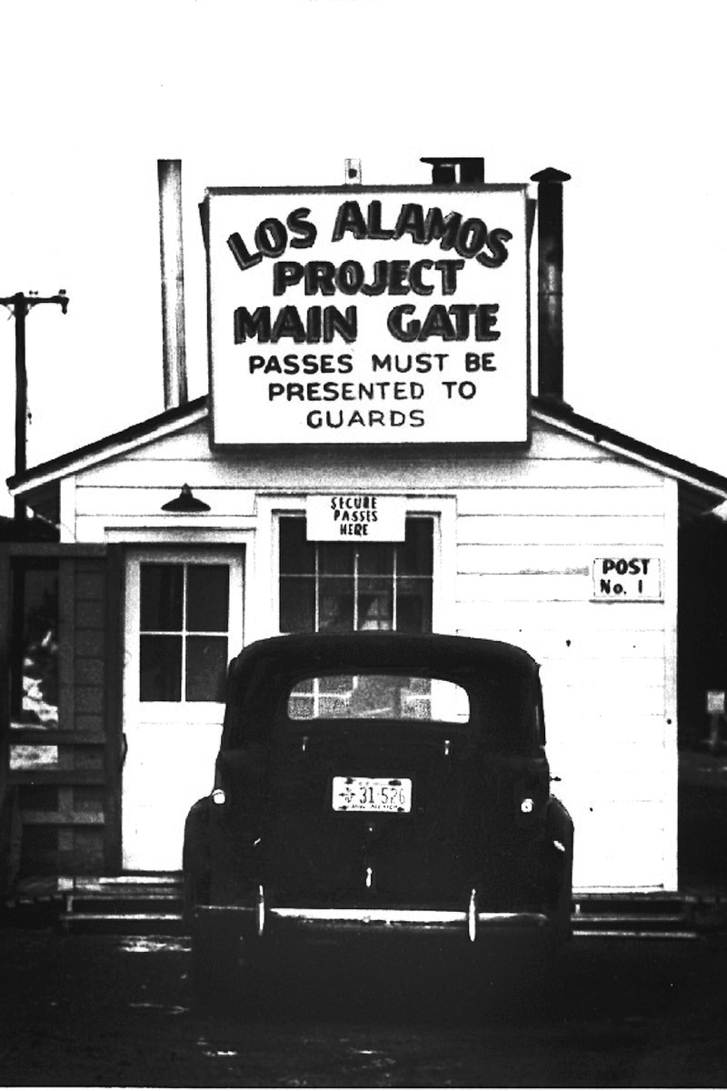


 Chaco Culture National Historical Park, formerly Chaco Canyon National Monument, protects the 16 great houses in and around the canyon. The park’s great houses are the best preserved prehistoric architectural structures in North America. Additionally, archaeological and anthropological studies of the site have resulted in the discovery of over 1.5 million artifacts, most of which are in the care of the University of New Mexico in Albuquerque.


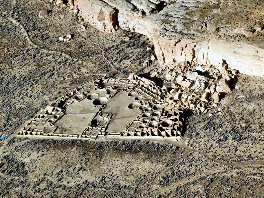


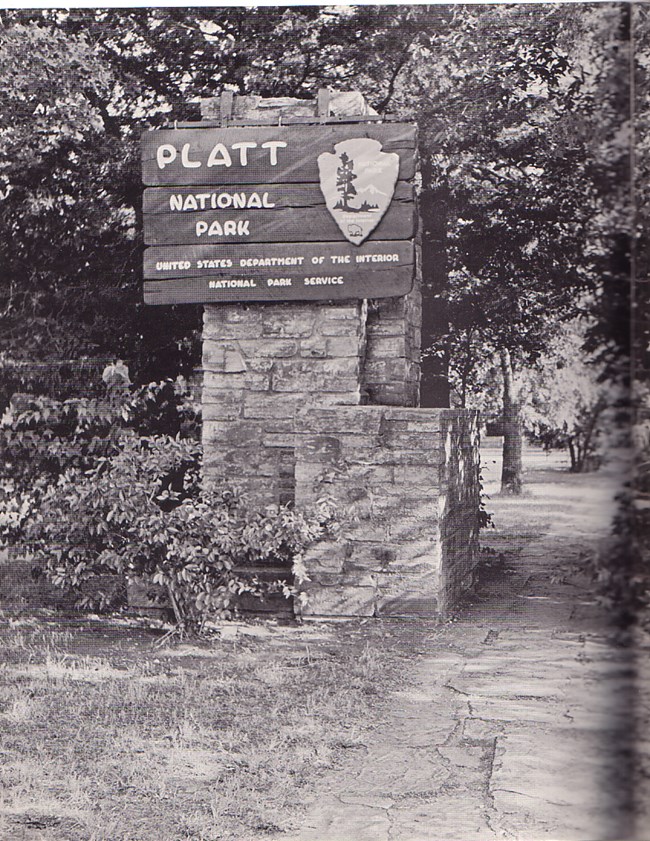
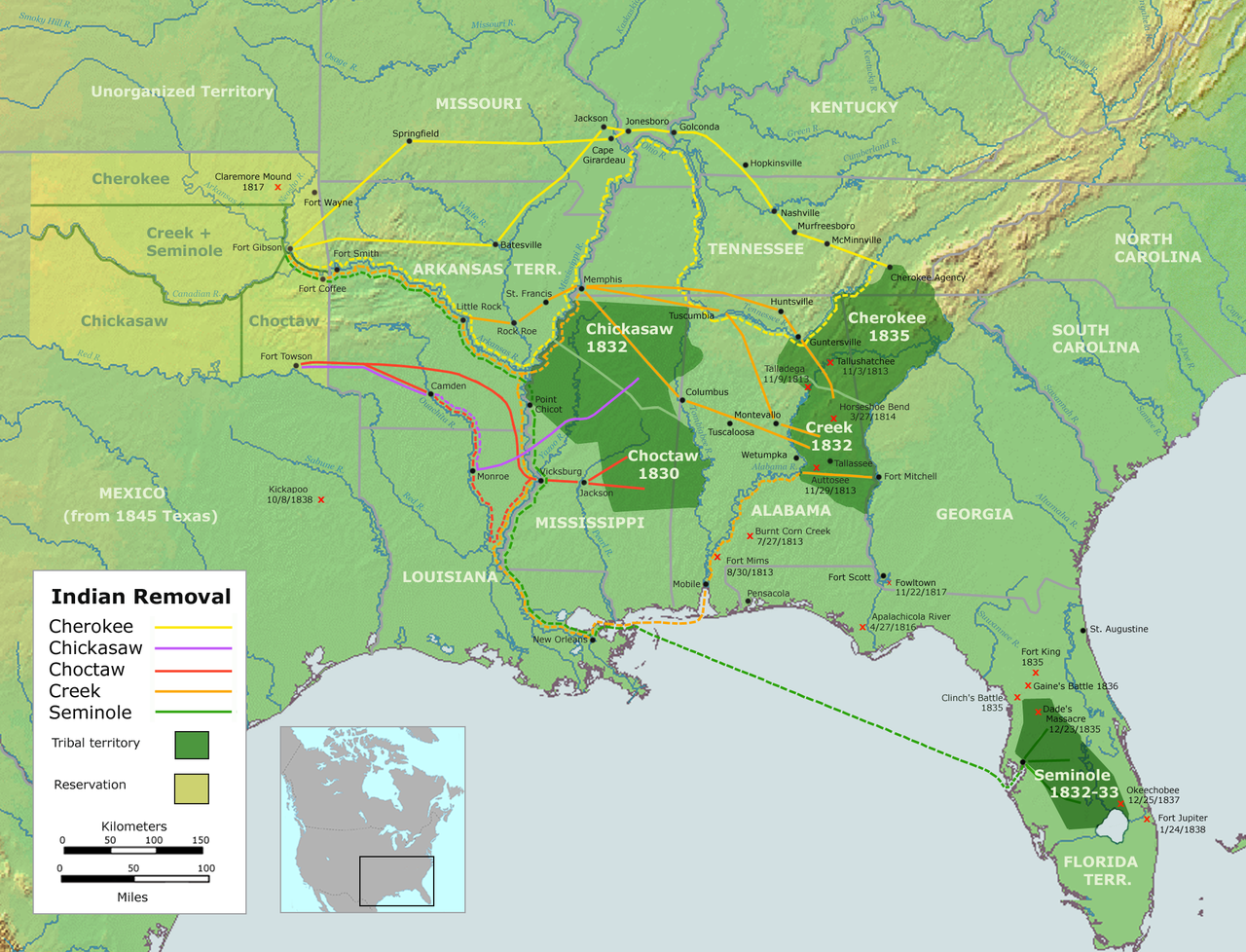


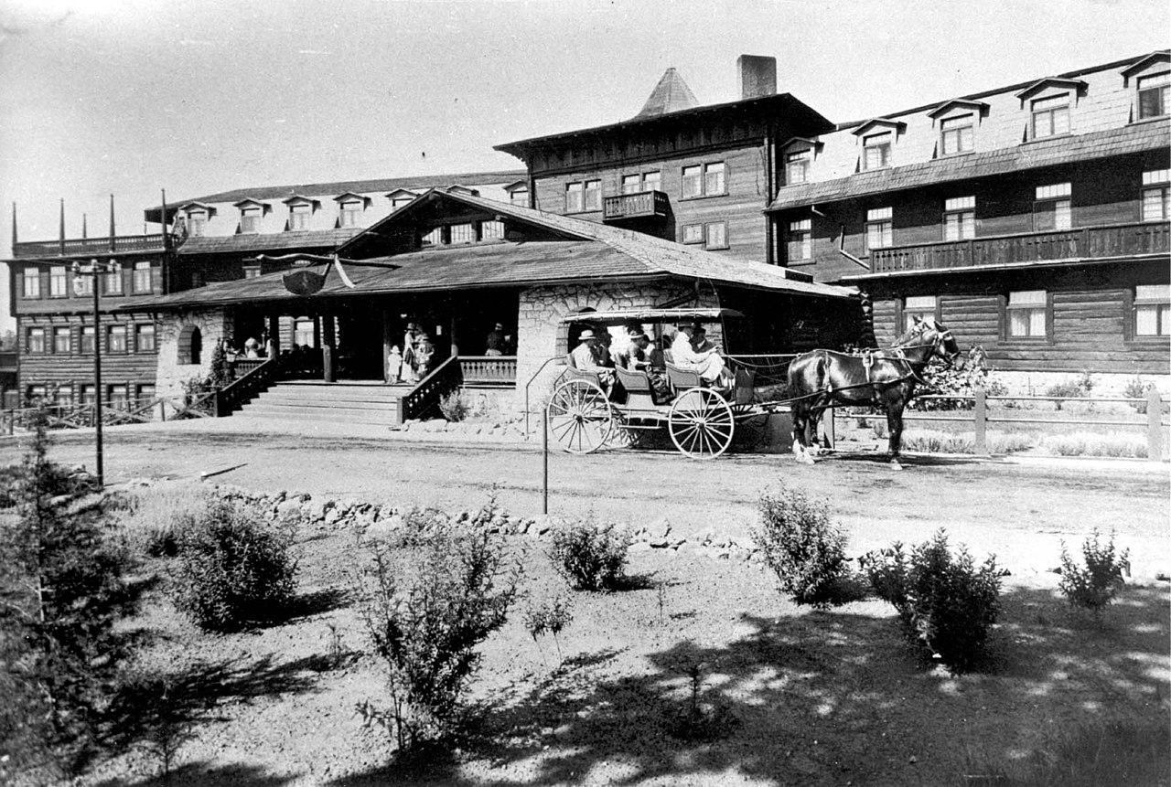


 The 1955 menu below is from the La Fonda in Santa Fe. We have eaten there, and though it’s no longer a Harvey House they were still serving fabulous food at the time of our visit. We’re including the menu to show the delicious-sounding meals of the time.


 Thankfully the water wasn’t deep, but Fernando said in 40 years of living and working in the canyon he hadn’t seen so much water in the wash. Not knowing the difference, we thought the watery wash just added to the adventure.
 Mostly made up of De Chelly sandstone, the canyon walls vary in height from 30 feet to 1,000 feet. All of them are spectacular.


 As a rainforest surrounded by rivers and swamplands, its inhabitants included intriguing pre-dinosaur age animals that roamed or swam in the area.


 According to the park: The colorful bands of the Chinle Formation represent ancient soil horizons. While the red, blue, and green layers generally contain the same amount of iron and manganese, differences in color depend on the position of the groundwater table when the ancient soils were formed. In soils where the water table was high, a reducing environment existed due to a lack of oxygen in the sediments, giving the iron minerals in the soil a greenish or bluish hue, such as at Blue Mesa. The pink and reddish layers were formed where the water table fluctuated, allowing the iron mineral to oxidize (rust).


 Need more national park inspiration? Try these other great parks:


 Thank you for letting us share Tonto National Monument with you! We are truly honored to have you join us on our road trips. If you’re looking for more road trip inspiration, check these out:
 We visited the east unit on a day when a cold front was blowing in and it was very windy. On the next day when we visited the west unit, we woke up to snow which thankfully disappeared quickly as the day warmed up. Both units were great, but if we had to choose only one, we would probably choose the west unit.


 Here are some interesting facts about saguaros:

 The Crested Saguaro Society has catalogued about 3,300 of these unusual cacti throughout the Sonoran Desert region. Information about their finds is kept in a secret database so that vandals and poachers cannot locate the unique specimens.


 Perhaps the Ancient Sonoran Desert People dug up the caliche while digging their irrigation canals, and then carried it to the construction site in baskets.


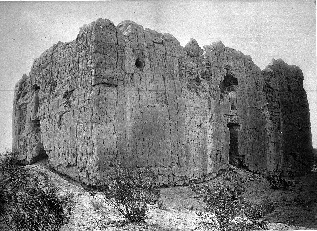


 Details of the facade include depictions of the crops that the O’odham people grew, such as squash, grapes, watermelons, wheat, beans and corn. These plants are easily seen in the top section. Also in the top section are male and female lions. Note that they do not look like African lions, but they look like the puma or mountain lions that the O’odham people would have been familiar with. Interestingly, the lions are said to represent the king and queen of Spain because Arizona was still part of Spain when San Xavier was built. Perhaps the most intriguing parts of the top portion are the curlicues on either side of the facade.


 Most missions had a church cemetery, and Tumacacori was no different. White walls surrounded the little cemetery which is located behind the church. Nooks that would have held the 14 Stations of the Cross are still visible in the thick wall. There are some graves in the Tumacacori cemetery, although none of them are original to the functioning mission. Sadly, the cemetery’s original graves were desecrated by vandals and grave robbers after the mission was abandoned. Then adding insult to injury, the cemetery was used for a time as a cattle corral.


 The six wooden santos (saints) that once stood in Tumacacori’s church now reside behind glass in the park’s museum. We apologize for the glare.


 Bisbee Mining and Historical Museum sits right in the middle of town and is a “shouldn’t miss” for any visitor. Covering the history of Bisbee and its mining heritage, the museum appropriately occupies the building that once housed the Phelps Dodge Corporation’s general offices. The building was designated a National Historic Landmark in 1983. While we photographed a lot of the museum’s displays, it was the historic photos that grabbed our attention the most.
 The scenes above and below reflect a very different Bisbee than what we see today. Of course, mining was the top priority in Bisbee, so civic responsibilities and city beautification wasn’t really on anybody’s mind until the early 1900s.
 In 1908, Bisbee even began operation of its first cable cars that ran to Warren and back. As a city on the rise, the population had grown to 25,000 by 1910. In 1917, the first open pit mine was established in an effort to supply the high demands for copper during WWI. However, by 1974, the Phelps Dodge Corporation had ceased production of the pit mines. Underground operations were closed in 1975 causing many of Bisbee’s residents to leave to find work elsewhere. Today Bisbee is the home of about 4,000 residents.
 Lowell, Arizona, a suburb of Bisbee, was a small mining town in its own right before the Phelps Dodge Corporation began the Lavender Pit mining operation. Though once excavations of the huge open pit mine began, Lowell was, quite frankly, in the way. Phelps Dodge gave Lowell’s residents the option of selling their homes to the company for market value or having them moved to other locations. Today, all that remains of Lowell is Erie Street, which sits adjacent to the Lavender Pit, and is a quarter mile long time capsule.


 We spent an hour walking both sides of the street in Lowell. It’s a definite not-to-miss attraction when visiting Bisbee.


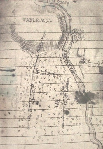


 Cahokia Mounds is a UNESCO World Heritage Site, a National Historic Landmark, and is on the National Register of Historic Places. Here is a link to the website:


 “The most important alignments are the winter and summer solstices, marking the southernmost and northernmost sunrise positions, and the fall and spring equinoxes, when the sun rises due east, midway between the solstice posts. Also, at the equinoxes the sun appears to emerge from the front of Monks Mound, perhaps confirming a link between the sun and the chief who ruled from the top of the mound.”


 Today benches commemorating each of the Little Rock Nine can be found near the reflecting pool in front of the school. Statues of them also grace the grounds of the state capitol building. Every one of the nine students graduated from college. Some even went on to earn post graduate degrees, and some have written books about their experiences. Click


 Pecos National Historical Park is located near Pecos, New Mexico. The park protects the National Historic Landmark site which is composed of the ruins of an ancient pueblo and a mission church.

 Website link:


 Our visit to Pecos National Historical Park unfortunately did not take place on a day when they were offering tours of the Forked Lightning Ranch. Perhaps we will go back one day to take the tour because the ranch has a colorful past that includes a rodeo legend as well as some Hollywood royalty!
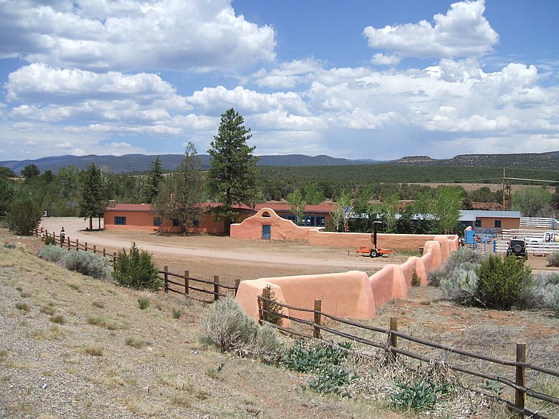
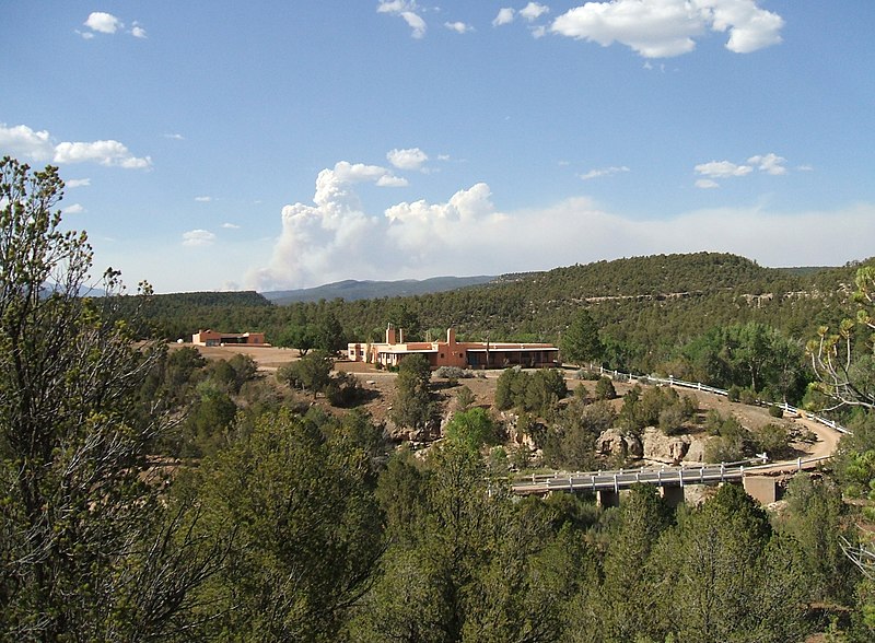
 Thank you for joining us on our road trip to Pecos National Historical Park! We hope we have inspired your wanderlust. Leave us a comment below and tell us about your own journeys. We would love to hear from you.


 found off the Strip as well as downtown, and there are many RV campgrounds in and around the city.


 Do you know the difference between stalagmites and stalactites? A stalagmite grows on a cave’s floor, so watch where you’re walking, or you might (mite) trip over it. Stalactites grow from a cave’s ceiling, so if they don’t hang on tight (tite) they could fall. A park ranger at Carlsbad Caverns told us this years ago, and we haven’t forgotten his wise words!


 Bonus stop
 adjoining Billy the Kid Casino is open year-round.


 stays. It takes a lot of stays to earn a free one, but just one free night can save money for other things. Consider joining AARP (if you’re 50 or older) or become a AAA member. The fees for joining are nominal, and members can receive discounts on hotels and restaurants as well as other benefits. For those traveling to a specific destination to spend several days or for those who travel in larger groups, Airbnb or VRBO properties may be more cost-effective than hotel rooms.
 experiences. Another trick is to pick up a couple of low denomination ($10.00 – $20.00) gift cards for your favorite chain restaurants on grocery shopping trips then stash them away to use when traveling. Gift card purchases won’t add much to your shopping bills, but they will come in handy for “free” meals on the road. Starbucks, McDonalds, Subway, Sonic, Dunkin’, Dairy Queen, and other chains can be found almost everywhere in the U.S., even airports.

 Google for money saving coupons to amusement parks, zoos, and other entertainment venues. Amusement parks and zoos periodically offer reduced prices, two for one, or free admission. Take note of free national park days which can be found here:


 *Recommended hotel in Santa Fe: Inn on the Alameda. Within walking distance of the plaza and Canyon Road galleries. Free breakfast.


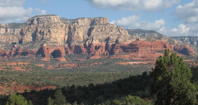 Nestled in the heart of the American Southwest, Sedona, Arizona is truly one of the prettiest cities we have visited. Life in red rock country seems to move at a slower pace, and the city offers great places to relax, shop, view spectacular scenery, and eat. Sedona is a dark sky community which means there is an ordinance against light pollution. On clear summer nights, the Milky Way can be seen arching across the sky from horizon to horizon! By day, the red rock scenery is enchanting, and to make it even better the city averages 278 days of sunshine per year. Sedona is a great year-round destination, but we particularly like to visit during the early fall. Sedona is:
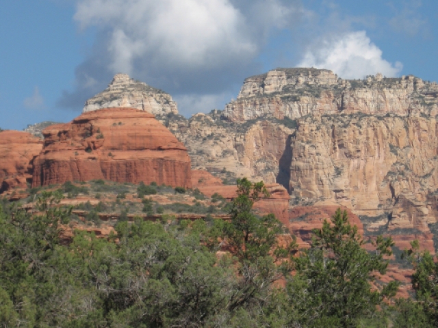

 The town of Sedona grew up from farm settlements along Oak Creek when the first homesteaders arrived during the mid-1800s. Near the turn of the century, a man by the name of T.C. Schnebly arrived and made his home where the ever-popular Tlaquepaque Arts & Shopping Village sits today. In 1902 the industrious Mr. Schnebly applied for the first post office in the area, and it is his wife, Sedona, for whom the city is named.
 1 – Hop on a trolley. Want to take a tour of the city and get some helpful information about the area? Sedona Trolley has you covered with 55-minute tours starting at $23.99 for adults and $15.99 for children 12 and under. Several tour options and times are available. Do this first for the best introduction to the city. Here is a link to the website:


 Museums, shopping, live entertainment, beautiful hotels, and upscale as well as funky bars can all be found on the San Antonio River Walk. Then there’s the outstanding food! Of course, everyone’s favorite in San Antonio is Mexican food, and there is plenty of that to go around.


 Home to the San Antiono Express-News newspaper for more than 90 years, this beautiful Art Deco building was opened in 1929. The newspaper’s parent company, Hearst Corp., moved the newsroom and printing operation to other sites in 2020 and put this building on the market for sale. What intrigued us about the building was not just its historic beauty, but the bas-relief panel above the door. (What can we say…we love art!) It was sculpted by none other than Pompeo Coppini, the same artist who created the stunning Alamo Cenotaph. The carved stone panel (shown below) features images representing labor, education, enlightenment, truth, and justice.
  It is our understanding that in March 2022, the building was sold to a property development investment group from Austin. We will be anxious to see what they do with this fabulous property.


 The museum complex admission is (currently) $5.00 for adults and $4.00 for children 6-16. Children 5 and under are admitted free. For AAA members and people over 60, it is $4.00. (We paid $4.00 each, but we’re not saying which discount we got!)


 As we mentioned, Big Bend National Park lies in an area that was once the edge of an ocean. The Fossil Discovery Exhibit showcases some of the creatures that inhabited the area millions of years ago including sea life and dinosaurs. Kids and adults alike will enjoy exploring this open-air museum space which is located approximately eight miles north of the Panther Junction Visitor Center.


 The Lajitas Golf Resort and Spa features modern, well-appointed hotel rooms with an Old West vibe, as well as a multitude of amenities and activities for the entire family. A general store and a gated RV campground are also located within the resort. Charter air services are available from Dallas/Fort Worth and Houston. For further information, here is a link to the resort’s website:


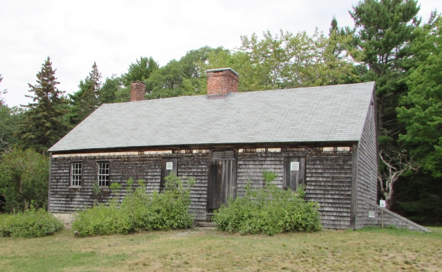


 While the Mission Concepcion church was constructed in the Spanish Colonial style, some Moorish features were also incorporated, such as this pretty archway and stairwell outside of the church. This nook was so unexpected, we had to wonder if it was original to the mission.


 Mission San Jose was our favorite of the four missions. It is also the most restored, with the majority of the restorations having been completed in the 1930s by the Civilian Conservation Corps (CCC) which gave unemployed young men work relief during the Great Depression. Approximately 80% of the church is original.


 Espada also had an aqueduct which still exists today and diverts water from the San Antonio River to the mission and its farmland. A portion of the aqueduct is pictured above as it crosses Piedras Creek, and below is the acequia (irrigation canal). This acequia is still used by people who live near Espada.


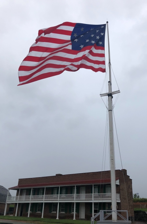


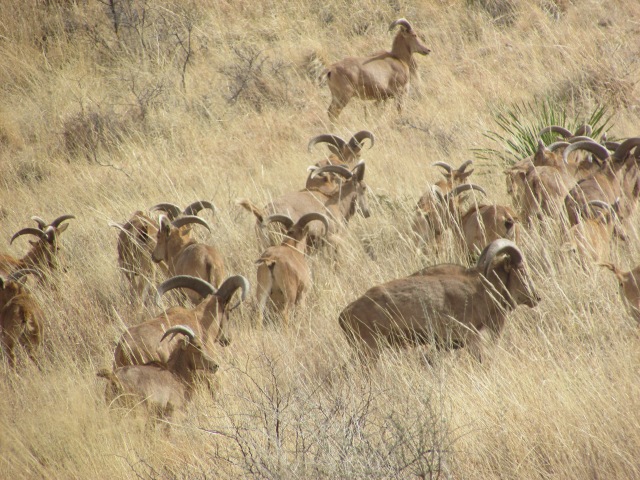


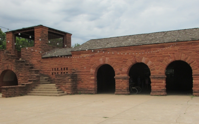


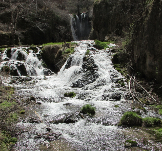


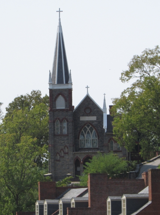


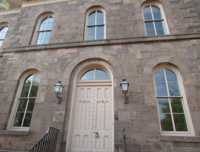


 This container ship happened by while we were at the river.
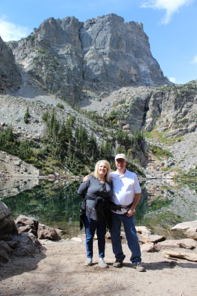


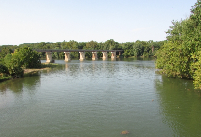


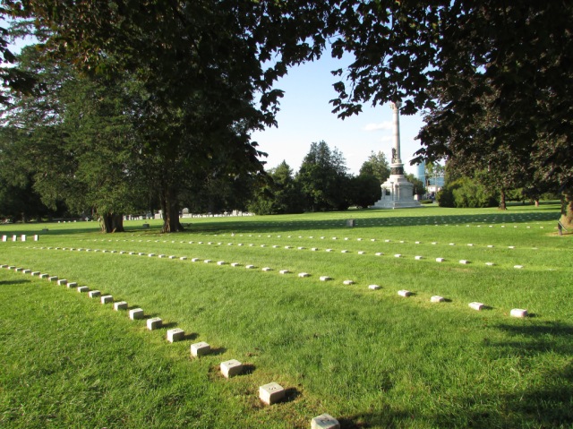

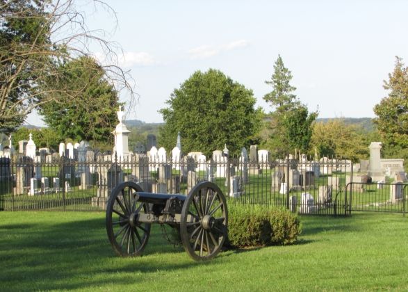


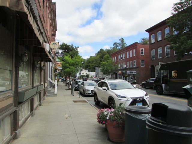


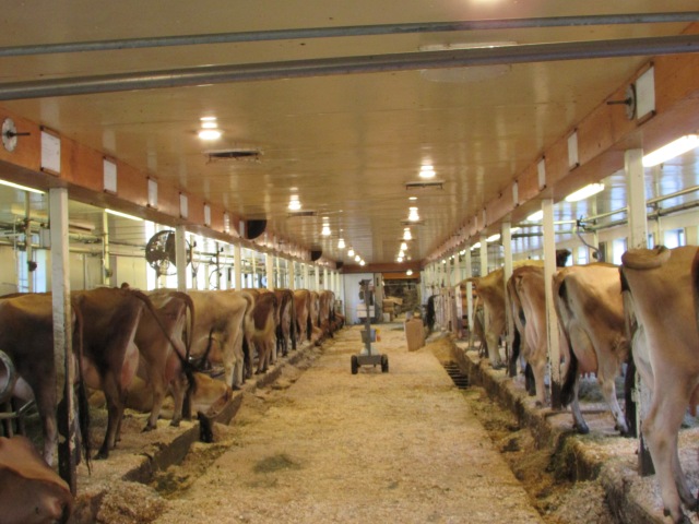


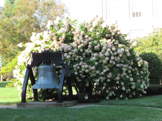


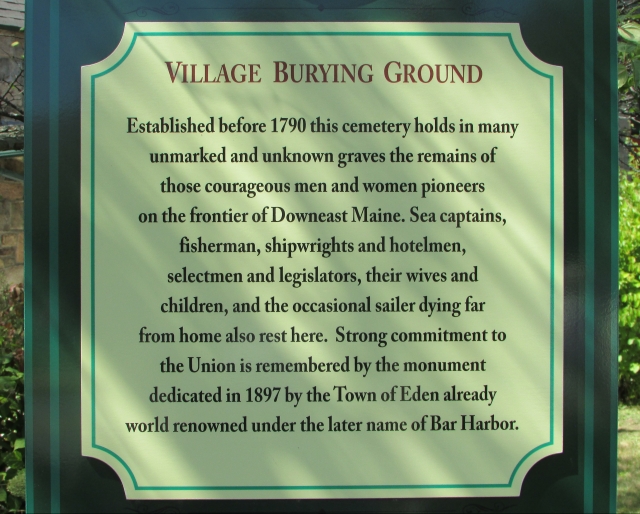
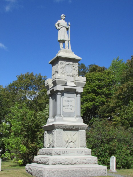


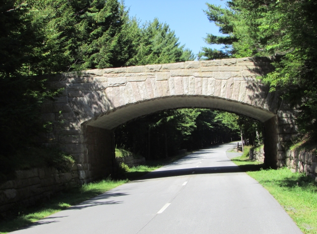


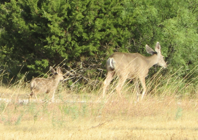


 And, our favorite sunset shot:
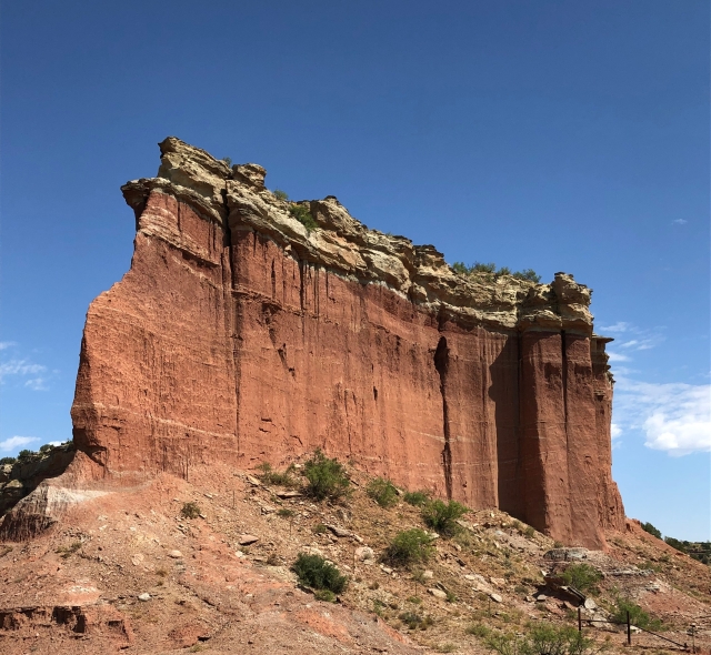


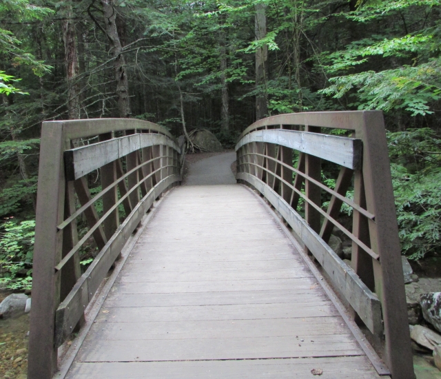

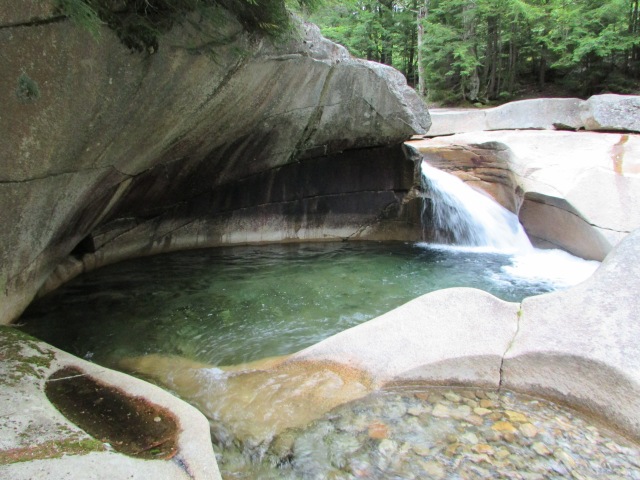

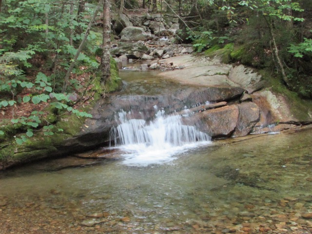


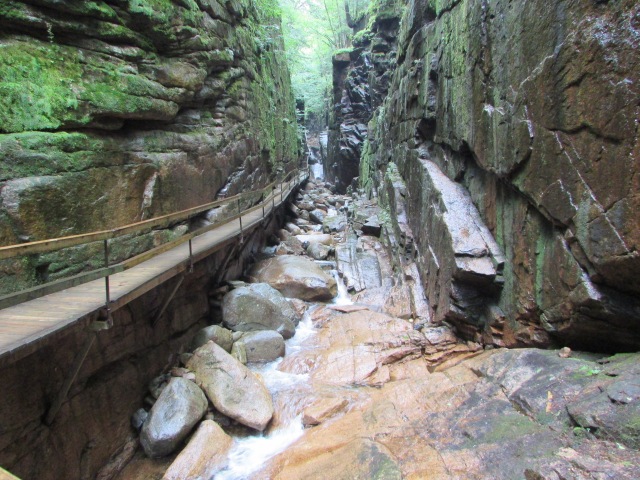


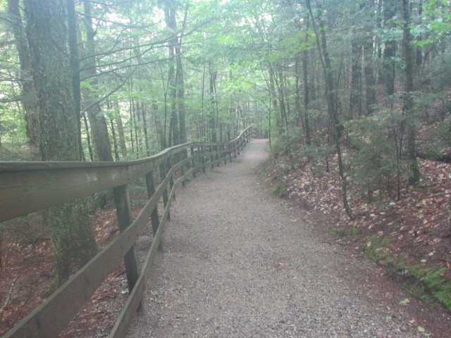

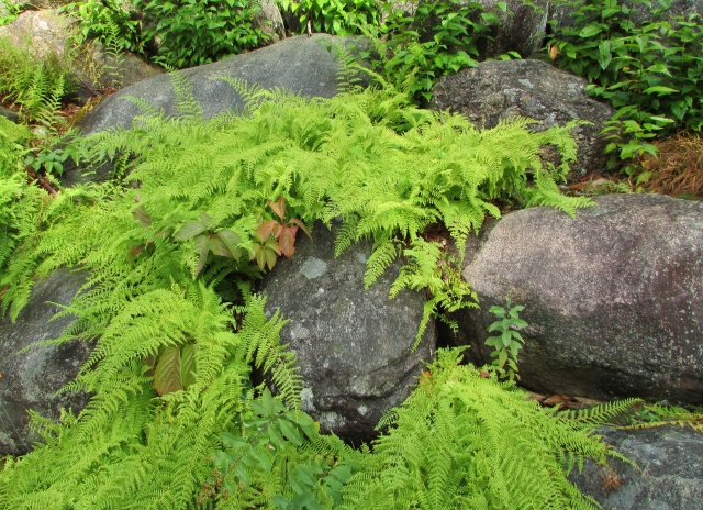


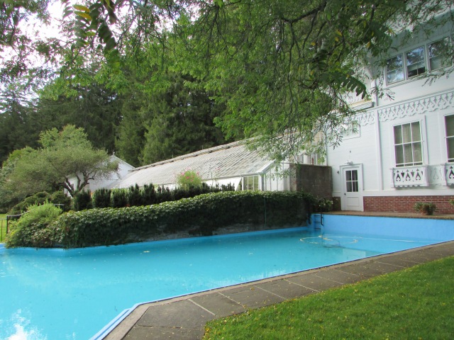


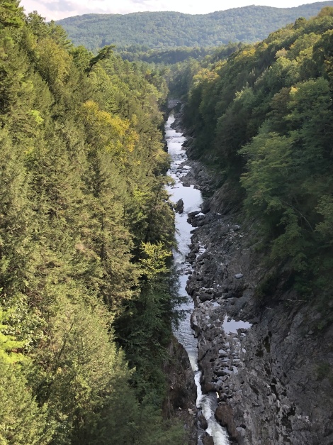


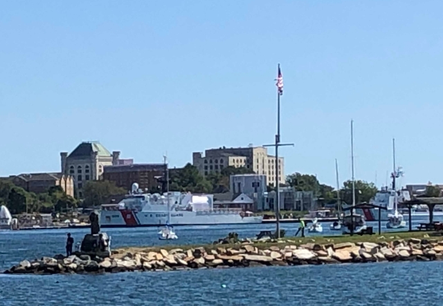


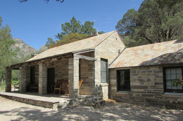


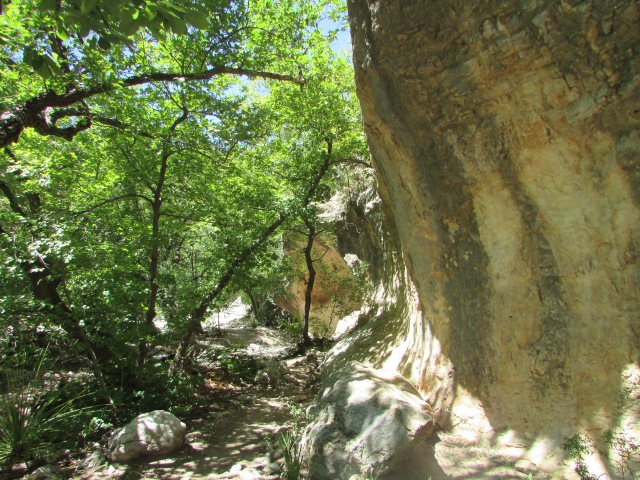
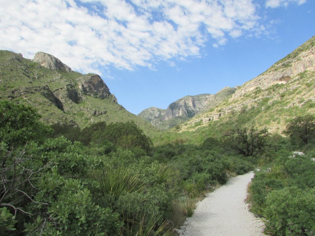


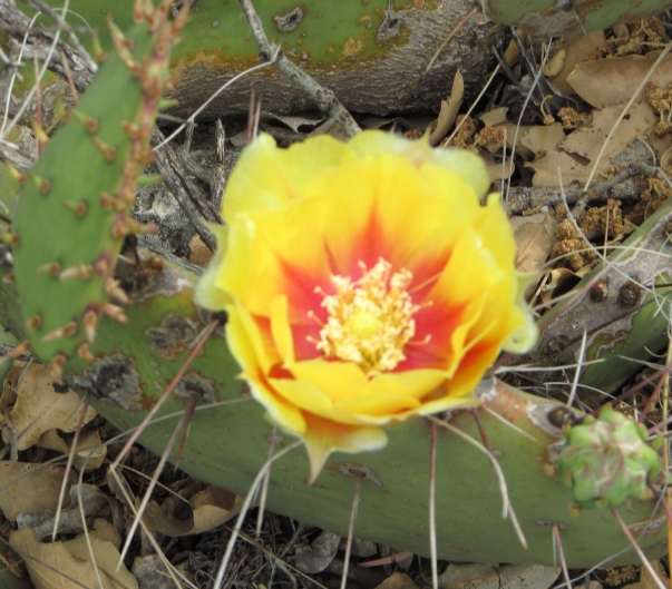
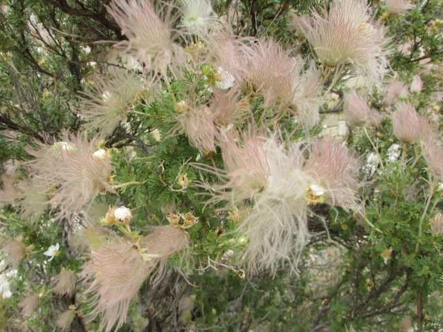


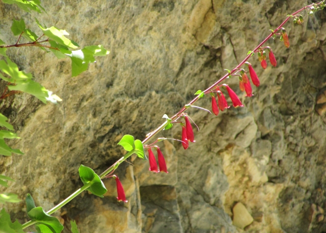


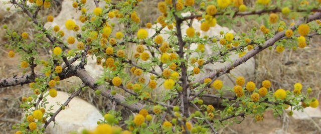


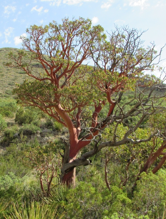


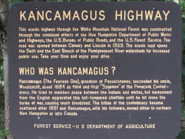

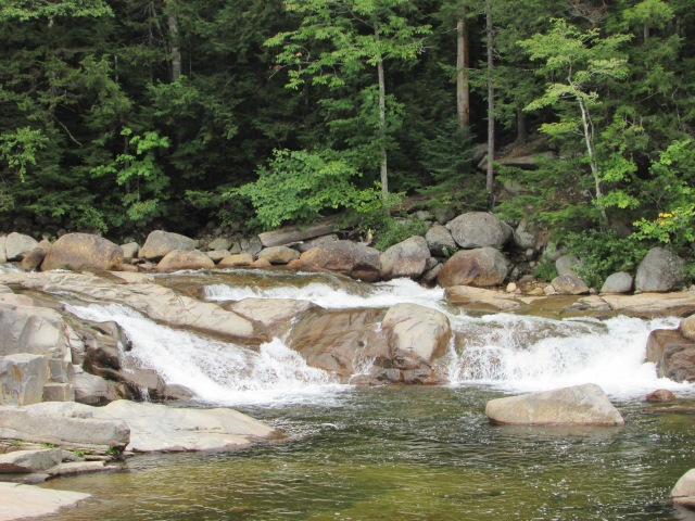


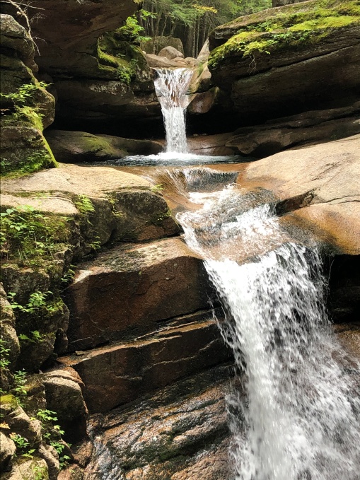


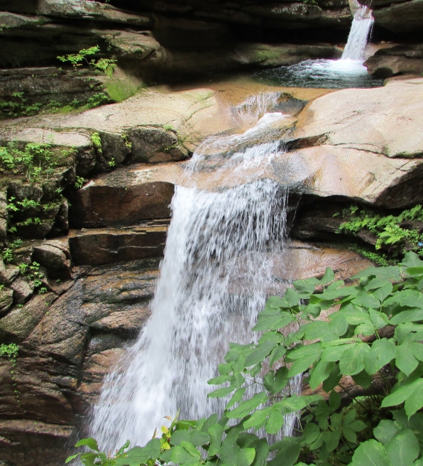


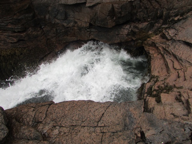


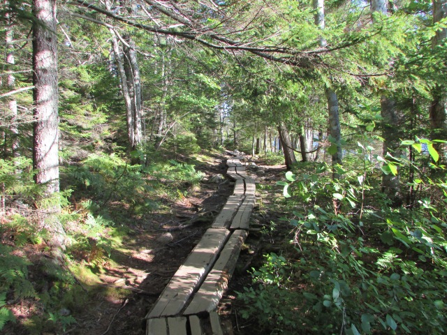
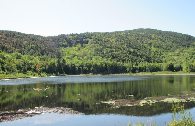

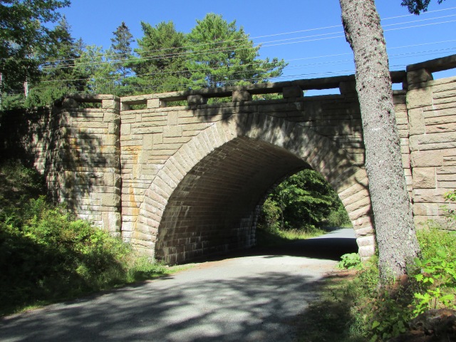


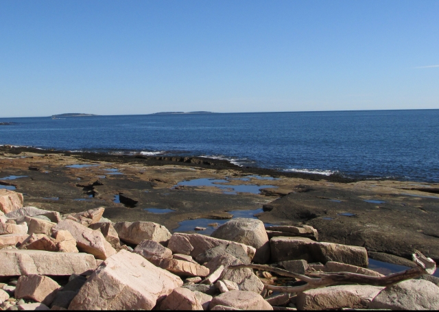
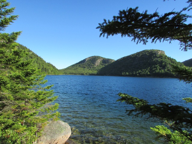


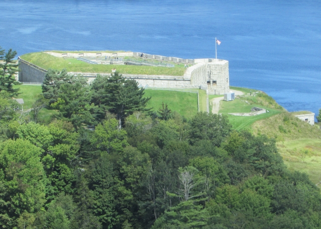
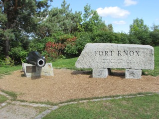
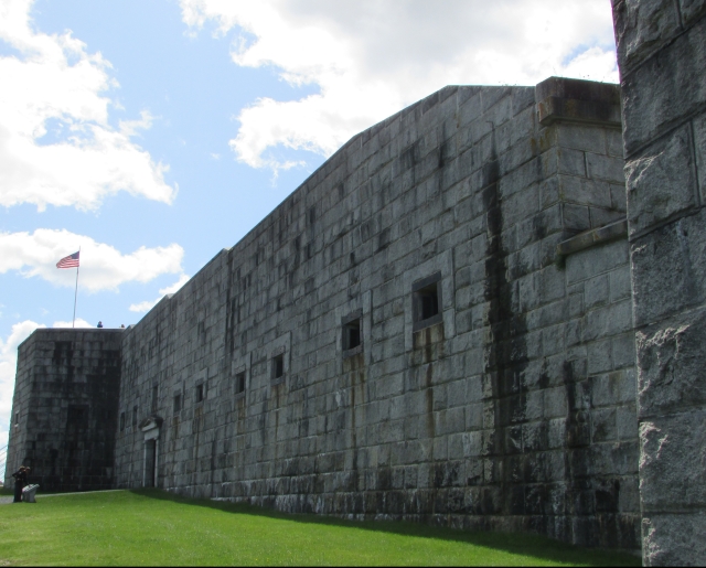
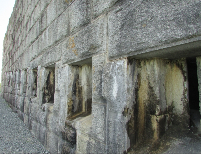


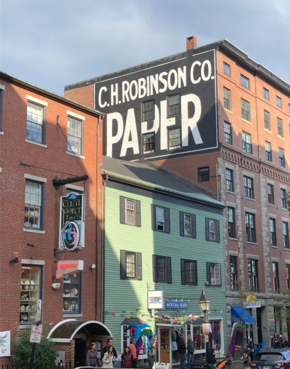


 The sun was in the right place at the right time for this shot. That usually doesn’t happen for us – we just got lucky this time. No filters. Look at those spectacular colors!


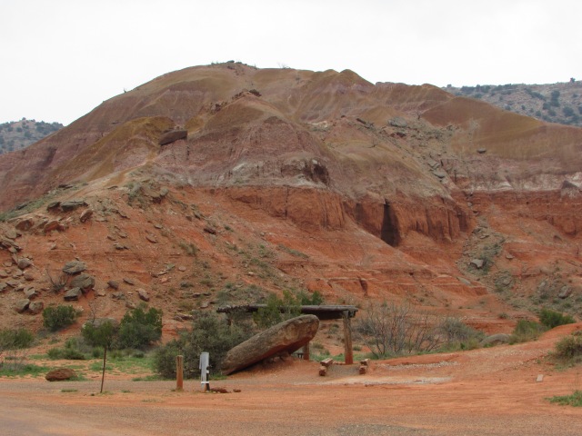

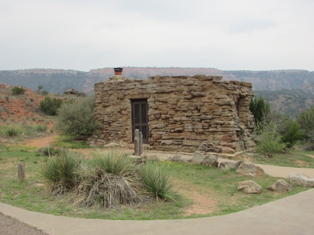


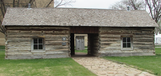


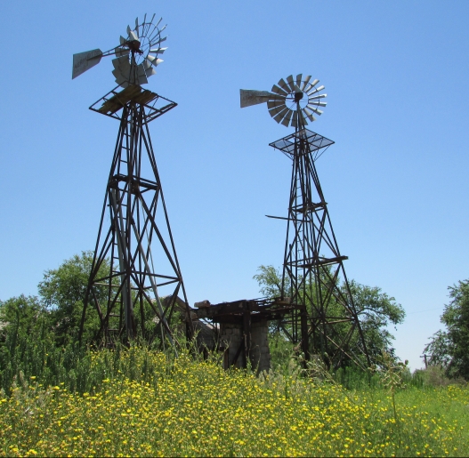


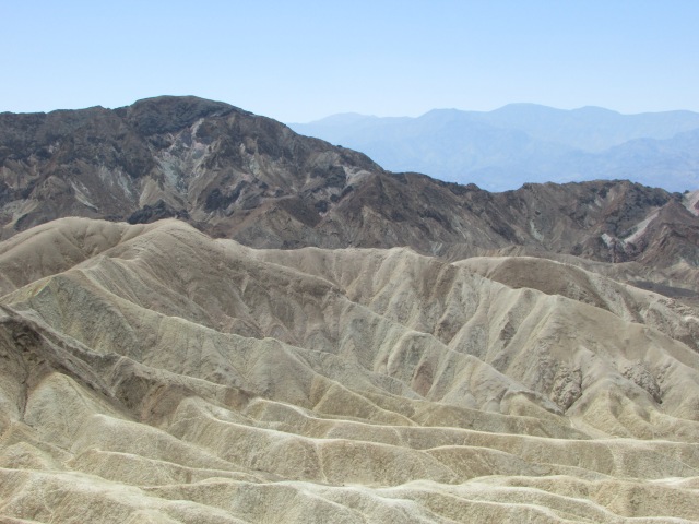


 Fort Griffin is home to the Official State of Texas Longhorn Herd, and a few of them star in the show! We had never seen a more well behaved bunch of cattle before. Plus, they’re just kinda awesome. For more information about Fort Griffin, please see our Abilene, Texas post. Here’s a link: